
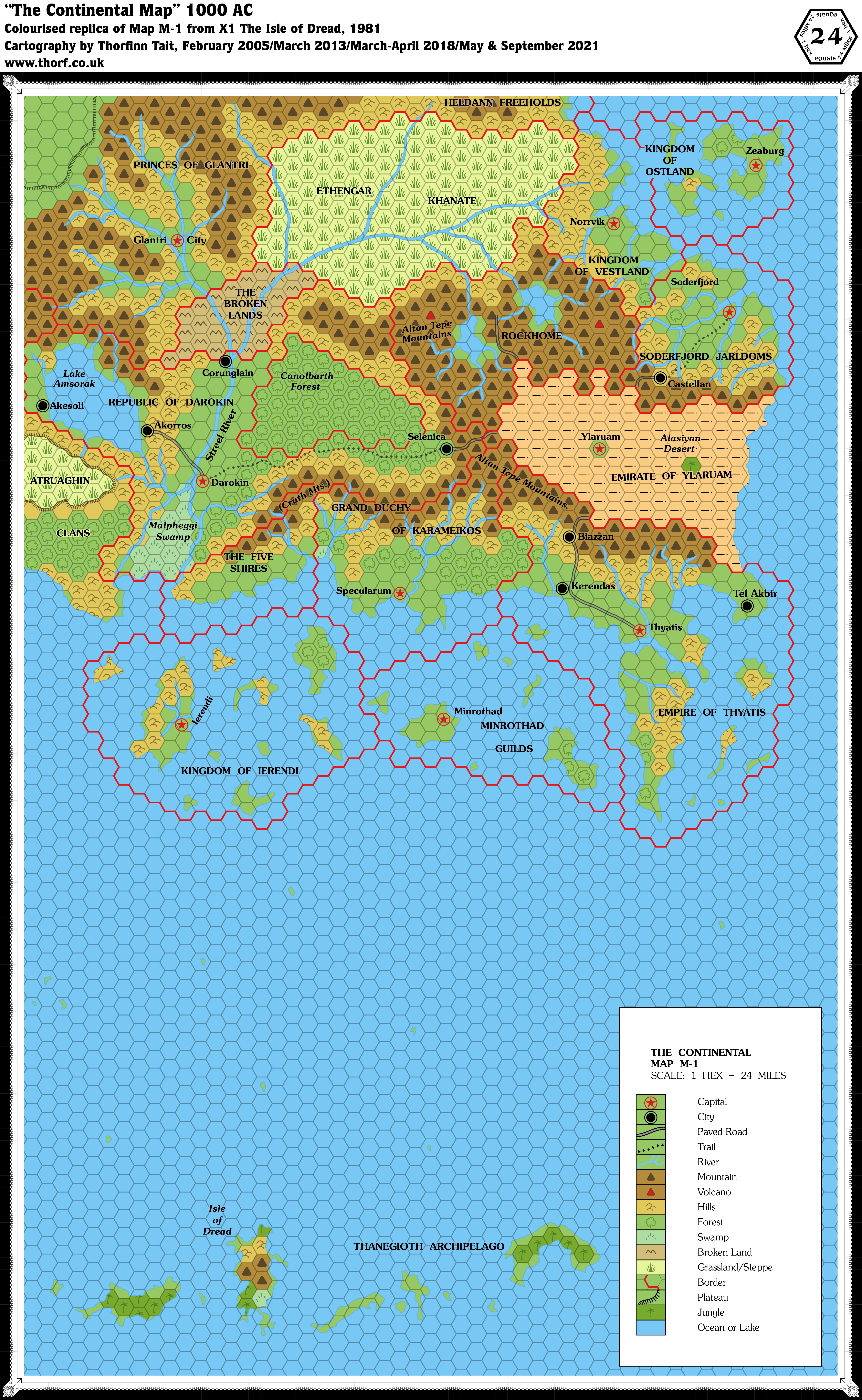
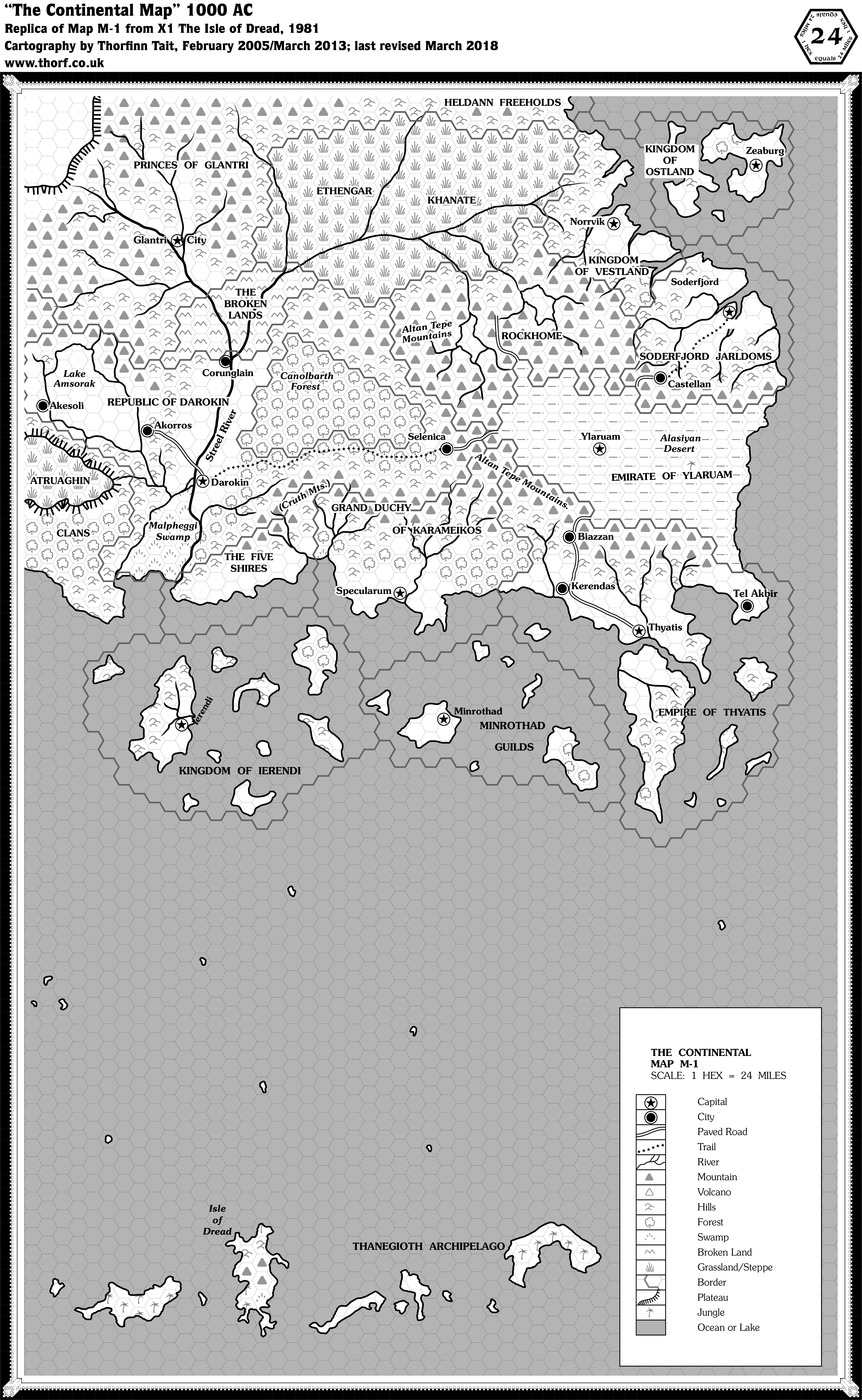
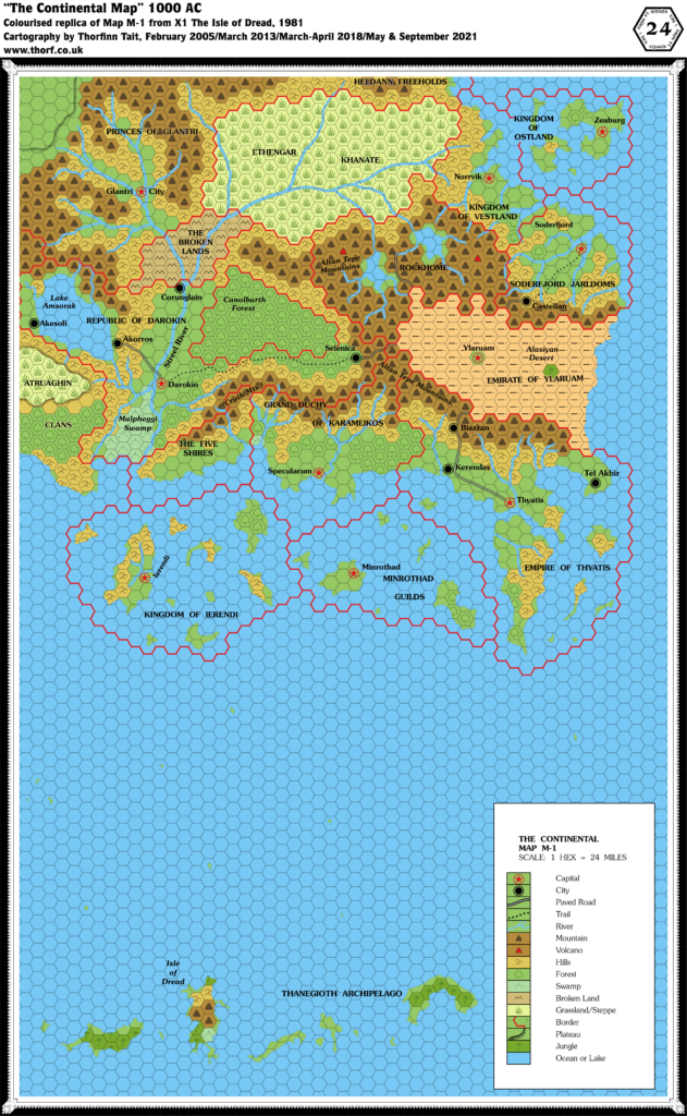
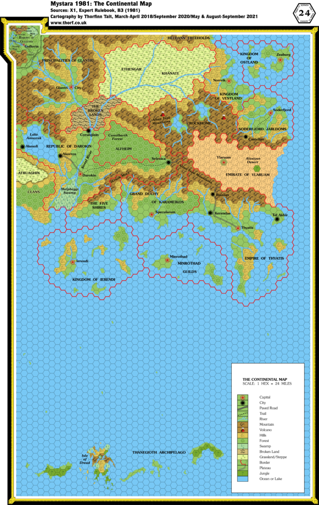
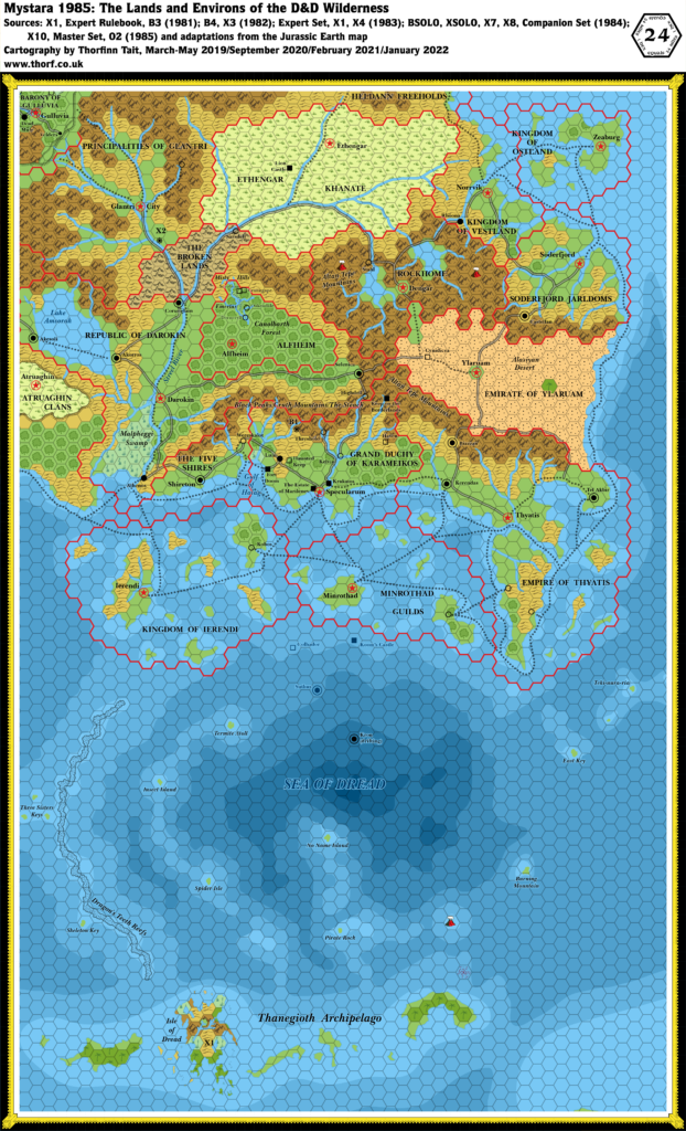
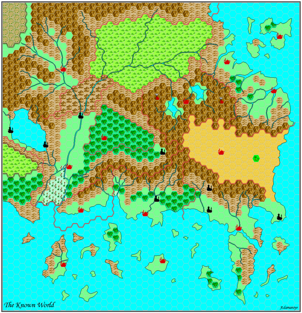
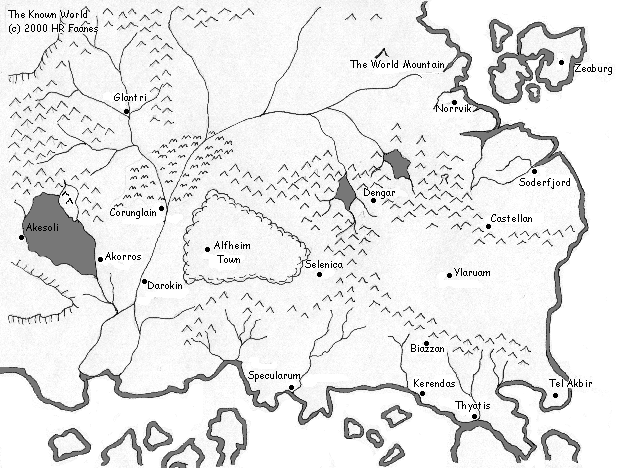
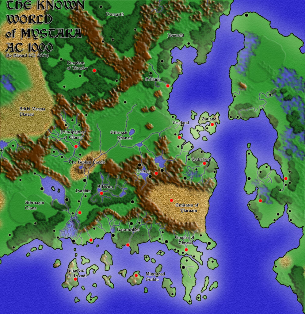
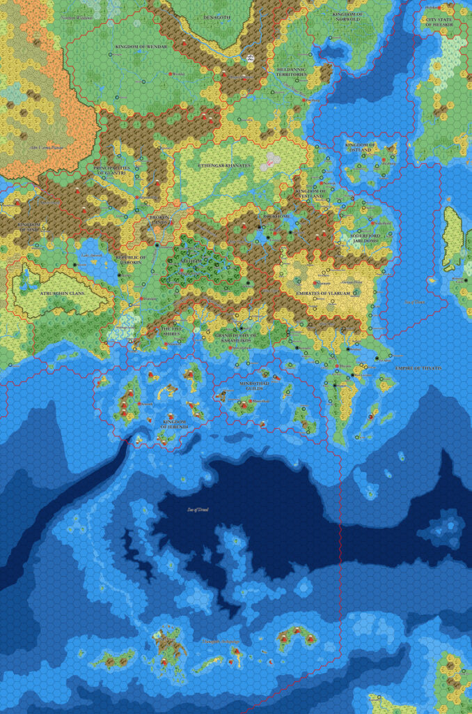
X1 (1981) Known World, 24 miles per hex
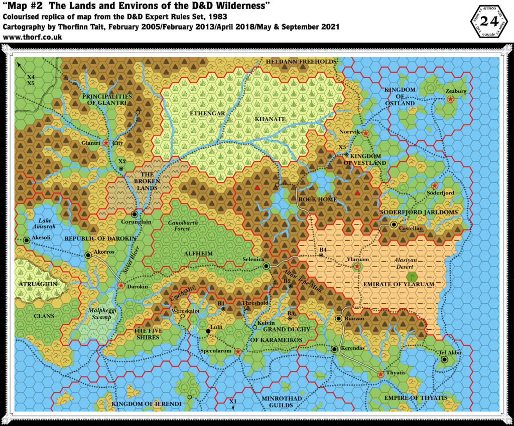
This is the seminal, iconic map from which the world of Mystara was born. It introduces all of the now-familiar Known World countries. What it lacks in detail, it makes up for in sheer potential — which thousands of DMs have taken great advantage of over the years, and later supplements expanded and built upon wonderfully.
The map appeared as a two page spread in X1. 1983’s reprint added a few missing names (most notably Alfheim) and smaller towns (such as Threshold), while the Expert Rules Set (1983) reproduced the northern half of the map on a single page, cropping the Sea of Dread and the Thanegioth Archipelago while adding trails and a few other details.
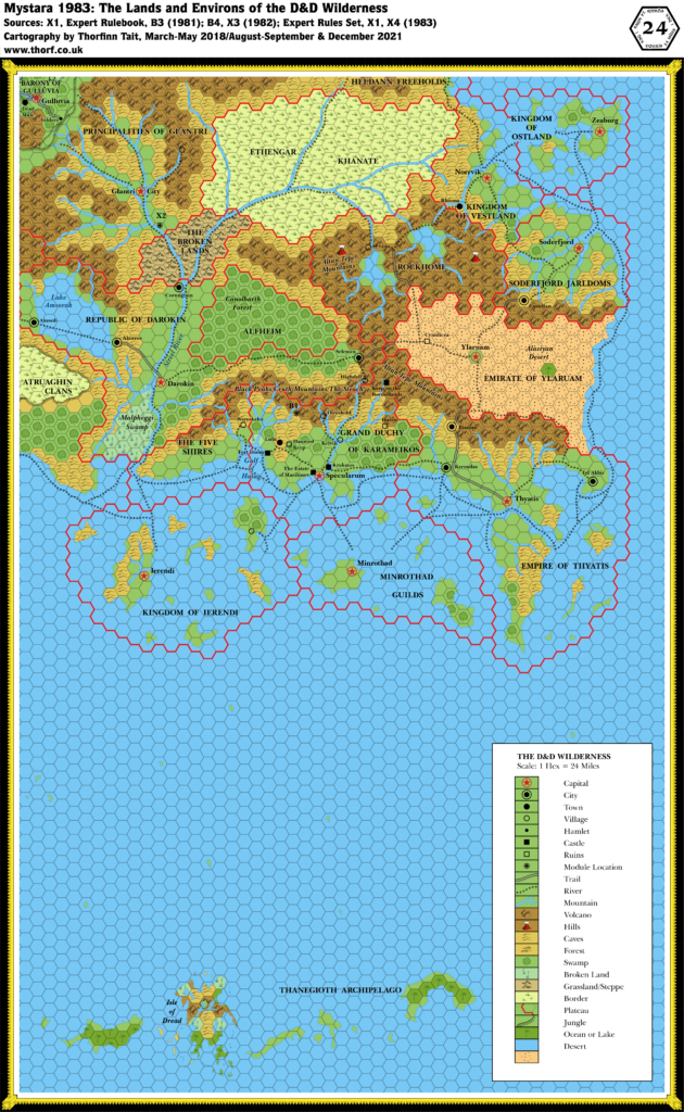
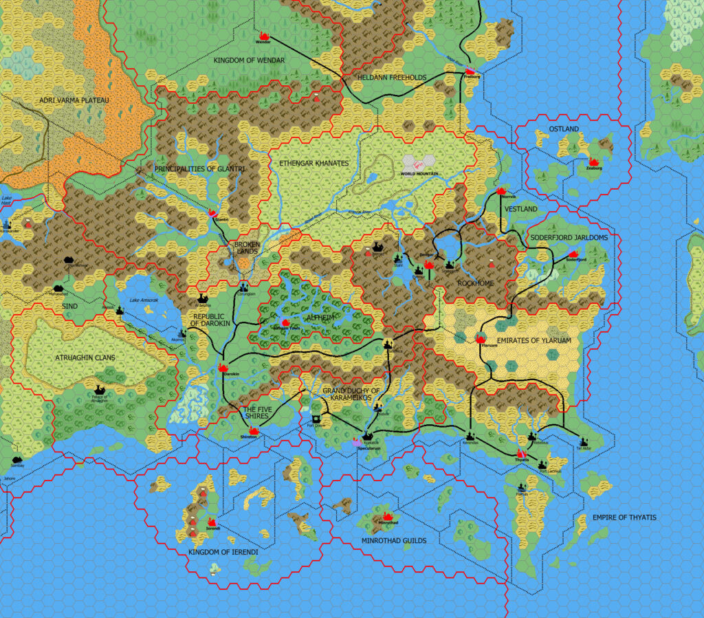
Replica Map (September 2021)
Sources
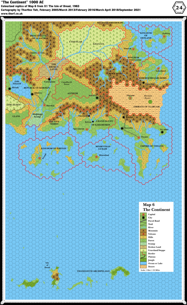
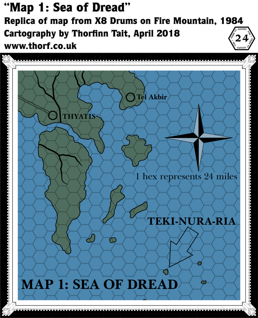
- X1 The Isle of Dread (1981) (PDF at DriveThruRPG)
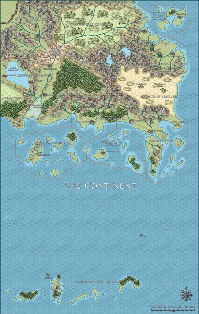
- The Continental Map M-1, pages 16-17 (centrefold)
Chronological Analysis
This is Map 1. It was published in 1981. The updated version of this map has not yet been released. See also Appendix C for annual chronological snapshots of the area. For the full context of this map in Mystara’s publication history, see Let’s Map Mystara 1981, Part I.
The following lists are from the Let’s Map Mystara project. Additions are new features, introduced in this map. Revisions are changes to previously-introduced features. Hex Art & Fonts track design elements. Finally, Textual Additions are potential features found in the related text. In most cases, the Atlas adopts these textual additions into updated and chronological maps.
Additions
- Borders — full borders for all Nations added (see Nations below), except the Atruaghin Clans, the Princes of Glantri, and the Heldann Freeholds. The Emirate of Ylaruam is missing a sea border.
- Coastline — from the coast of the Atruaghin Clans to the southern part of the Heldann Freeholds
- Islands — the islands of Ierendi, Minrothad, Thyatis, and Ostland; the Thanegioth Archipelago and of course the Isle of Dread; and ten small islands scattered across the as-yet-unnamed sea. Ostland’s western isles are partially obscured by a label, though their coastline is actually visible.
- Lakes — Lake Amsorak.
- Nations — Atruaghin Clans, Republic of Darokin, Ethengar Khanate, The Five Shires, Princes of Glantri, Kingdom of Ierendi, Grand Duchy of Karameikos, Heldann Freeholds, Minrothad Guilds, Kingdom of Ostland, Rockhome, Soderfjord Jarldoms, Empire of Thyatis, Kingdom of Vestland. (But see also Revisions below.)
- Mountains — Altan Tepe Mountains, Cruth Mountains.
- Plateaus — the eastern part of the Atruaghin Clans plateau, as well as the southeastern part of the plateau northwest of Glantri, albeit both as yet unnamed.
- Rivers — The Streel River.
- Settlements — Capitals: Darokin, Glantri City, Ierendi, Minrothad, Norrvik, Soderfjord, Specularum, Thyatis, Ylaruam, Zeaburg. Cities: Akesoli, Akorros, Biazzan, Castellan, Corunglain, Kerendas, Selenica, Tel Akbir. (But see also Revisions below.)
- Terrain — The Alasiyan Desert, the Canolbarth Forest and the Malpheggi Swamp all make their first appearances on this map.
- Trade Routes — three main routes connect to the Alasiyan Desert, although trails are not shown within the desert itself: Akorros-Darokin-Selenica-Alasiya, Soderfjord-Castellan-Alasiya, and Thyatis-Kerendas-Biazzan-Alasiya. Two segments of this are trails (Darokin-Selenica and Soderfjord-Castellan), while the rest is road. A fourth route leads through Rockhome to the desert.
Revisions
- Nations — many cities from Lawrence Schick’s Original Known World (OKW) map (Darokin, Glantri, Ierendi, Minrothad, Thyatis, Ylaruam) became nations, using the original name for both the name of the capital city as well as the nation itself. Karameikos went from city to nation. Atruaghin, Ethengar and Heldann went from tribe to nation.
- Settlements — many OKW map cities (Akesoli, Akoros, Corunglain, Darokin, Glantri, Ierendi, Karameikos, Minrothad, Selenica, Thyatis, Ylaruam) became settlements on X1’s map.
- Spelling — Akoros (OKW map) became Akorros.
- Terrain — many OKW map labels (Altan Tepe Mountains, Lake Amsorak, Canolbarth Forest, The Streel) became terrain of the same type on X1’s map. Kingdom of Alasiya became the Alasiyan Desert. Malpheggi went from tribe name to swamp.
Hex Art & Fonts
- Fonts — Souvenir.
- New Symbols — Capital (five pointed star in a circle), City (filled circle in a circle), Paved Road (white line bordered by two black lines), Trail (dotted line comprised of small X’s), River, Mountain (grey triangle), Volcano (white triangle with grey outline), Hills (three linked curves), Forest (a single deciduous tree), Swamp (five dashes pointing upwards arranged in an arc), Broken Land (upside down W shape), Grassland/Steppe (five lines arranged like a grass tuft), Border, Plateau (solid line with short lines extending away from it showing the slope), Jungle (a single palm tree), and Desert.
Textual Additions (X1 1981)
- Climate— “general weather patterns of this part of the continent move from west to east. Hence, much rain falls on the western edge of the Altan Tepe mountains, while little or none falls on the Alasiyan desert. The warm offshore currents near Thyatis and Minrothad modify the weather somewhat in the south, making the climate there similar to the Mediterranean.” Also, “southern farm lands are extremely fertile, due to a thick layer of rich ash from the ancient volcanic hills. The farmers have discovered better ways to grow most crops. The heavily irrigated and terraced gardens of the southern farmlands produce more food than any other area on the map.” And, “The climate in the Thanegioth Archipelago is tropical, similar to the Pacific South Seas islands (Oceania) and the Caribbean. The climate south of the Cruth mountains (running west to east) is moist and temperate, with mild winters. The climate of Darokin and Glantri is warm and sunny, similar to that of southern France. The climate of the Ethengar steppes is mild in the summer, but cold and bleak in the winter, like the Russian steppes around the Black Sea. The climate of the northeastern coast is wet and mostly overcast, similar to that of Denmark.” (p. 4)
- Government— Glantri: magocracy, Ethengar: warring clans, Heldann: independent homesteads, Ostland: monarchy, Vestland: monarchy, Soderfjord: monarchy, Broken Lands: anarchy, Rockhome: dwarven homeland, Atruaghin: clans, Darokin: plutocracy, Alfheim: elven monarchy, Ylaruam: monarchy, Five Shires: halfling federation, Karameikos: grand duchy, Ierendi: oligarchy, Minrothad: syndicracy, Thyatis: autocracy. (p. 3)
- Immortals — Oloron, Lord of the Skies, is the “deity” of Umlat, the tribal cleric of Mantru village on the Central Plateau. (p. 22)
- Nations— although the map had a different name, the text provides the familiar “Principalities of Glantri“. Similarly, though the map is missing a label for the elven homeland, the text provides “Alfheim“. (p. 3)
- Races— Alfheim: elves, Broken Lands: outcasts and monsters, Five Shires: halflings, Rockhome: dwarves. Everything else is assumed to be human. (p. 3)
- Real-world analogy— Ethengar: horsemen of the Asian steppes (Huns, Mongols, Magyars, Turks, and so on). Heldann: medieval Iceland. Vestland, Ostland and Soderfjord: vikings. Darokin: Venice or Genoa in medieval Italy. Ylaruam: Arabic desert states or the Central Asian city-states of Palmyra, Damascus, or Samarkand. Thyatis: medieval Byzantine empire. (p. 3)
- Rulers— Only one name is provided, along with the titles for most of the nations’ rulers. Glantri: princes and princesses; local councils of elders and princely stewards; one prince elected “dictator” for one year in emergency. Ethengar: usually no leader, occasionally a strong “khan” unites the warring clans. Heldann: no ruler. Vestland: king. Ostland: king. Soderfjord: jarl. Atruaghin: usually no leader, but temporary elected leader in times of war. Alfheim: king. Ylaruam: emir. Five Shires: five sheriffs (one for each shire). Karameikos: Duke Stephan Karameikos. Ierendi: king and queen as figureheads, but actually certain aristocratic families. Minrothad: heads of the various trading guilds. Thyatis: emperor. (p. 3)
- Settlements— Glantrian princes and princesses are said to each have “a castle hidden in some remote wilderness area”. (p. 3)
- Terrain— Canolbarth Forest: “Because Canolbarth is tended by the elves, it is far larger than a natural forest in this area would be”. Thyatis canal: the channel between Thyatis and the large island to its south is said to be a canal, with the island in fact being a peninsula. However, the map clearly shows it to be channel. Ylaruam oasis: Ylaruam is “built in the midst of the largest oasis in the Alasiyan Desert”. (p. 3)
- Trade routes— Rockhome road: the dwarves “built and maintain the road through the mountains for caravans. They charge a toll from all who pass”. Alfheim trail: “Darokin pays the elves to protect the caravan route through the forest to Selenica”. Ylaruam: this city is said to be the the centre of caravan routes running north to south and east to west, although the map only marks trails leading to the edge of the desert. (p. 3)
Join in the Discussion at The Piazza
Come and join in the discussion about this map at The Piazza, where I am holding a “read through” of the Let’s Map Mystara project.


2 November 2018 @ 12:52 pm
4 Mile hexes also make it easier to interface with the 8 mile hexes, I would think. Very Cool