
Geoff’s Adakkian Sound, 72 miles per hex
Before the Internet age, many fans of Mystara drew their own maps of various parts of the world. With the start of the world wide web in the mid 90s, most budding cartographers quickly began to investigate digital mapping; only a very few were able to post their existing hand-drawn maps in digital form.
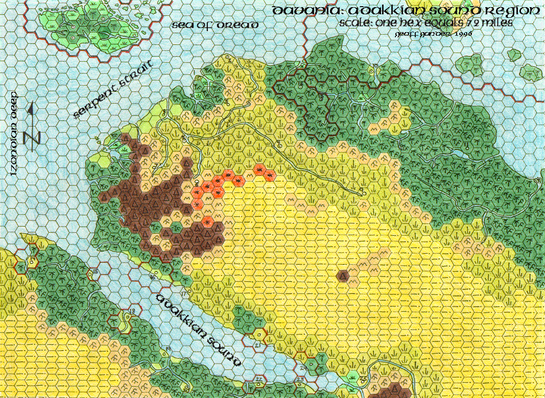
As far as I have been able to determine, this is the very first of these fan-made maps posted on the Internet: the first piece of Geoff Gander’s complete map of Davania at 72 miles per hex. It should come as no surprise that Geoff chose this piece of Davania, because it includes all of the hex map reference points between Davania, Brun, and the islands in between.
The map itself is a seminal work for Mystara, as it takes an area previously only shown in very rough form on the two world maps and adds details to every part of the continent. Every map of Davania since has either drawn inspiration from it or adopted its features wholesale. In short, it’s not just one of the earliest fan-made maps; it’s also one of the most influential.
Fan-made Map by Geoff Gander (October 1996)
This is an original map created by one of Mystara’s excellent fan cartographers. For more information on the cartographer, including a gallery of all their maps, see also Appendix M: Mappers of Mystara.
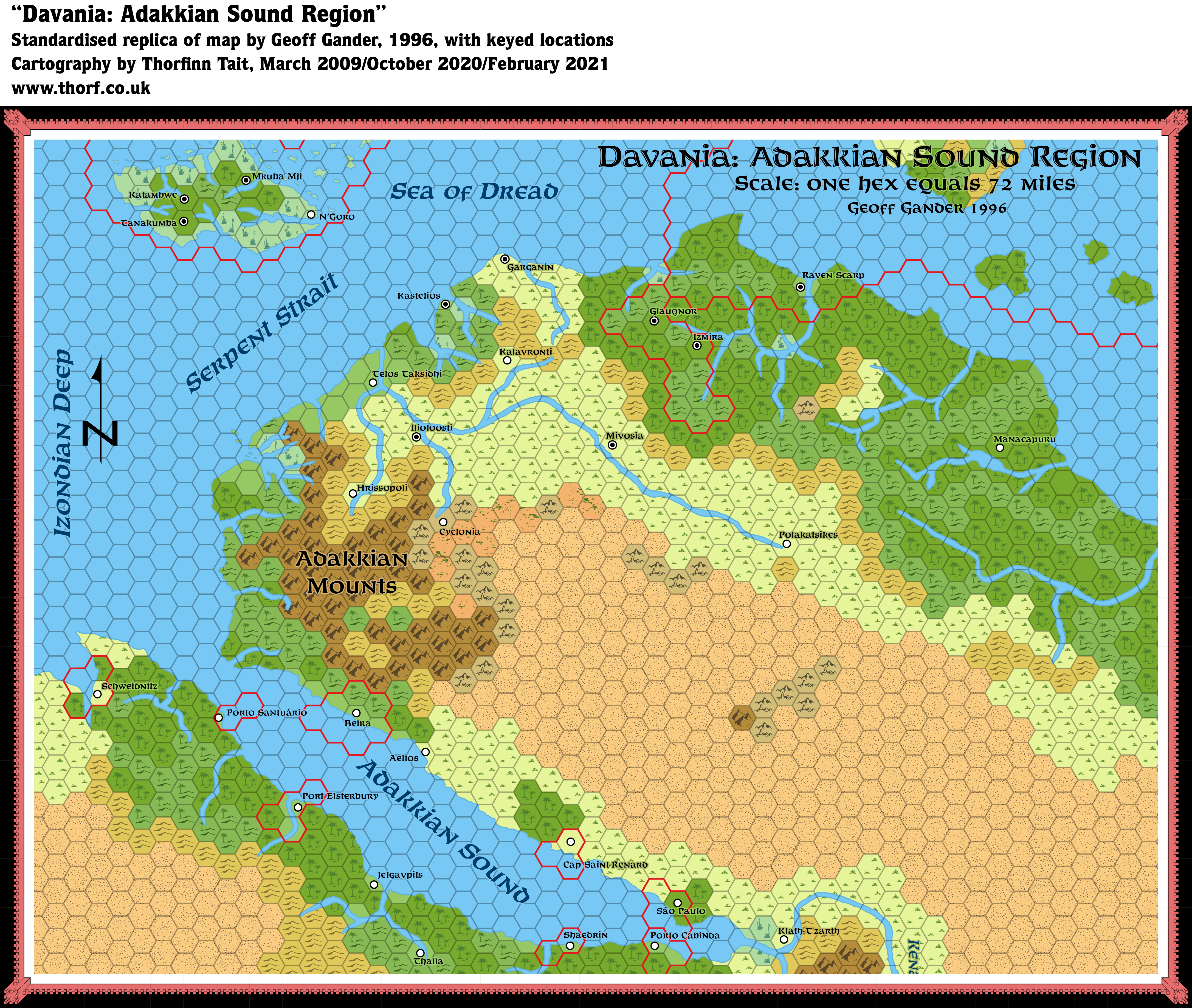
Replica Fan-made Map (February 2021)
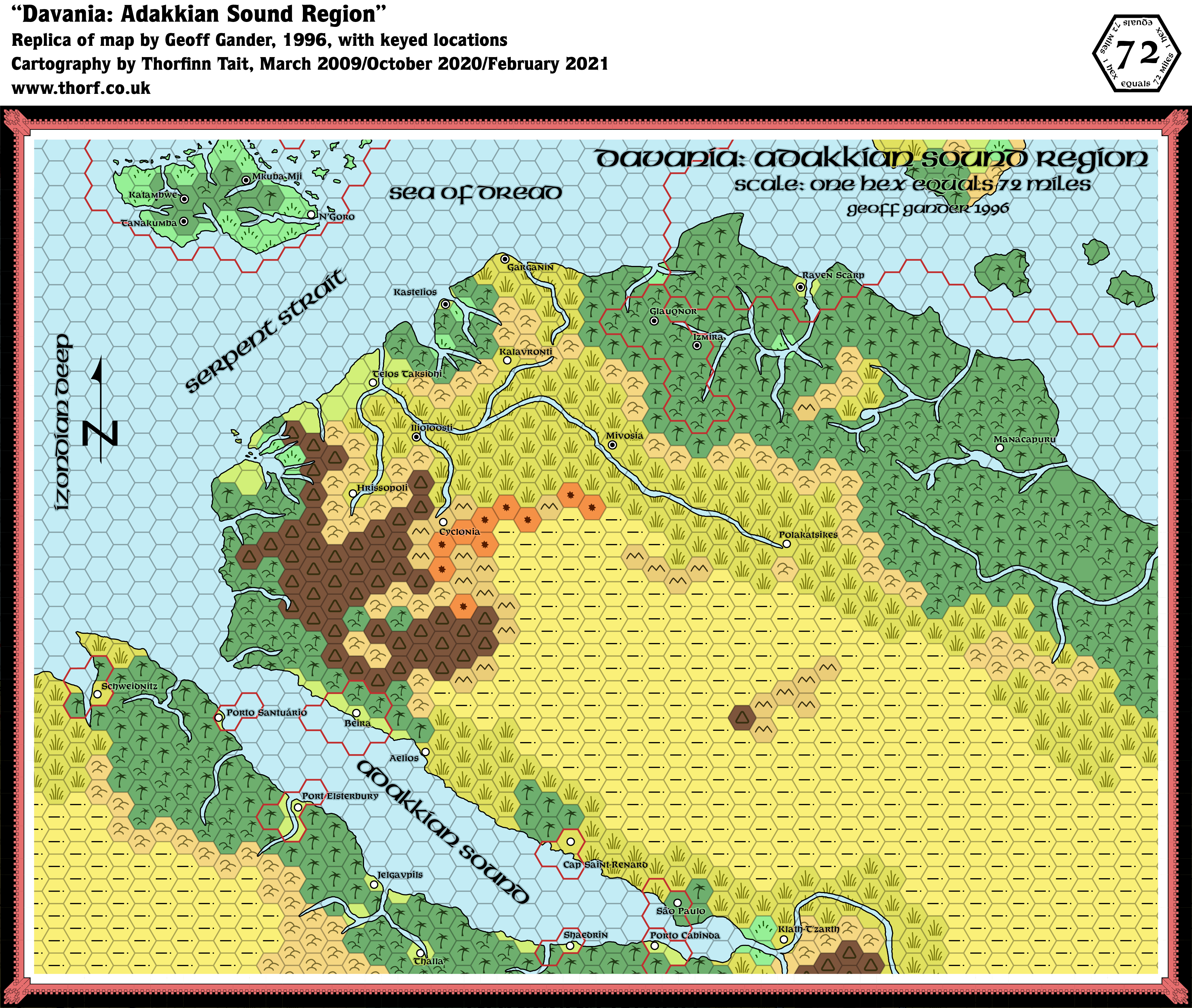
Replica Fan-made Map with Original Palette (February 2021)
Sources
- Dawn of the Emperors (1989) (PDF at DriveThruRPG)
- Hollow World Campaign Set (1990) (PDF at DriveThruRPG)
- Outer World Planetary Map
- Champions of Mystara (1993) (PDF at DriveThruRPG)
- Poor Wizard’s Almanac II (1993) (PDF at DriveThruRPG)
Secondary Sources
- Description of Cities in the Adakkian Sound region from the MML posted 18 June 1998 (Vaults of Pandius)
References
- Geoff’s entry in Appendix M: Mappers of Mystara
- Geoff’s author page at the Vaults of Pandius
Map Types
The Atlas of Mystara includes a few fundamentally different types of maps. The colour of the castle wall border on each map shows which category it belongs to.
- Replica maps (white castle border) are exact replicas of primary source maps. They present the world of Mystara as the original source materials depict it, warts and all. No attempt has been made to fix errors of any kind — even typos. As far as possible, replica maps use the same art as the original maps, though in many cases they are colourised. These maps are the main source material of the Atlas of Mystara, forming the base of all of the updated maps.
- Updated maps (green castle border) present the Atlas of Mystara’s consistent view of the world, with all errors, alignment issues, and so on fixed. They use standardised hex art and fonts. Anything not marked as a replica map is an updated map.
- Chronological maps (yellow castle border) provide snapshots of Mystara at the end of a certain year in its publication history. In effect, they are updated maps created from a limited list of sources. The years in question appear in the title of each map.
- Fan-made maps are unofficial maps created by other fan cartographers. As such, they do not follow the Atlas’s castle border colour scheme. The Atlas presents these maps in their original form, with the permission of the cartographers. The Atlas considers these maps secondary sources, and updated maps of areas not covered by official maps make extensive use of them. In a few cases, the Atlas also presents Replica fan-made maps (red castle border).
Chronological Analysis
This is a fan-made map. It was published in 1996. The updated Atlas version of this map is not yet available. See also Appendix C for annual chronological snapshots of the area. For the full context of this map in Mystara’s publication history, see the upcoming Let’s Map Mystara 1996. (Please note that it may be some time before the project reaches this point.)
The following lists are from the Let’s Map Mystara project. Additions are new features, introduced in this map; Revisions are changes to previously-introduced features; Hex Art & Fonts track design elements; and finally Textual Additions are potential features found in the related text. In most cases, the Atlas adopts these textual additions into updated and chronological maps.
Coming Soon


19 February 2021 @ 10:41 pm
Geoff’s Davania maps have long made me want too tackle mapping Davania at 24 miles per hex. I have visions of really creative ideas around mazes of canyons and plateaus with the massive mountain complex.