
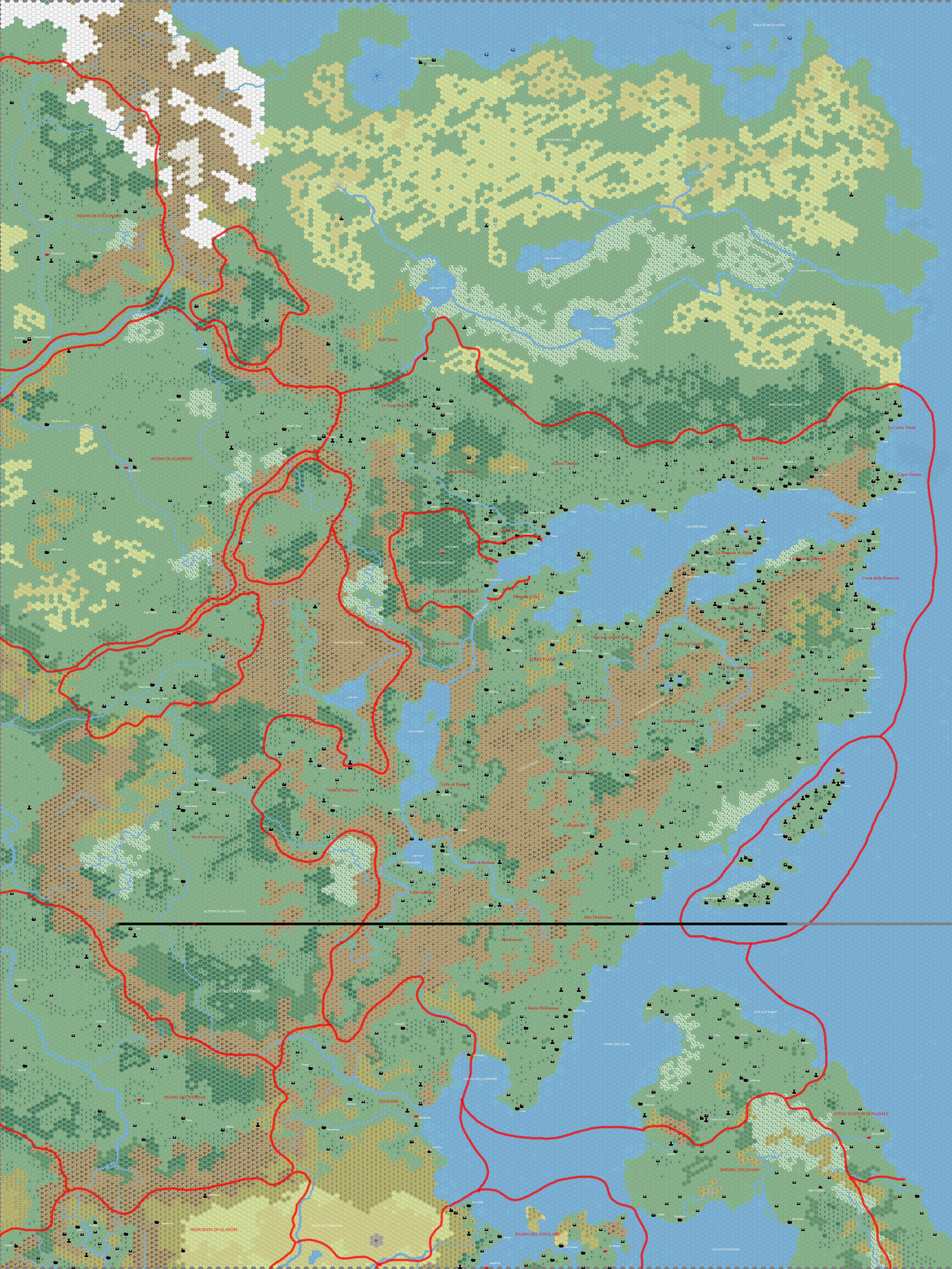
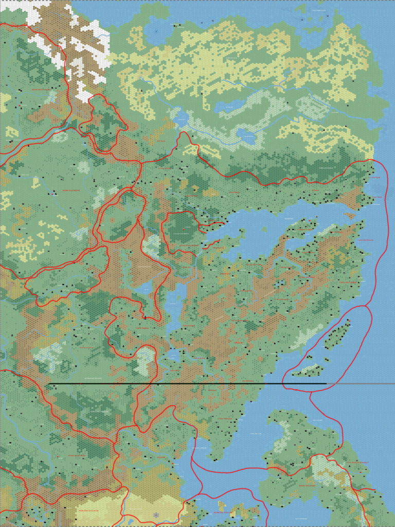
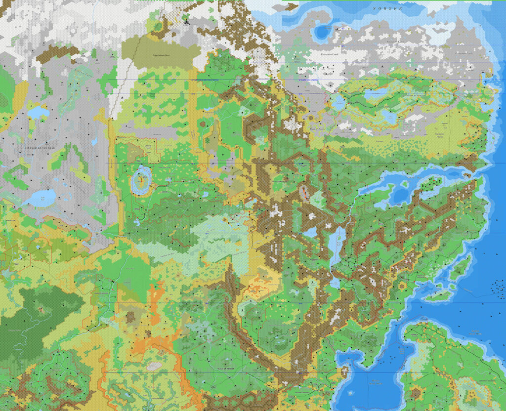
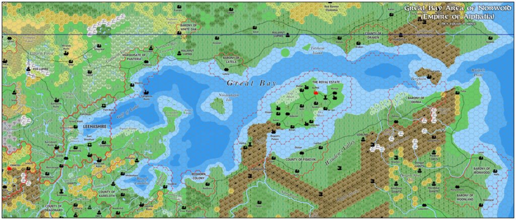
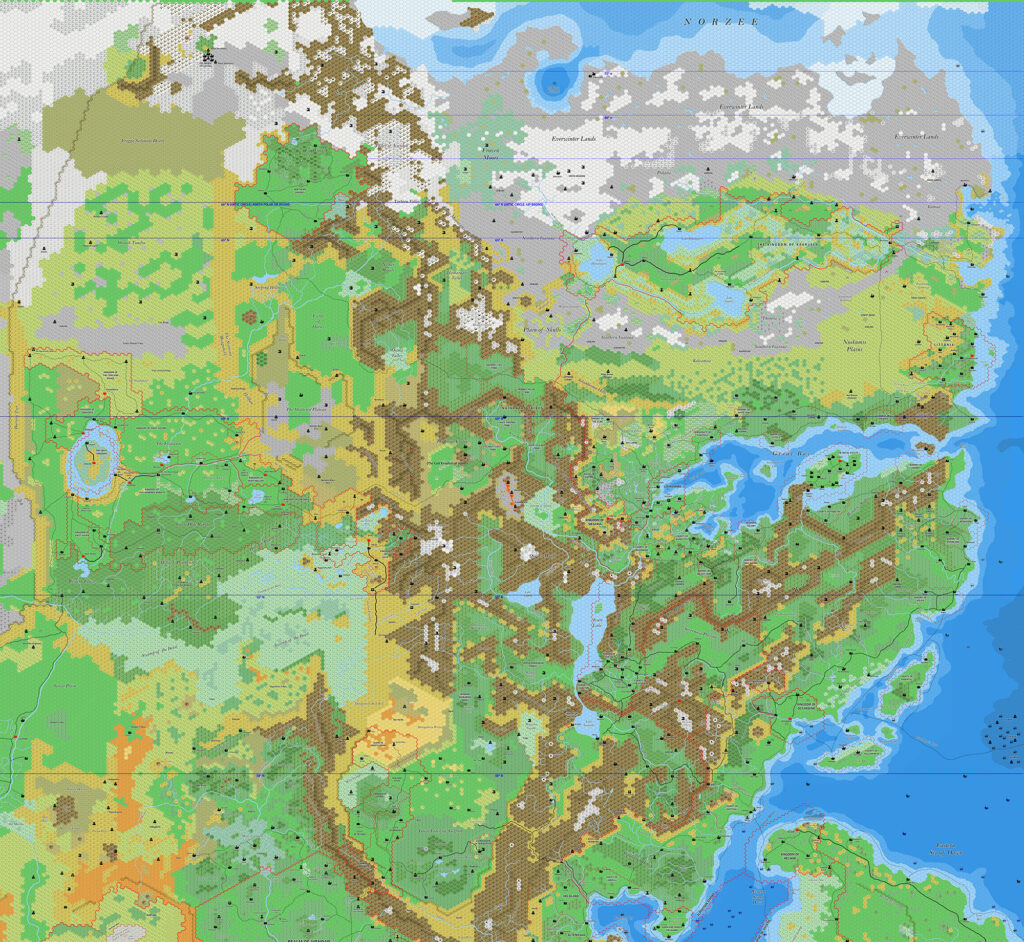
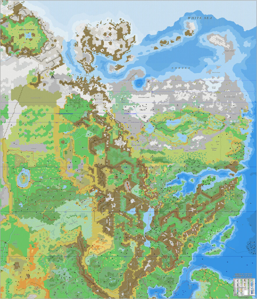
Kal’s Norwold, 8 miles per hex
Of the last set of maps Andrea shared in 2009, two were rather special — and quite different from his other maps. Both dealt with Norwold. The difference? The scale.
Up until this map, Andrea had only ever shared 24 mile per hex maps. There was no hint that he had worked on anything larger scale. But here we have a beautiful full 8 mile per hex map of Norwold, stretching all the way from Glantri in the south up to the far northern coast of Norwold. It’s such a massive undertaking that not many mappers have achieved such a map, even today. Andrea is one of those select few.
As with all of Andrea’s maps, it was designed for his own campaign, and therefore includes numerous changes and additions about which we have no further information. It’s also set in 1160 AC, the present day (at the time) of his campaign.
Finally, there is a visual error due to file corruption. As with his Borea map, I have converted the map to a new PNG file to avoid data errors, but the visual glitch remains.
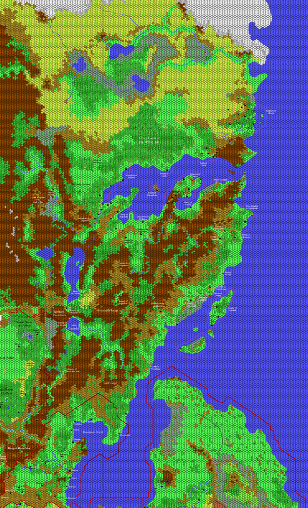
The existence of this map makes me wonder just how much of the world Andrea mapped out at larger scales. He is primarily known in the community as a mapper of the whole world, but in fact since he was creating these maps for his home game, it seems likely that he made more. A lot more, I would suspect.
Fan-made Map by Andrea Francolini (January 2009)
This is an original map created by one of Mystara’s excellent fan cartographers. For more information on the cartographer, including a gallery of all their maps, see also Appendix M: Mappers of Mystara.
Sources
- CM1 Test of the Warlords (1984) (PDF at DriveThruRPG)
Fan Sources
- Thibault’s Norwold, 8 miles per hex (2002)
- Thibault’s Norwold North, 8 miles per hex (2005)
- Thibault’s Norwold South, 8 miles per hex (2005)
References
- All of Andrea’s maps at the Atlas of Mystara
- Andrea’s entry in Appendix M: Mappers of Mystara (upcoming)
- Andrea’s author page at the Vaults of Pandius
Chronological Analysis
This is a fan-made map. It was published in January 2009. The updated Atlas version of this map is not yet available. See also Appendix C for annual chronological snapshots of the area. For the full context of this map in Mystara’s publication history, see the upcoming Let’s Map Mystara 2009. (Please note that it may be some time before the project reaches this point.)
The following lists are from the Let’s Map Mystara project. Additions are new features, introduced in this map. Revisions are changes to previously-introduced features. Hex Art & Fonts track design elements. Finally, Textual Additions are potential features found in the related text. In most cases, the Atlas adopts these textual additions into updated and chronological maps.
Under Construction! Please check back again soon for updates.
")

