
M5 Valley of Kings, 24 miles per hex
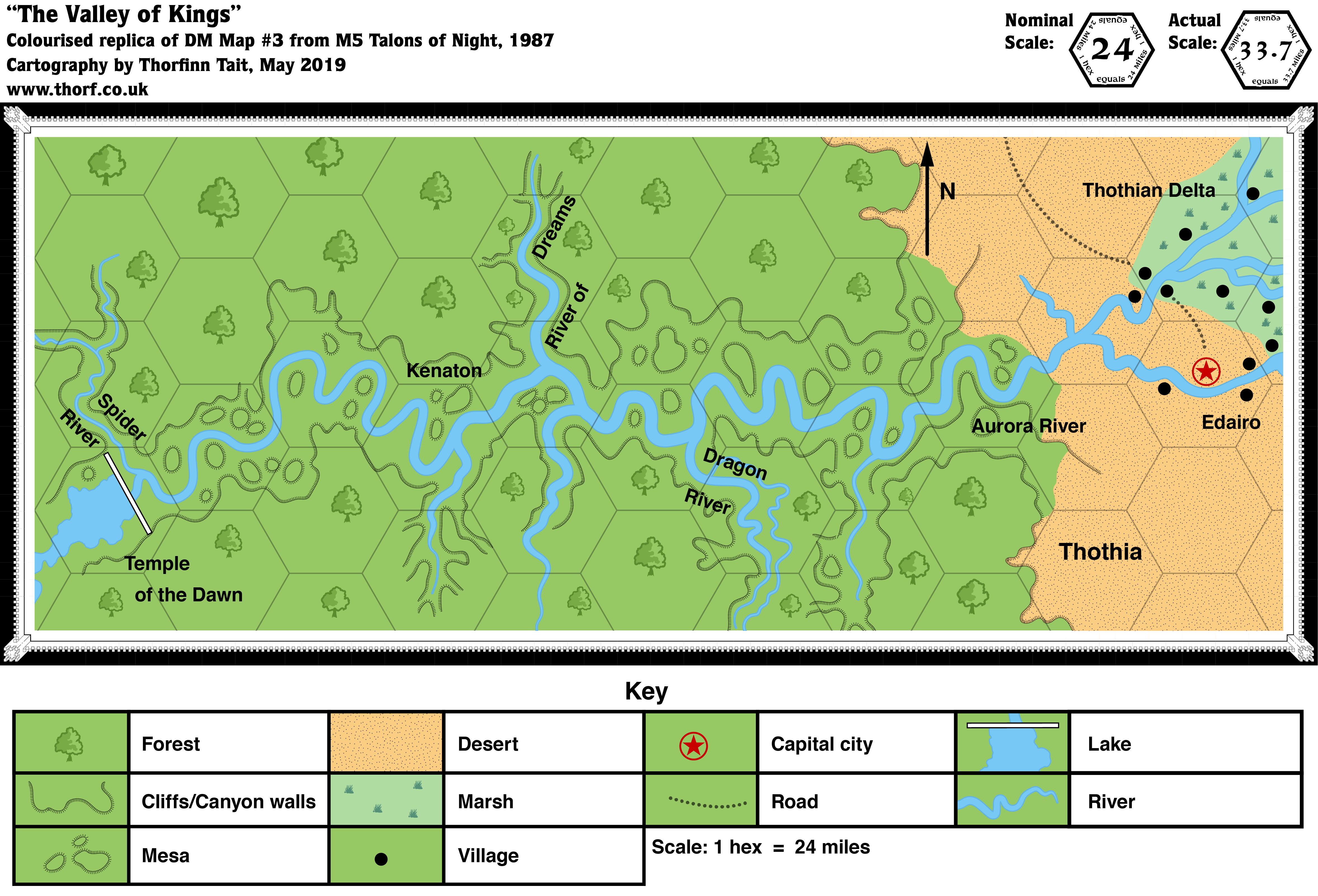
M5 included a few detail maps of the area around the Aurora River flowing down from the Upper Thothian Plateau. Of these, the Valley of the Kings map is by far the best, depicting a river winding through canyons until it reaches its delta and the coast.
The map uses the same hexes as the larger Isle of Dawn map, but printed much larger. My replica is larger still, equating to a 6.7 mile per hex map if compared to my regular hexes — five of which would fit inside each of these large hexes.
Replica Map (May 2019)
Sources
- M5 Talons of Night (1987) (PDF at DriveThruRPG)
- “DM Map #3: The Valley of Kings”, page 23
- “Players’ Aid #4: The Valley of the Dawn”, page 27
- Cartography by Dennis Kauth, Steve Sullivan
Map Types
The Atlas of Mystara includes a few fundamentally different types of maps. The colour of the castle wall border on each map shows which category it belongs to.
- Replica maps (white castle border) are exact replicas of primary source maps. They present the world of Mystara as the original source materials depict it, warts and all. No attempt has been made to fix errors of any kind — even typos. As far as possible, replica maps use the same art as the original maps, though in many cases they are colourised. These maps are the main source material of the Atlas of Mystara, forming the base of all of the updated maps.
- Updated maps (green castle border) present the Atlas of Mystara’s consistent view of the world, with all errors, alignment issues, and so on fixed. They use standardised hex art and fonts. Anything not marked as a replica map is an updated map.
- Chronological maps (yellow castle border) provide snapshots of Mystara at the end of a certain year in its publication history. In effect, they are updated maps created from a limited list of sources. The years in question appear in the title of each map.
- Fan-made maps are unofficial maps created by other fan cartographers. As such, they do not follow the Atlas’s castle border colour scheme. The Atlas presents these maps in their original form, with the permission of the cartographers. The Atlas considers these maps secondary sources, and updated maps of areas not covered by official maps make extensive use of them. In a few cases, the Atlas also presents Replica fan-made maps (red castle border).
Chronological Analysis
This is Map 71. It was published in 1987. The updated version of this map has not yet been released. See also Appendix C for annual chronological snapshots of the area. For the full context of this map in Mystara’s publication history, see the upcoming Let’s Map Mystara 1987.
The following lists are from the Let’s Map Mystara project. Additions are new features, introduced in this map; Revisions are changes to previously-introduced features; Hex Art & Fonts track design elements; and finally Textual Additions are potential features found in the related text. In most cases, the Atlas adopts these textual additions into updated and chronological maps.
Coming Soon


