
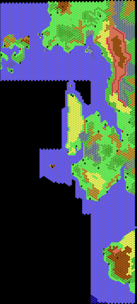
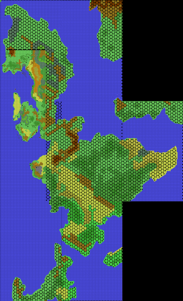
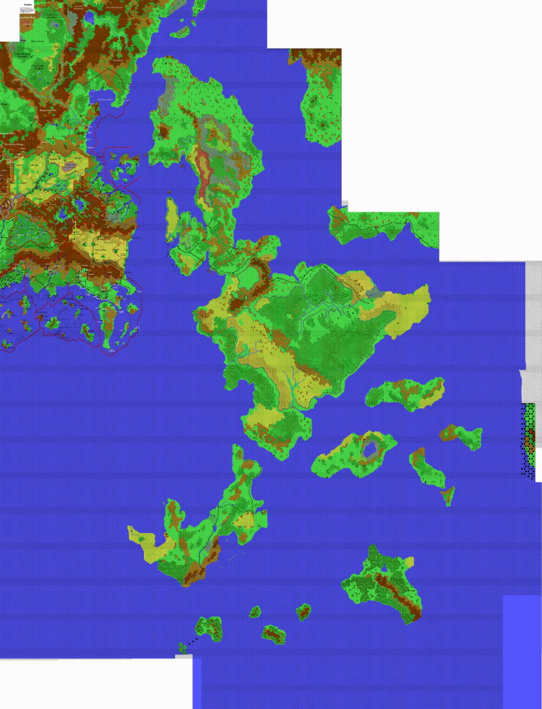
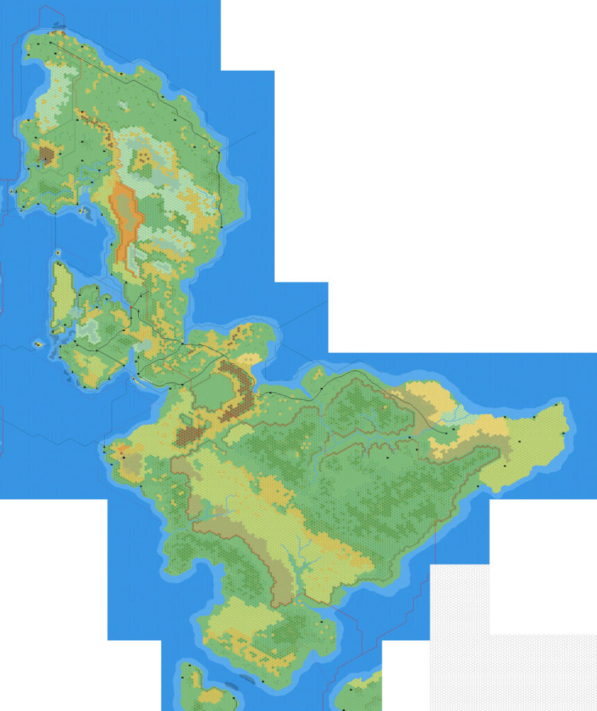
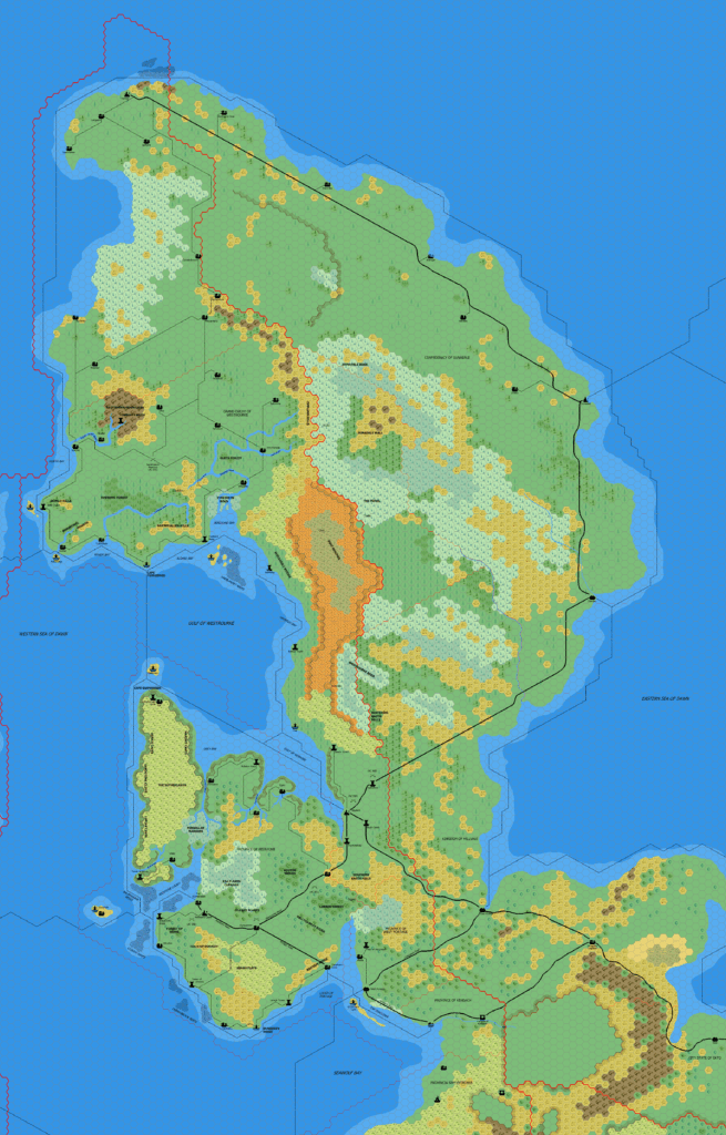
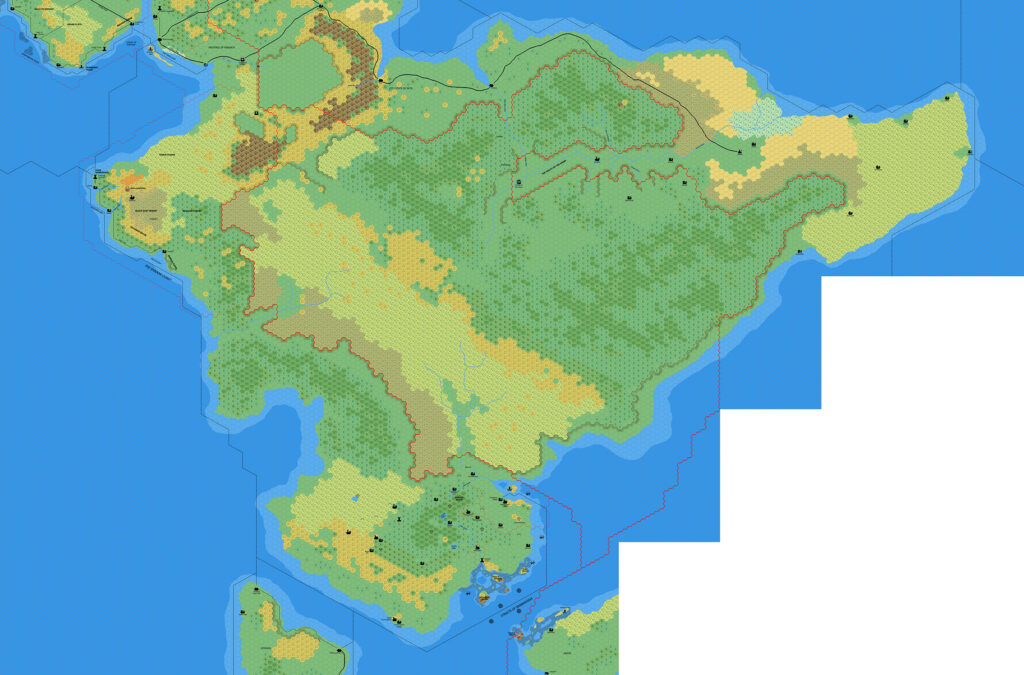
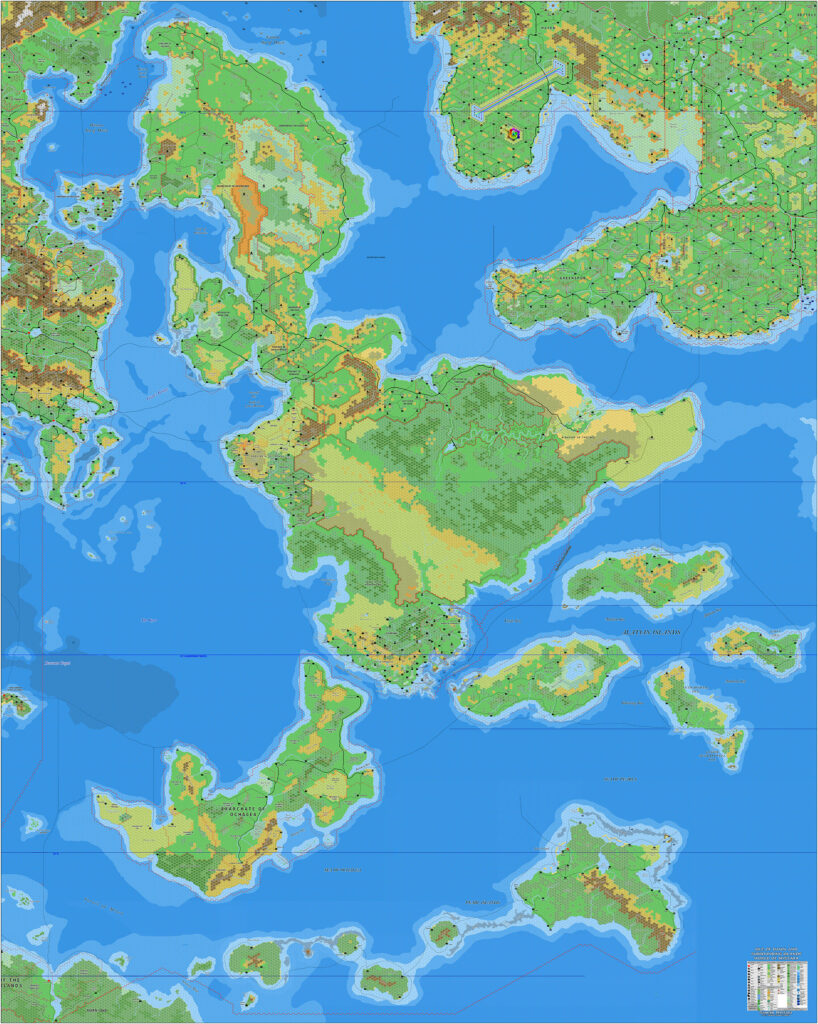
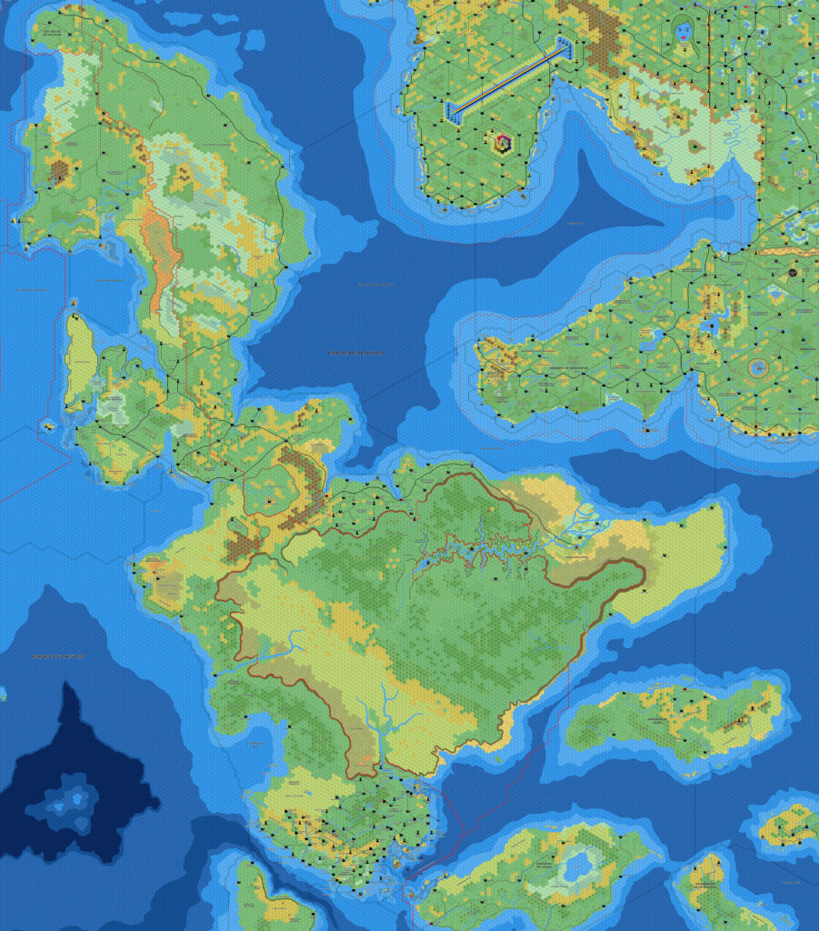
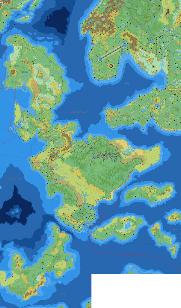
Mark’s Isle of Dawn, 8 miles per hex v3
For the full story of Mark’s 2025 redesign of his mapping style, see the post for his Known World, 8 miles per hex v3 map.
As with his Known World map, Mark expanded his Isle of Dawn map to the south, adding in most of Ochalea and more of the Alatian Islands. Only eastern Gaity remains unmapped at this point. On the other hand, there is a glaring gap in the southeast, where only the edges of the Pearl Islands are visible. It seems likely that Mark will add these in at some point in the future, so surely at least one more update is on the cards.
He also expanded to the north, so that the coast of Norwold is now included, along with another large chunk of Alphatia.
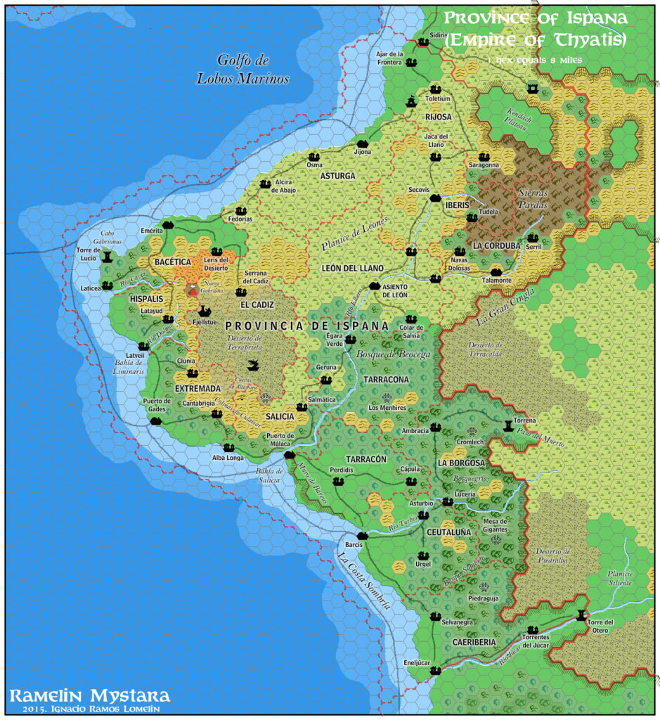
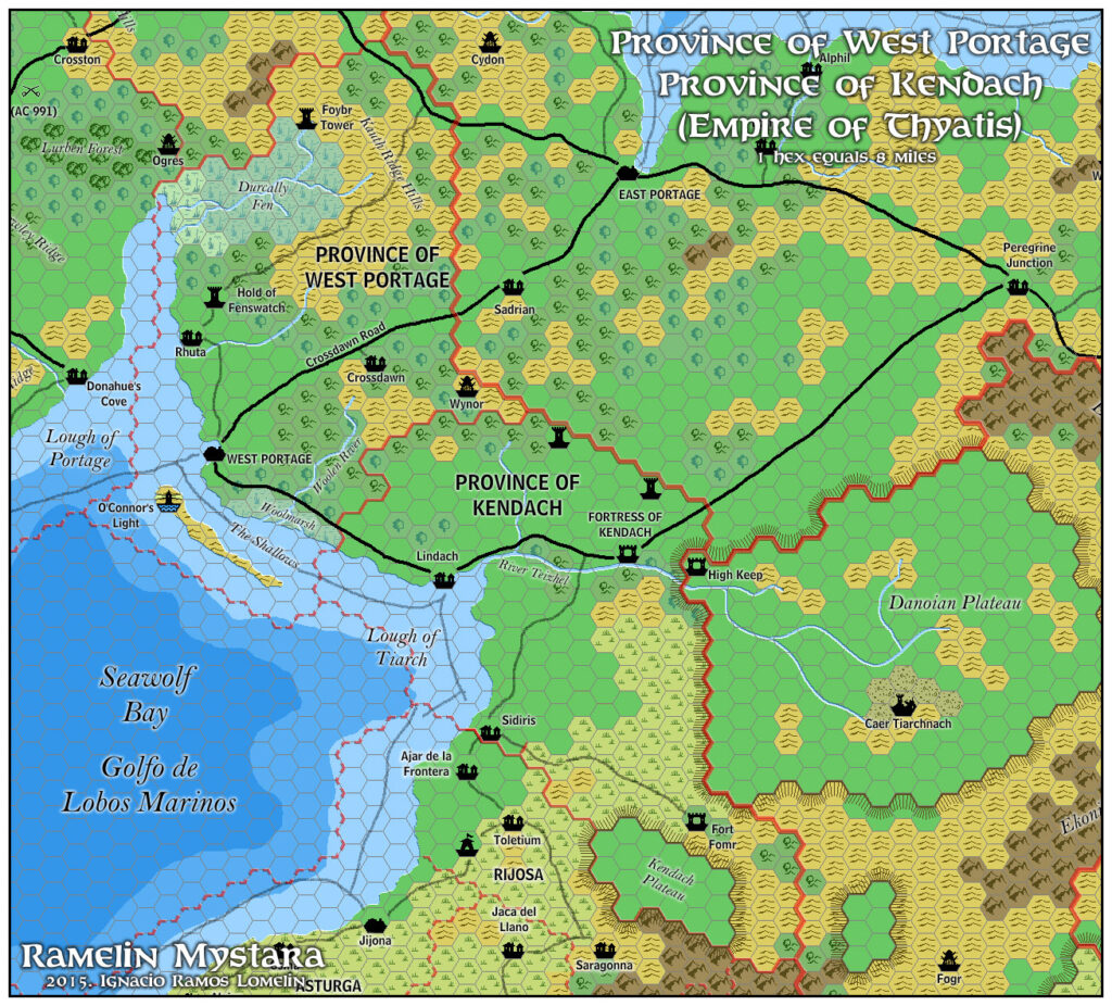
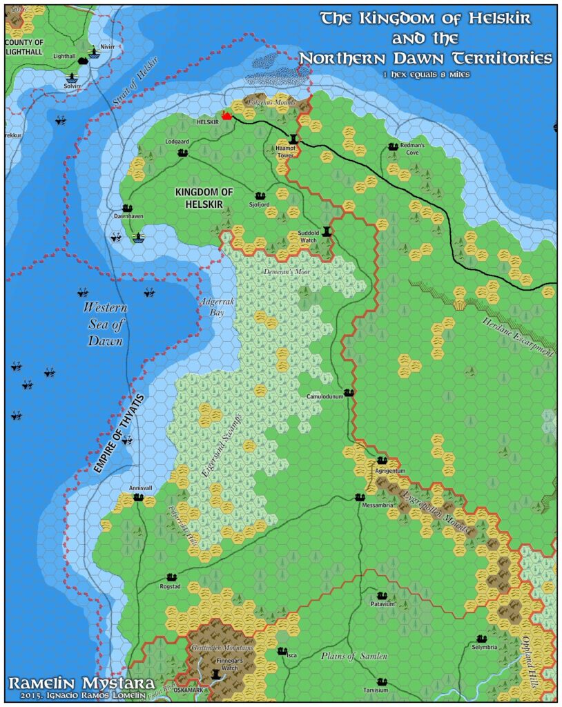
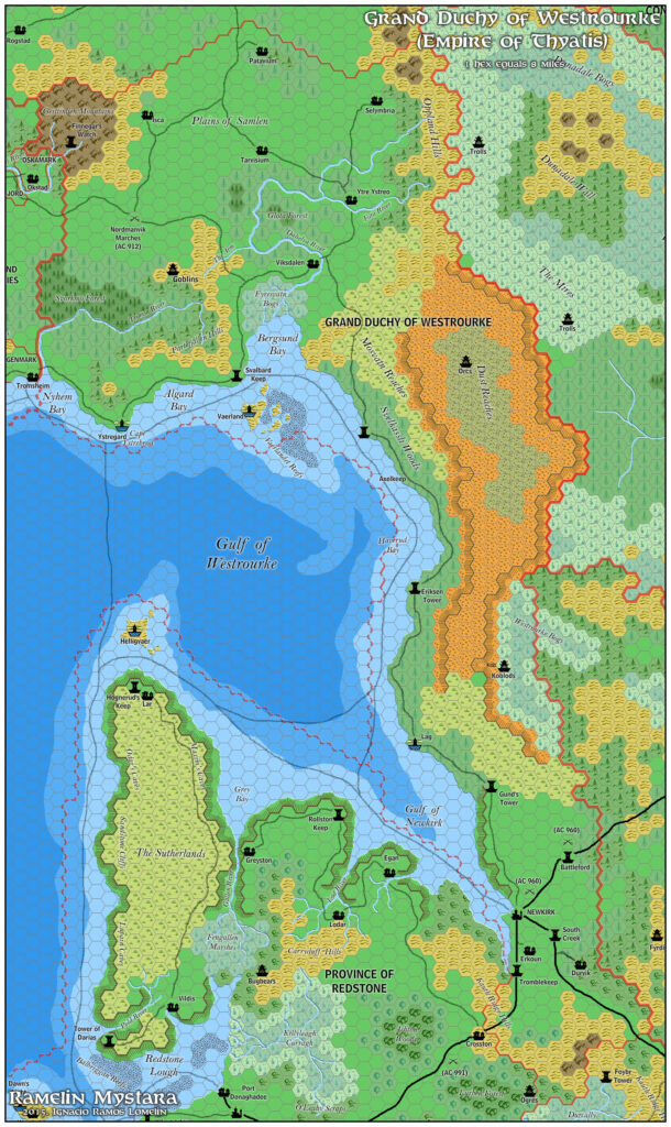
Finally, Mark noted that he had added in some more details: “There are a few additional areas and new labels included as I’ve reviewed some additional sources (mainly Ramelin) and made a few things up for my own work.” These additions include a lot of new settlements and other features around the Shadow Coast area of the Isle of Dawn.
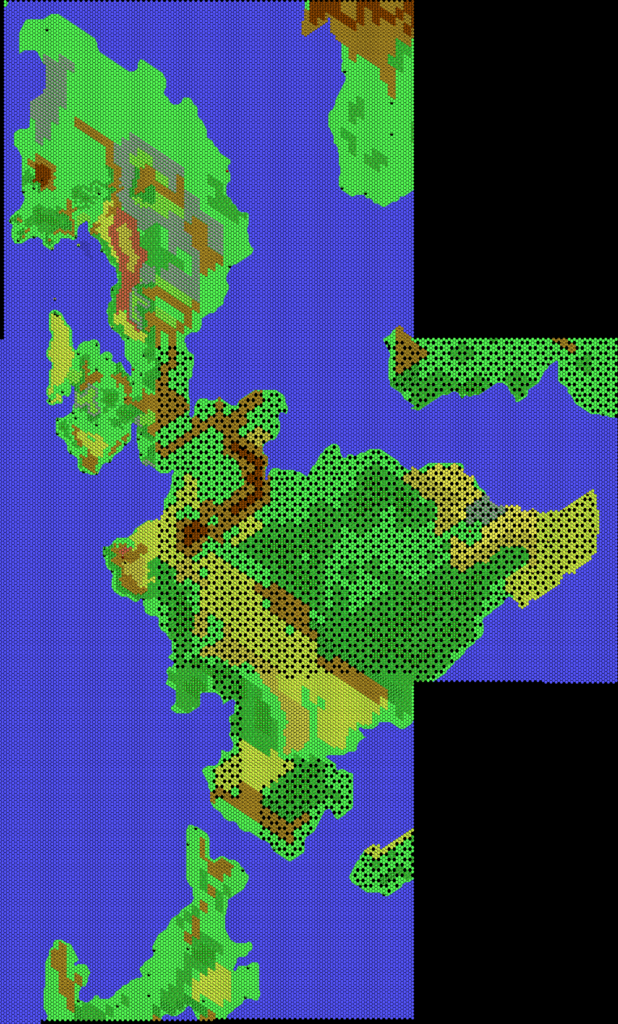
Fan-made Map by Mark Howard (July 2025)

This is an original map created by one of Mystara’s excellent fan cartographers. For more information on the cartographer, including a gallery of all their maps, see also Appendix M: Mappers of Mystara.
Sources
- Dawn of the Emperors (1989) (PDF at DriveThruRPG)
- TM2 The Eastern Countries (1989) (PDF at DriveThruRPG)
Fan Sources
- Thibault’s Isle of Dawn, 8 miles per hex v4 (September 2002)
- Mark’s Isle of Dawn, 8 miles per hex v1 (April 2006)
- Mark’s Isle of Dawn North, 8 miles per hex (September 2006)
- Mark’s Isle of Dawn South, 8 miles per hex (October 2006)
- Zendrolion’s Caerdania, 8 miles per hex (April 2008)
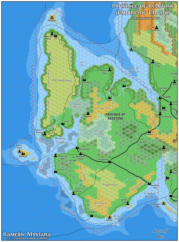
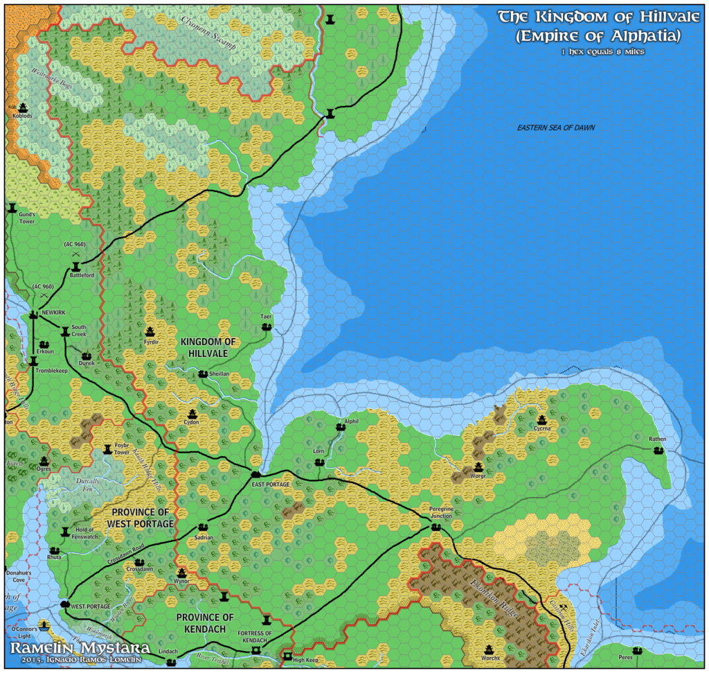
- Ramelin’s Isle of Dawn, 8 miles per hex (November 2017)
- Mark’s Isle of Dawn, 8 miles per hex v2 (January 2022)
- New Maps at Mark’s web site (July 2025)
References
- All of Mark’s maps at the Atlas of Mystara
- Mark’s entry in Appendix M: Mappers of Mystara (upcoming)
- Mark’s author page at the Vaults of Pandius
Chronological Analysis
This is a fan-made map. It was published in July 2025. The updated Atlas version of this map is not yet available. See also Appendix C for annual chronological snapshots of the area. For the full context of this map in Mystara’s publication history, see the upcoming Let’s Map Mystara 2025.
The following lists are from the Let’s Map Mystara project. Additions are new features, introduced in this map. Revisions are changes to previously-introduced features. Hex Art & Fonts track design elements. Finally, Textual Additions are potential features found in the related text. In most cases, the Atlas adopts these textual additions into updated and chronological maps.
Under Construction! Please check back again soon for updates.

")
