
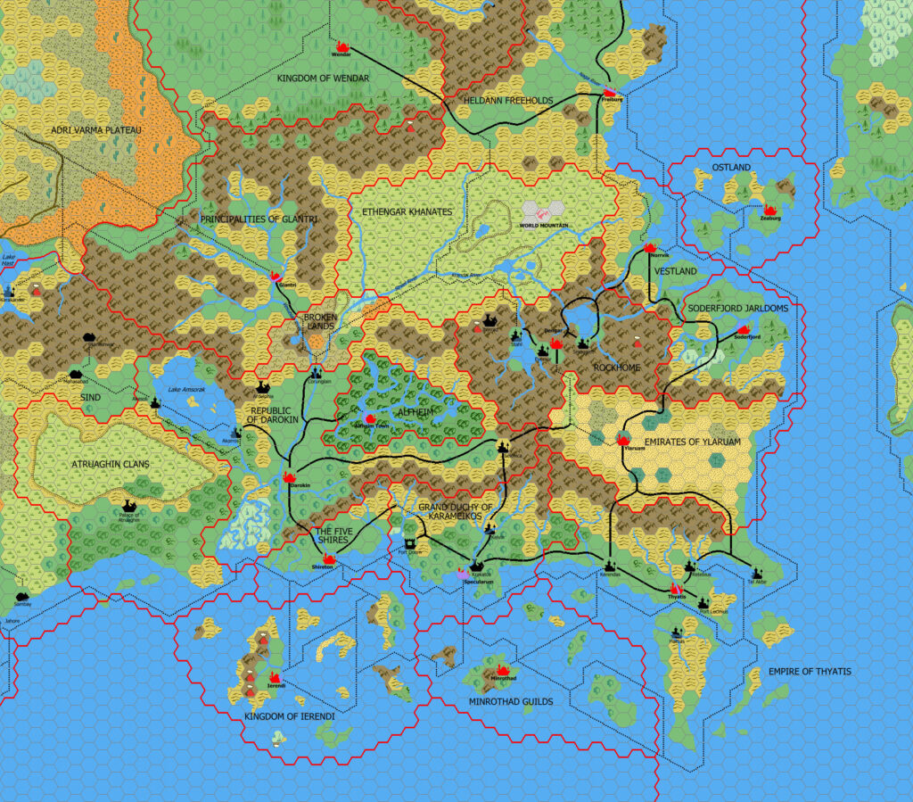
Mark’s Known World Region, 8 miles per hex v2
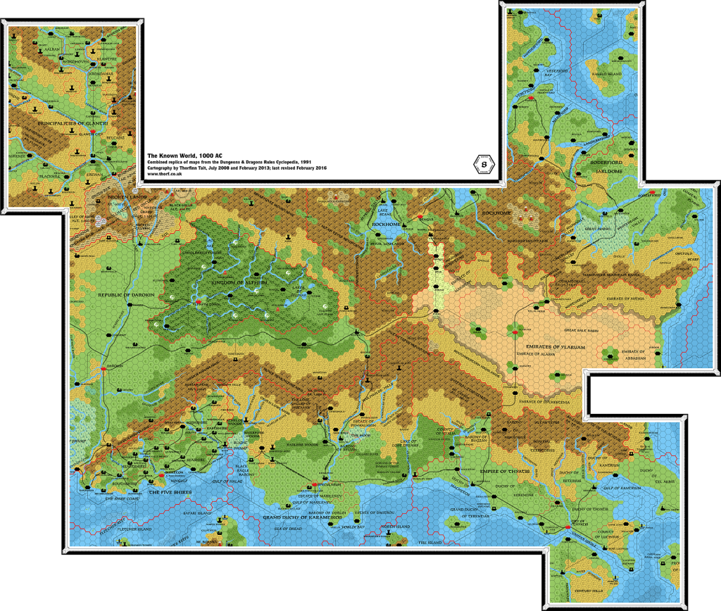
Although he didn’t announce these updates on his web page, Mark continued to revise and update his new Known World trail map from its debut in February 2021. I have divided these maps into three groups to avoid too much duplication. The first two versions established the base map. The next three, in this post, tweaked the artwork and made some other small adjustments, mainly at the northern and eastern edges of the map.
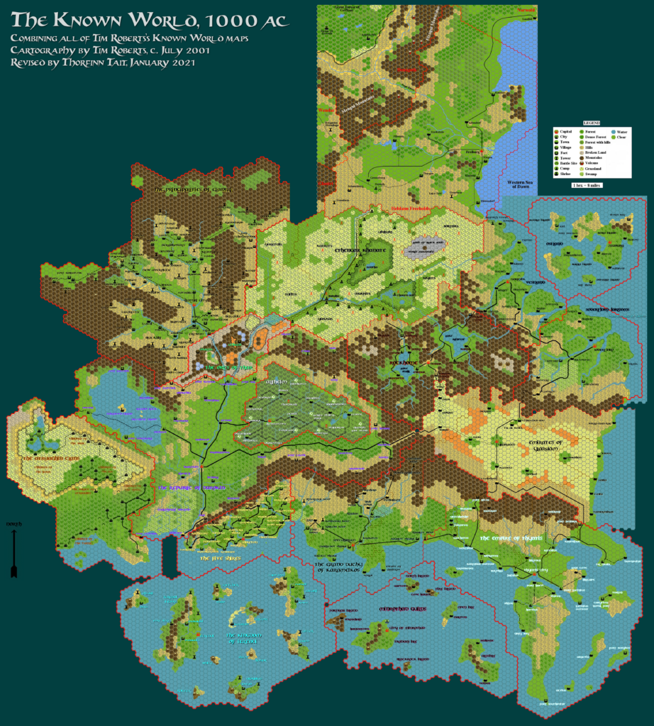
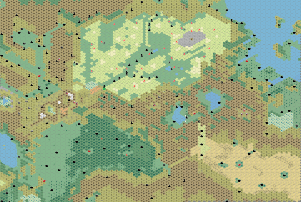
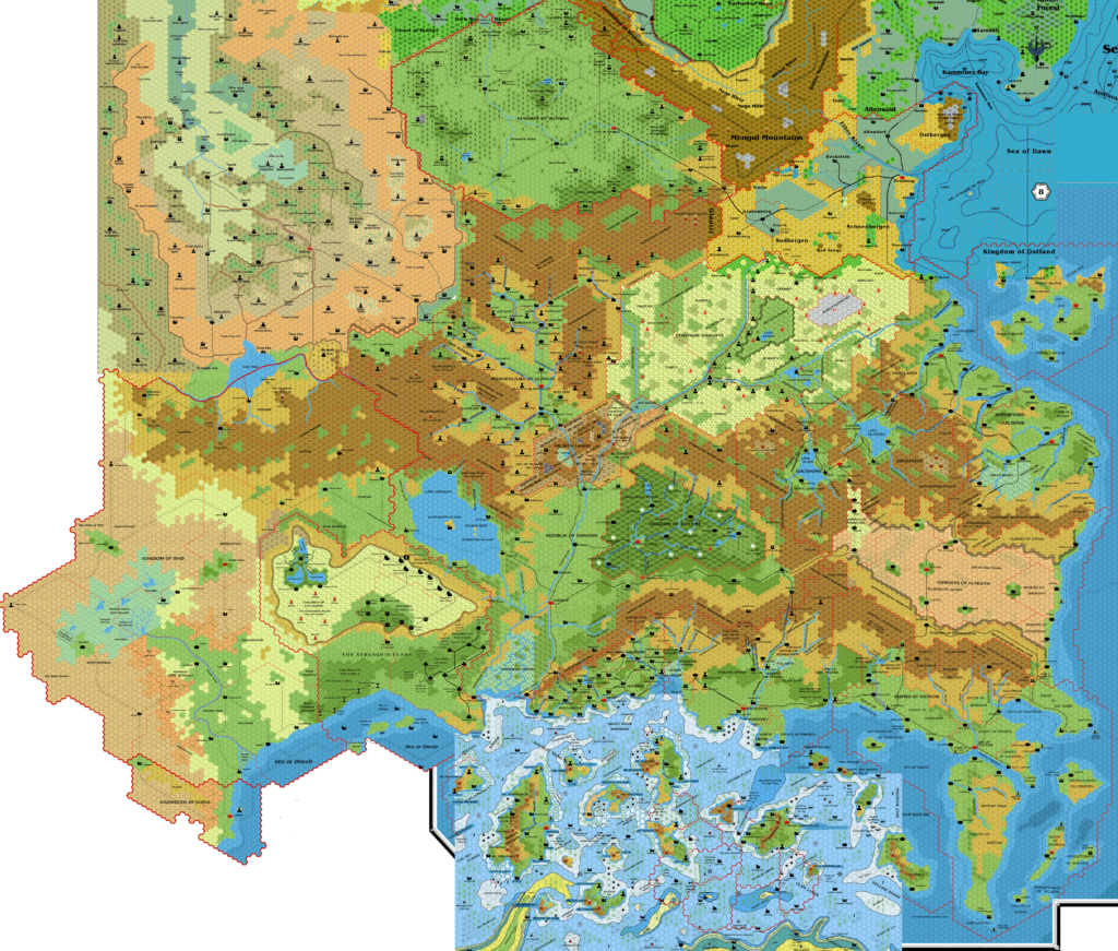
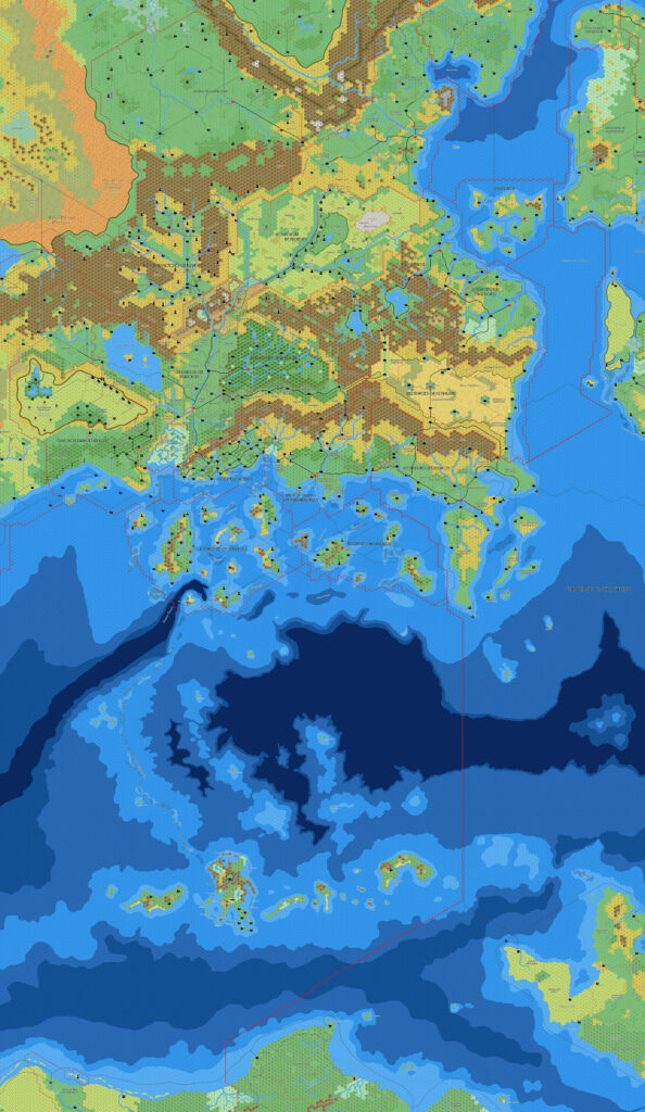
The art upgrade affected the plateaus, which Mark had long been unhappy with. He achieved his new style as early as April 2021, just a couple of months after posting the first versions. You can see this second below.
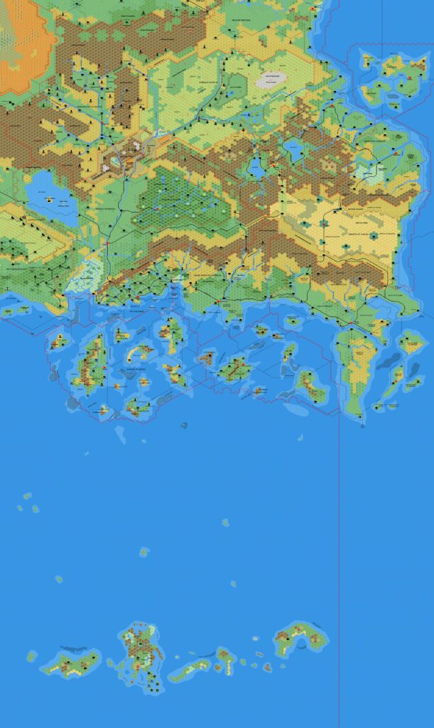
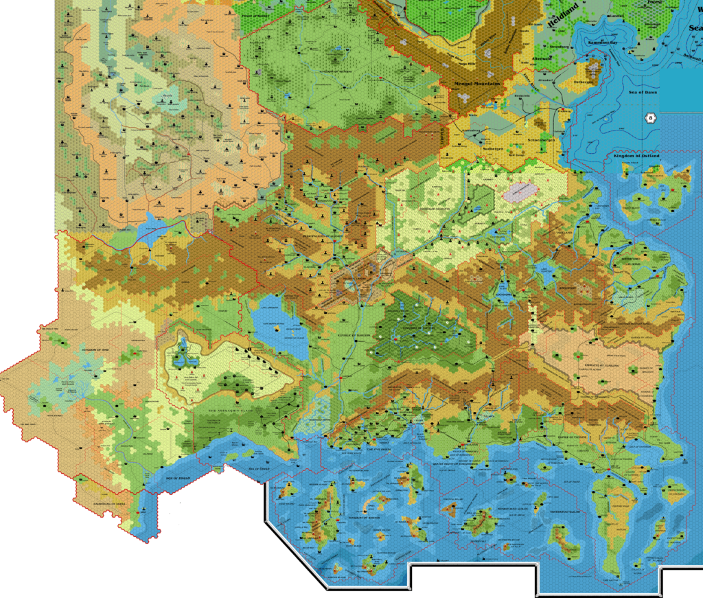
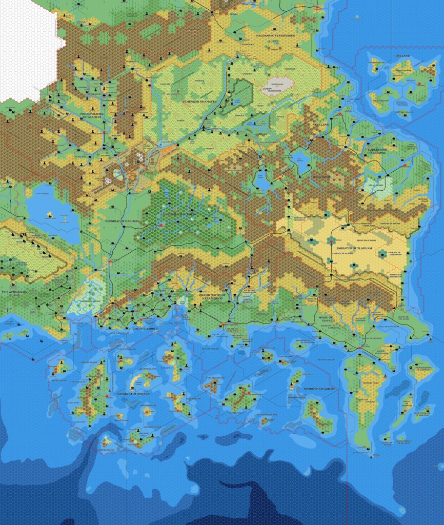
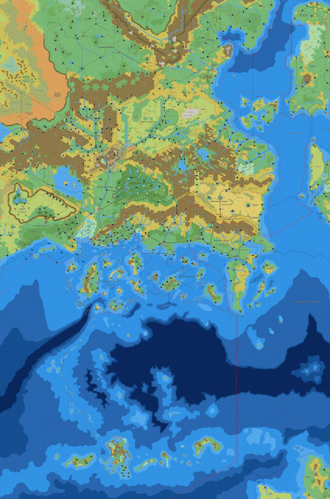
He then made successive changes in another three versions, all in January 2022, although I have missed out the middle two and skipped to the last one (first below). These changes included: tweaks to trails in the Adri Varma, Wendar, Denagoth, and northern Isle of Dawn; fixes to at least one label that had been clipped accidentally; and the addition of a double border marking the extents of the Empire of Thyatis.
There may have been other minor changes besides these, but in general there’s minimal difference between any two versions of these maps. Note also that Mark probably considers these all to be incremental updates to the same map; I have merely tracked his progress through the files available to me.
Mark would return with a further version in 2025, with more sweeping changes.
Fan-made Map by Mark Howard (January 2022)
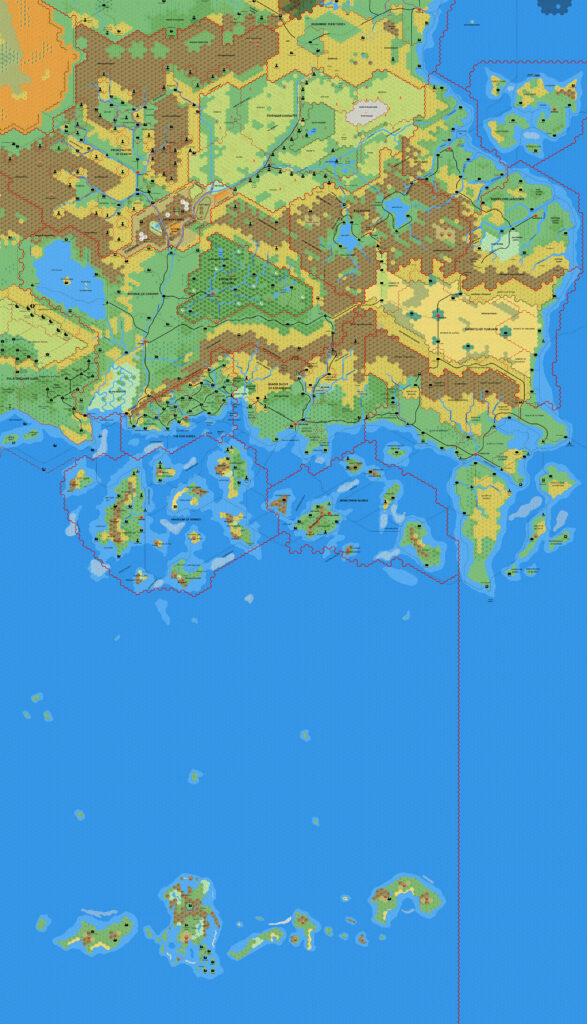
Fan-made Map by Mark Howard (April 2021)

This is an original map created by one of Mystara’s excellent fan cartographers. For more information on the cartographer, including a gallery of all their maps, see also Appendix M: Mappers of Mystara.
Sources
- GAZ1 The Grand Duchy of Karameikos (1987) (PDF at DriveThruRPG)
- GAZ2 The Emirates of Ylaruam (1987) (PDF at DriveThruRPG)
- GAZ3 The Principalities of Glantri (1987) (PDF at DriveThruRPG)
- GAZ4 The Kingdom of Ierendi (1987) (PDF at DriveThruRPG)
- GAZ5 The Elves of Alfheim (1988) (PDF at DriveThruRPG)
- GAZ6 The Dwarves of Rockhome (1988) (PDF at DriveThruRPG)
- GAZ7 The Northern Reaches (1988) (PDF at DriveThruRPG)
- GAZ8 The Five Shires (1988) (PDF at DriveThruRPG)
- GAZ9 The Minrothad Guilds (1988) (PDF at DriveThruRPG)
- GAZ10 The Orcs of Thar (1989) (PDF at DriveThruRPG)
- GAZ11 The Republic of Darokin (1989) (PDF at DriveThruRPG)
- GAZ12 The Golden Khan of Ethengar (1989) (PDF at DriveThruRPG)
- GAZ14 The Atruaghin Clans (1991) (PDF at DriveThruRPG)
- Dawn of the Emperors (1989) (PDF at DriveThruRPG)
- TM1 The Western Countries (1989) (PDF at DriveThruRPG)
- TM2 The Eastern Countries (1989) (PDF at DriveThruRPG)
- PC3 The Sea People (1990) (PDF at DriveThruRPG)
Fan Sources
- Geoff’s Heldann, 8 miles per hex (1998)
- Atlas of Mystara (2005-present)
- Norwold placement from Brun, 24 miles per hex (1984)
- Discussions of Isle of Dread placement
- Mark’s Known World, 8 miles per hex v1 (March 2005)
- Geoff’s Northern Wildlands, 8 miles per hex (November 2005)
- Mark’s Known World and Sea of Dread, 8 miles per hex v1 (April 2006)
- JTR’s Denagoth, 8 miles per hex (April 2006)
- JTR’s Heldann, 8 miles per hex (May 2007)
- JTR’s Landfall, 8 miles per hex (July 2007)
- Mark’s Known World and Sea of Dread, 8 miles per hex v2 (January 2019)
- Mark’s Known World, 8 miles per hex v2 (September 2019, April 2020)
- Known World (Reworked) at Mark’s web site (February 2021)
- Mark’s Known World Region, 8 miles per hex v1 (February 2021)
References
- All of Mark’s maps at the Atlas of Mystara
- Mark’s entry in Appendix M: Mappers of Mystara (upcoming)
- Mark’s author page at the Vaults of Pandius
Chronological Analysis
This is a fan-made map. It was published in April 2021 and January 2022. The updated Atlas version of this map is not yet available. See also Appendix C for annual chronological snapshots of the area. For the full context of this map in Mystara’s publication history, see the upcoming Let’s Map Mystara 2021 and 2022.
The following lists are from the Let’s Map Mystara project. Additions are new features, introduced in this map. Revisions are changes to previously-introduced features. Hex Art & Fonts track design elements. Finally, Textual Additions are potential features found in the related text. In most cases, the Atlas adopts these textual additions into updated and chronological maps.
Under Construction! Please check back again soon for updates.


")