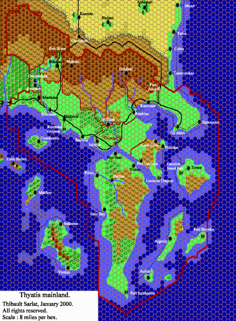
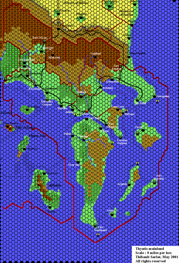
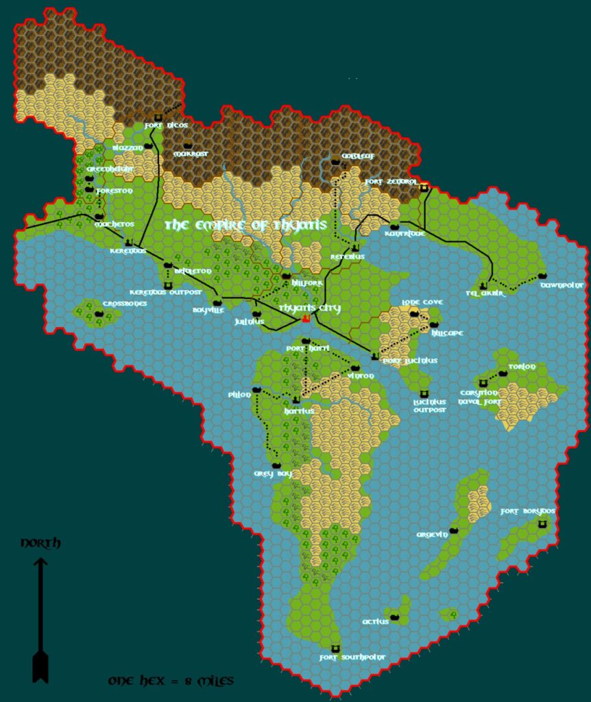
Tim’s Thyatis, 8 miles per hex
For an introduction to Tim’s hex maps, see the post for his Known World, 24 miles per hex map.
Along with Karameikos and the Five Shires, Thyatis was one of the nations that Tim had mapped previously in Campaign Cartographer. Unlike that map, his hex map stayed largely true to the original Dawn of the Emperors map.
Fan-made Map by Tim Roberts (c. July 2001)

This is an original map created by one of Mystara’s excellent fan cartographers. For more information on the cartographer, including a gallery of all their maps, see also Appendix M: Mappers of Mystara.
The Atlas has been unable to contact the original cartographer. This map therefore appears here without explicit permission from its creator. Any information on how to get in touch with them would be most welcome.
Sources
- Dawn of the Emperors (1989) (PDF at DriveThruRPG)
Fan Sources
- Tim’s Thyatis (1998)
References
- All of Tim’s maps at the Atlas of Mystara
Chronological Analysis
This is a fan-made map. It was likely published in July 2001. The updated Atlas version of this map is Thyatis, 8 miles per hex. See also Appendix C for annual chronological snapshots of the area. For the full context of this map in Mystara’s publication history, see the upcoming Let’s Map Mystara 2001. (Please note that it may be some time before the project reaches this point.)
The following lists are from the Let’s Map Mystara project. Additions are new features, introduced in this map. Revisions are changes to previously-introduced features. Hex Art & Fonts track design elements. Finally, Textual Additions are potential features found in the related text. In most cases, the Atlas adopts these textual additions into updated and chronological maps.
Under Construction! Please check back again soon for updates.