
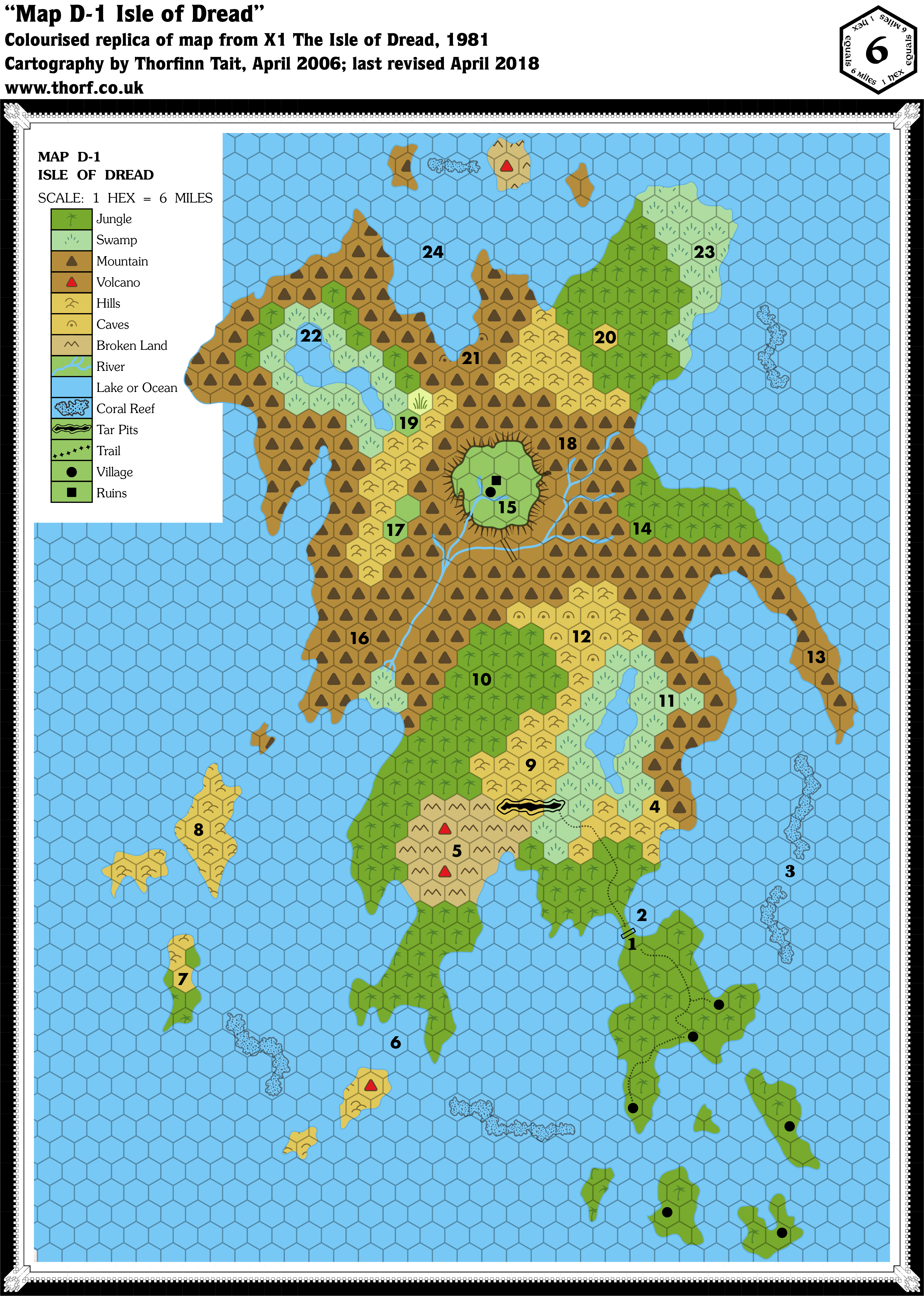
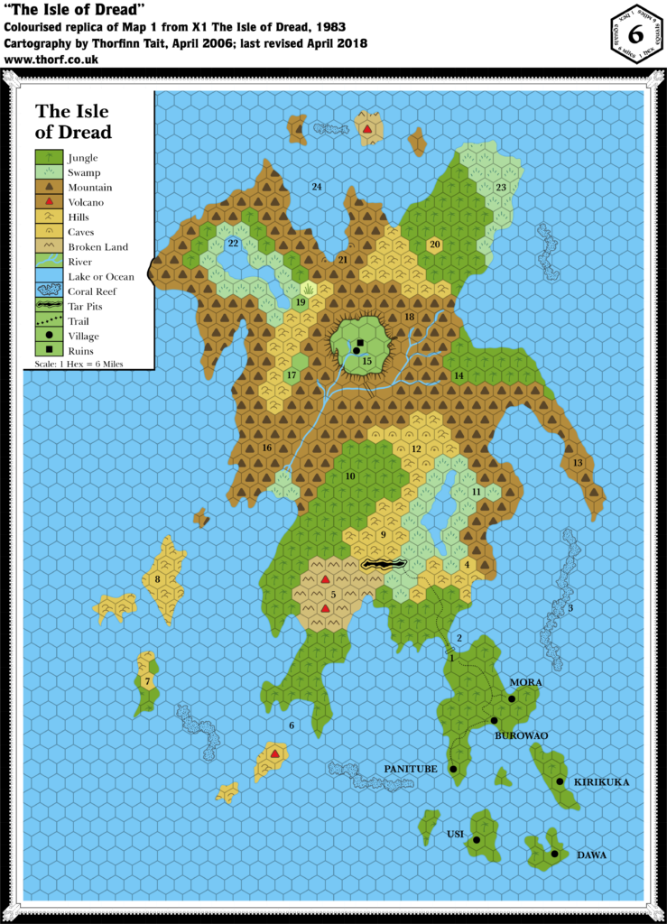
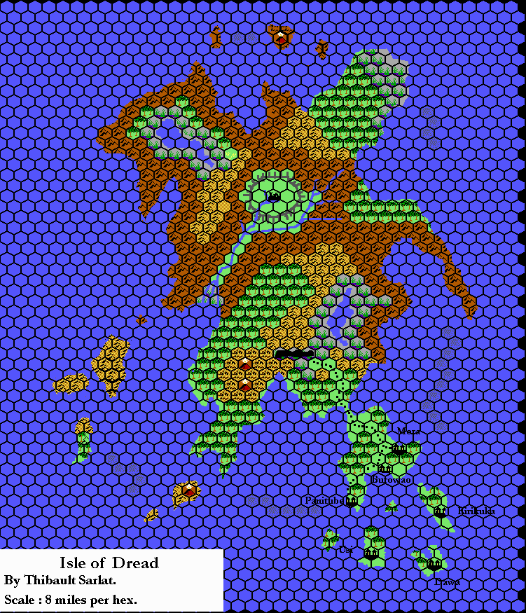
X1 (1981) Isle of Dread, 6 miles per hex
X1 contains not one but two iconic Mystara maps. The first is the Known World map. The other is this map: the original Isle of Dread map.
The map itself used horizontal rather than vertical columns of hexes, but since nothing around it was ever mapped, this doesn’t really pose a great problem. Much more problematic is the scale, and it has become common knowledge in the Mystara community that the map needs to be interpreted as 4 miles per hex in order to get it to match with the size of the Isle as shown on the 24 mile per hex map. The alternative — rescaling the 24 mile per hex map’s Isle to match the 6 mile per hex scale — would put the Isle of Dread out of scale with the other islands in the Thanegioth Archipelago, although it’s an equally valid solution.
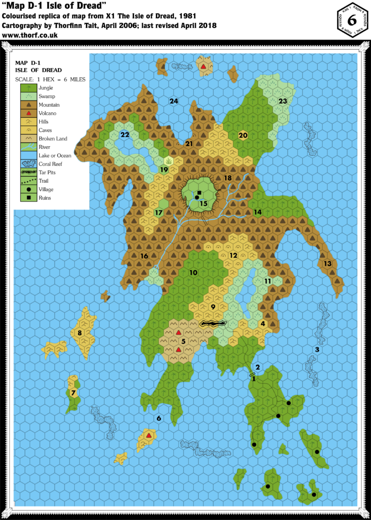
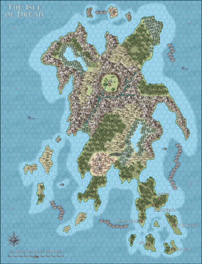
Replica Map (April 2018)
Sources
- X1 The Isle of Dread (1981) (PDF at DriveThruRPG)
- Map D-1 Isle of Dread, page 14
- Players’ Map, page 32
Chronological Analysis
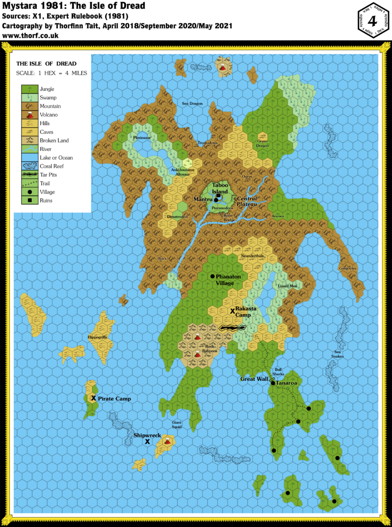
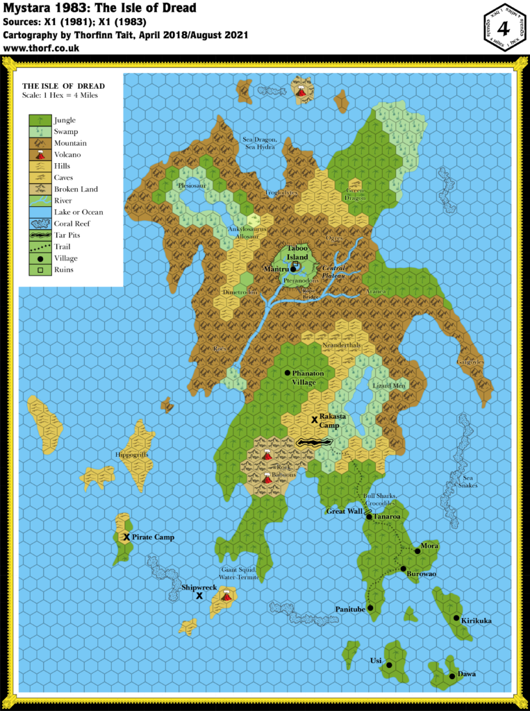
This is Map 2. It was published in 1981. The updated version of this map has not yet been released. See also Appendix C for annual chronological snapshots of the area. For the full context of this map in Mystara’s publication history, see Let’s Map Mystara 1981, Part II.
The following lists are from the Let’s Map Mystara project. Additions are new features, introduced in this map; Revisions are changes to previously-introduced features; Hex Art & Fonts track design elements; and finally Textual Additions are potential features found in the related text. In most cases, the Atlas adopts these textual additions into updated and chronological maps.
Additions
- Bridge— a rope bridge crosses the central river.
- Islands— fourteen small islands dotted around the Isle of Dread.
- Lakes— two lakes on the Isle of Dread.
- Plateaus— the Central Plateau.
- Reefs— six long reefs between the islands.
- Rivers— a single river network originating on the plateau and in the mountains to its east, flowing down to the swamp.
- Settlements— six villages are marked in the southeast of the map, with another on the Central Plateau next to some ruins. One more is marked only on the players’ map, although it does appear as a “1” label on the main map.
- Terrain— the overall terrain is somewhat different from the 24 mile hex map, as is to be expected when converting to larger scale. Lots of detail has been added, including tar pits, and reefs round the coast.
- Trails— a single trail network links three villages on the southeastern peninsula with the wall before continuing on to the tar pit.
Revisions
- Coastline— the Isle of Dread is significantly bigger on the larger scale map. It retains the same overall shape, but is much wider east to west, with lots of added detail all round the coast.
- Islands— the small island to the immediate west of the Isle of Dread should appear on this map, but was omitted. Given the differing shape of the Isle of Dread between maps, this was likely an oversight.
- Scale— at the printed scale (6 miles per hex), the Isle of Dread would be much bigger than the 24 mile per hex map shows. As the quote from the Atlasnoted, there are two possible solutions to this: either change the scale of the Isle of Dread map, or increase the size of the Isle on the 24 mile per hex map. I have chosen to change the scale.
Hex Art & Fonts
- Fonts— Souvenir for titling and legend; Futura for keyed numbers.
- New Symbols— Caves (dot inside upside-down U shape), Coral Reef (black shapes in the sea), Tar Pits (black shape surrounded by offset black outline), Village (filled circle), Ruins (filled square).
Textual Additions (X1 1981)
- Altitude— the Central Plateau is 3,000′ high. (p. 12)
- Bridge— the rope bridge is said to be 300′ long. (p. 10) It’s also said to be one of the three ways to gain access to the central plateau. (p. 12)
- Fauna— bull sharks at 2, sea snakes at 3, rock baboons at 5, giant squid at 6 (all p. 8); hippogriffs at 8 (p. 9); lizard men at 11, neanderthals at 12, gargoyles at 13, aranea at 14, pteranodons at 15, rocs at 16 (p. 10); dimetrodon at 17, ogres at 18, ankylosaurus and allosaur at 19, green dragon at 20, troglodytes at 21, plesiosaur at 22, sea dragon at 24 (all p. 11).
- Government— the seven villages of the Isle of Dread are matriarchies. (p. 7)
- Key— the text provides details for the numbers marked on the map. (p. 7-11) These have been detailed in the appropriate categories in this list.
- Settlements — the 1 on the map indicates the village of Tanaroa; the players’ map actually shows it as an icon, too. (p. 7, 32) “The other villages are Kirikura, Dawa, Mora, Panitube, Burowao, and Usi.” (p. 7) Unfortunately the text doesn’t state which village is which. “The population of all seven villages is about 2100 total.” (p. 7) Since all the villages use the same map, it makes sense to consider that they each have roughly the same population, meaning that each village has about 300 inhabitants. 7 is a pirate camp, population 41. (p. 8) 9 is a rakasta camp, population 19. (p. 9) Since we don’t have an icon for camps yet, they have been marked with X for now. 10 is a phanaton village, population 100. (p. 9)
- Shipwreck— described under “Sunken Treasure” as “on the southwestern side, between the smoking mountains and the reef”. (p. 27) For lack of a symbol, this has been temporarily marked with an X.
- Terrain— caves at 5 (p. 8), 12 (p. 10), 18 and 20 (p. 11). The terrain type for these caves is usually noted in the text. Many hexes were left blank for clarity on the black and white map; these have been extrapolated from surrounding terrain and added. The green dragon’s lair at 20 has been marked as a hills hex (p. 11).
Join in the Discussion at The Piazza
Come and join in the discussion about this map at The Piazza, where I am holding a “read through” of the Let’s Map Mystara project.


Let’s Map Mystara 1981 II – Thorfinn Tait Cartography
2 November 2018 @ 11:10 pm
[…] 2: “Isle of Dread” from X1 […]
9 July 2021 @ 2:11 pm
any chance of getting an isle map with numbered hexes? it would make hex crawling so much better. Both the DM and PC maps…. heck i’d pay $ for them.
10 July 2021 @ 8:38 pm
That should be doable, although my mapping system doesn’t have a way to do it built in. Believe it or not, you’re the first person who has ever asked for this feature!
If you’d like to contribute to my Mystara mapping, the best way is to join my Patreon. It’s set up to handle customisation requests such as this.
6 October 2020 @ 9:20 pm
Hi Thorf
Excellent work as always.
One question though…
you saiid; ” Scale— at the printed scale (6 miles per hex), the Isle of Dread would be much bigger than the 24 mile per hex map shows. As the quote from the Atlas noted, there are two possible solutions to this: either change the scale of the Isle of Dread map, or increase the size of the Isle on the 24 mile per hex map. I have chosen to change the scale.”
I assume you did this to comply also to the 24 mile hex shape fitting within the general image of Mystara. I totally agree that is the easiest and best resolution to this original flaw.
This X1 map was 6 mile per hex,… you said this is adjusted,…yet you still have 6 mile per hex on this map revealed here?
Did you rescale or not in this case?
As I will go to map this island in a 1 map hex scale in the future (probably next year) , how is the X1 scale actually, so I will not make scaling flaws then.
Could you explain me the change you made in detail? You may do so in PM if needed.
Greets
Robin
6 October 2020 @ 9:32 pm
Hi Robin!
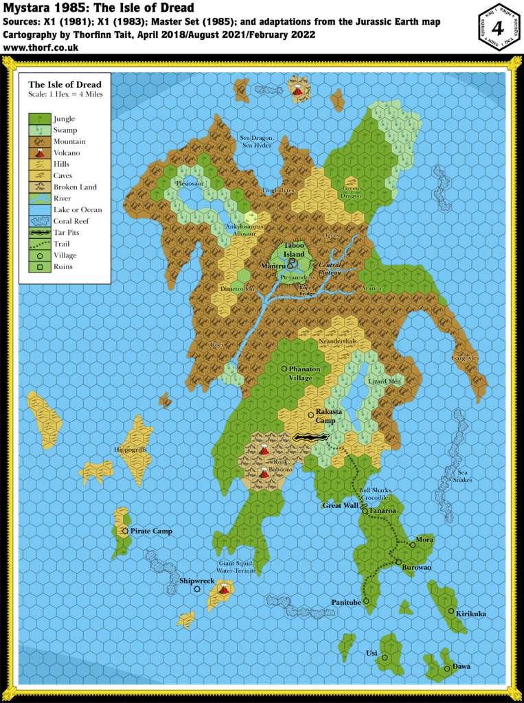
Remember that this is the replica map, so I haven’t actually made any changes to it at all. I’d suggest you check out the updated map, but I don’t seem to have posted it yet. So in the meantime let me point you towards the most recent version from Let’s Map Mystara, which is currently the 1985 version:
https://mystara.thorfmaps.com/appendix-c/mystara-1985/
By the way, I agree with you that this is confusing, and I’m slowly phasing in a new way of noting this, by listing both a “nominal scale” and an “actual scale” on maps affected by this sort of issue. X10’s Karameikos map and X9’s Savage Coast map are good examples of this in action that have already been posted.