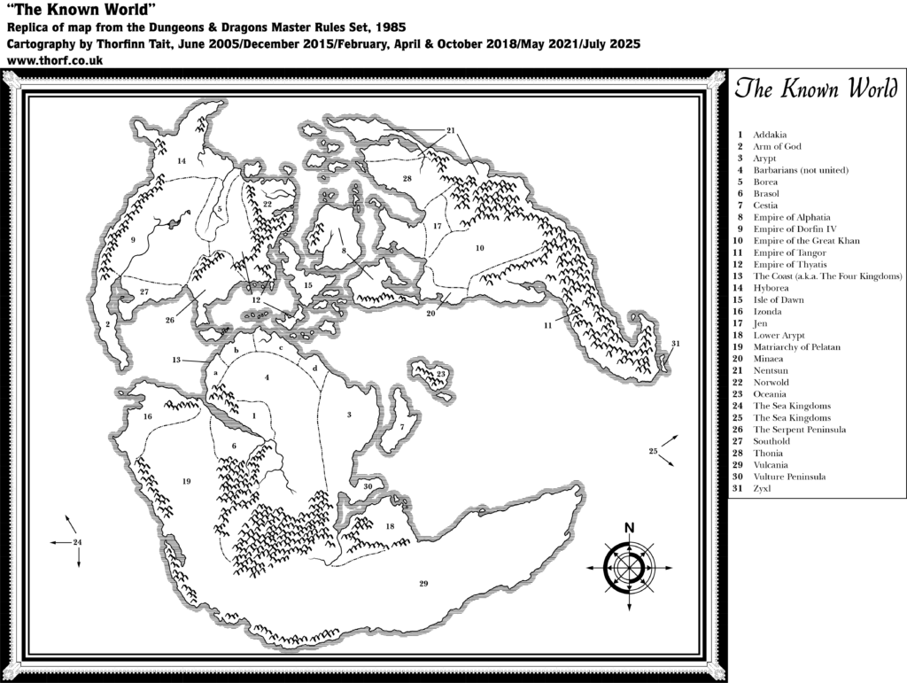
The fifth year of publication brought major changes to Mystara, with the publication of the world map, as well as expansion of the world to the east and west.
The World Map
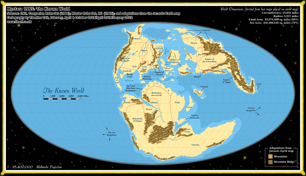
It’s not clear precisely when the world map was conceived, but it seems likely that the idea preceded 1984’s continental map (Brun), because the shapes of the continents are very clearly based on a certain map of Jurassic Earth which appeared in 1983 Time Life book Continents in Collision. Brun was the least faithful to its inspiration, while the other two continents (Davania and Skothar) were far closer. And yet, Brun’s map is close enough to suggest that the inspiration had already been found during its drafting.
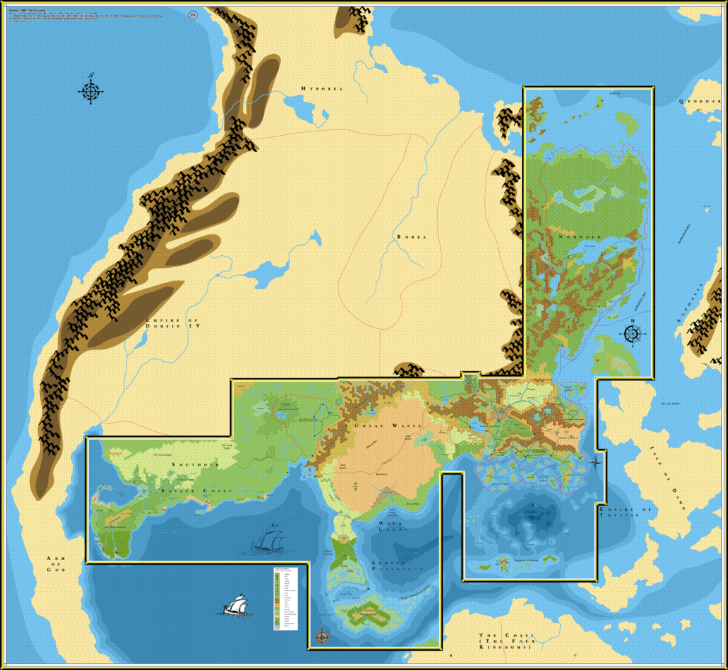
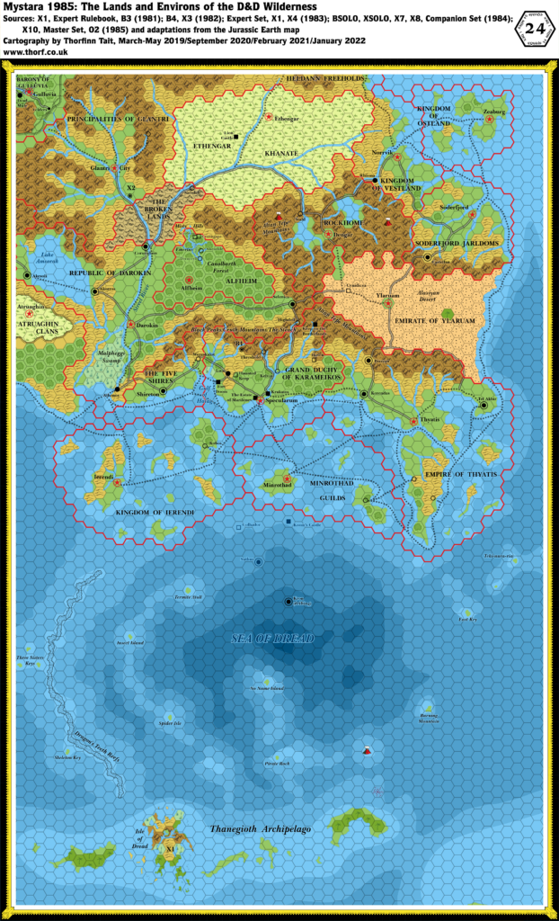
In any case, the world map provided a view of the entire world, complete with major mountain ranges and a few lakes and rivers. It was also extensively labelled, with each major region getting its own label — although whether these were intended as political or geographical labels is often open to interpretation, and the explicitly political names likely represent the dominant power in that region rather than massive nation states. The “Empire of Thyatis” label proves the truth of this.
Map Projection
Putting the world map together with the map that inspired it allows us to georegister Mystara using the Jurassic Earth map, giving the whole world a projection (Mollweide) and associated geographic coordinates. It also yields insight into the intended shape of large mountain ranges marked on the world map, as well as providing general coastal shelf/ocean depths. All of these things have thus been incorporated into the set of 1985 maps presented below.
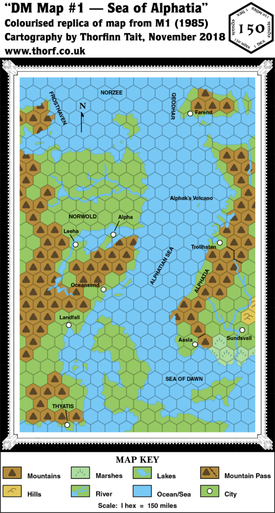
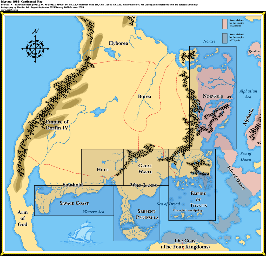
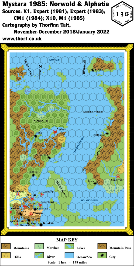
M1 expanded the hex map coverage of the world to the east, revealing a little more of Alphatia, albeit in a different configuration from the world map. This inconsistency is impossible to resolve at this point, and so is presented as-is.
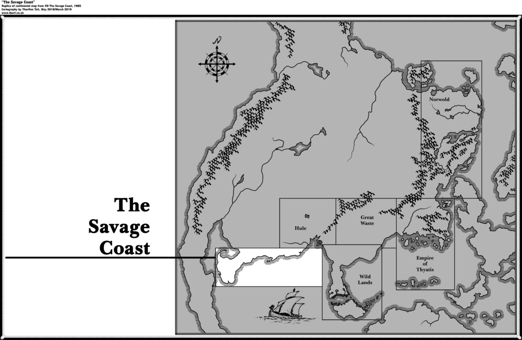
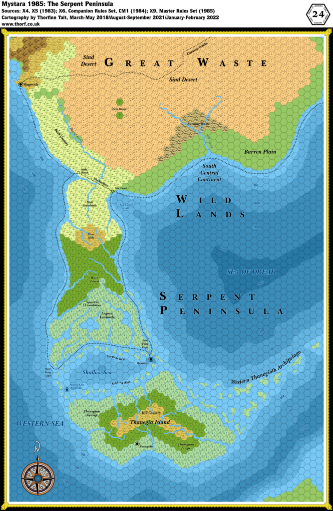
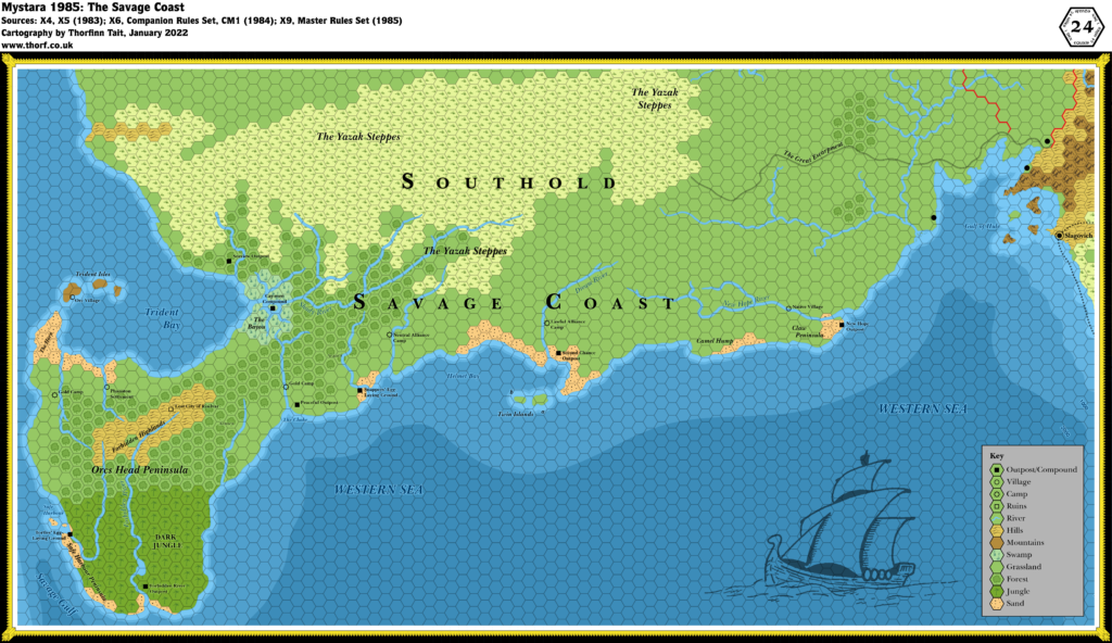
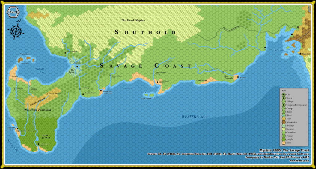
X9 introduced the Savage Coast in the far west. Although it suffered from scale problems, and (like Norwold) had its own unique rotation, this addition to the body of hex maps formed the base for all future expansions of the area.
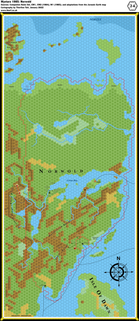
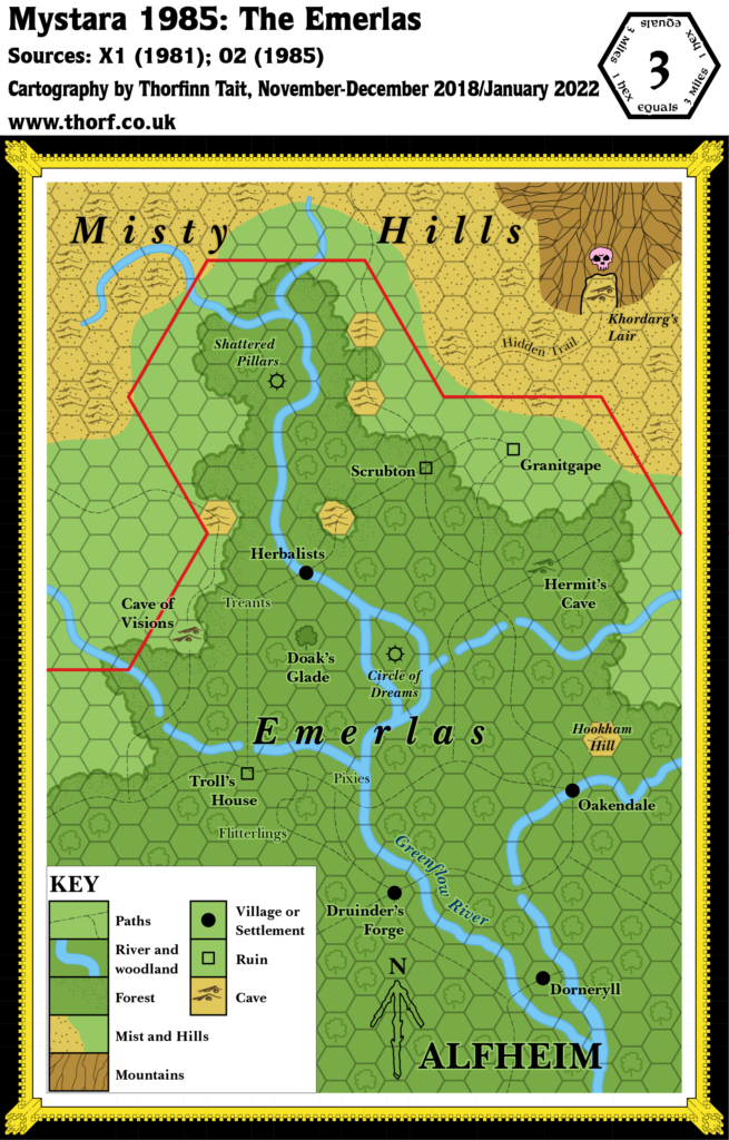
Finally, a number of modules provided detailed maps of new dominions and localities, mostly in Norwold but also Alfheim. While in 1985 they may have seemed to be a footnote to the broader overall additions, these larger scale (zoomed in) maps would turn out to be a preview of future efforts in the coming years, where the focus would soon shift from a continental to a national level.
The Maps
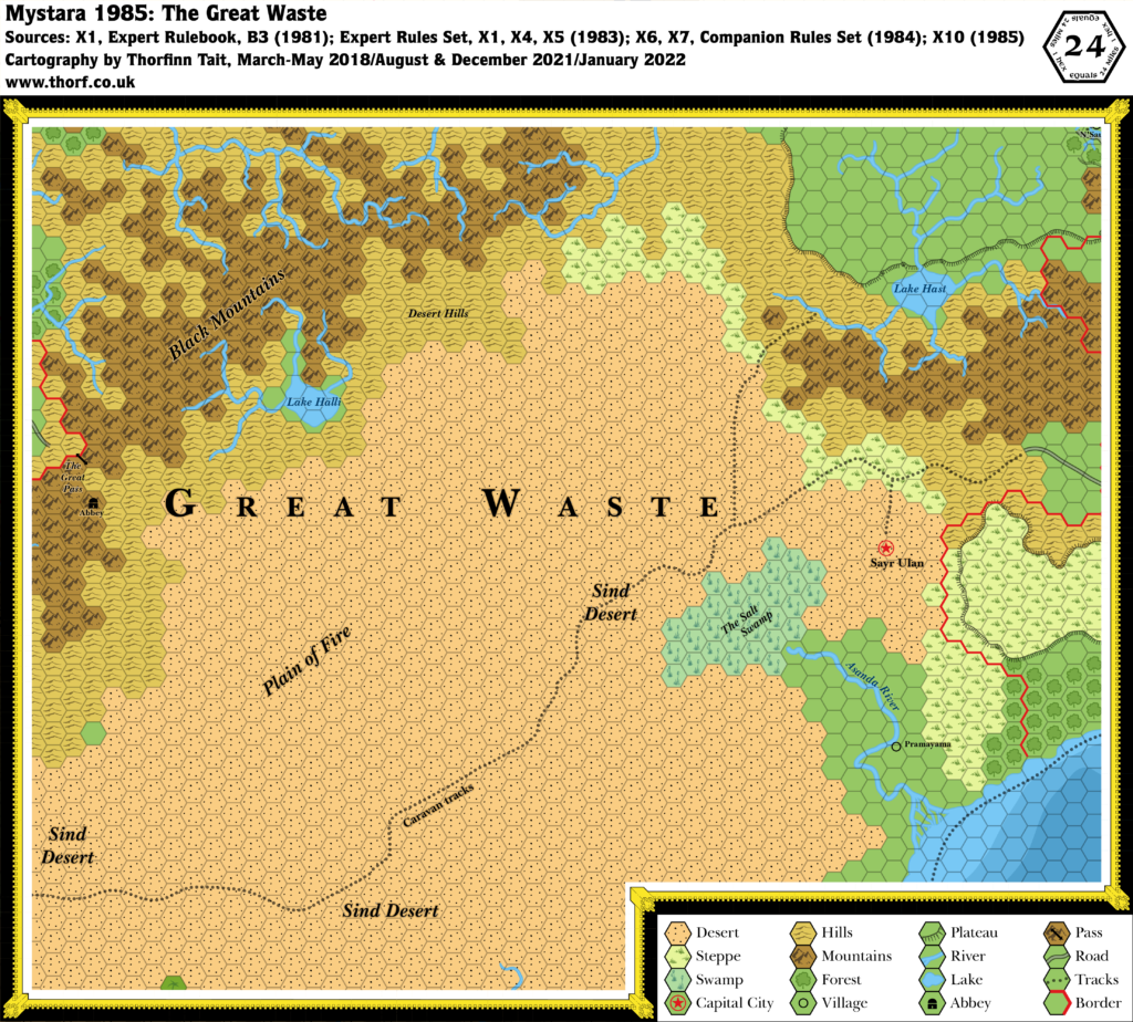
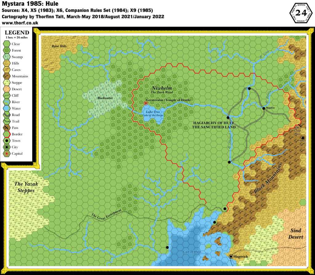
These maps have been made internally consistent, adopting the most detailed shapes and positions of each element. (But note the discrepancy in the shape of Alphatia, as noted above.)
Note that maps remaining unchanged from the previous two years do not appear here. Please refer to Mystara 1983 and Mystara 1984 for those maps.
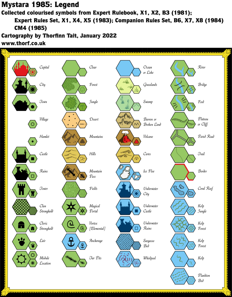
- Art — the printed style from 1981’s Expert Rulebook‘s Legend, with additional symbols from the 1983 Expert Rules Set and 1984 Companion Rules Set’s Legends.
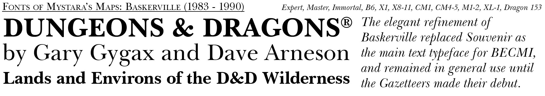
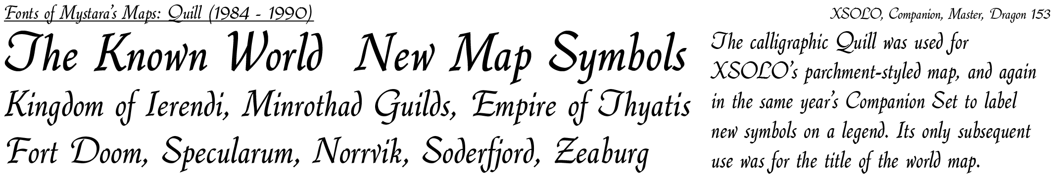
- Fonts — Baskerville, with some titling in Quill. In the absence of an iconic font for the year, 1985’s maps used a wide range of fonts, from the previously established Baskerville to Benguiat, Helvetica, Libra, Quill, and hand-written text. Korinna snuck in for its first appearance with a cameo on CM5’s compass rose.
References
For more details on the individual maps and their interpretation here, please refer to the original Let’s Map Mystara project articles listed below.
- Let’s Map Mystara 1985
- Let’s Read the Known World/Mystara post 351 — 1985 discussion starts at this post
1985 Product Lineup
This table lists all the relevant products published in 1985, with links to each map’s individual page here at the Atlas. Product titles link to PDFs at DTRPG where they are available.
| Map | Name | Hex | Year | M | Source | Reference |
|---|---|---|---|---|---|---|
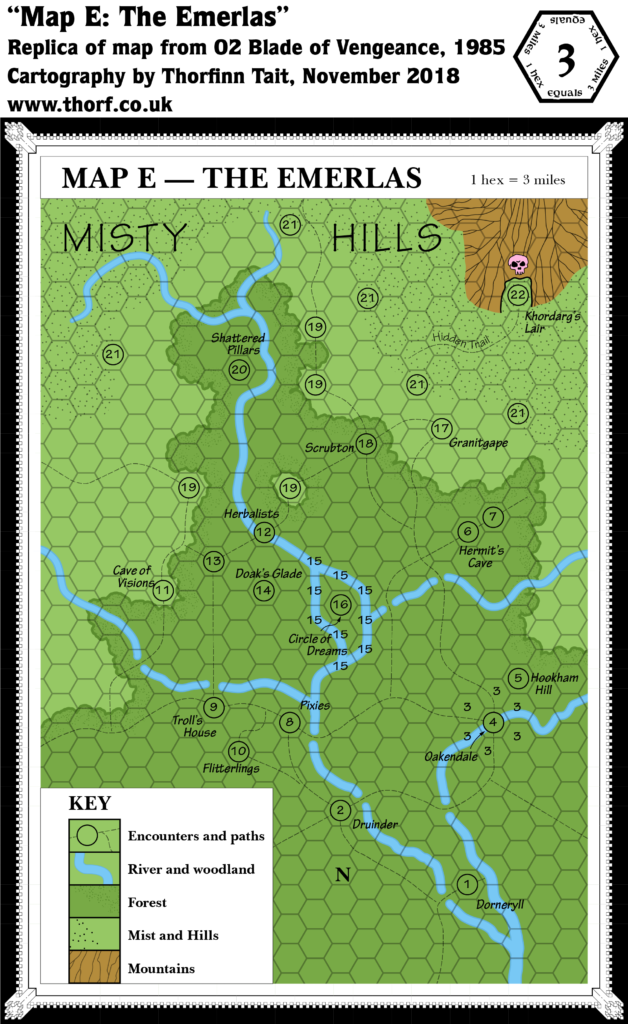
| 29 | Map E — The Emerlas | 3 | 1985 | 2 | O2 Blade of Vengeance | Cover Gatefold |
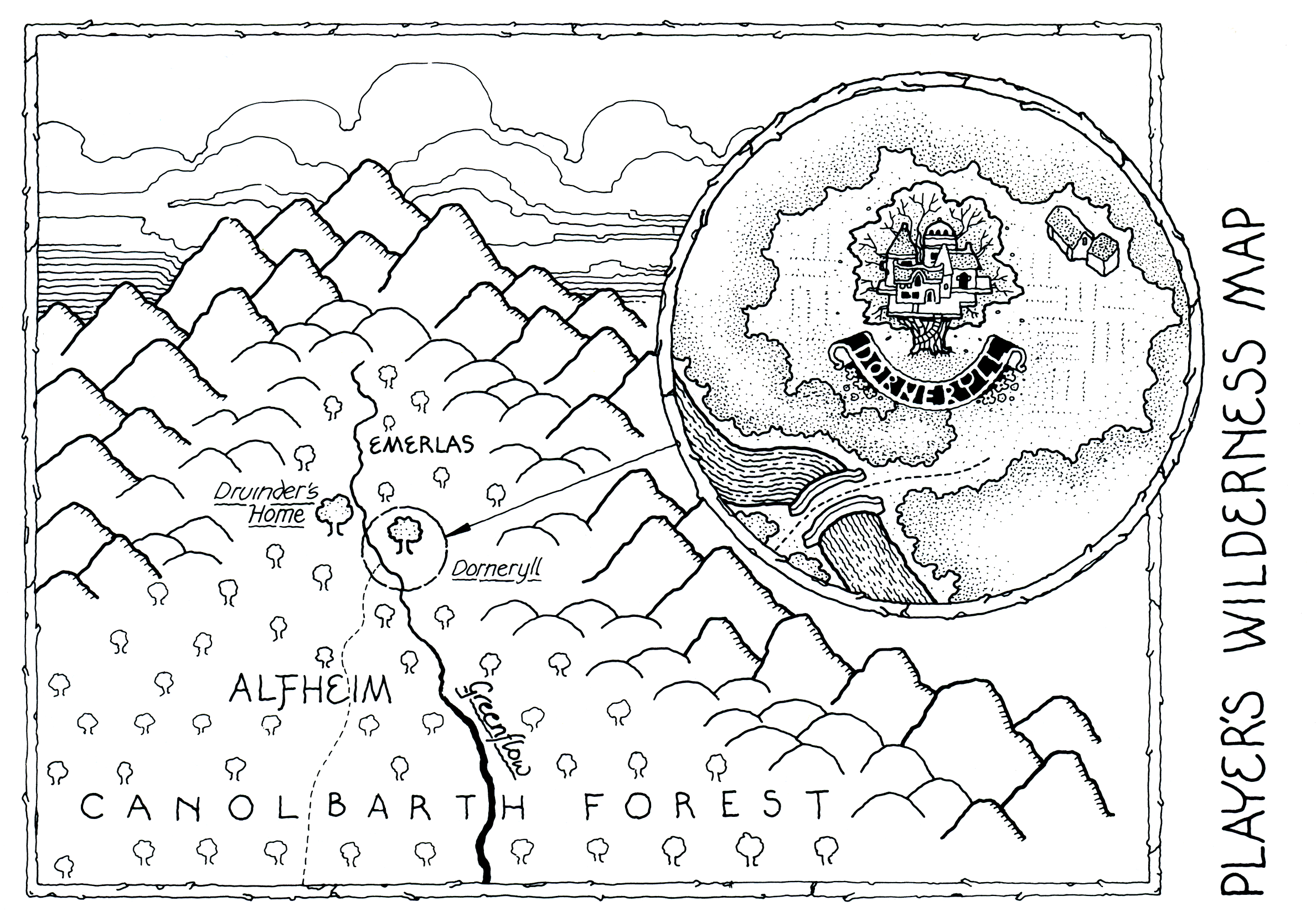
| 30 | Player's Wilderness Map | - | 1985 | 2 | O2 Blade of Vengeance | p. 31 |
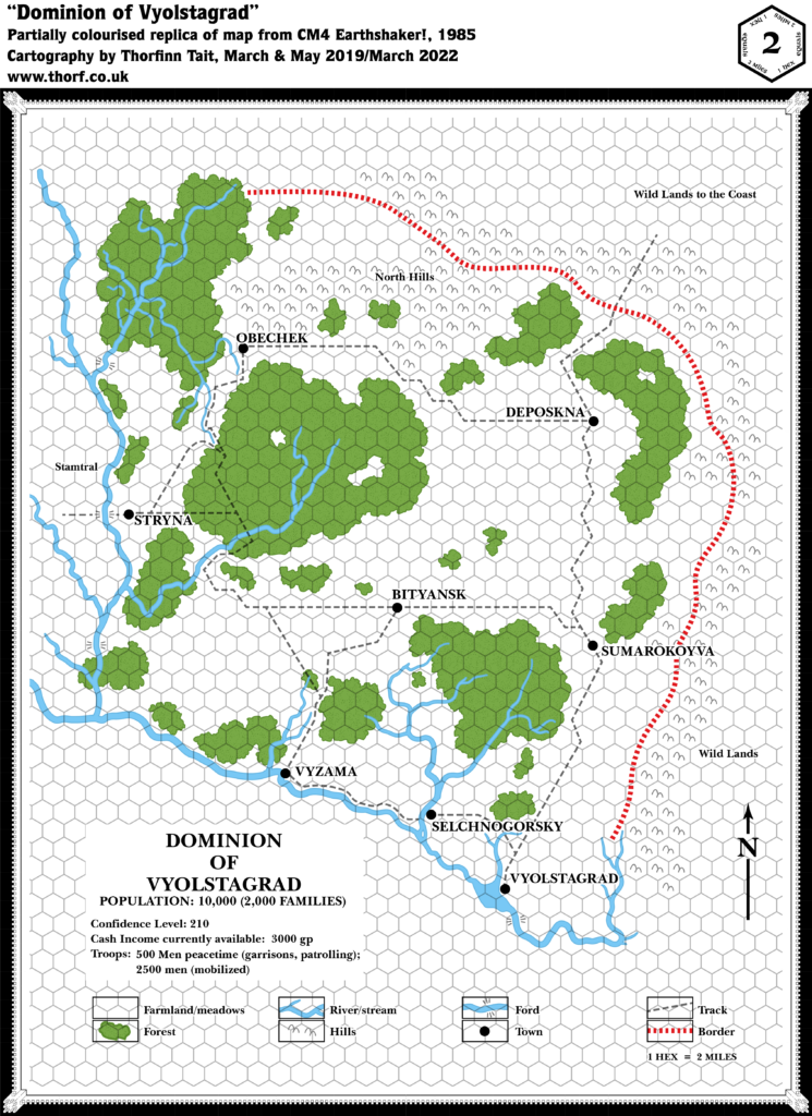
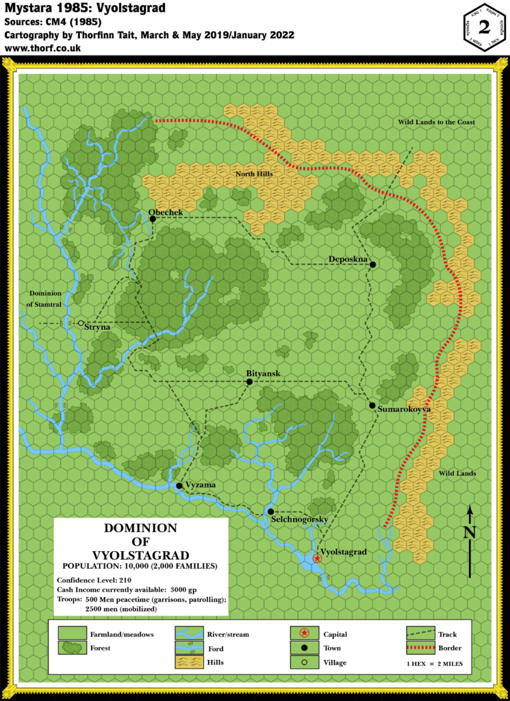
| 31 | Dominion of Vyolstagrad | 2 | 1985 | 4 | CM4 Earthshaker! | p. 13 |
| 32 | The Known World | - | 1985 | 6 | Master Set | Master DM's Book Inside Cover |
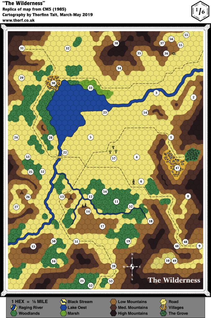
| 33 | The Wilderness | 1/6 | 1985 | 7 | CM5 Mystery of the Snow Pearls | Cover Gatefold |
| 34 | DM Map #1 - Sea of Alphatia | 150 | 1985 | 10 | M1 Into the Maelstrom | p. 3 |
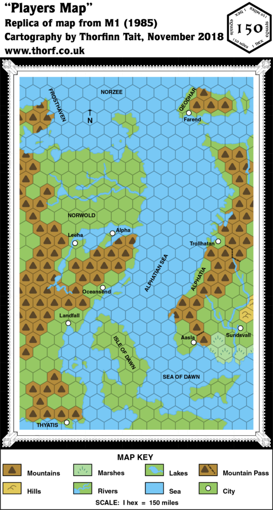
| 34 | Players Map | 150 | 1985 | 10 | M1 Into the Maelstrom | Cover Gatefold |
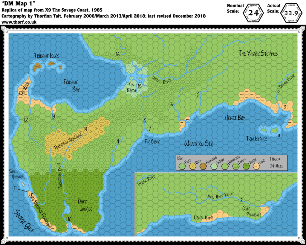
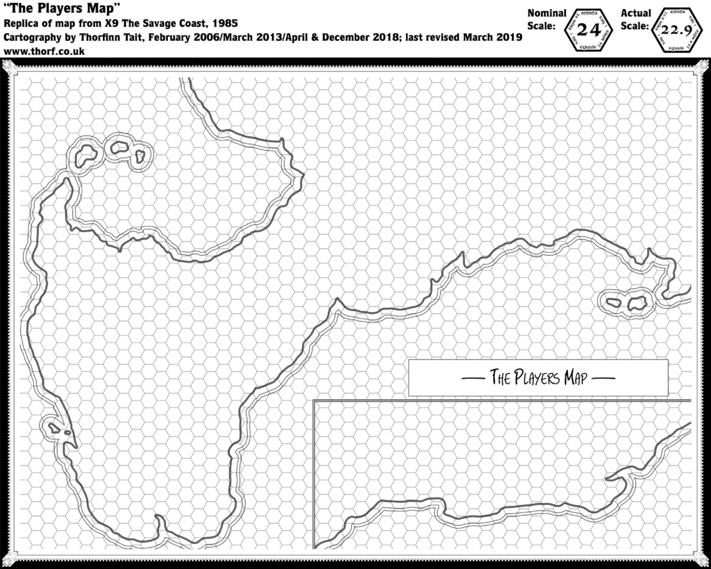
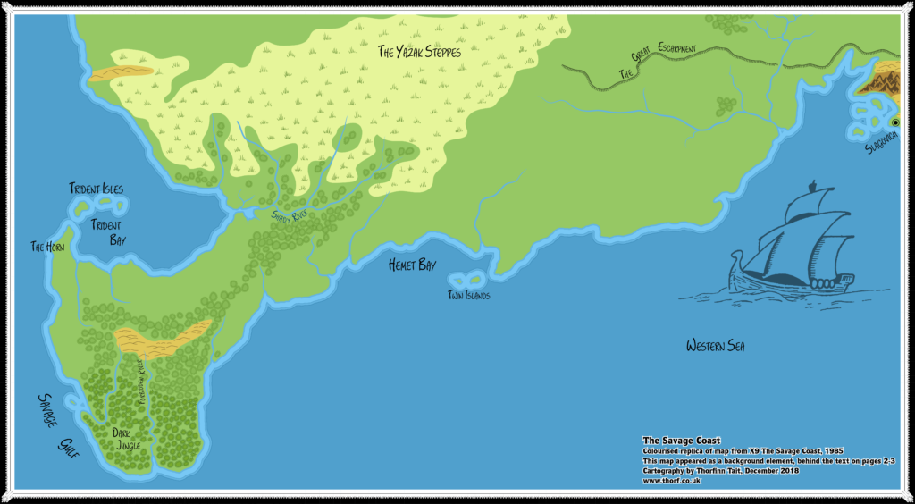
| 35 | The Savage Coast | - | 1985 | 10 | X9 The Savage Coast | p. 13, 20 |
| 36 | DM Map 1 | 24 | 1985 | 10 | X9 The Savage Coast | Cover Gatefold |
| 36 | The Players Map | 24 | 1985 | 10 | X9 The Savage Coast | p. 19 |
| 37 | [Savage Coast] | - | 1985 | 10 | X9 The Savage Coast | p. 2-3 |
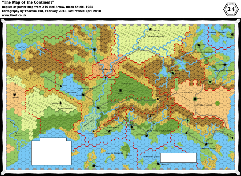
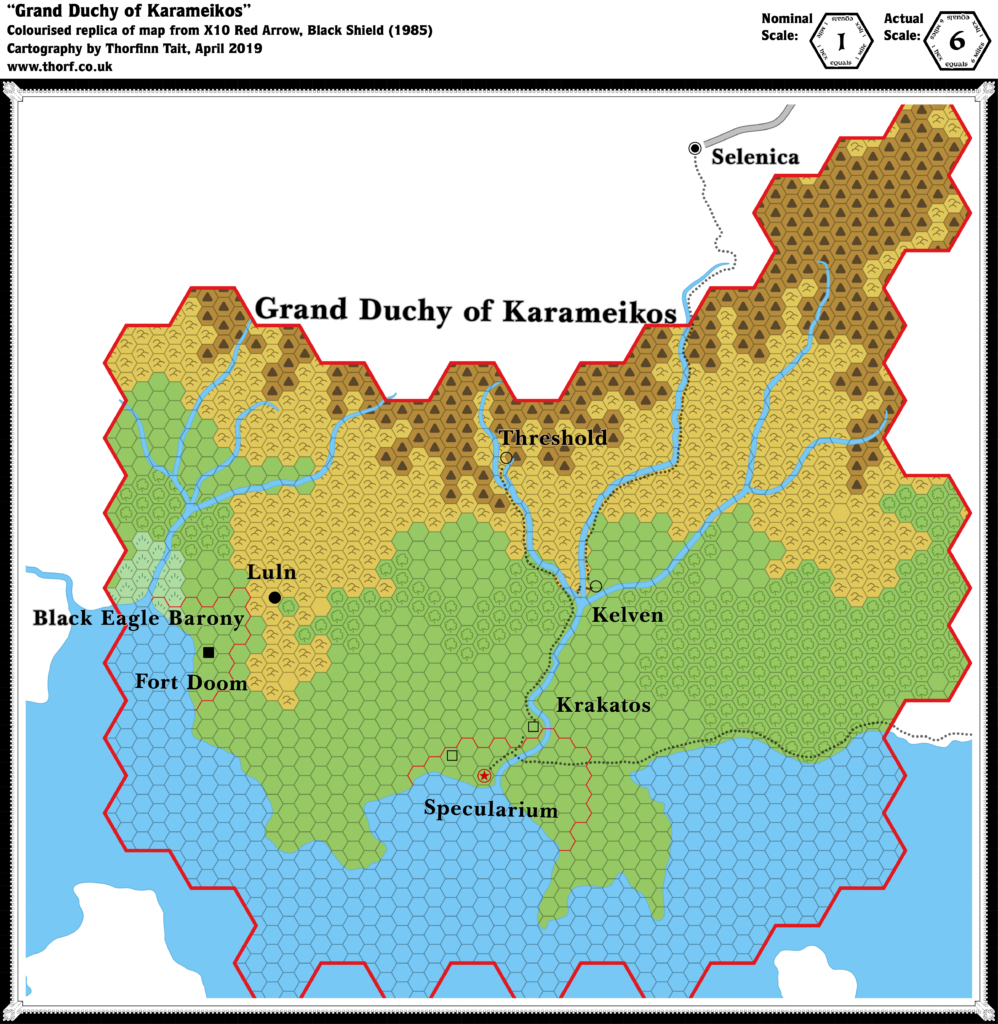
| 38 | [Known World] | 24 | 1985 | 11 | X10 Red Arrow, Black Shield | Poster Map |
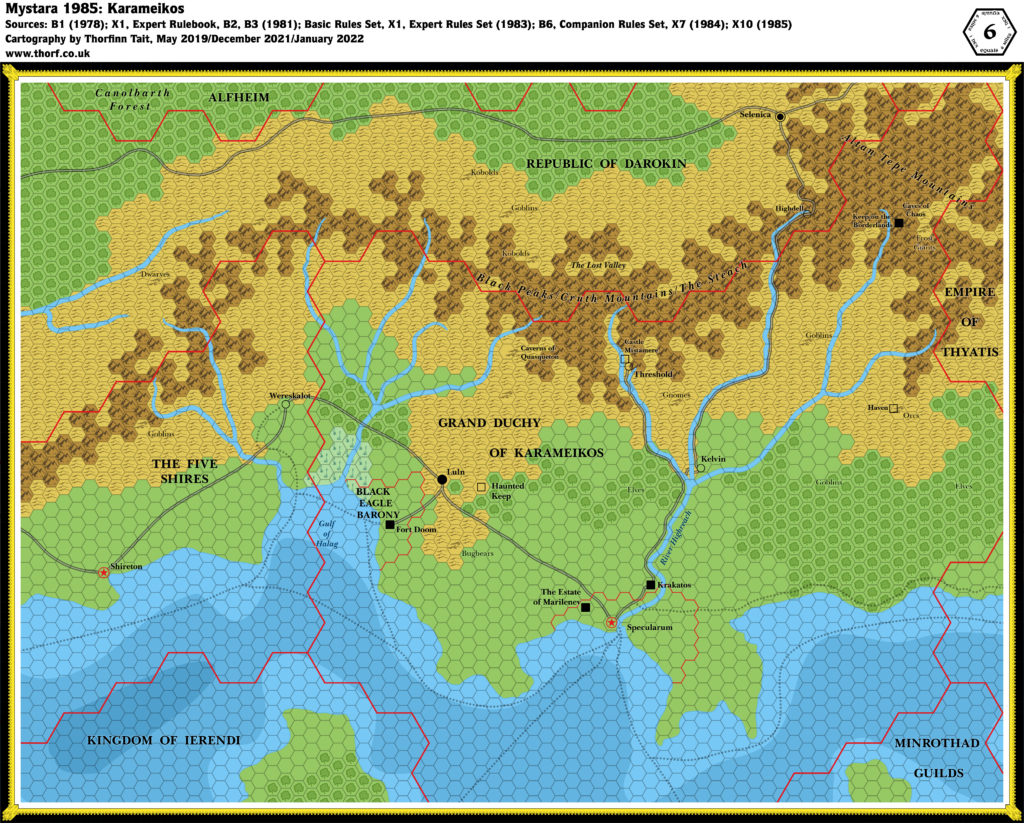
| 39 | Grand Duchy of Karameikos | 6 | 1985 | 11 | X10 Red Arrow, Black Shield | p. 15 |
1985 Map Gallery
This gallery shows all of the geographic maps published over the course of the year. These are replicas of the original maps. For full details, please check out the post for each map, linked to in the table above. For corrected and expanded versions, use the maps near the top of this page.