Writer, mapper, designer—our very own Polymath
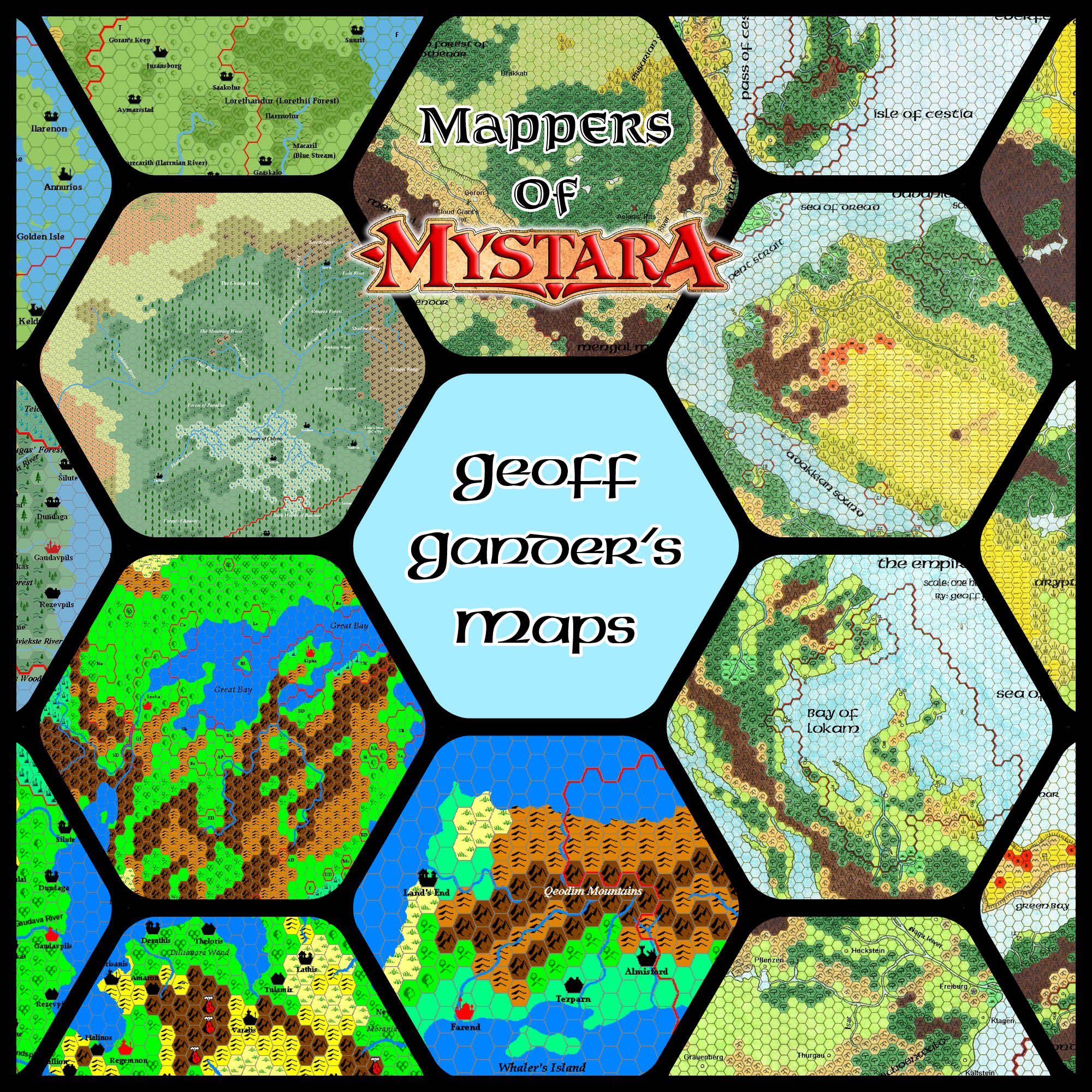
Beginning with his hand-drawn maps of Davania in the early days of the online Mystara community, Geoff Gander has contributed a great many things to the setting over the years. From the nation of Selhomarr (Mystara’s version of Atlantis) to the Outer Beings, his creations have won the hearts of many a fan — and not just for the maps, as he is also a consummate designer.
Profile
- Nickname: Seer of Yhog (Vaults author page, Piazza profile, Blog, DriveThruRPG products, RPG Geek profile)
- Location: Ottawa, Canada
- Maps Posted: 1996-2007, 2009-2013, 2018, 2021
- Areas of Interest: Davania, Selhomarr, assorted other places
- Scales: 72 miles per hex, 24 miles per hex, 8 miles per hex, 40 miles per hex, and others
- First Posted Map: Davania: Adakkian Sound Region, 72 miles per hex (October 1996)
- Software: Hand-drawn (1996-1998), Andrew Theisen’s Mapping System (1998-2003), Hexmapper (2005-present), Thorf’s hex art in MS Paint (2009-2010)
- Mapping Style: Traditional hand-drawn hex symbols, coloured with pencils; Andrew Theisen’s bright and snappy hex art; subdued palette in Hexmapper (similar to Thibault Sarlat and Francesco Defferrari); Thorf’s hex art and palette
- Fonts: American Uncial D (early maps), Arial, Times
Overview
Although some of the “Old Ones” have left, there are enough of us around yet, and many new faces besides.
“Greetings from an old friend”, 28th January 2005, MML
An early member of the Mystara Mailing List (MML) from 1996, Geoff initially made a name for himself with his scans of hand-drawn maps. He may well have been the first Mystaran to post maps on the Internet. From there, his contributions blossomed and thrived, and his work remains popular with the community to this day. Indeed, he is one of a very small number of people who have continued to create for Mystara almost every year since he started.
Let’s take a look at some of his augmentations and additions to Mystara, from 1996 to 2021 — of course focused on his maps.
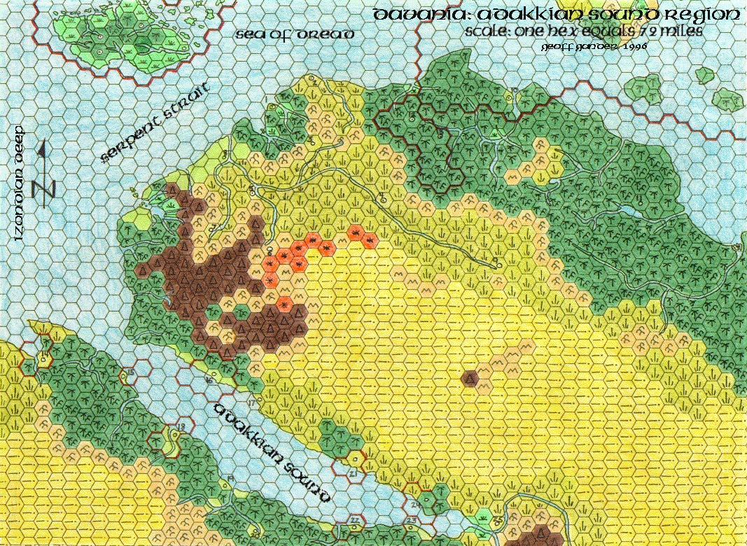
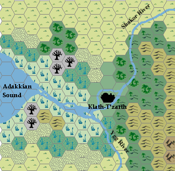
I’ve been developing Davania as a place for exploration for a few months now, and I’ve created a detailed map of the Addakian Sound region, and all areas north on that continent.
“Davania”, 14th September 1996, MML
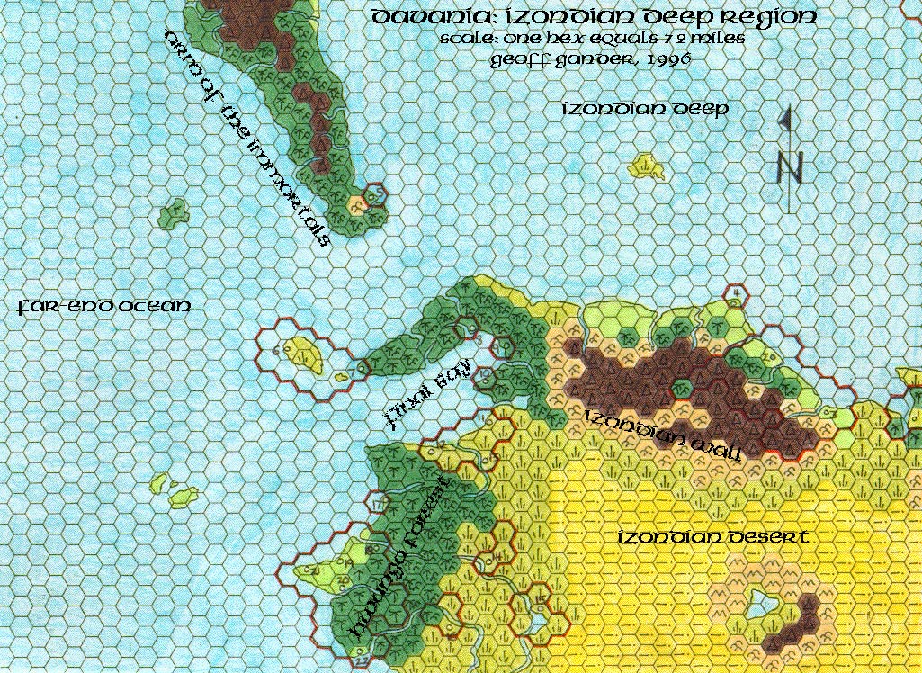
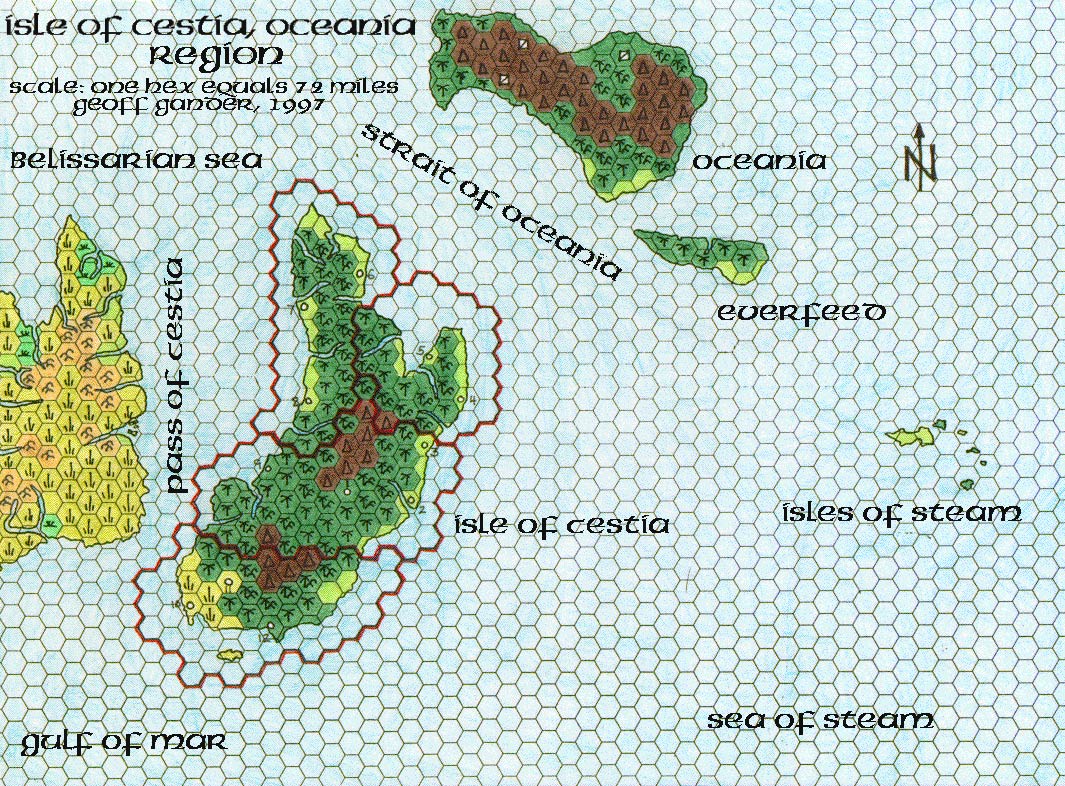
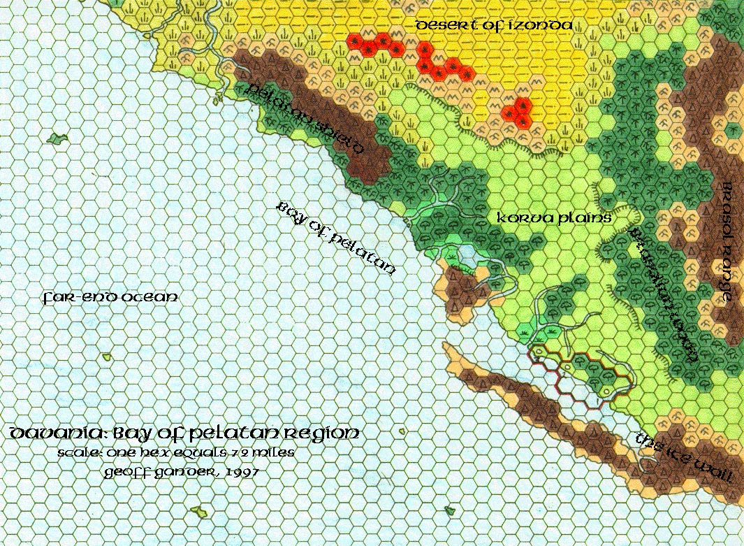
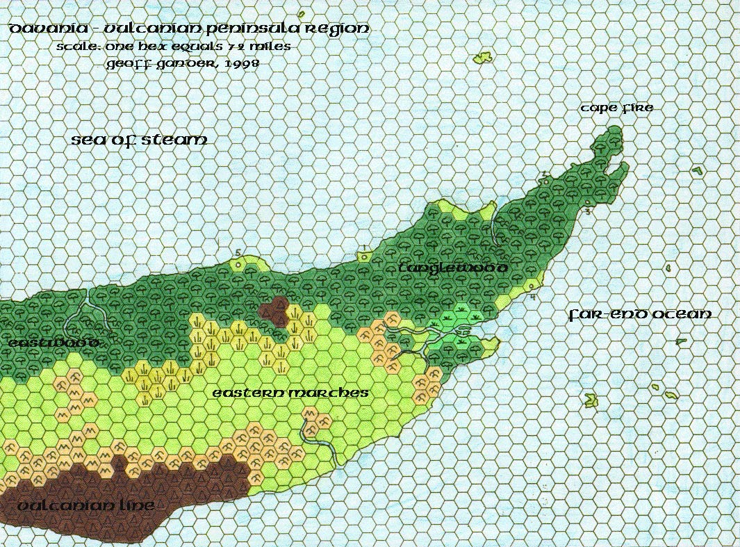
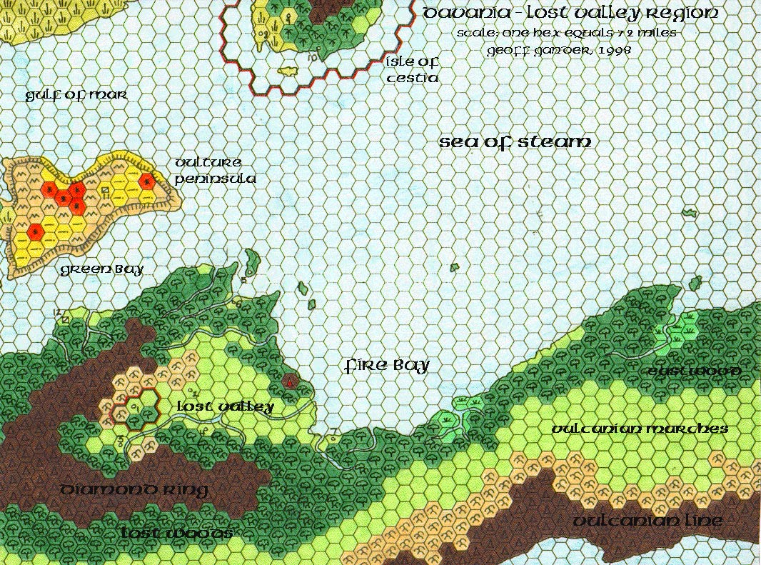
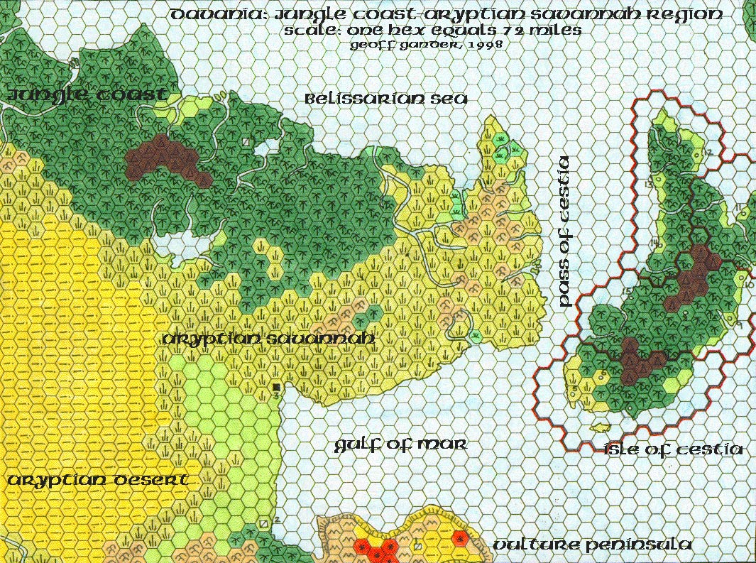
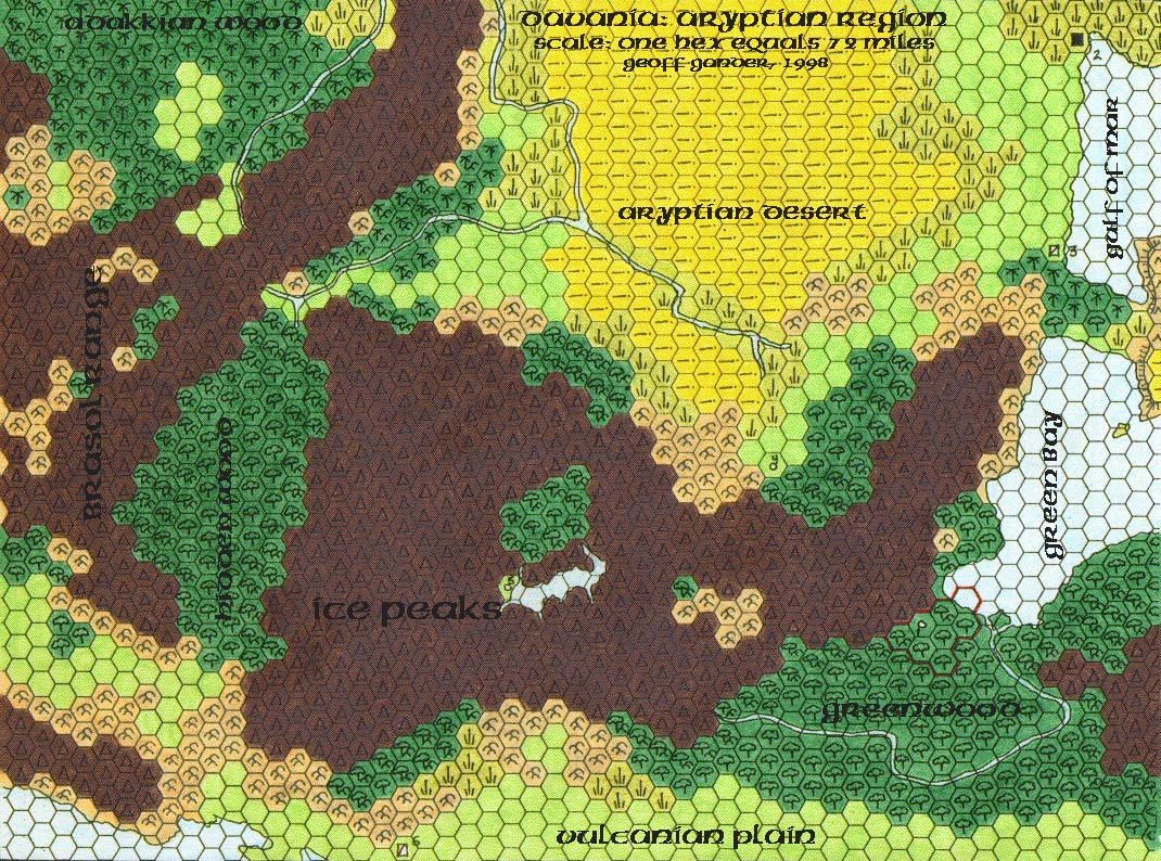
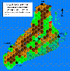
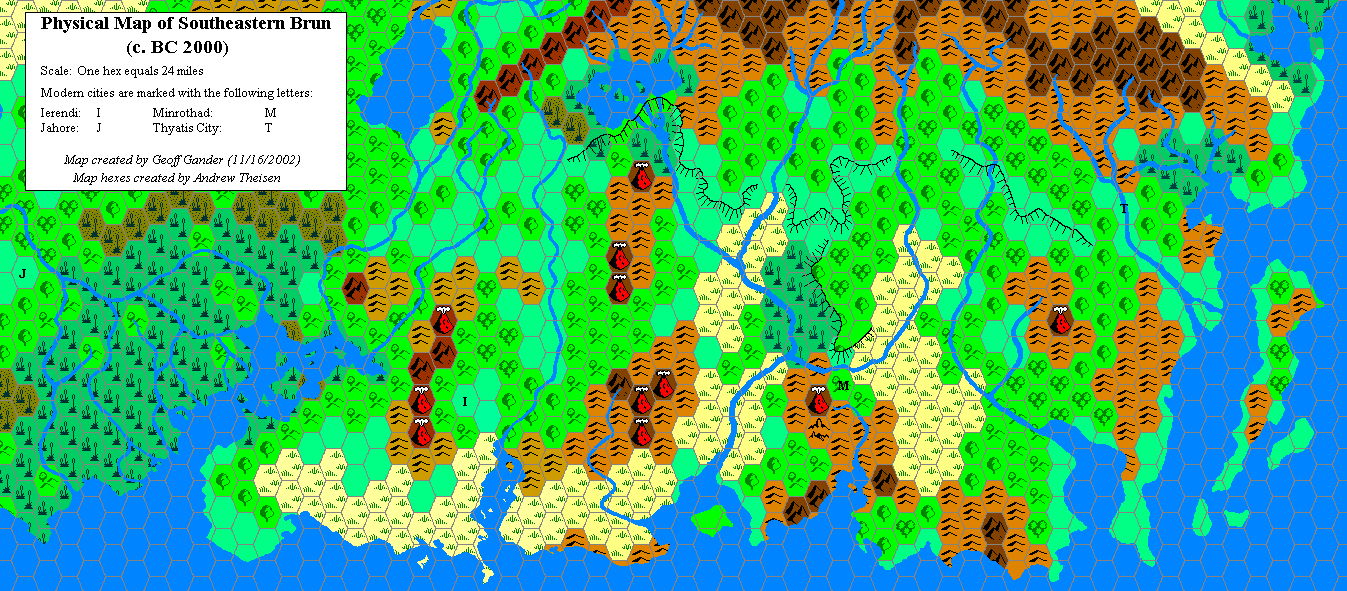
Davania (1996 – 1998)
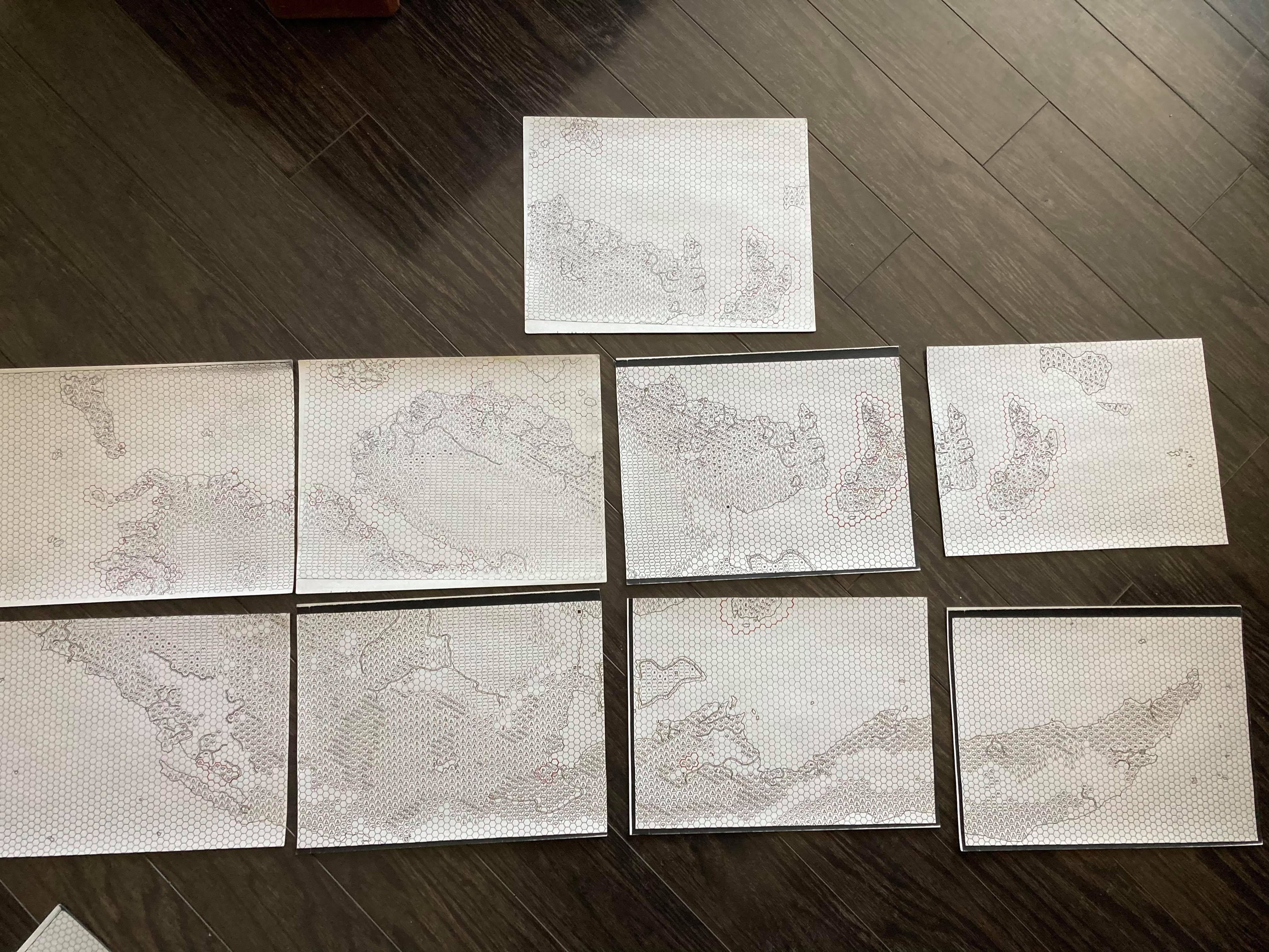
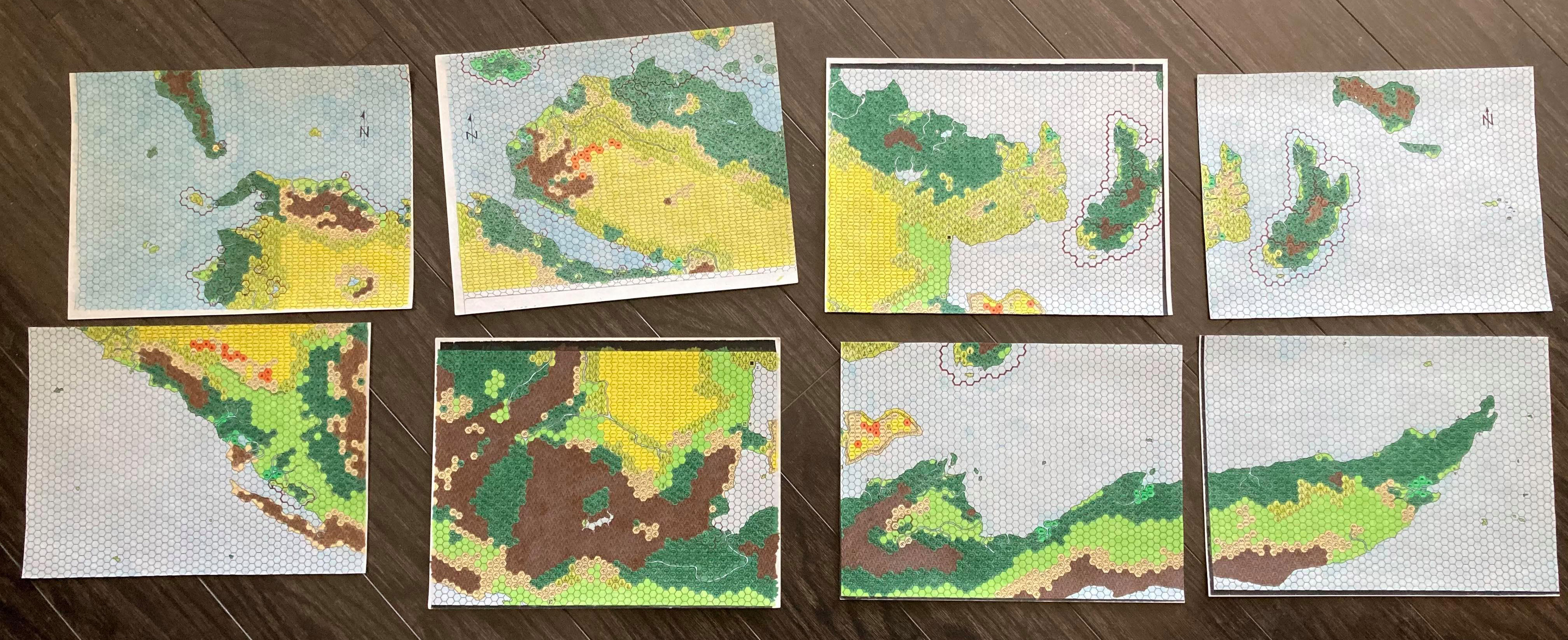
Geoff began talking about mapping Davania in mid-1996, in the early days of the MML. He did all of his mapping by hand, painstakingly copying the coastlines and terrain from the Hollow World Set world map onto a set of US Letter sheets of hex paper.
Current Projects: In my spare time I work on a BIG colour hex map of Davania — all composed of 8.5 x 11 sheets of hex paper, all terrain features fitting together just so (@#^%@#^%!! Frustrating, but rewarding).
“A List Survey”, 22nd September 1997, MML
It took him two years to finish the project, from initial drafting to final colouring, scanning, and labelling on the computer.
Just a quick note to say that the last two maps of Davania have been uploaded to my site — two years’ worth of work is over!! We now have total coverage of the continent — all free for everyone to use.
“Site Update!!!”, 11th May 1998, MML
It’s hard to overstate the significance of this project, or its importance to Mystaran cartography as a whole. It remains one of the most audacious, complex, and ambitious productions in our community’s history — and it’s all the more amazing to think it was carried out by hand.
It’s worth noting that Geoff is definitely not the only Mystara fan to have mapped such a large portion of the world by hand; many others have talked about their early efforts, before everything turned digital in the late 90s. However, he is one of the only people to have posted his extensive hand-drawn maps, and certainly the earliest.
The only sources I used were the world map in the HW boxed set (for ideas as to where Davania’s different land forms ended/began/mixed/etc., as well as where the coasts ran), and the map of the Sea of Dread in PWA II. In the latter case, I used the scale (1 hex=72 miles), and basically made the Adakkian Sound map an extension of that one (cutting off the northern half, of course). Apart from that, the details that I created for the continent (including the Isles of Steam and the assorted islands, ridges, and so forth) are largely my own creation, aside from the placement of Vanya’s Rest and areas covered in the Dragon articles.
“Site Update!!!”, 12th May 1998, MML
The legacy of Geoff’s Davania map is clear: he has had a permanent impact on the community’s conception of the southern continent, and his maps have been referenced and remixed ever since. After someone (I think Ethan Deneault) knitted together all of Geoff’s maps into a single image, Thibault Sarlat was the first to reference Geoff’s design, using it for his own 72 mile per hex map in 2001, and adapting that for his 24 mile per hex version in 2002. Andrea Francolini referenced Geoff’s map, probably through Thibault’s adaptation, in his 2008 masterwork presenting the whole world at 24 miles per hex. I myself contributed a replica in 2009, which Francesco Defferrari then altered for his own incredible maps in 2014.
None of this would have been possible if Geoff hadn’t sat down one day in 1996, and started to draw his map.
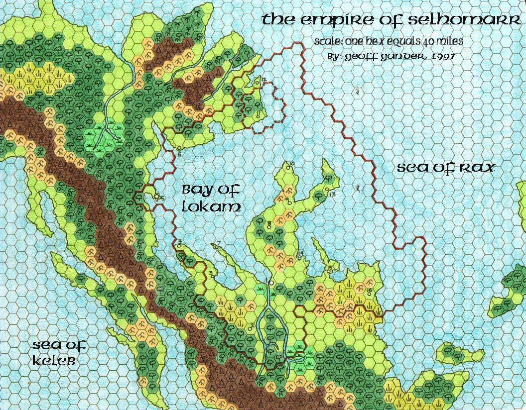
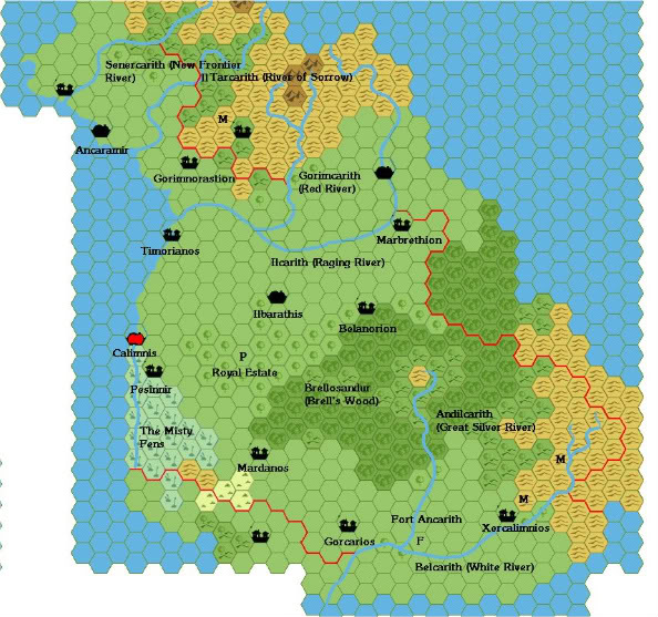
Selhomarr, Lhomarr and Y’hegg T’uhath (1997 – 2000)
I’ve added an interesting culture to the HW, on Suridal, to be exact….
“Alfheim” thread reply, 22nd November 1997
If Davania’s map is Geoff’s most lasting contribution to Mystaran cartography, surely Selhomarr is his most significant and enduring original creation. In his own words from the time:
Selhomarr is a nation that I created for the HW. It is located on the continent of Suridal, in the southeastern corner of the HW world map (remember that E and W are reversed). I have written both DM’s and Player’s Guides (both available on various sites) for this nation, as a Gazetteer for it. Without going into excessive detail at this time, I based the culture on RW myths relating to Atlantis, and if you read the history, you’ll see some connections.
“Site Update!!!”, 12th May 1998, MML
Selhomarr is a Mystaran Atlantis, rising and falling thousands of years before even ancient Blackmoor.
Well, actually, no — that was Lhomarr. Selhomarr is the present-day remnant of ancient Lhomarr in the Hollow World. It’s therefore no surprise that Selhomarr is the most accessible and detailed of these creations, because Lhomarr itself is the realm of ancient, in fact prehistoric history.
Nevertheless Geoff has created maps and setting details for both — as well as their ancient enemy, Y’hegg T’uhath. Which is a story in itself, for which see the next section.
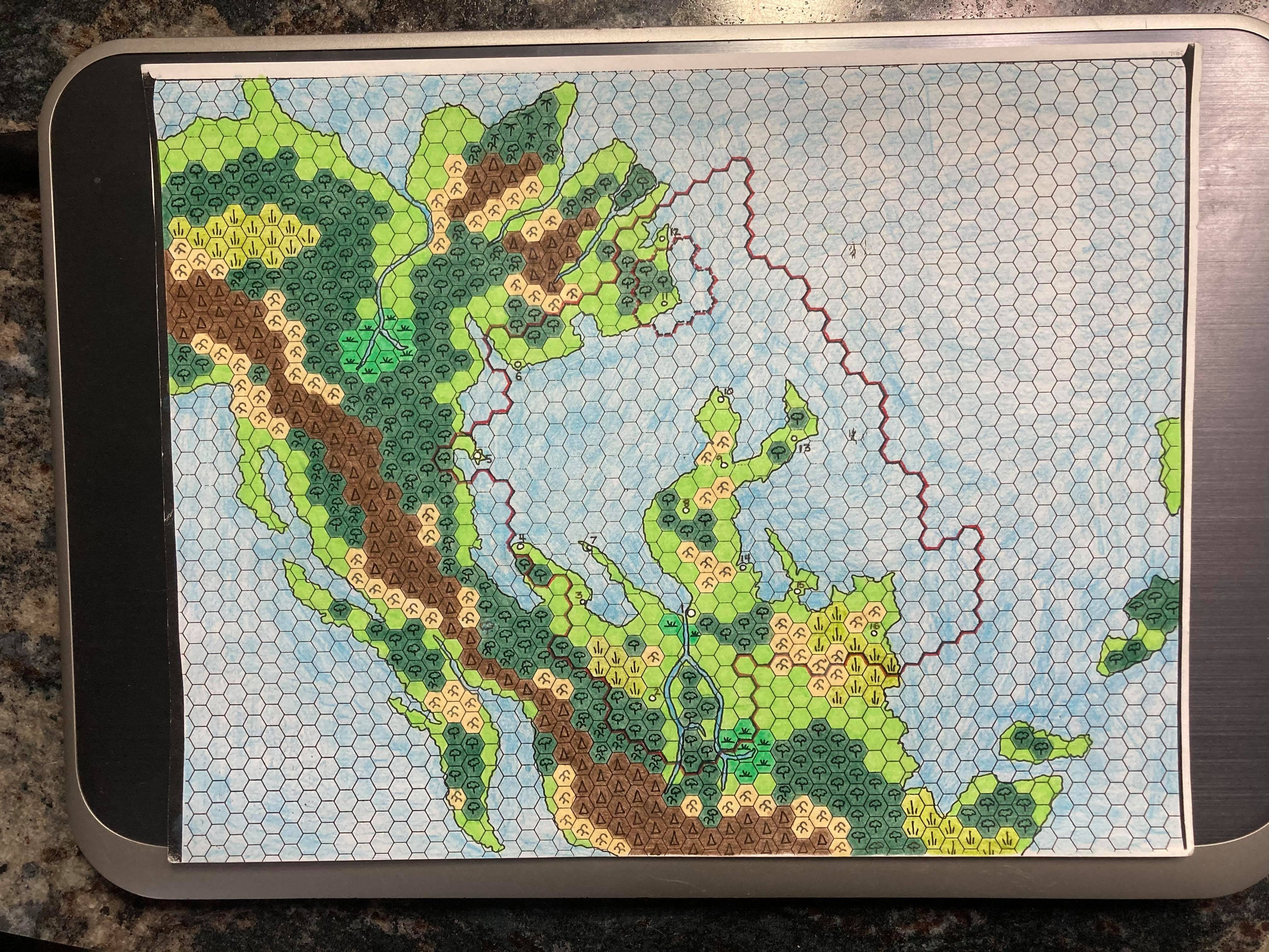
Geoff’s Selhomarr map appeared in between pieces of Davania, in late 1997. As with Davania, he took the Hollow World Set map — in this case a small section of the southeastern continent of Suridal — and transcribed it to hex format by hand. The resulting map showed an empire worthy of the scale and grandeur of the Hollow World.
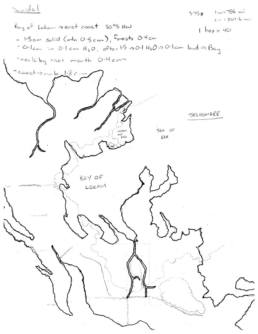
Geoff’s original note sheet and sketch, made prior to drawing the 40 mile hex map of Selhomarr. 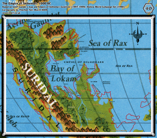
A comparison of Geoff’s Selhomarr coastlines with the Hollow World Set map. It’s amazing how close he got it!
I have notations at the top where I calculated the distances on the HW world map for various geographical features. In the upper right I have notation for the size of an inch on the HW world map versus a 40 mile hex map, based on calculations I must have done elsewhere. You can also see rough lines where I sketched out the mountain ranges and major forests, and perhaps the most interesting detail is the hand-drawn border… Ilarnn originally was supposed to have two exclaves, but I simplified that for the final map. This was in pencil, then I traced it over… the actual hand-drawn map was traced off of this one.
Thoughts on the original Selhomarr sketch, 24th March 2021
The maps of Lhomarr and Y’hegg T’uhath came a little later, in 1998 and 2000 respectively, by which time Geoff had switched over to digital cartography.
The Carnifex and the Outer Beings
While I am inclined to take Selhomarr as Geoff’s most important original creation, it seems clear that the gaming community at large, including most of our own Mystara community, probably considers Selhomarr’s ancient enemy as the more significant. This is because Geoff took inspiration from M3’s carnifex together with his own interest in fantasy-horror and came up with the Outer Beings, an ancient enemy powerful enough to rival the Immortals and even the Old Ones themselves.
These Outer Beings lurk at the edges of creation, eternally trying to pry their way out of their magical prison and enter the wider confines of the Multiverse — most often by influencing vulnerable mortals, bending them to their own sinister wills.
Geoff’s creation became so popular that it was actually even referred to in an official D&D book. But let’s get back to the maps.
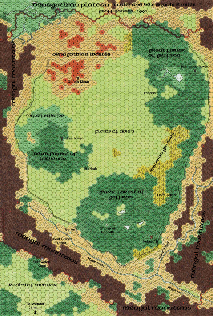
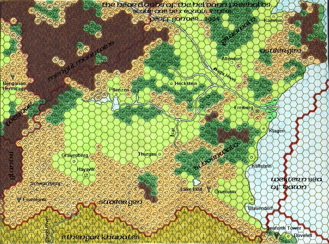
Denagoth and Heldann (1998)
Geoff produced two more hand-drawn maps before he shifted to digital cartography. Both maps dealt with nations presented in X11, and both maps showed their respective areas in detail for the first time.
Look no farther! I am currently drawing an 8-mile hex map of the Denagoth Plateau — to be added to this year’s almanac — if this is what you seek. I am also working on a more “canon” map of Norwold — hopefully one that overcomes these technicalities.
“Alfheim + Maps” thread reply, 24th November 1997


The technicalities Geoff refers to are the so-called “Norwold Conundrum”, which is to say the continuity problem caused by reconciling X11’s map with CM1’s.
Well, for one thing the Heldann Freeholds acquired some of Denagoth’s mountain terrain, according to the new maps (the border has moved one hex-line west), and southern Norwold has been changed utterly. The map given in CM1 seems accurate — the one in X11 is not, because it has Norwold stretching as far south as the Naga river, which in later maps is well within HF territory.
“Alfheim + Maps” thread reply, 24th November 1997
This problem has plagued Mystara’s cartographers ever since X11’s publication in 1986. As can be seen here, Geoff, working together with Andrew Theisen, found a solution to this problem, which he implemented in his Denagoth and Heldann maps, as well as his 1999 map of Norwold. Thibault Sarlat mentioned this solution when posting his own Norwold map:
I want to thank Geoff and Andrew for their precious help in correcting the discrepancies in the official maps contained in X11, Dawn of the Emperors, CM1 and Champions of Mystara.
—Thibault Sarlat, “New maps available on my site”, 20th September 1999, MML
Geoff’s Denagoth remains one of the best sources for the villainous nation. JTR referenced it in his own design for Denagoth in Gaz F2 (2006), although it hasn’t been the subject of that many fan-made maps.
On the other hand, Heldann has been mapped many times since, with each version building on the last. Geoff’s designs can be seen throughout, although some of the later maps added a lot more detail.
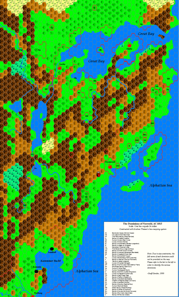
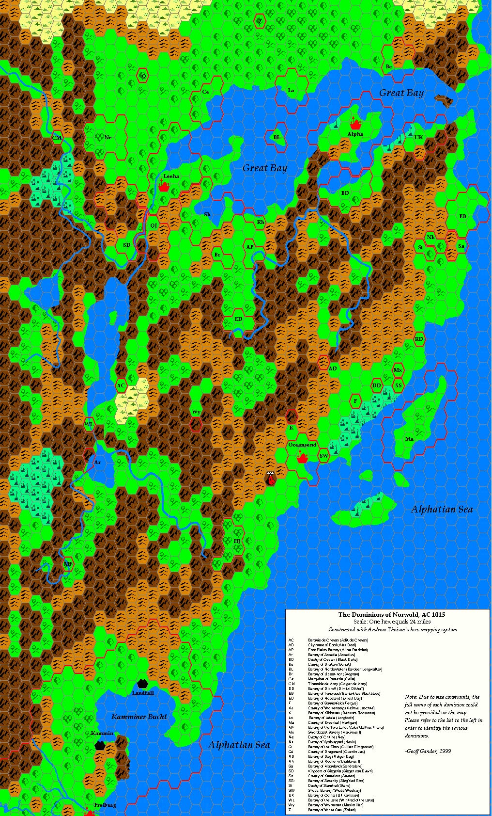
Norwold (1998)
Geoff’s Norwold map is a masterwork for two reasons: first, it proposes a solution for the Norwold Conundrum — although perhaps only for the Heldann part, as it doesn’t take into account Denagoth on the edge of the map to the southwest. This solution became known as the Kamminer Bucht, or Kamminer Bay.
Second, it worked in all of the dominions he could find in published works, the vast majority of which had no official placements. This work remains relevant today, although it has been somewhat superseded by later work by the Italian Mystara community and the maps of Simone Neri.
Tome of Mystara and Mystaran Almanacs (1998 – 2003)
Geoff’s Norwold map serves another purpose as part of the AC 1015 Mystaran Almanac. This was the first of many maps Geoff would do for the fan-made Almanac series. (Or possibly the second, as the quotation above implies that Denagoth also belonged to one of the almanacs.)
All but the last of these maps utilised Andrew Theisen’s hex map templates, and aside from the Norwold map, most were small detail maps, with a limited scope — as befits the subject. Still, this work was important, because the earliest fan Almanacs had no such maps, coming as they did before the advent of digital mapping in the fan community.
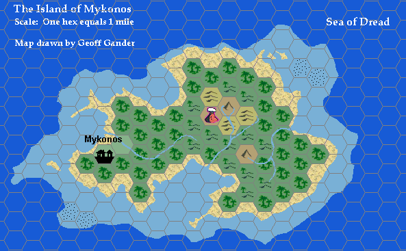
By the time Geoff completed his last map for the Almanacs, Mykonos, 1 mile per hex in December 2003, he had been working pretty constantly on Mystaran maps for more than eight years. But it was not yet time to take a break!
Mykonos represented another milestone in Geoff’s mapping: the transition to Hexmapper, which would dominate most of his maps from then on.
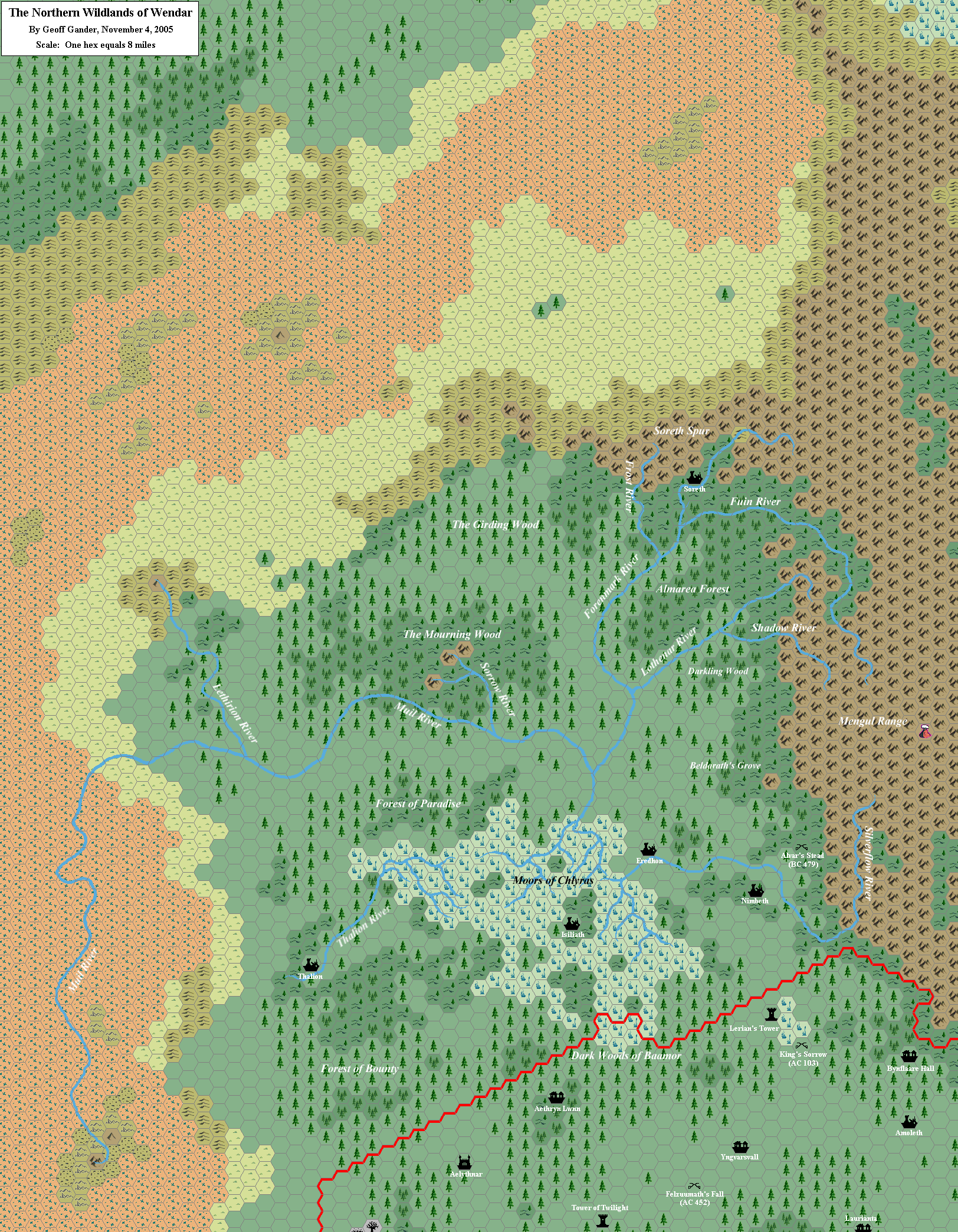
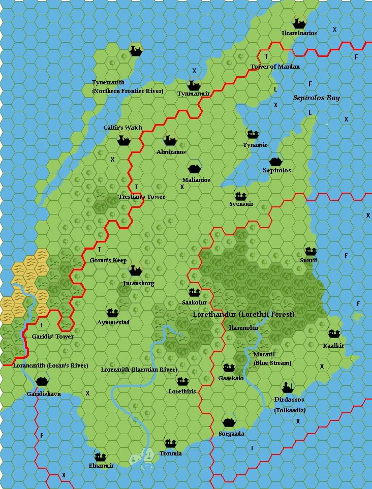
Wendar and the Northern Wildlands (2005)
In July 2005, I initiated a community project to add detail to the much-neglected nation of Wendar, which up to that point had been mapped rather nicely by Thibault Sarlat, but was still woefully lacking in settlements and other icons. Geoff took part in this project in earnest, but this also led him to another project of his own:
In X11, the map of Wendar and Denagoth depicts the region to the northwest of the two nations as being the “Northern Wildlands” — relatively lush in the southeast, but becoming more arid to the northwest. Taking that as a base, I looked at the work of Christian Constantin and Thibault Sarlat, in which a good deal of detail was added. The general landforms remained the same, though — pleasant in the southeast, but becoming more inhospitable to the northwest. I have maintained this geographical layout.
“Northern Wildlands Map”, 30th November 2005, MML
In November 2005, he released his Northern Wildlands map — a companion to Wendar, describing the land to its immediate northwest, and explaining why it was not also part of Wendar.
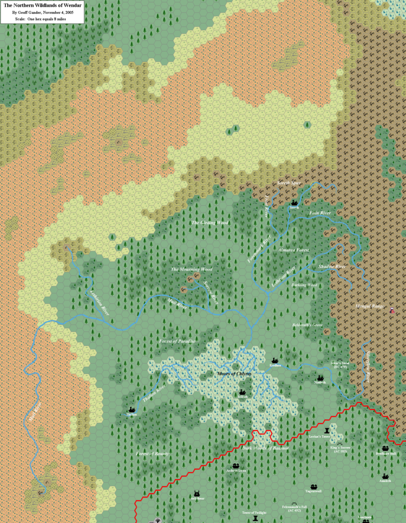
The next year, JTR adapted Geoff’s map to his own style when he released Gaz F3.
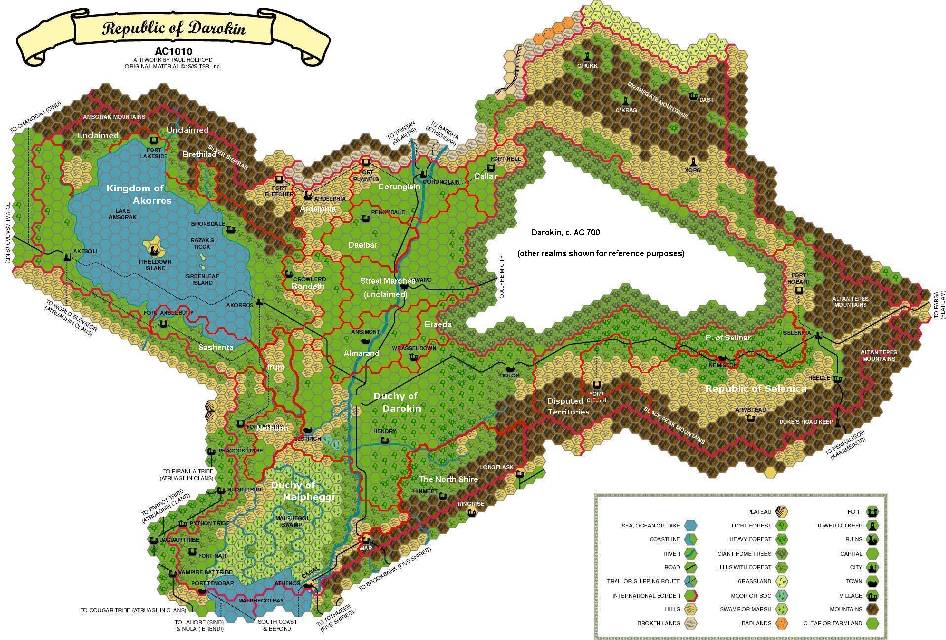
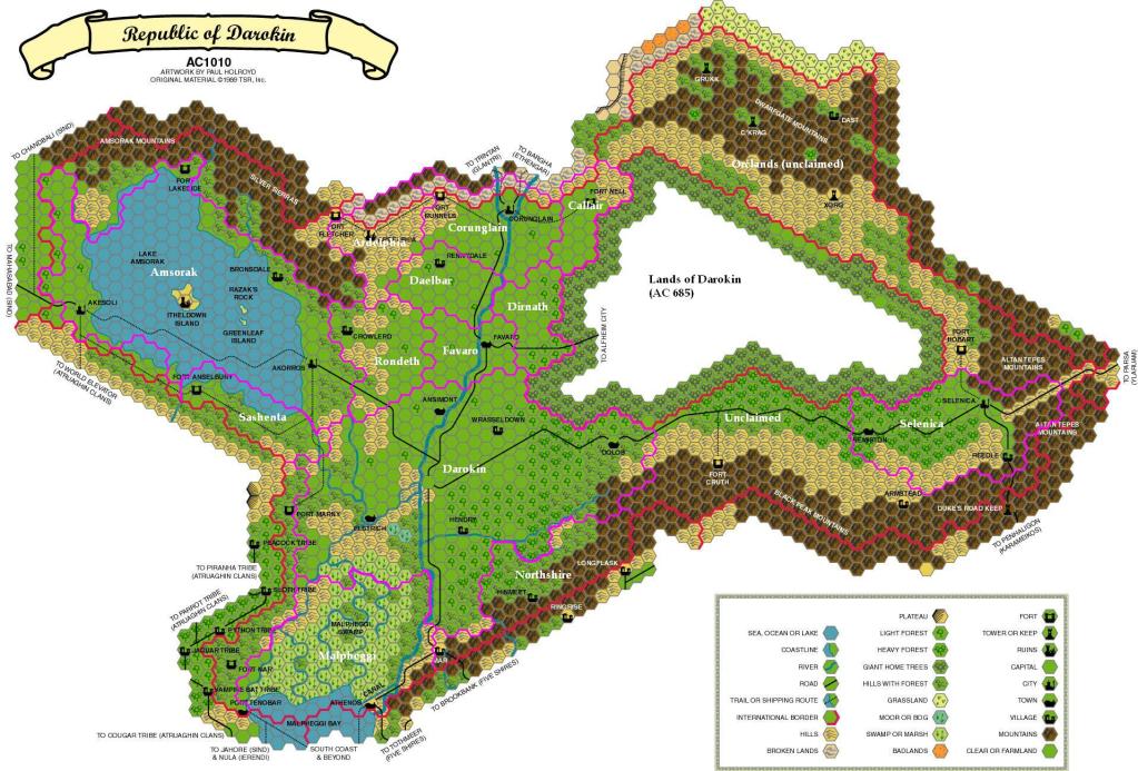
Darokin (2004, 2006, 2009 – 2010)
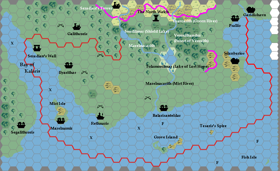
If you noticed that 2004 had no maps listed above, you were correct. But in fact 2004 saw the first of Geoff’s marked up maps of Darokin, exploring the history of that nation. Most of these maps used Paul Holroyd’s Darokin, 8 miles per hex map as a base, painting in borders to show the state of the nation at a certain point. They came in three stages, beginning with a collaboration with Aarok Nowack in 2004, continuing through contributions to my Darokin Provinces thread of 2006, finally culminating with an active role in Mike Phillips’ Darokin project in 2009-2010, in which Geoff provided marked up maps which Mike then used to create finished historical maps of Darokin — bringing the long-building Darokin history project to a satisfying conclusion.


Of course, with the nature of the community being such as it is, this was not the first time Geoff had worked on such a joint project. Although I have concentrated on the maps in this article, in fact Geoff has been a constant contributor and indeed leader in many fan projects, including the Mystaran Almanacs, Gaz F, and many others.
But the Darokin project is significant because it involved Geoff marking up maps, then others bringing them to completion. This was a significant shift for Geoff, if you consider that in the early days he defined himself primarily as a cartographer.
Selhomarr Revisited (2009 – 2010)
In fact, Darokin wasn’t the first example of such a project, although its finished maps appeared sooner. Earlier in 2009, I chose Geoff’s Selhomarr as the subject for my first ever replica of a fan-made map. This quickly led to the Davania replica, and then to adding to both maps — which in turn led to something entirely unexpected, as Geoff and I collaborated on an 8 mile per hex upgrade to his Selhomarr map.


In many ways this was a dream project for me, as up until that point I had always worked by myself, and on maps made by TSR’s cartographers — none of whom were available for feedback. I can also say with pride that it was a blast to work with Geoff, who is unfailingly positive and supportive — despite the darkness and horror lurking in many of his designs! 😉
At first Geoff’s designs for Selhomarr were completed or near-completed maps. He even adapted Andrew Theisen’s mapping system to use my hexes:
I created individual hex tiles out of your various maps, and assembled them by hand in MSPaint — basically the same process as Andrew’s old hex tiles.
“Hollow World: Selhomarr, 8 miles per hex”, 21st March 2009, The Piazza
But as we went on, I encouraged him to be as rough as he liked in his drafts, and leave the end result to me. My hope was that this would open up the possibility to be more creative, and remove the mapping system as a barrier to creation. I like to think that this worked rather well, as Geoff’s drafts did indeed get rougher, but also a lot more detailed as the project went on.
He posted the final province of Selhomarr in late 2010, although it would be 2012 before I was able to catch up and finish the map. Notably, the edges of the map outside Selhomarr’s borders remained unfinished even in 2012.
Underground and Other Maps (2011 – 2013, 2018)
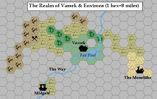
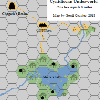
In many ways Selhomarr was the end of an era — or at least time to take a break! — for Geoff. The following years had the occasional marked up map, with just two completed maps to speak of, both dealing with small areas of underground territory: Vassek, beneath the Altan Tepes in 2011, and Cynidicean Underworld in 2018. The latter of these is his last hex map to date.
But a quick check of the Vaults of Pandius will show that while Geoff’s contributions to Mystara may have slowed slightly in these years, they never stopped. He has become a regular contributor to Threshold Magazine, providing articles almost every year since its debut. Of course he has also been working increasingly in professional circles, which at this point precludes Mystara, since it is not currently an option at the DMs Guild. Should that situation change… Well, we’ll have to wait and see.


The Future
In any case, I couldn’t be prouder to have such an amazing designer as Geoff Gander as a member of our community. Indeed, he has done so much that there are still reams and reams of things I haven’t even touched upon in this mammoth write-up of his activity!
I am quite sure that he will continue to surprise and enthral us with his writings for many more years to come — and probably sooner than we might think, at that. As of this writing, in March 2021, I feel a change in the air, and whisperings of a nation long past, but still thriving in the world within…
A fireside chat between Geoff and Thorf (minus the fire)
Thorf: How did you first get interested in Mystara? What draws you to the setting?
Geoff: The very first time I’d heard about Mystara was a visit to my local gaming store in the late 80s. I saw a bunch of new sourcebooks with attractive covers, and GAZ5 The Elves of Alfheim caught my eye. I devoured the book and was amazed at the level of detail, and the more I read about Alfheim the more I wanted to learn about this fascinating “Known World” setting — which I recognised in the Expert rulebook. I’ve read sourcebooks for other settings, but the Gazetteer line still stands out for me as a “best practice” of sorts on how to present a world to players and GMs.
As for what draws me to Mystara, for me it’s the moral ambiguity and its cultural richness. There are “good” and “evil” characters, of course, but if you scratch the surface many of the main NPCs — and nations — of the setting are a balance of both. The shadowelves (for example) are seen as malevolent by the elves of Alfheim, but their political machinations are driven by a desire to secure a better life on the surface. Likewise, I appreciate the care taken by Bruce Heard and the various creative minds over the years to create a setting that is not a bland fantasy England, but reflects (but does not imitate) actual cultures around the world that don’t often get attention in roleplaying games.
What I find interesting now, is that when I first joined the Mystaran fan community I think I was mainly known for my maps, and it was only later that I switched over to writing. 🙂
I’m always awed by your ability to work on both designing and cartography — a true designer. I’ve always found the creating bit hard, myself, and floundered until I found my calling in maps. What was your favourite official map, and what did you like about it?
That’s a good one, as there are quite a few that I like! Probably my absolute favourite would be the map of the Serpent Peninsula in Champions of Mystara — the shape of the coastline and the numerous swampy islands is intriguing, combined with navigational paths, actual detail on Davania, different terrain types, an insert map of the lands around Tanakumba, and the diagram of the shell towers. To me, it’s a great model of a highly useful map that does even more than represent the lay of the land.
The corner of Davania was certainly a thrill, I agree. Speaking of Davania, when did you start mapping Mystara?
My very first map — in terms of something I shared with the Mystaran community — was my map of the Adakkian Sound region, in 1996 on the old Mystara Mailing List (MML). Little did I know where that would take me…
I found your original announcement, from October 1996… That was before my time on the MML. How did you draw your maps back then? Can you tell us a little about your process?
My very first maps — so all of Davania, as well as Denagoth, Heldann, and an unfinished project to map Skothar — were drawn by hand in pencil on hex paper, and then inked. Because I would colour them by hand, I was very leery of making any mistakes and ruining my work (each map took many hours to create), so I would photocopy the maps and then colour in the copies. I had a specific set of pencil crayons with the shades I wanted, and I remember when my chosen colour for grasslands wore out I had to visit several art stores until I could find an exact match! It took me many months during my undergrad to complete the Davania maps. Once done, I stored the maps in a special folder until such time as I had access to a scanner (first through a friend, then at work). I didn’t have access to fancy computers at that time, so the files were huge and the scanning process itself took a while.
I can only imagine. When did you change to digital mapping?
Once Andrew Theisen’s MS Paint-based hex mapping template was available, I switched to that. I enjoyed drawing maps by hand (and still do — all of my town and city maps are still done in that way), but the process was very finicky. If I made a mistake, I could simply undo it! More recently I switched to Arr-Kelaan’s Hexmapper program, which had a colour palette that more closely matched the Gazetteer standard, and it didn’t require copying and pasting individual hexes. I used this software for my draft maps of Selhomarr. That program was then no longer supported by the designer, and most maps I create now are hand-drawn maps of towns or cities — so in some ways I came full circle!
What challenges did you face during your mapping projects?
I’m a bit of a stickler for perfection — both in what I write and create. The biggest challenge for me, when creating a map, is ensuring its accuracy with respect to any official sources. The Davania map, for example, took hours to outline in sketch form against the world map from the Hollow World boxed set, and while I can’t remember the formula I used to extrapolate each twist in the coastline into a series of 8.5 x 11 sheets of hex paper (and while we now know the issues surrounding the projection used to make the world map in the first place, as you have pointed out to the community in the past), I’m satisfied with the result.
Perhaps this is another reason why I focus more on city and town maps, or I’m more liable to map out previously unknown territories, nowadays. 😉
I’m still amazed at your achievement with Davania — and without computers to help! Happily, the legacy of your map lives on in every other map of the area since, as we all base our work on your creation. I think it would be hard to overstate the significance of your Davania map. Was it your favourite area to work on?
While I’m extremely proud of my work on Davania, and I see it as the project that launched me into cartography, my favourite area was Selhomarr. That was the first original Mystaran setting that I developed (technically it’s older than Littonia, even though I believe I posted about the latter on the MML first), and bringing it to life in all of its coloured hex glory (and taken even further by you!) was probably my happiest mapping moment.
Working on Selhomarr with you was a lot of fun. We really should get back to that someday! 😉 Do you have any future plans for your maps of Mystara?
That’s a good question! Right now my interest is mainly in developing more town and city maps — maybe I can find an easy program to give them a handmade look — to bring a level of added realism to the setting, that players and GMs can enjoy. As long as we have the Vaults of Pandius (with Shawn as our steward), I’m confident my work will be there for the community to enjoy. But I’m open to doing more maps, if the muse strikes!
I couldn’t agree more. We all owe a debt of gratitude to Shawn as our community archivist. So Geoff, what are you doing these days? Can you tell us about some of your current projects?
As some people know I write short fiction (mainly horror and science fiction) on top of gaming goodness. My stories have been published by a number of magazines — both in print and online — but my first love remains writing for roleplaying games. Currently I am a freelancer with Fat Goblin Games (where I work on TinyD6 sourcebooks as well as some 5th Edition and other products) and Sentinel Hill Press (where I write material for Arkham Gazette magazine, which expands on the core Arkham area setting). In the past I’ve also written OSR compatible adventure modules for Expeditious Retreat Press, too — these modules were also written to be easy to insert into Mystara. More products should be out later this year, including a sourcebook for the Forgotten Realms that I’m really excited about!
I still actively create material for Mystara, and most of it is geared towards my own campaign of 10 years. Some notable projects include:
- The Dream World (a sub-setting loosely based on certain elements of Lovecraft’s Dreamlands, but with different twists and one sub-class)
- Rules for Outer Being magic (this is more than spell lists for NPC cultists, however)
- A detailed, investigation-heavy adventure module set in Darokin (which I do plan to release at some point)
Thank you very much, Geoff! I look forward to many more great things from you to come.
Geoff’s Maps
Gallery


Sources
In researching this article, I searched out all the references I could find, and consulted with everyone I could track down. I have made every effort to ensure that the information is accurate, but in some cases I may have slipped up — especially when dealing with maps that are years or even decades old. I take full responsibility for any mistakes; please don’t hesitate to point these out if you find them! Following is a summary of my sources for your reference.
- Direct messaging with Geoff Gander
- It Started with a Single Hex-Map in Threshold Magazine Issue #5
- Mystara Mailing List Archive
- Mystara Message Board Archive
- Geoff Gander’s personal archives
- Hervé Musseau’s personal archives
- Thibault Sarlat’s personal archives
25 March 2021 @ 11:08 pm
Such an in-depth and interesting journey following Geoff’s mapping adventures!
Thanks for journaling and sharing this, Thorf.
26 March 2021 @ 2:02 am
Thank you, Thorf, for shedding light on my work, and for being such a wonderful collaborator on past, present, and (hopefully) future projects! You’ve turned what (to me) was simple enthusiasm about our shared hobby into a fascinating retrospective. 🙂
26 March 2021 @ 6:08 am
Niccccceee.
I now even have more respect for Geoff, doing his creations.
I did use some of his work in my maps and was already very happy with his work.
Thanx for this nice compilation.