
Wrath of the Immortals Alphatian Region 1010 AC, 72 miles per hex
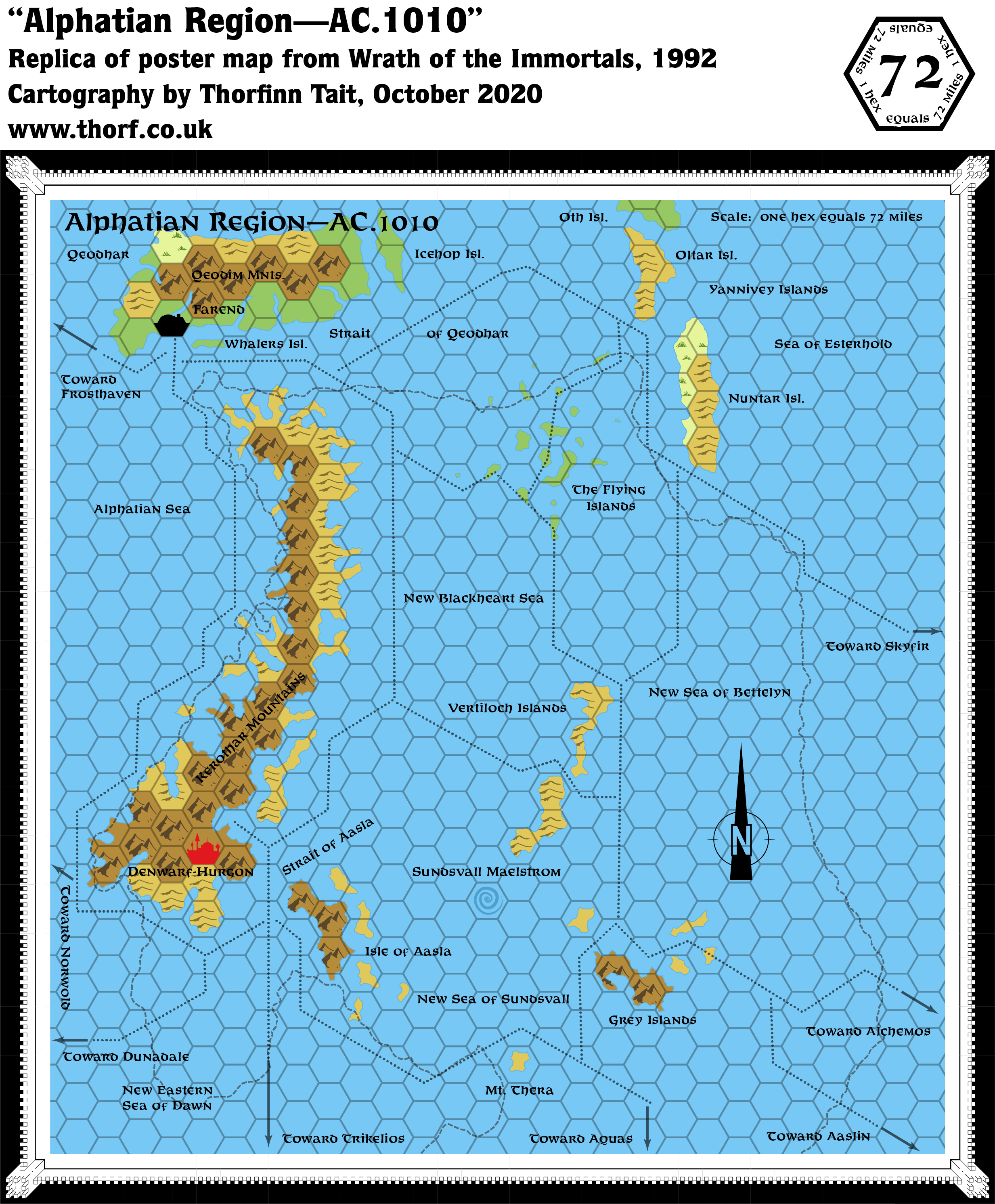
Post-disaster Alphatia, or rather Alphatia Region, as most of the island continent has gone — vanished beneath the waves.
This map, the second of a pair showing the area pre- and post-disaster, is fascinating in a grotesque sort of way. It was the first time for a Mystara map to show such a drastic change to the geography of the world, aside from the Pre-Cataclysmic world map from the Hollow World Set. It’s interesting to see the new island and sea names, which were further developed in the Poor Wizard’s Almanac later in the same year.
Replica Map (October 2020)
Sources
- Wrath of the Immortals (1992) (PDF at DriveThruRPG)
- Poster map A (Cartography by Dennis Kauth)
Chronological Analysis
This is Map 201. It was published in August 1992. The updated version of this map has not yet been released. See also Appendix C for annual chronological snapshots of the area. For the full context of this map in Mystara’s publication history, see the upcoming Let’s Map Mystara 1992.
The following lists are from the Let’s Map Mystara project. Additions are new features, introduced in this map; Revisions are changes to previously-introduced features; Hex Art & Fonts track design elements; and finally Textual Additions are potential features found in the related text. In most cases, the Atlas adopts these textual additions into updated and chronological maps.
Coming soon

")
")