Rules Cyclopedia Known World, 24 miles per hex
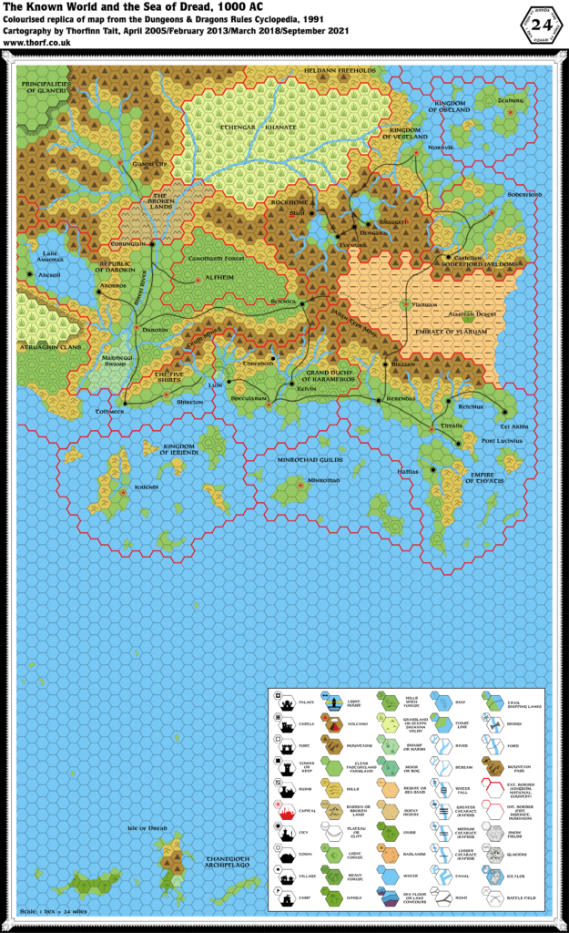
The Rules Cyclopedia was the last book to reprint X1’s iconic Known World map. While some minor updates were made to bring it into line with the developments of the past decade, it ended up being puzzlingly out of sync with the Gazetteer series maps. Two further maps were produced of the Known World, but none included the Isle of Dread and the Thanegioth Archipelago to the south; this would be its last appearance in Mystara books.
The map differs from X1’s map as follows: changed the font from Souvenir/Baskerville to Feinen Bold; added quite a few more settlements (Tothmeer, Luln, Stahl, Evemur, Smaggeft, Castellan, Retebius, Hattias), though they could have added a lot more; Luln placed in a strange location; added far more roads and a few trails; changed the style of the plateaus; and so on.
Perhaps the most surprising thing is that they didn’t change the hex art, despite the beautiful new expanded legend in the bottom right corner. (The legend unfortunately obscured a major island of the Thanegioth Archipelago.)
Replica Map (September 2021)
Sources
- Dungeons & Dragons Rules Cyclopedia (1991) (PDF at DriveThruRPG)
- Untitled map, pages 270-271

1 January 2024 @ 8:14 pm
it is possible to access to an editable version of this map? I’d like to translate it to my language
2 January 2024 @ 8:06 pm
Hi.
I’m looking for a version of this map without the names, or at least, in an editable separate layer.
Does anyone know where to find it?
Thanks!
3 January 2024 @ 12:29 pm
Hi there. Thanks for your comment. Please check your e-mail.