Pixel-perfect maps from an 8-bit enthusiast
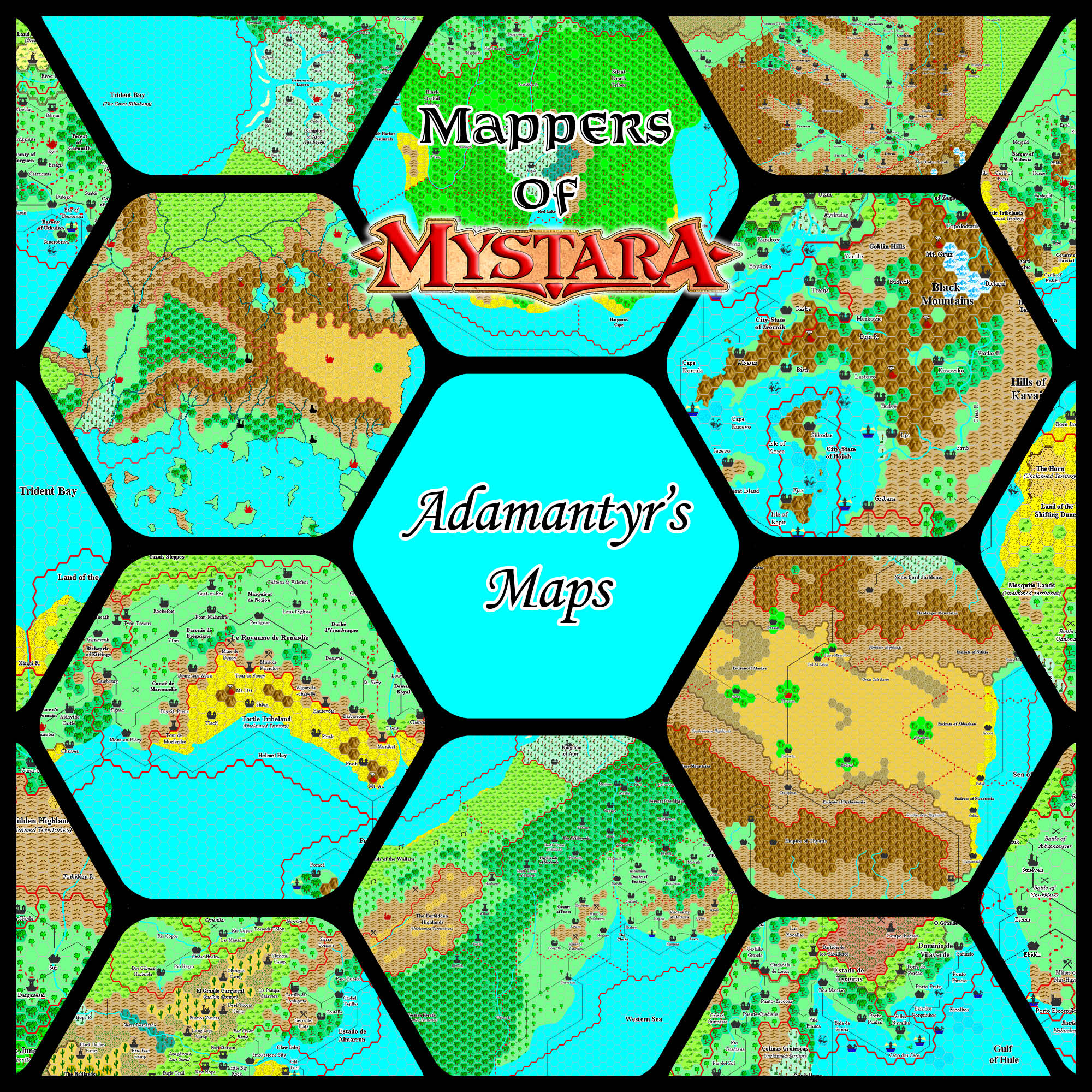
At a time when software and hardware limitations were a major issue for Mystara’s cartographers, Adamantyr created a beautiful set of maps in his own unique style, influenced by his love for computer RPGs.
Profile
- Nickname: Adamantyr (Vaults author page, Twitter profile); previously went by Ironwolf
- Location: Washington, USA
- Maps Posted: 1999-2003
- Areas of Interest: Savage Coast, Known World
- Scales: Almost all 8 miles per hex, with a single 24 mile per hex map
- First Posted Map: Isle of Dread, 8 miles per hex (November 1999); first finished map was Eastern Gulf of Hule, 8 miles per hex (January 2000)
- Software: MS Paint
- Mapping Style: Bright and light colours, with custom-drawn pixel art hexes
- Fonts: Monotype Corsiva (titling), Times (all other labels)
Overview
Adamantyr was quite active on the Mystara Mailing List (MML) during its heyday in the late 90s. He was an active DM and player at that point, and took part in many memorable discussions. He also frequented the Mystara Message Board (MMB) in the mid 2000s.
“Forewarning: I do it the hard way.”
I’m working in Paint, using it to draw both hexes and the legend to construct the maps. The only real slow part to it is the coastlines and rivers, also contours and borders, otherwise, I should have a pretty snazzy looking map done soon.
“Maps in the Works”, 29th August 1999, MML
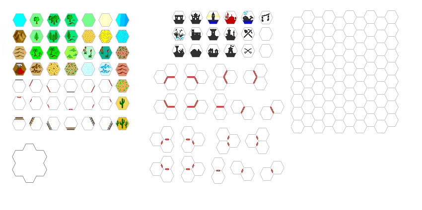
His first mention of making some maps came in August 1999, when he talked about creating his own set of hex art icons in MS Paint. Then in November he shared a small map of the Isle of Dread converted to 8 miles per hex, using this art. This was actually a crop of a larger work-in-progress map showing the whole Thanegioth Archipelago, but unfortunately he never completed it.
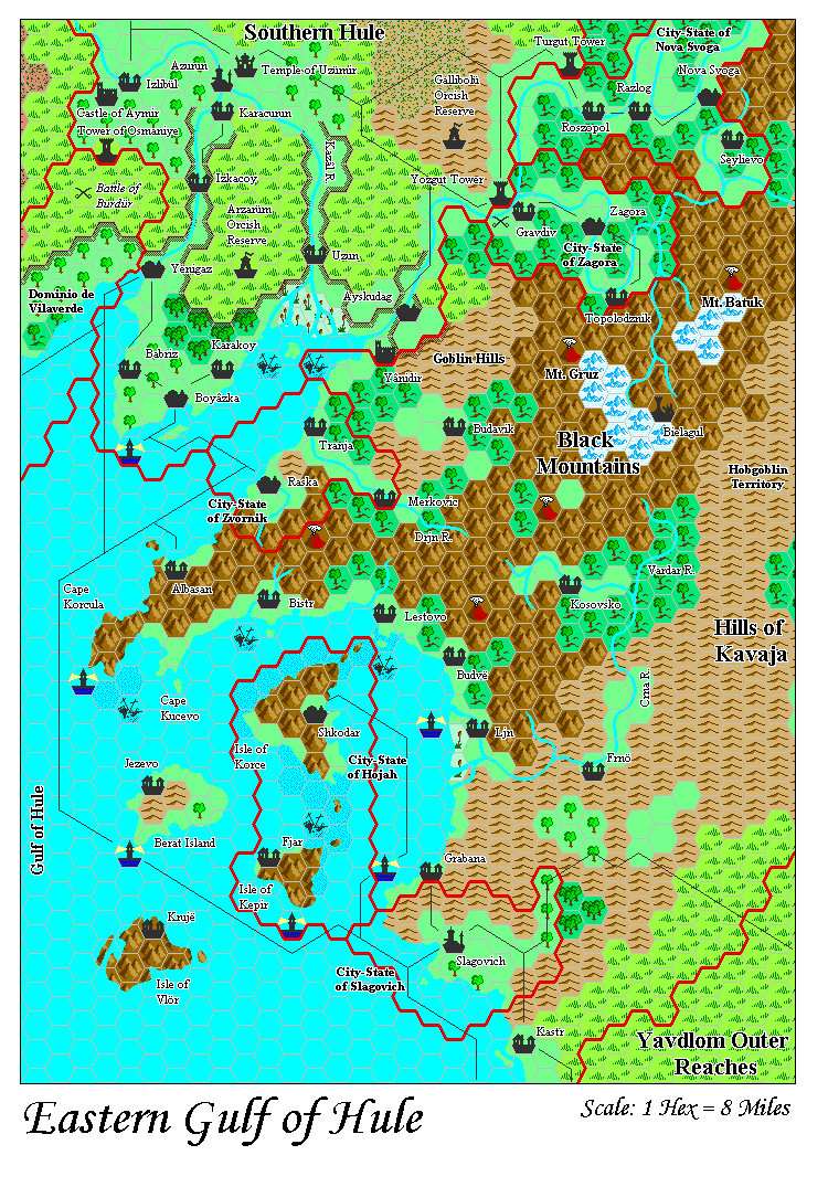
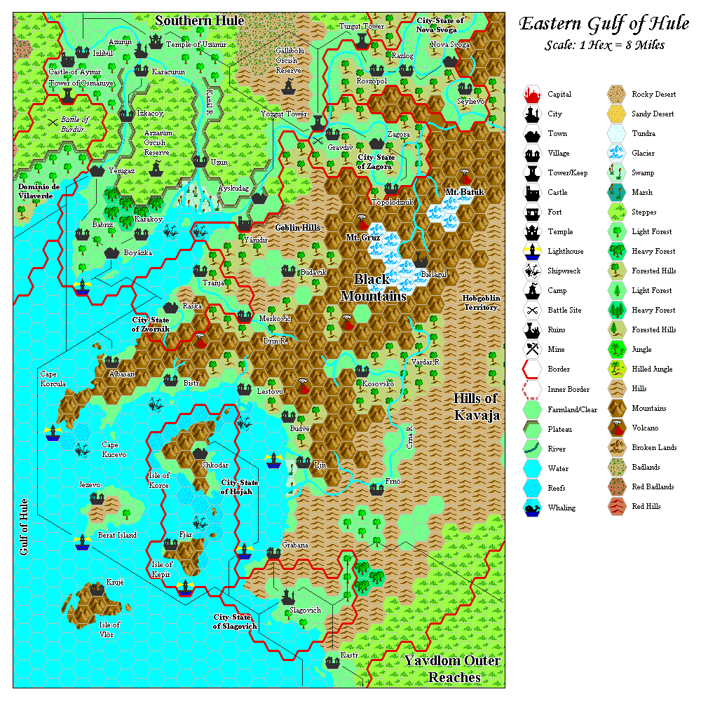
Following this, in early January 2000 Adamantyr posted a work-in-progress Known World map. After some revisions to this map, his interests moved to the Savage Coast, and his first finished map soon followed: the Eastern Gulf of Hule, 8 miles per hex.
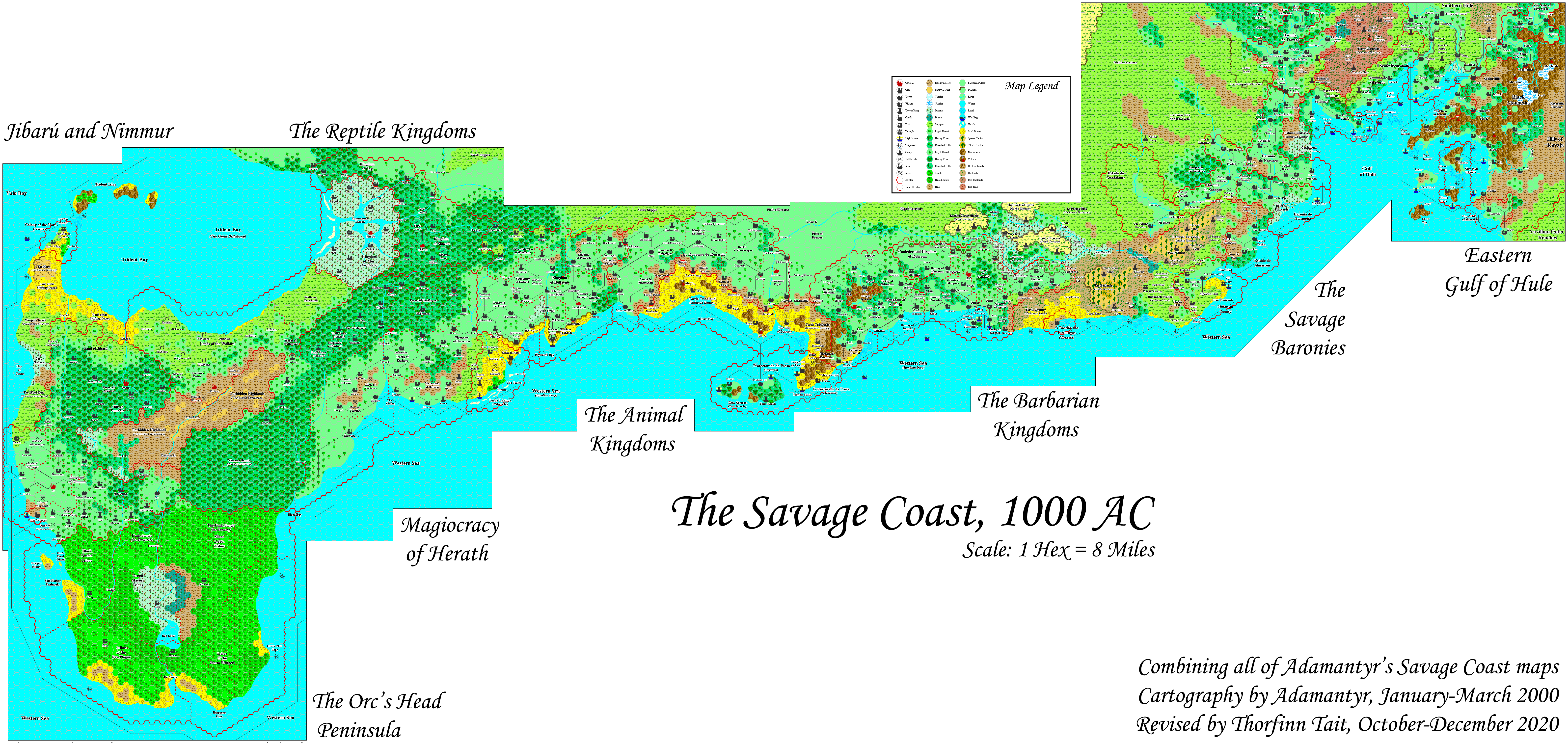
The Savage Coast
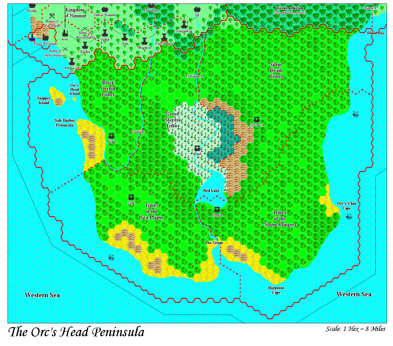
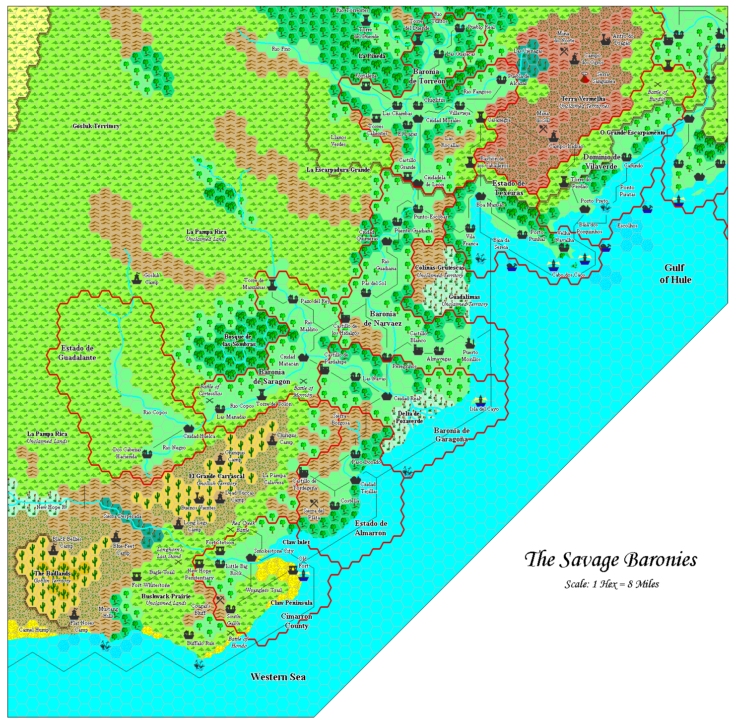
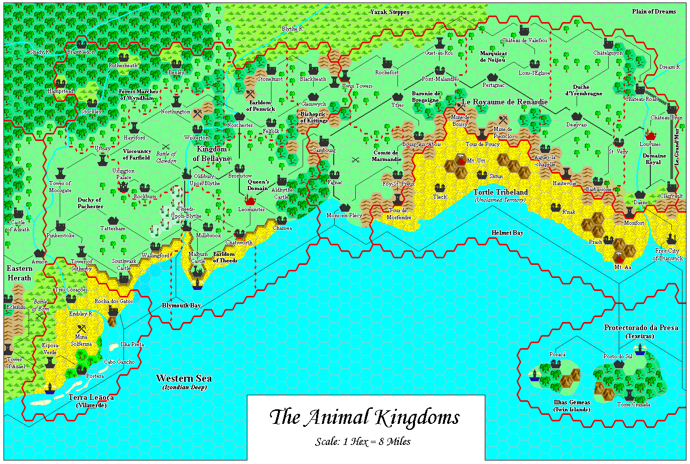
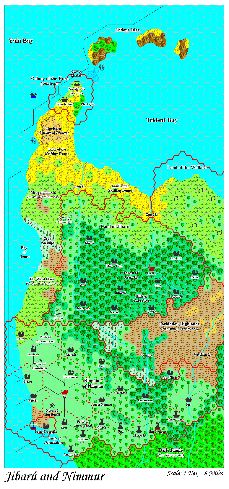
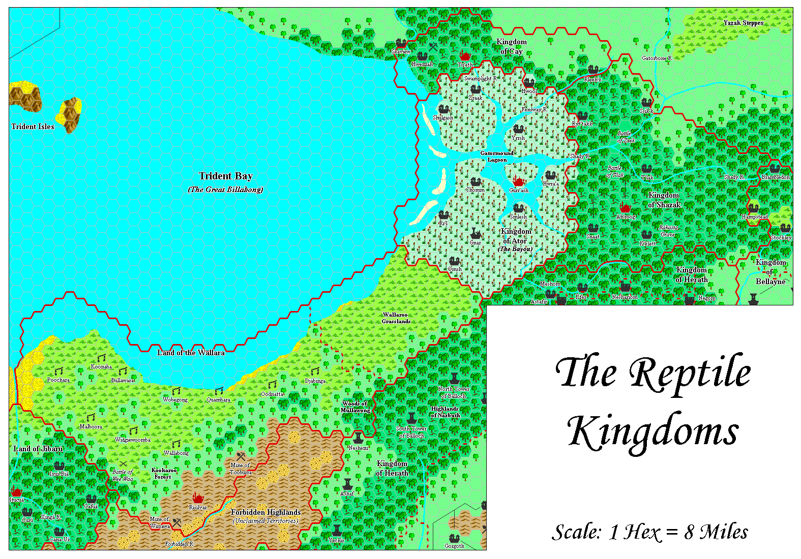
The rest of Adamantyr’s maps largely followed the journey of the Princess Ark along the Savage Coast: the Savage Baronies; the Barbarian Kingdoms of Robrenn and Eusdria; the Animal Kingdoms of Bellayne and Renardy; the Magiocracy of Herath; Jibarú and Nimmur; the Reptile Kingdoms of Shazak, Ator and Cay; and finally the Orc’s Head Peninsula. All of these were presented in 8 miles per hex, including the Orc’s Head, which he converted from 24 mile per hex maps.
This appeared between January and March 2000, except for the last two, which he completed in July 2001. Unfortunately, technical limitations with the computers of the time prevented the assembling of the maps into a single trail map.
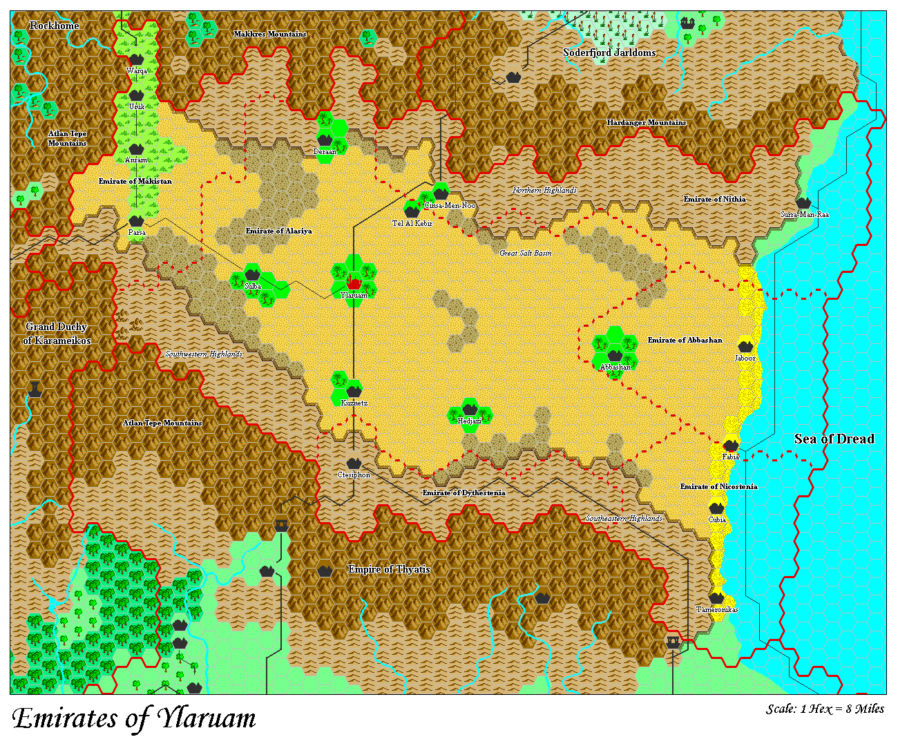
He also posted maps of Karameikos and Glantri during this time, and completed one of Ylaruam, too. The dates for these are not entirely clear, although they certainly stem from the 2000-2003 period.
8-bit Style
I copied the originals by eye and hand in MS Paint, and created layers for the coastlines, water, hexgrid, and assorted terrain work. That way I could just drop copies on top of each other for the finished product.
“The Known World Map — Done!”, 11th January 2000, MML
Unlike many of Mystara’s other cartographers, Adamantyr’s style arrived almost fully formed with his first maps. After just a short period of trial and error, he quickly established his signature style, and then stuck to it. The result is a very nice set of cohesive and consistent maps, with a deliberate artistic influence from the 8-bit computer game era.
The main evolution that can be seen involves the presentation of rivers (black border or none) and other line-based art (borders, roads, etc.). The labels also took some thinking to establish a good style — as they usually do for all cartographers. Some earlier versions of Adamantyr’s maps have been lost, but there is enough to see this progression in style.
Combined Maps
To the best of my knowledge, it wasn’t until 2015 that anyone produced a combined version of Adamantyr’s Savage Coast maps. At that time, I assembled his Orc’s Head Peninsula, Jibarú and Nimmur, Herath, and Reptile Kingdoms maps into a single piece to assist with my work on Lining Up Mystara.
Then in late 2020 I combined the whole series, and shared it with the man himself on Twitter. This may well be the first time these maps were all posted as a single trail map.
Interview
Adamantyr graciously agreed to answer some questions for this article.
How did you first get interested in Mystara? What draws you to the setting?
I’ve loved the setting ever since I first looked at the map in the old Expert rules book. What I liked about it was they used real-world cultural examples to fill in the world.
Did you have a favourite official map?
I think the map for Rockhome was my favorite, because it was the first Gazateer I got as a Christmas gift, and the map is a lot more interesting in terms of depth than some of the others.
When did you start mapping Mystara?
In the late 90’s, when the only source for maps was in Dragon magazine for the new Savage Coast. I was also intrigued to try and reproduce the commercial maps TSR did.
When and where did you post your first map online?
On my own gaming website, dedicated to my 2nd Edition AD&D campaign based on the Savage Coast.
What software did/do you use? Or did/do you draw your maps by hand?
I used MS Paint mostly, although I also used Paint Shop Pro to do some quick color changes that MS Paint didn’t have the capacity to do.
What were/are the limitations or peculiarities of that software?
Mainly, MS Paint doesn’t support layering and only allows pure white as a transparency color. It also doesn’t let you blast and change colors across the entire image easily.
Please describe your process in brief.
The maps are built out of multiple images, which are copied and pasted on top of each other for the final result.
First, I created a basic hex pattern with enough size for reasonable resolution of the icons, then created a large grid map and saved it as a blank map.
I also hand-drew the icons, creating a map legend.
I’d then hand-draw the rivers and coastlines, using the original maps as a guideline. When finished, I’d wipe the hex map out using the eraser tool but retaining the coastlines. Then fill in the water.
Then I’d create the hex map itself, copy and pasting the hexes and placing them by hand. As the “water” layer would overlap it, I wasn’t worried about the hex graphics carrying into water areas.
Then the border layer, which involved copying and pasting hex outlines.
Then the trickiest layer, the text labels. I usually would do a semi-complete map then type and place the text in their respective areas. Then I’d have to color-wipe using eraser all the hex graphics. (Which I always avoided using pure black in for this reason.) Then I’d outline by hand each text with a single layer of pixels in a garish color that was easy to see. Then using the eraser tool I’d swap this color with a NEAR white, usually 254/254/254 RGB, which would not be transparent but would also give it a nice white outline when pasted on top.
What challenges did you face during your mapping projects?
Mainly the limitations of MS Paint, which has if anything gotten more limited. I liked Paint Shop Pro better but Corel chose to go a more Adobe Photoshop route with it which I disliked.
What was your favourite area to work on?
Probably the Savage Coast. I loved merging the disincorporated maps into larger pieces and seeing it all together.
Do you have any future plans for your maps of Mystara?
At the moment, I don’t. I’m doing more playing than running games right now, my brother runs a weekly D&D game (5E rules) over Discord and Fantasy Grounds. I’d originally planned to keep going and do every map of every Gazetteer location, but the time required to make the maps started to wear a bit, and I actually ended up going back to college around that time, which ate up a lot of my free time.
What are you doing these days?
I’m working on retro gaming projects mainly. 🙂 My CRPG for the TI-99/4a definitely was inspired a bit by the Known World. http://quixotic.adamantyr.com is my software site.
Adamantyr’s Maps
| Name | Vaults URL | Year | M | D | Date Source | Region | Scale | Notes |
|---|---|---|---|---|---|---|---|---|
| Legend | 1999 | 8 | 29 | MML | Legend | - | Work in progress | |
| Isle of Dread | 1999 | 11 | 9 | MML | Isle of Dread | 8 | ||
| Thanegioth Archipelago | 1999 | 11 | 9 | MML | Thanegioth Archipelago | 8 | Work in progress | |
| The Known World | 2000 | 1 | 11 | MML | Known World | 24 | Work in progress | |
| Eastern Gulf of Hule | eghule.gif | 2000 | 1 | 12 | MML | City States | 8 | First posted version |
| Eastern Gulf of Hule | eghule.gif | 2000 | 1 | 16 | MML | City States | 8 | Revised version with legend |
| The Savage Baronies | sbarony.gif | 2000 | 2 | 3 | MML | Savage Baronies | 8 | |
| The Barbarian Kingdoms | 2000 | 2 | 7 | MML | Robrenn, Eusdria | 8 | ||
| The Animal Kingdoms | aniking.gif | 2000 | 2 | 10 | MML | Renardy, Bellayne | 8 | |
| Karameikos | 2000 | 2 | 10 | MML | Karameikos | 8 | MML mention in 2000/2/10; date uncertain | |
| Legend | 2000 | 2 | 16 | File | Legend | - | ||
| Magiocracy of Herath | herath.gif | 2000 | 2 | 27 | MML | Herath | 8 | |
| Jibarú & Nimmur | jibnimm.gif | 2000 | 2 | 28 | MML | Jibarú, Nimmur | 8 | |
| Principalities of Glantri | 2000 | 3 | Guess | Glantri | 8 | Date uncertain | ||
| The Reptile Kingdoms | reptking.gif | 2001 | 7 | 16 | File | Ator, Shazak, Cay | 8 | Posted by Thibault 2002/1/31 |
| The Orc's Head Peninsula | dkjungle.gif | 2001 | 7 | 16 | File | Orc's Head Peninsula | 8 | Posted by Thibault 2002/1/31 |
| Emirates of Ylaruam | 2003 | 12 | 31 | File | Ylaruam | 8 | ||
| Trident Bay and Orc's Head Peninsula | 2015 | 12 | 12 | File | Orc's Head Peninsula | 8 | Revised by Thorf | |
| The Savage Coast, 1000 AC | 2020 | 10 | 18 | File | Savage Coast | 8 | Revised by Thorf | |
| The Savage Coast, 1000 AC | 2020 | 12 | 17 | File | Savage Coast | 8 | Revised by Thorf |
Gallery


Sources
In researching this article, I searched out all the references I could find, and consulted with everyone I could track down. I have made every effort to ensure that the information is accurate, but in some cases I may have slipped up — especially when dealing with maps that are years or even decades old. I take full responsibility for any mistakes; please don’t hesitate to point these out if you find them! Following is a summary of my sources for your reference.
- Direct messaging with Adamantyr
- Mystara Mailing List Archive
- Mystara Message Board Archive
- Adamantyr’s personal map archive
- Thibault Sarlat’s personal map archive
2 February 2021 @ 2:05 am
Thank you, Adamantyr! And thank you, Thorf, for bringing us such a great presentation of his work!
4 February 2021 @ 12:54 pm
Agreed 1000%! Thank you, Thorf, for taking the time to profile all of the community’s cartographers!
4 February 2021 @ 11:20 pm
Great to see these maps again. I think these and Geoff’s jpegs of hand drawn maps were some of the first things I found returning to Mystra in the early 2000’s
4 February 2021 @ 11:30 pm
The Atlas of Mystara is built on the shoulders of giants. 🙂