One of the first to rearrange the Known World
Ever wanted to change the Known World to a configuration that makes more geographical and political sense? Eric Anondson has done just that.
Profile
- Nickname: Anondson, AdmundfortGeographer (Vaults author page, Piazza profile, DeviantArt profile)
- Location: Twin Cities, Minnesota, USA
- Maps Posted: 2014
- Areas of Interest: Known World
- Scales: 8 miles per hex
- First Posted Map: Known World Rearranged (May 2014)
- Software: Hexographer, Worldographer, Affinity Designer
- Mapping Style: Hexographer palette and hex art (refined palette close to published maps, but with darker greens and a more diverse icon set)
- Fonts: None
Overview
We are all familiar with the usual complaints about the Known World’s geography: how can a hot desert be right next to a cold and wet northern realm? The steppes are far too small! And so on. But how many of us have taken these ideas and used them to rework the layout of the region?
Eric Anondson was one of the first — perhaps even the very first — to do this, and share his resulting map. It’s a wonderful glimpse into a parallel Mystara, where things are the same but different.
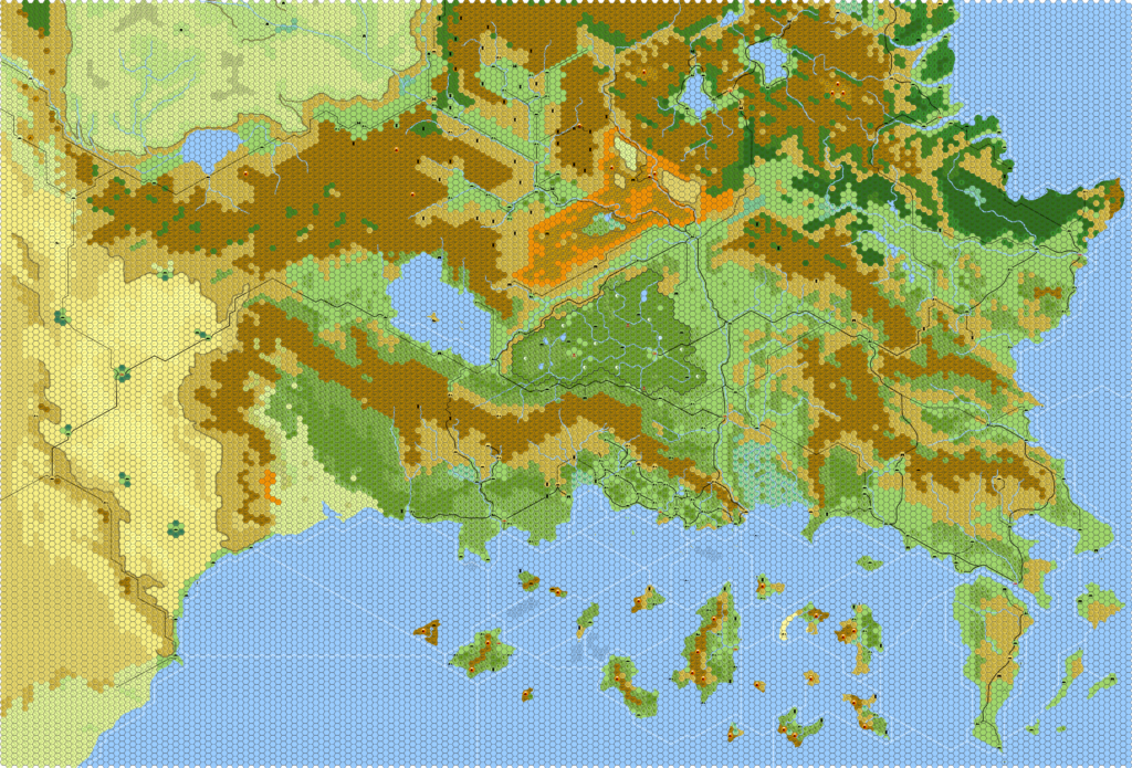
It’s the Known World, but not as we know it
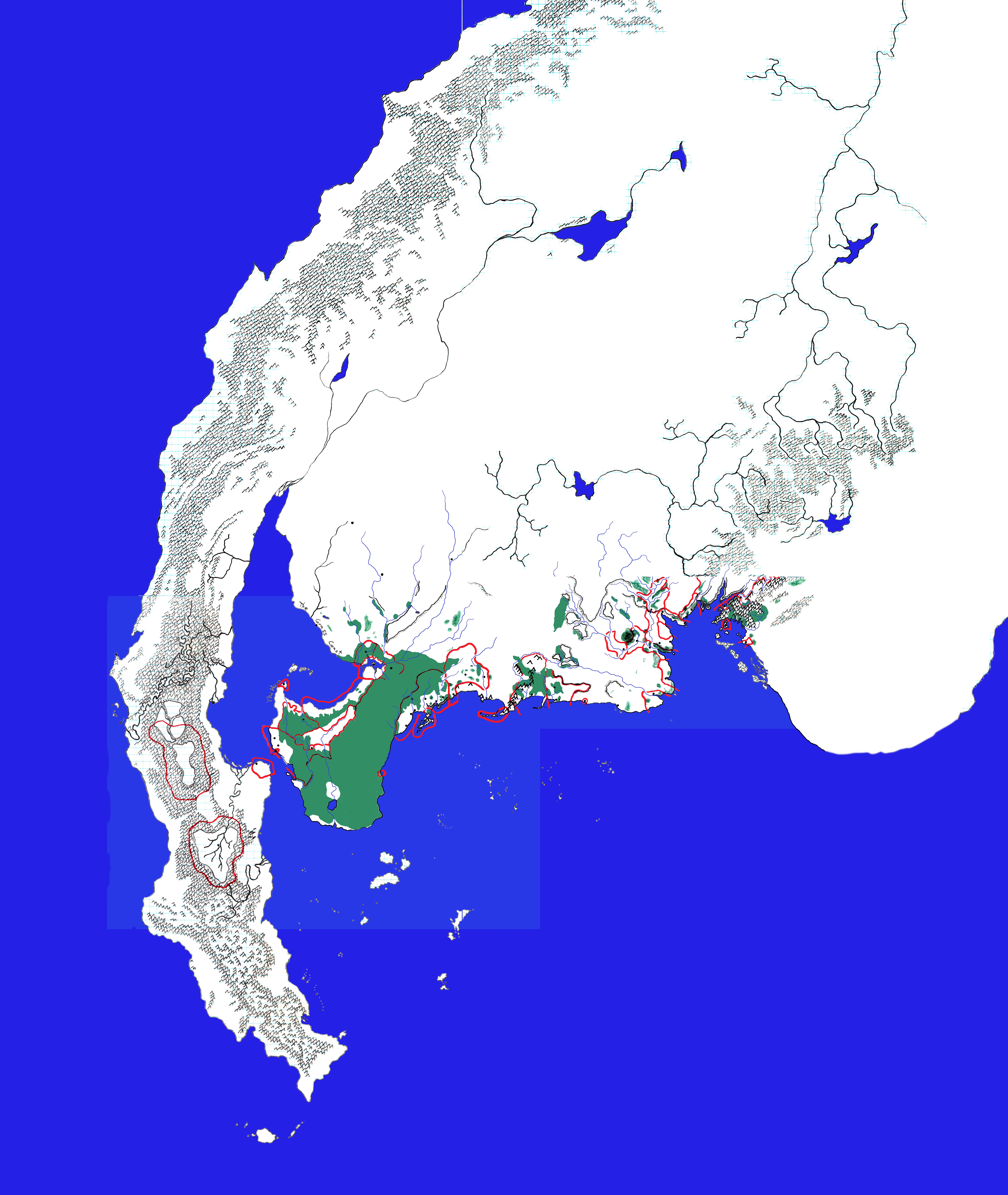
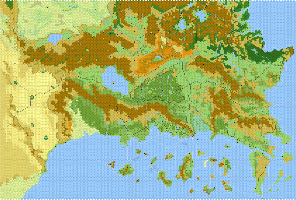
Eric’s solutions to the typical criticisms of the Known World are rather good. He used the hex format to his advantage, allowing some regions to be flipped and others to be rotated. For example, Darokin, Alfheim, Karameikos and the Five Shires are all flipped east-west, while Ylaruam has been rotated and shifted to the eastern edge of the Great Waste, and Ethengar moved up onto the Adri Varma Plateau.
All of Eric’s changes are well thought out, with the overall aim being for things to make a little more sense than the originally rather random selection of nations did.

Eric started out drawing paper maps, one of which survives in scanned form today (see below). More recently he has been working on the computer. His Known World project dates back to 2010, although he didn’t post it online until 2014.
Since Eric shared his work, quite a few others have been inspired to post their own remakes of the Known World, and as a result the community has enjoyed a number of alternate takes of our favourite region.
Thank you, Eric!
Interview
Eric graciously agreed to answer some questions for this article.
How did you first get interested in Mystara? What draws you to the setting?
I got first interested in Mystara with the Basic, Expert, and Companion boxes and with the module B4. I was young when I got those and I swiftly moved onto AD&D and Greyhawk. But I was and still am tremendously promiscuous with setting worlds because I love grabbing ideas that I can use to put into my own home-brew where I ran a majority of my campaigns. I drifted away from BECMI for AD&D/2nd ed. and those abundant setting worlds. Years later I had just come back from GenCon in Milwaukee where I got to watch Tim Beach DM for a demonstration table of Red Steel and I went into my FLGS looking for another setting and I saw that new TSR setting box, Red Steel, on the shelf. I grabbed it, dove in and saw it explicitly was in the same world as the setting of the BECMI line. When I get hooked into a setting I am a completist and want everything, and Red Steel hooked me on the entire wider world of Mystara. So if I am more honest, I would credit Red Steel as when I really got interested. What continues to draw me to the setting is that the entire planet is mapped in general, mass planetary migrations are documented, there is a cosmology very different than other D&D settings, and only a small corner is deeply detailed.
Did you have a favourite official map?
My favorite Mystara map is the continent of Brun in the Companion box. I’m a fan of pencil/ink hand-drawn maps (such as of the style of Dyson Logos) and the sparse continent of Brun inspired me, with the clear call towards Late Jurassic Earth, with so much potential to add my own details from exploration.
When did you start mapping Mystara?
Hmm, back when I was first taken in with Red Steel I wanted a complete western Brun in the amount of detail of the poster maps from the Red Steel box. I nearly completed that hand drawn map in the mid 90s. I have long since lost those maps but not before I wisely scanned them. It seemed to be an early reflection of my rearranging the Known World in that I took liberties with the Savage Coast. I was never content that civilization was so crammed on the coast so in those early maps I pushed the plains back just a bit and gave the nations on the coast more room and stretched them a bit.
When and where did you post your first map online?
The re-arranged Known World are the only Mystara maps I’ve posted online, but a few years prior to my Mystara maps I posted my re-creations of different regions of the Flanaess of Greyhawk. The Flanaess regional maps were first posted on Canonfire! and hosted on my MobileMe storage. I took that down a few years later and started a Deviant Art page for those maps then a few years after that I added my rearranged Known World to my Deviant Art page.
What software do you use? Or do you draw your maps by hand?
My regional maps of the Flanaess started as poster sized pencil maps which I scanned then took into Photoshop on my Mac. At the time I was helping run the Living Greyhawk region of The Shield Lands and wanted re-usable maps I could put in the modules we created. I colorized those pencil maps with Photoshop and slowly began mapping more of the continent. When I got around to wanting to re-map the Known World I felt Photoshop would not do. At the time I saw that Hexographer was a tool that would let me create something in the style closest to the Gazetteer maps.
What are the limitations or peculiarities of that software? What challenges did you face during your mapping projects?
I was trying to draw a Known World map as large as the entire Western Countries Trail Map, all in 8 miles per hex. Once again ambition exceeded the ability of my tools. Having completed the hex work and coasts, I began adding names and roads, saving regularly. I returned the next day and the files refused to reopen. I recall an error that the file was too large. Luckily my Mac’s Time Machine recorded a version I could revert back to. Though I lost that day’s work, I was able to split the map in two. A north and a south of the Known World. Yet again, as I added more details of icons, and road, the files eventually grew in size and the south map again failed to re-open one day as it had grown too large. I reverted the files again to a version I could open, exported .jpgs and published those on my Deviant Art page. I set those files aside as my attention drifted away, as it does, and in my belief that Hexographer would never be able to re-open those files I purged the originals! You have no idea how much I regret that, but I was in a rare mood that day…
Please describe your process in brief.
I have a passion and college education in Geography. I am one of the many who have stared at the Known World and looking at the charming hodgepodge of nations tried to grapple how they could fit in harmony and what possible believable history these would have emerged from. To create my re-arranged version of the Known World there were a lot of personal assumptions and personal wishes that were informed in some parts by my Geography background. I had at least one guideline I set that what was in the Known World region now was not relocated outside the Known World. Placing Ylaruam where I did gave cause for me to extend my project to the Great Waste so I could find a suitable location for Sind (on the west coast of the Great Waste). One significant region I did not have a place in mind was the Atruaghin Clans. I pulled that region out completely with the expectation I would locate it somewhere else. I haven’t come up with a location but I was leaning towards a place such as near Yalu Bay or in the Hollow World. I have not put a lot of thought towards it yet.
What was your favourite area to work on?
Western Brun—which to me is everything west of the Black Mountains. This is partly because Red Steel/Savage Coast was my gateway into Mystara. But mostly because I find the wider undescribed detail about what exists in this part of the continent more promising from a DM-creator angle. Beyond the Savage Cost and Orc’s Head Peninsula we do not know much in comparison. Even Hule, the Sylvan Realm and the Arm of the Immortals is thin in detail, my imagination about what I could fit starts racing! But there is a third reason that is simply my personality… I prefer running campaigns that are off the well-trod adventuring grounds, I do this in every published campaign setting I run in. That is, pick a corner that is clearly not going to be the center of attention.
Do you have any future plans for your maps of Mystara?
I want to re-draw everything in a better tool. I have gotten access to a vector drawing tool (Affinity Designer) that seems to accept importing your Illustrator files quite well. Now I need to master it. I’ve tinkered with it a little but have run into roadblocks trying to get grids to align perfectly as I expand regions. I’m sure there is some simple novice-level trick I’m missing. Once I got that down I’ll be up and running (when I have free time back!)
What are you doing these days?
In the realm of gaming and fantasy mapping, I’m DMing my son, brothers, and nephews in a long running 5e campaign that has reached 16th level in a home-brew setting that has massively borrowed elements from Mystara, especially the Savage Coast and Princess Ark. I’m hoping one of my crew will step up and DM our next campaign, but odds are I’ll be strong-armed to running the next campaign too, so I’m beginning preparation on campaign by hunting for ideas.
You can find my previously uploaded maps from my Greyhawk mapping project and the Re-arranged Known World at https://www.deviantart.com/admundfortgeographer.
I’d love to hear an overview of your project.
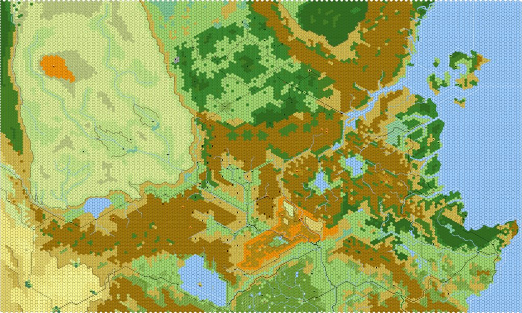
This whole thing started off as a mental experiment on what to do with Ylaruam. The placement of Ylaruam always felt like a needle scratching a record, especially with it a short jaunt from Scandinavian-inspired nations among many things that made my brain wrestle with it. Once I started moving Ylaruam around, the rest started falling into place.

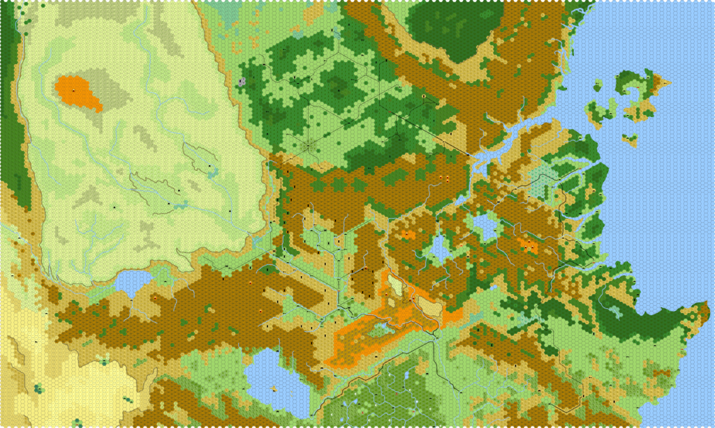
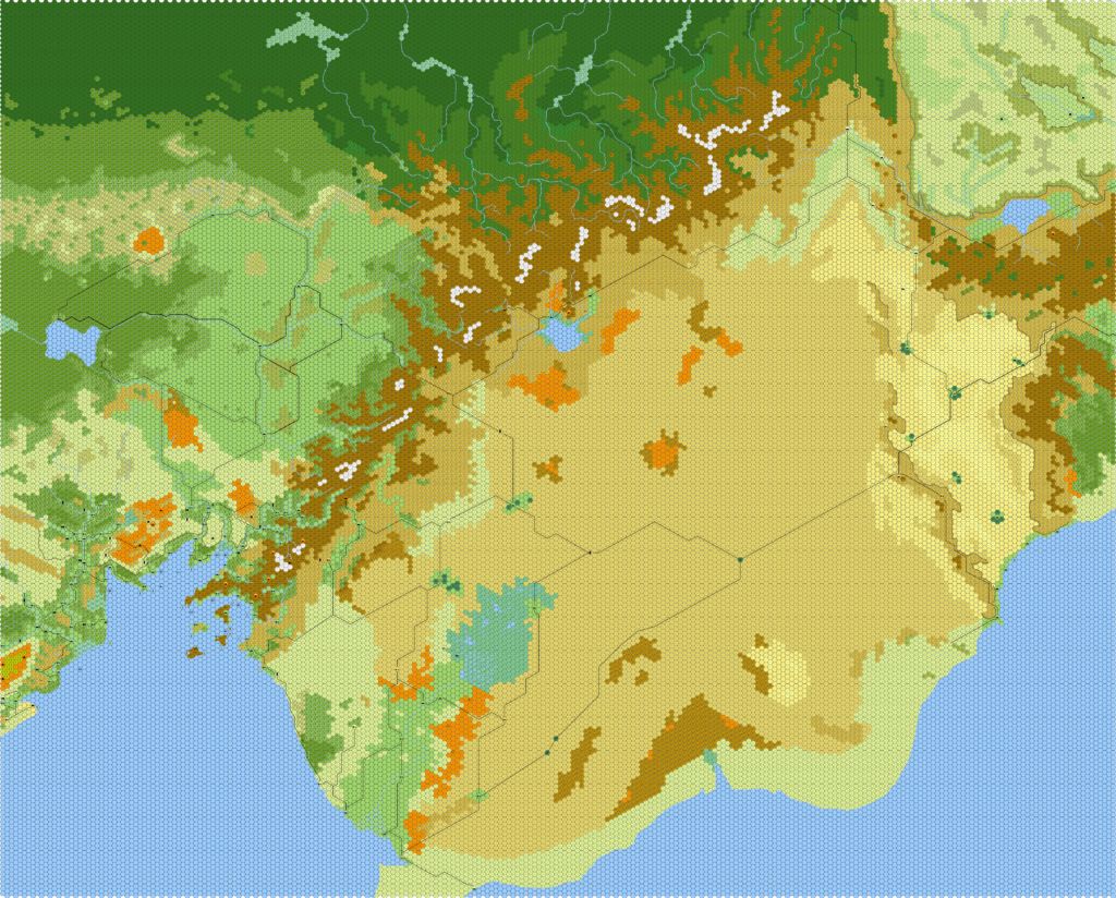
Initially I simply removed Sind and swapped Ylaruam in its place. But as I scoured the source material I grew to appreciate Sind more and wanted it somewhere and not far. I settled on the west coast of the Great Waste, south of Graakhalia. With a slight horizontal flip and slight rotation it fit in well. I liked that it gives another reason for traders to want to cross the desert.
To fill in Ylaruam’s absence I grabbed pieces of Thyatis. I took Hattias and dropped it on the north side of the Altan Tepes. I relocated the County of Lucinius to the island Hattias vacated. I wanted the Duchy of Thyatis to be more prominent so I expanded its territory to include the area Lucinius vacated. North of Hattias’ new position I placed the entirety of the Heldann Freeholds between Hattias and the Northern Reaches, with a little bit of unclaimed dense forest.
As I lined up Hattias, Heldann Freeholds, and the now rotated Northern Reaches along this eastern coast of the Known World, I needed a better place for Rockhome. I settled on giving Rockhome a new home right on top of where Ethengar was and moving Ethengar to the western side of Glantri. Having Rockhome closer to Glantri felt satisfying to me, giving the tension Glantri’s wizards have towards the Known World’s dwarves. For a nomadic people, Ethengar had long felt cramped in its space. Having Ethengar on the Adri Varma plateau felt like a suitable location, like replicating the Huns settling in Central Europe. The Adri Varma plateau was also much less confining than their original placement. Things felt like they were working out!

On the southern coast I could have left things alone, but I still had some things that bugged me here. For instance Karameikos was supposed to have a feeling of a remote, detached Thyatian province. But it’s basically right next door to a multi-continent colonizing expansionistic empire. A bit more distance would suit me. I was also less satisfied with the large watershed that drained into Malpheggi Swamp. So I horizontally flipped Alfheim, Malpheggi Swamp, Karameikos, Five Shires, and part of Darokin (leaving Lake Amsorak in place). Placing Malpheggi Swamp as the separation between Thyatis and Five Shires gave me a more satisfying geographic barrier between Thyatis and the coast to the west than a small river. Moving the river and swamp to be the geographic barrier to Thyatis and the west meant flipping Alfheim around too.
This horizontal flip now gave me a more distant shore to drop Karameikos that was close enough yet geographically separate to not just be a casual march of legions over to settle down the rebellious natives. Flipping the central area like this gave me a much more pleasing rearrangement of river and overland trade routes. Plus it enlarged the core of Darokin and, in my opinion, a wider river network to traverse and build an economy around. I even imagine an expansive canal network throughout.
I didn’t need to horizontally flip Ierendi and Minrothad and I’m not holding strongly to it, but it also felt right to move Minrothad a bit further from Thyatis to position those islands in a nice position along the sea trade routes to the west. Having the island nations positioned across from the land nations in the normal Known World felt right.
I had a few extra areas to come up with something. For instance, by removing Atruaghin, I still had space west of Karameikos between it and Ylaruam. I’m leaning toward having it inhabited by different animal-headed races like gnolls or lupin, who live a more tribal, hunter-gatherer state. Then there was still a thin gap between Rockhome, Broken Lands, and Heldann. So I added a bit more Broken Lands to the eastern side of the Broken Lands. But I’ve always been dissatisfied with how compact the Broken Lands were, so in my head, the gap between Rockhome and the Dwarfgate Mountains is inhabited by more Broken Lands humanoids. In fact, it is littered with battlefields where the dwarves of Rockhome and Broken Lands humanoids have fought over the centuries. As I was unable to complete drawing the roads in Rockhome, I was going to be connecting a trail between Corunglain and Karrak Castle through this gap region.
I also had one more thin gap. North west of Rockhome and Northern Reaches I had a space to fill between those nations and Wendar/Denagoth. I took inspiration from the fjords of the Northern Reaches and decided to extend a very long fjord. I meant to get back to this region and add the outlet of the Naga River through the mountains as Geoff Gander’s map has. But by bringing this longer fjord this deep it also allows me to route a river watershed of Wendar to the sea to the east. It would like to have a port so I added one at the mouth of whatever river I was going to draw. I think I intended this river to not be a settlement of Wendar’s but rather of the disunited “barbaric” Antalian people along the coast from here all the way north into Norwold.
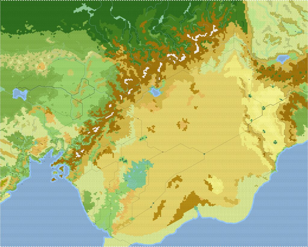
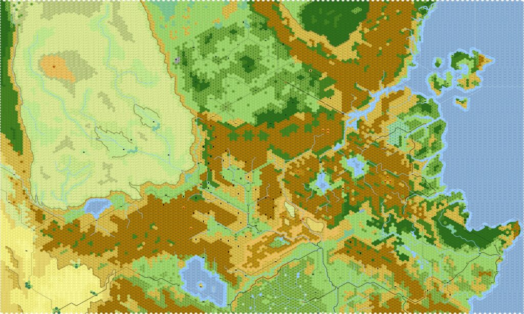
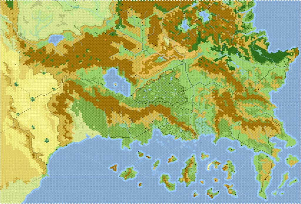
Eric’s Maps
| Name | Vaults URL | Year | M | D | Date Source | Scale | Notes |
|---|---|---|---|---|---|---|---|
| Western Brun | - | mid-90s | ? | ? | Interview | - | Assembled by Thorf |
| Great Waste Region | - | 2010 | 8 | 29 | File | 8 | First version |
| Known World North | - | 2013 | 2 | 8 | File | 8 | First version |
| Known World South | - | 2013 | 3 | 3 | File | 8 | First version |
| Great Waste Region | Map | 2014 | 5 | 17 | DeviantArt | 8 | Revised version |
| Known World North | Map | 2014 | 5 | 17 | DeviantArt | 8 | Revised version |
| Known World South | Map | 2014 | 5 | 17 | DeviantArt | 8 | Revised version |
| Great Waste Region | - | 2022 | 4 | 22 | DeviantArt | 8 | High resolution version |
| Known World North | - | 2022 | 4 | 22 | DeviantArt | 8 | High resolution version |
| Known World South | - | 2022 | 4 | 22 | DeviantArt | 8 | High resolution version |
Gallery

Sources
In researching this article, I searched out all the references I could find, and consulted with everyone I could track down. I have made every effort to ensure that the information is accurate, but in some cases I may have slipped up — especially when dealing with maps that are years or even decades old. I take full responsibility for any mistakes; please don’t hesitate to point these out if you find them! Following is a summary of my sources for your reference.
- Direct messaging with Eric
- Mystara Mailing List Archive
- Mystara Message Board Archive
24 September 2023 @ 1:54 am
There is a missing parenthesis near Lake Amsorak.
Is “It would like” correct?
24 September 2023 @ 8:17 am
Thanks for proofing it, Hervé! Much appreciated. I fixed the missing part. Eric was saying that Wendar would like to have a port, so I think grammatically it’s fine, yes.
25 September 2023 @ 1:08 am
Thank you for the interview, Thorfinn! This past year just got through a year-long burst of energy that I used to produce a large wave of Flanaess regional maps in Greyhawk. I ran out of enthusiasm and energy as I reached a point I was going to have to re-touch some of the earliest maps produced about twenty years back. The amount of work to re-draw the old regional maps and piece together things was more than I could mentally take on, so I put it back on pause. Maybe long term pause.
I had hope to get back to a regional Mystara hex map for western Brun where I would drop in the Atruaghin clans. Maybe just north of Yalu Bay. I was able to get Worldographer working on my newest Mac, I have also dabbled at trying to get your old free vector assets to work in an (affordable) Affinity vector drawing program on my Mac to make these re-arranged maps in that instead. I almost had that fully setup, but my attention was pivoted over to complete the Greyhawk regional project before I got started.