Creator of the first Mystara web map
Years before Google Maps was a thing, and even before Google Earth had appeared on the scene, Ricardo created a web map of the Known World. Not only that, but he was one of the first to choose a mostly subdued palette, emulating the overall feel of the original printed maps.
Profile
- Nickname: Darkblood (Vaults author page, Piazza profile)
- Location: São Paulo, Brazil
- Maps Posted: 2000-2002
- Areas of Interest: Known World
- Scales: 8 miles per hex
- First Posted Map: The first six panels of his Known World map (October 2000)
- Software: Adobe Photoshop
- Mapping Style: Custom-drawn hexes with a carefully-chosen subdued palette
- Fonts: Palatino

Overview
A web map of the world has long been a dream of many a Mystara fan. Nowadays, of course, it’s hard to even imagine life without Google Maps or one of its equivalents, but in fact it only debuted in 2005, while its precursor Google Earth only came out in 2001. Nevertheless, the idea was no stranger to the community, and it had already come up more than once on the Mystara Mailing List in the late 1990s.
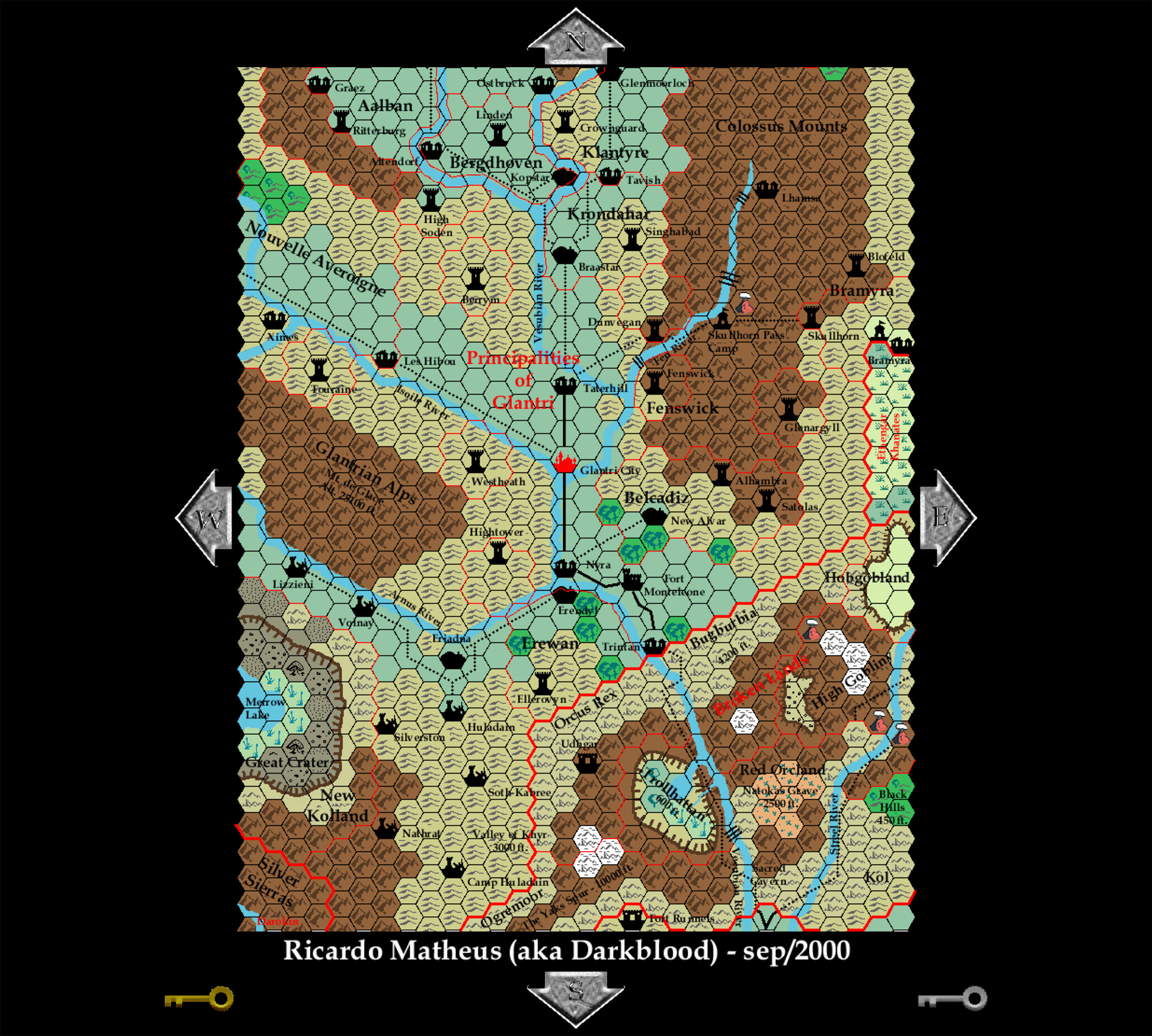
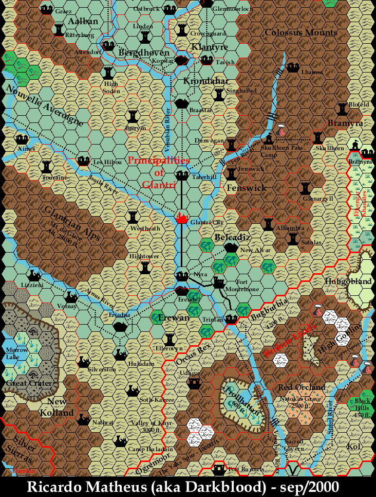
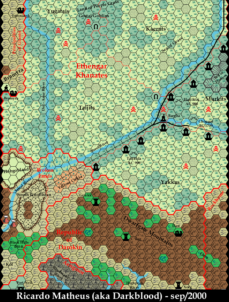
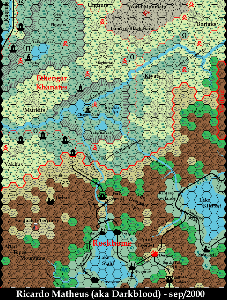
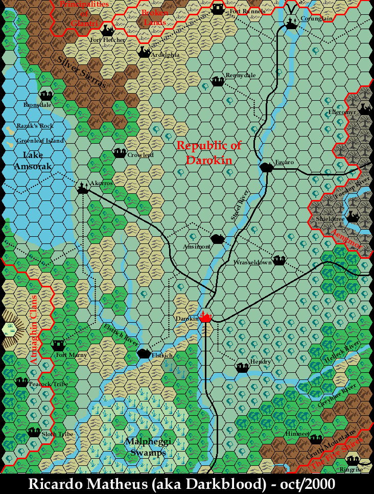
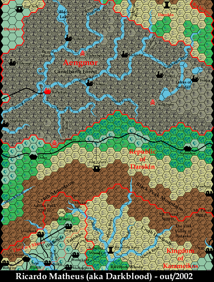
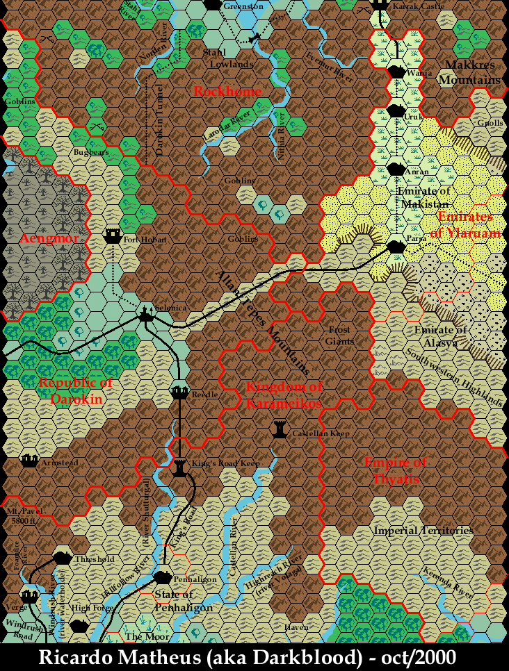
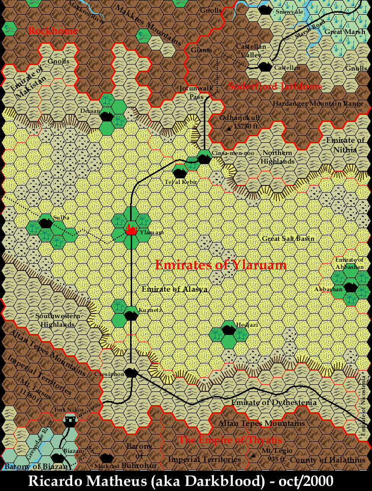
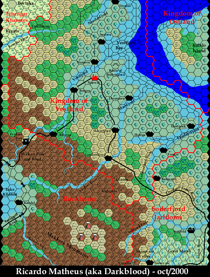
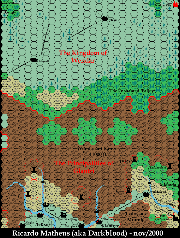
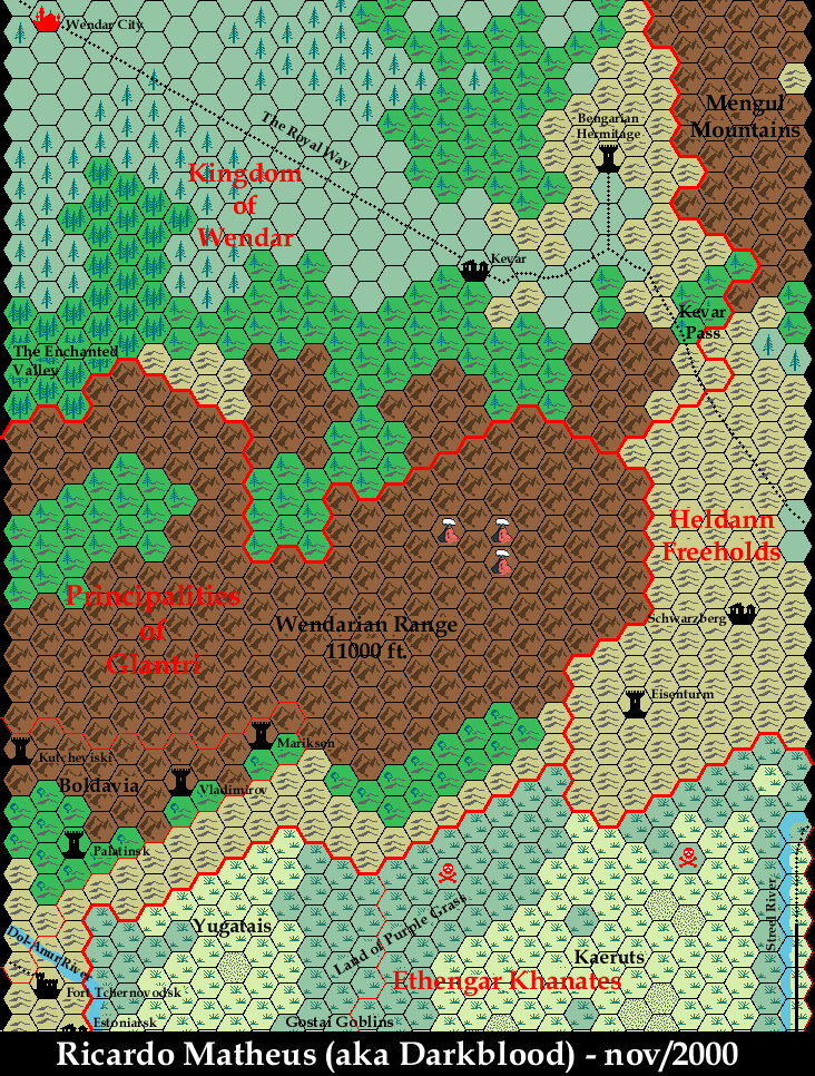
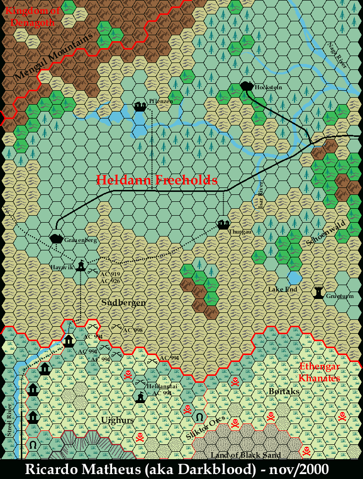
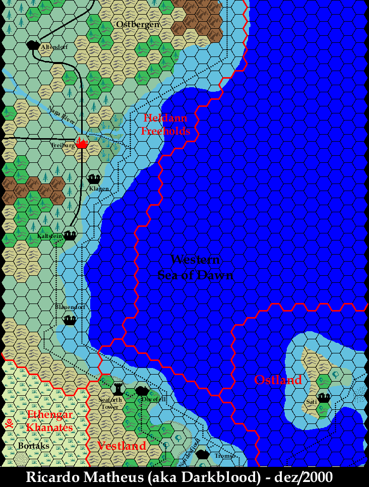
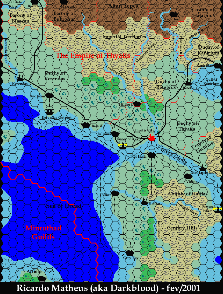
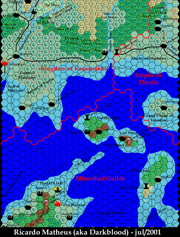
Brazilian Ricardo “Darkblood” Matheus was the first to turn this dream into a reality. His Mystara’s Map Navigator debuted in October 2000, with six of the eventual fifteen panels in place from the start.
I felt the need to have good quality maps of Mystara on the web. Back then people didn’t yet dream of having PDFs for sale and the original stuff was hard to get, I only owned one or two of the Gazetteers and some other stuff.
Ricardo Matheus, The Mystara’s Map Navigator, 2009
Ricardo’s story is an interesting one, because his project was born of necessity: in Brazil, Mystara books — and therefore maps — were hard to come by, and his collection was limited to those he was able to find. This is a story that seems very far away in modern times, what with platforms such as eBay, DriveThruRPG, and all the other net shopping sites. But back in the 80s and 90s, it was a very common one outside of the US, as well as away from large cities. I myself (in the UK) struggled to find many books, and the vast majority of my collection came from TSR’s UK Hobby Shop mail order.
I would by eternally grateful to anyone who send me some of the gazetteer’s maps I don’t have (you see, I live in Brazil, simply there are no stores for used RPG books and it’s hard to find some USA dealer who want’s to send them here).
Ricardo Matheus’s original call out for maps, 2000
As he relates in the interview below, it was through the help of other fans that he was able to complete the project. It’s interesting to note the names of those who helped Ricardo: Leigh Witney, who sent his maps to Ricardo in Brazil; and Tim Roberts, who scanned many maps and sent them digitally. Neither Leigh nor Tim seem to have any credits at the Vaults, but Tim Roberts created his own maps of Mystara, including some Campaign Cartographer maps (three of which I have copies of; there may be more), as well as a whole series of Known World maps using Paul Holroyd’s mapping system. Mystara’s cartographers stick together! 🙂
A Navigator with style
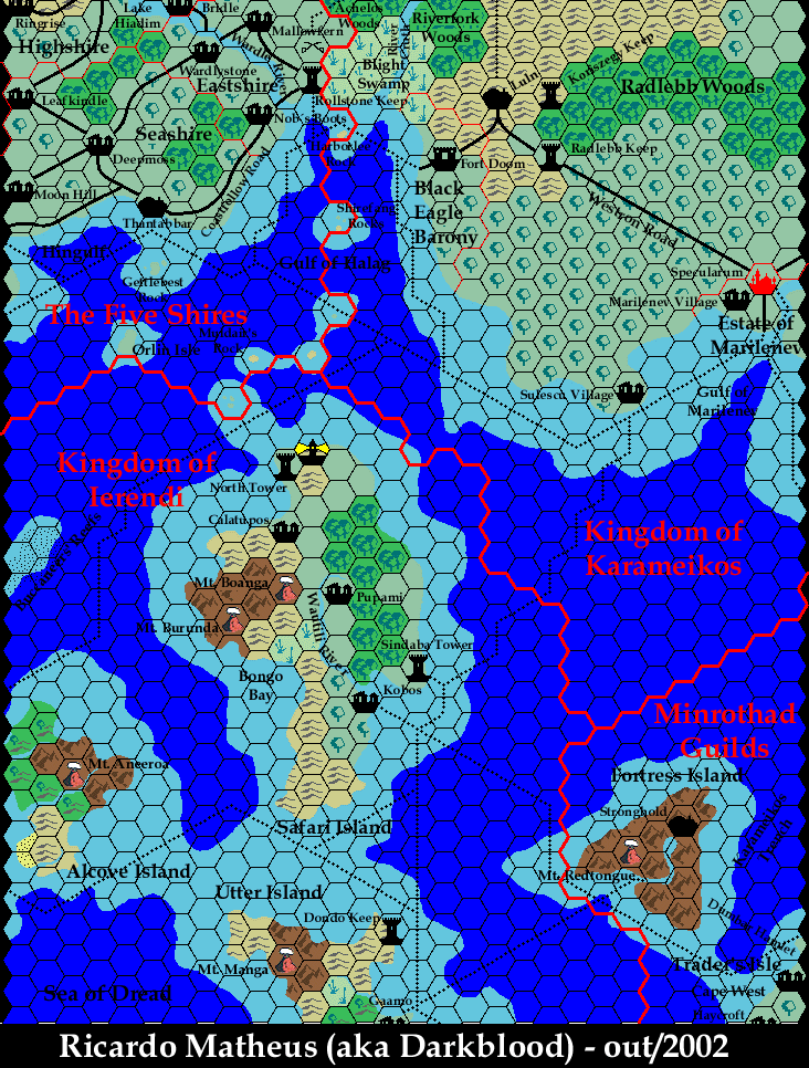
The other interesting thing about Ricardo’s project is how pretty his maps were. Again, technology at the time was very much holding back a lot of would-be fan mappers, and many of our maps of the time had a rather poppy, VGA graphics style to them. By this time, Paul Holroyd’s seminal Illustrator maps had already appeared, as had Christian Constantin’s Photoshop masterpieces.
Ricardo chose to make his maps in Photoshop, assembling his own nicely subdued palette (with the exception of his deep water colour!), and working up his own hex art. The result was the closest thing yet to the printed maps at that time, nicely evoking their feel and atmosphere.
He also provided a full set of map legends, split into different sections for each map panel. This may seem like a small thing, but it’s one that us fan mappers often tend to overlook, and it was much appreciated.
Legacy
The Mystara’s Map Navigator lives on to this day, archived at the Vaults of Pandius. In 2009, Ricardo also wrote a wonderful history and explanation of the project, which I highly recommend you to read. You can find it on the index page.
In terms of significance, Ricardo chose to set his maps in 1011 AC, making them a great source for anyone working on post-Wrath of the Immortals maps. He also detailed parts of Wendar and Heldann that never appeared on official maps, referencing other fan-made maps by people such as Geoff Gander and Thibault Sarlat.
All of this remains highly relevant today, and Ricardo’s full Known World map, complete with its legend, can now be seen and easily referred to in a composite form in the map I posted in February 2021.
Interview
Ricardo graciously agreed to answer some questions for this article.
How did you first get interested in Mystara? What draws you to the setting?
Well, I first got into it for real world economic reasons. Brazil was a very closed country during the 80’s, so a lot of things got here with a huge delay, and RPGs were one of them, only becoming a thing here in the mid/late 90’s. Even when books and boxed sets started appearing around, you had to get what showed up, not exactly what you wanted. That meant usually getting the basic books and modules scattered all over the place. (For a long while I had AD&D’s Monster Manual and Dungeon Master’s books, but not the players!) The first “complete package” (in terms of having a complete set of rules, and a setting) I got was the Rules Cyclopedia. I was immediately drawn to those color maps of the “Known World”. Almost at the same time I found a copy of the PWA II. I was immediately enchanted by the concept of having a setting which was “evolving” in time. What ensued was a decades long hunt for more Mystara material.
Nowadays, what I like most about Mystara is the relation to real world cultures (makes it easy to get immersed into it) and the diversity. I recognize that a lot of things present here can be found in other settings too, but this is the one I grew up in 😀
Did you have a favourite official map?
That would be the Trail Maps (technically two products, but I’ll abuse the question). The sheer size and completeness of it blew my mind.
When did you start mapping Mystara? When and where did you post your first map online?
Late 90’s I was running a campaign centered around Glantri in AC 1011, but as the PCs started exploring around I felt the need to update the maps I had (which were mostly set in AC 1000) and fill the gaps from the material I was missing (I owned only one or two gazetteers at that point, most of the setting info I had came from the PWA’s and maps I found online). I was a member of the MML and I thought people might be interested, so I launched a website, The Mystara Map Navigator, to see if I could attract help to my cause (which it did).
What software did/do you use? What were/are the limitations or peculiarities of that software? Please describe your process in brief.
I used Photoshop, which I think was version 5 or 6 at the time. One of the main aims I had at that point was to produce maps that looked more (in terms of colors and symbols) to what was in the Gazetteers, as most maps circulating on the MML were done in software that looked “8-bit”y, if you know what I mean. My process can only be described as primitive: I had a Photoshop file with a collection of hexagonal tiles (forests, mountains, etc.) and I would literally copy and paste each hex into place (no snapping that I knew of!!!) in a layer that lay under the black hex grid. Then a layer went between those two with rivers, roads, plateau borders and other details that didn’t fit a hexed approach. Text and borders would go above all that. It took weeks to get one finished.
What challenges did you face during your mapping projects?
The main limitation I remember was the fact that I didn’t have a lot of material (at first, see below) and, guess what: THE INTERNET. Dial up connections meant I had to keep my maps small, not only in dimensions, but also in definition. At some point I had beautiful high definition templates for the hexes, but that was blowing up my PC memory and would not be feasible to put online anyway. So I settled for more pixelated art and nowadays it is my maps that look videogamy, lol.
I’d love to hear an overview of your project.
It lasted about two years, but the milestones are definitely all connected with the participation of MML members. At the start I had to count on the two Gazetteers I owned and the fragments in Rules Cyclopedia. There were fan made maps online, but they usually didn’t cover published areas or I didn’t know how canon they were. My original cry for help can still be seen at the Vaults of Pandius.
After the website launch, I went from having almost no material to having every Mystara published map in about 6 months. People scanned maps, found material in local shops and sold it to me (no online shopping at that time, I had to actually give strangers my credit card number) or just gave me stuff. It was wonderful. The two highlights were Tim Roberts, who scanned a lot of his gazetteer maps, and Leigh Witney, who took all maps he had and mailed them from Luxembourg to Brazil! (I had them all photocopied in colors here, and sent all back.)
What was your favourite area to work on?
I liked doing the crater in the south of Glantri. I don’t think there were existent colored hex maps of that area when I made it (I think there was a BW one in PWA II).
Do you have any future plans for your maps of Mystara?
Not any plans really. I wish I had the time to cover at least the whole Known World before I stopped. But late 2002 I was about to start my PhD in physics (which was followed by an academic career, marriage and kids) so my “time out” from mapping eventually became permanent. I am happy to see the project becoming obsolete though, with so many high quality maps available.
What are you doing these days?
I still run D&D games these days (at a slow pace though, mostly once a month). A few years ago I realized I had never run a campaign during the Glantri/Alphatia/Thyatian war (AC 1000 – 1010) so I decided to give 5th edition a try at the same time I did that. So now I’m GMing a campaign loosely based on Wrath of the Immortals, but using D&D5E rules.
Ricardo’s Maps
| Name | Vaults URL | Date | Notes |
|---|---|---|---|
| Grid 0 | 0.gif | 2000/10/05 | |
| Grid E1 | e1.gif | 2000/10/05 | |
| Grid E2 | e2.gif | 2000/10/05 | |
| Grid S1 | s1-old.gif | 2000/10/05 | First posted version |
| Grid S1E1 | s1e1-old.gif | 2000/10/05 | First posted version |
| Grid S1E2 | s1e2.gif | 2000/10/05 | |
| Grid S1 | s1.gif | 2000/10/08 | Revised version |
| Grid S1E3 | s1e3.gif | 2000/10/17 | |
| Grid E3 | e3.gif | 2000/10/22 | |
| Grid N1 | n1-old.gif | 2000/10/29 | First posted version |
| Grid N1 | n1.gif | 2000/11/09 | Revised version |
| Grid N1E1 | n1e1.gif | 2000/11/21 | |
| Grid N1E2 | n1e2.gif | 2000/11/23 | |
| Grid N1E3 | n1e3.gif | 2000/11/23 | |
| Grid S2E3 | s2e3.gif | 2001/02/07 | |
| Grid S2E2 | s2e2.gif | 2001/07/09 | |
| Grid S2E1 | s2e1.gif | 2002/10/25 | |
| Grid S1E1 | s1e1.gif | 2002/10/25 | Revised version |
Gallery


Sources
In researching this article, I searched out all the references I could find, and consulted with everyone I could track down. I have made every effort to ensure that the information is accurate, but in some cases I may have slipped up — especially when dealing with maps that are years or even decades old. I take full responsibility for any mistakes; please don’t hesitate to point these out if you find them! Following is a summary of my sources for your reference.
- Direct messaging with Ricardo
- Mystara Mailing List Archive
- Mystara Message Board Archive