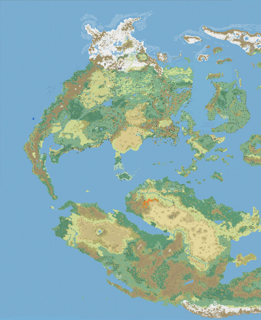
First to map the whole world at 24 miles per hex
In the late 90s and the 2000s, one of the holy grails of Mystaran mapping was a full map of the world at 24 miles per hex. Thibault Sarlat almost got there, but never finished eastern Skothar. It was Andrea Francolini, known as Kal on the Italian and English Mystara Message Boards of the time, who first accomplished this feat, in 2006. His maps have been hugely influential ever since.
Profile
- Nickname: Kal (Vaults author page)
- Location: Italy
- Maps Posted: 2005, 2006, 2009
- Areas of Interest: Mystara continental and world maps
- Scales: 24 miles per hex
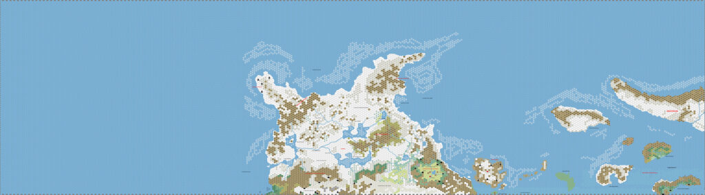
- First Posted Map: Brun, 24 miles per hex (January 2005)
- Software: Hexmapper and Photoshop
- Mapping Style: Hexmapper standard
- Fonts: Book Antiqua
Overview
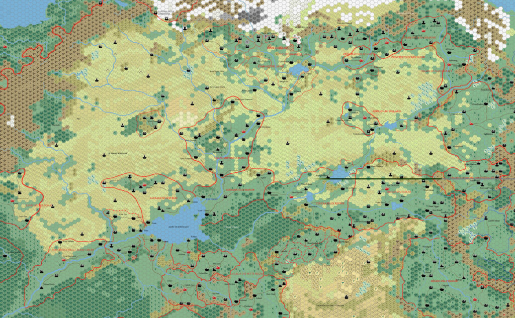
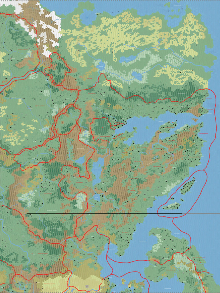
“Kal’s world map”, or simply “Kal’s map” — in the Mystara community, these phrases are synonymous with the idea of a 24 mile per hex full world map of Mystara.
It would be no exaggeration to say that Andrea Francolini burst onto the scene when he shared his maps to the community at large back in February 2005.
He posted on the Mystara Mailing List of the time, riding on a wave of enthusiasm for new maps of Mystara. It really was a wonderful month for fans of Mystaran maps: in the same month that Andrea posted his first maps, I started posting daily maps for my “Secret Project” that would eventually be revealed to be the Atlas of Mystara and Mark Howard began posting his maps too. In other words, Andrea, Mark, and myself all made our mapping debuts in February 2005.
But where Mark and I posted individual maps, Andrea rapidly revealed that he had already mapped out large swathes of the world. His early 2005 maps already included all of Brun, as well as footholds in Skothar and Davania.
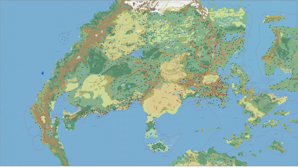
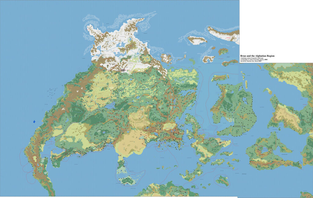
Amazingly, he went on to post a completed map of the whole world the very next year: 2006. He has mentioned that it took roughly a year of work to get to this stage. I suspect that he managed it because he was doing it for his own campaign.

Since this was the very first world map to be completed at this scale, Andrea’s map — Kal’s map — quickly became a fixture in the community. Other cartographers used and adapted it, making their own additions and customisations. Everyone talked about it, first at the MMB, then later at The Piazza.
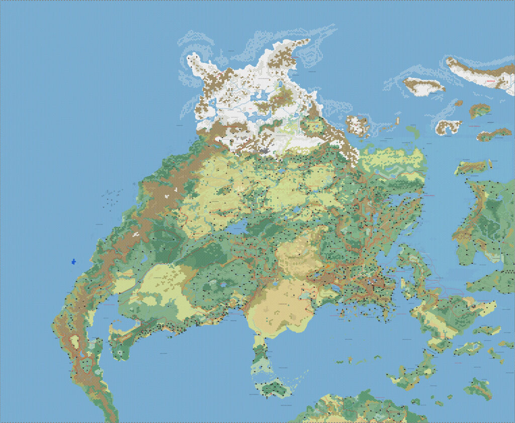
One fan, Stone Reed Marshall, even printed out the whole map and put it up on his garage wall. His story made for a very memorable discussion at The Piazza, and he continued to make edits to it for some time afterwards.
displayed on Multizar’s garage wall
posing in front of Kal’s map
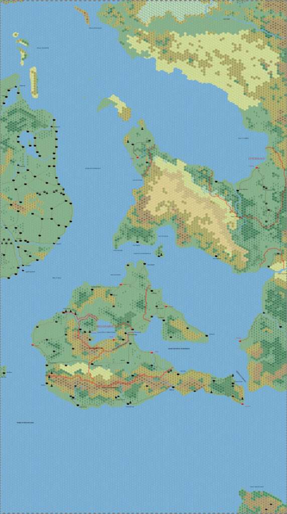
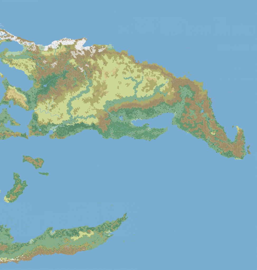
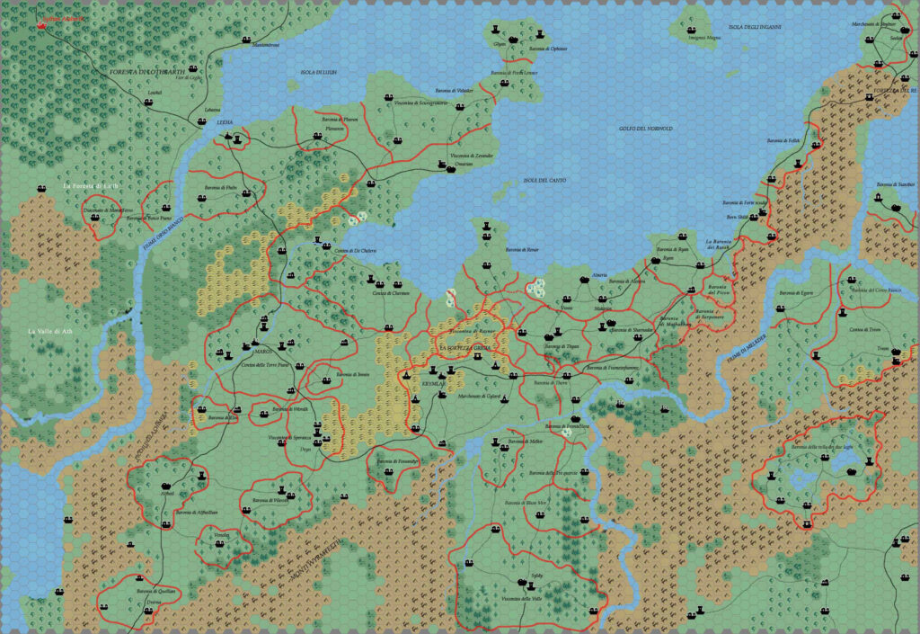
After releasing his world map, Andrea continued to make maps for his long-running campaign. He has only shared a few of these since, most notably with an updated map of Brun, bringing it up to his campaign’s current date of 1160 AC. He also released some more detailed maps of Norwold.
But really, after gifting the community with a completed world map, what more is there left to do?
As I understand it, Andrea has a lot more maps that he has never published online. Hopefully he will share more of these in the years to come — I’m quite sure we would all love to see more of his maps. In the meantime, his world map will forever remain the first of its kind — an astounding achievement in Mystaran cartography.
Thank you, Andrea!
Interview
Andrea graciously agreed to answer some questions for this article.
How did you first get interested in Mystara? What draws you to the setting?
Mystara was the very first setting I started playing with when I got introduced to RPGs 40 years ago. Initially I didn’t understand the depth and complexity of the setting, but then I started realizing the passion and attention that was present in this work of human creativity with the various Gazetteers that were produced. Then, once I discovered the community that kept for years the setting history alive, I definitively fell in love with it, devouring all possible updates and creating my own.
Did you have a favourite official map?
Probably my favorite map ever was the CM1 Norwold one connected with one of the campaigns produced back in time.
When did you start mapping Mystara?
I believe right after I dungeon mastered the CM1 campaign, when we came to a point we needed to describe the territories the players gained. When I realized we needed frequent map updates, I started looking for digital tools instead of keeping drawing over and over, and experimented with several solutions. Once I landed on the very old and solid Hexmapper, I started building first the Norwold map and then clapping together more and more regions.
When and where did you post your first map online?
I frankly can’t recall that anymore. I was part of an Italian RPG forum years ago and then became friends with Marco Dalmonte, who introduced me to the Vaults of Pandius. Probably something went published there.
What software did you use, and what were its limitations?
I initially started by hand but then started using Hexmapper for the base + Photoshop for the details (rivers, roads, various layers).
Hexmapper was a very basic tool, all editing in BMP. Files got gigantic pretty soon and hardware requirements grew over and over. Luckily, working as an IT Manager for a huge high tech business, I had access to the best computers of the time (though RAM was never enough ahhahah). Anyhow that became really a challenge with computers at that time, as Photoshop images with all those layers were really difficult to manage AND to save (no cloud backups, so losing something was crushing).
Please describe your process in brief.
First I had to consult the available material and determine which was best to start work with. Once I had a pretty good understanding of what to create, I started with making the perimeters of the interested areas, ensuring they matched other maps. Once all the terrain was set, then it was time for the sea, rivers, towns. The final step was with Photoshop, where I added borders, roads, text, special effects… It took months for every map.
What challenges did you face during your mapping projects?
The greatest one was time. The complete Mystara mapping took probably a whole year, during which I dedicated nights. Then there was the fact that many areas had limited or no source material to look at, so I had to simply decide what favored my campaign more.
What was your favourite area to work on?
Surely the Borean plateau, that opened for me so many different paths to expand the campaign I was playing with my friends. That took over 20 years to complete — a single campaign for 20 years, straight up to 36th level.
Do you have any future plans for your maps of Mystara?
It has been probably 10 years from the last time I played D&D or any RPG. Now I’m frankly considering whether I should introduce it to my daughter (9 years old) and I’ll surely rely on the old D&D rules I adapted over time and the setting I evolved from the original (I created my own gazetteers for Norwold and Borea).
It’s fantastic that I still see parts of threads connected with my maps from 20 years ago, hahaha.
Andrea’s Maps
| Name | Year | M | D | Source | Region | Scale | Notes |
|---|---|---|---|---|---|---|---|
| Bellissaria and Esterhold | 2005 | 1 | 3 | File | Bellissaria and Esterhold | 24 | Includes no labels variant |
| Brun South | 2005 | 1 | 3 | File | Brun, Isle of Dawn, Alphatia | 24 | Includes no labels variant |
| Brun North | 2005 | 1 | 3 | File | Northern Brun | 24 | Includes no labels variant |
| Brun | 2025 | 3 | 7 | File | Brun, Alphatian Sea Region | 24 | 2005/1 maps combined by Thorf 2025/3 |
| Mystara Eastern Hemisphere | 2008 | 6 | 7 | File | Outer World | 24 | Eastern half of kal-mystara-24-ac1000.jpg |
| Mystara Western Hemisphere | 2008 | 6 | 7 | File | Outer World | 24 | Western half of kal-mystara-24-ac1000.jpg |
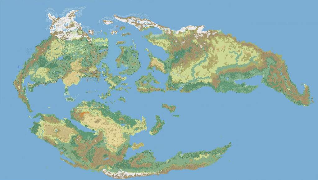
| Mystara | 2008 | 7 | 14 | File | Outer World | 24 | |
| Border Kingdoms of Borea | 2009 | 1 | 28 | File | Borea | 24 | |
| Brun | 2009 | 1 | 28 | File | Brun | 24 | |
| Central Norwold | 2009 | 1 | 28 | File | Norwold | 2.9 | |
| Norwold | 2009 | 1 | 28 | File | Norwold | 8 | File damaged |
| Sind | 2009 | 1 | 28 | File | Sind | 24 |
Gallery

Sources
In researching this article, I searched out all the references I could find, and consulted with everyone I could track down. I have made every effort to ensure that the information is accurate, but in some cases I may have slipped up — especially when dealing with maps that are years or even decades old. I take full responsibility for any mistakes; please don’t hesitate to point these out if you find them! Following is a summary of my sources for your reference.
- Direct messaging with Andrea
- Mystara Mailing List Archive
- Mystara Message Board Archive
- Kal’s Map of Mystara discussion thread at the MMB, archived here at the Atlas (November-December 2006)
- Large Map of Mystara discussion thread at The Piazza (June-July 2008)
- Kal’s World Map discussion thread at The Piazza (September 2011-May 2014)