
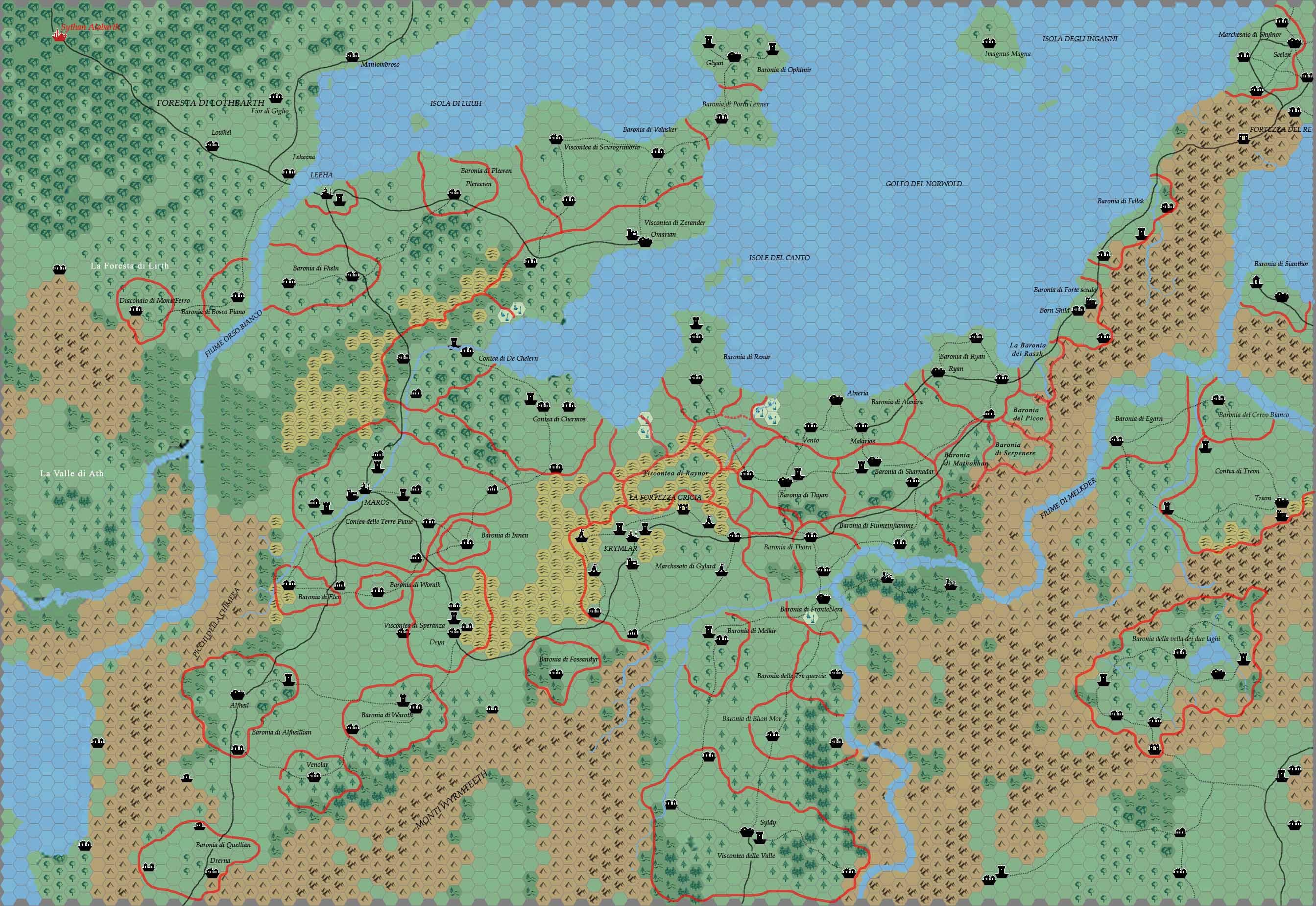
Kal’s Norwold Central, 2.9 miles per hex
This is Andrea’s last map to date — or at least the last map he has shared to date. Together with his Norwold, 8 miles per hex, these maps give a peek into the more detailed development of his home campaign. Of course this is clearly visible in his extensive — indeed world-spanning — 24 mile per hex mapping, but these maps give a lot more detail.
I can’t quite remember where I found the information for the scale of this map. It seems rather unique, and I have yet to see any other maps produced at this scale.
Fan-made Map by Andrea Francolini (January 2009)
This is an original map created by one of Mystara’s excellent fan cartographers. For more information on the cartographer, including a gallery of all their maps, see also Appendix M: Mappers of Mystara.
Sources
- CM1 Test of the Warlords (1984) (PDF at DriveThruRPG)
Fan Sources
References
- All of Andrea’s maps at the Atlas of Mystara
- Andrea’s entry in Appendix M: Mappers of Mystara (upcoming)
- Andrea’s author page at the Vaults of Pandius
Chronological Analysis
This is a fan-made map. It was published in January 2009. The updated Atlas version of this map is not yet available. See also Appendix C for annual chronological snapshots of the area. For the full context of this map in Mystara’s publication history, see the upcoming Let’s Map Mystara 2009. (Please note that it may be some time before the project reaches this point.)
The following lists are from the Let’s Map Mystara project. Additions are new features, introduced in this map. Revisions are changes to previously-introduced features. Hex Art & Fonts track design elements. Finally, Textual Additions are potential features found in the related text. In most cases, the Atlas adopts these textual additions into updated and chronological maps.
Under Construction! Please check back again soon for updates.


