
Sturm’s Pirate’s Rock, 0.9 miles per hex
Pirate’s Rock is one of the small islands scattered across the Sea of Dread. It lies slightly north of the Thanegioth Archipelago, first appearing in X1 before gaining a name and scant detailing in XSOLO. Francesco developed it for his adventure, The Three Starflowers, which appeared in Threshold Magazine Issue #4.
This was one of the first maps Francesco created for Threshold, along with his New Blackmoor map. Both maps date to December 2013, preceding their appearances in Threshold the next year, though Pirate’s Rock was seemingly completed a few days earlier.
Following the style of his previous Halag, 0.9 miles per hex map, he used a scale of 0.9 miles per hex, or one ninth of 8 miles per hex. The map shows a similar level of detailing to that map, and both maps are clearly intended for campaign use.
Fan-made Map by Francesco Defferrari (December 2013)
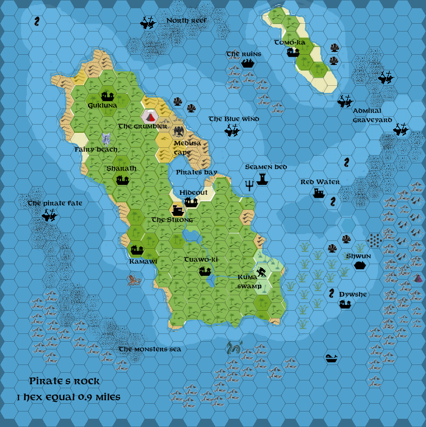
This is an original map created by one of Mystara’s excellent fan cartographers. For more information on the cartographer, including a gallery of all their maps, see also Appendix M: Mappers of Mystara.
Sources
- X1 The Isle of Dread (1981) (PDF at DriveThruRPG)
- XSOLO Lathan’s Gold (1984) (PDF at DriveThruRPG)
Fan Sources
- The Three Starflowers by Francesco Defferrari at the Vaults of Pandius (2014)
References
- All of Francesco’s maps at the Atlas of Mystara
- Francesco’s entry in Appendix M: Mappers of Mystara (upcoming)
- Francesco’s author page at the Vaults of Pandius
- Threshold #4 (30 June 2014) (Vaults of Pandius)
Chronological Analysis
This is a fan-made map. It was published in December 2013. The updated Atlas version of this map is not yet available. See also Appendix C for annual chronological snapshots of the area. For the full context of this map in Mystara’s publication history, see the upcoming Let’s Map Mystara 2013. (Please note that it may be some time before the project reaches this point.)
The following lists are from the Let’s Map Mystara project. Additions are new features, introduced in this map. Revisions are changes to previously-introduced features. Hex Art & Fonts track design elements. Finally, Textual Additions are potential features found in the related text. In most cases, the Atlas adopts these textual additions into updated and chronological maps.
Under Construction! Please check back again soon for updates.


