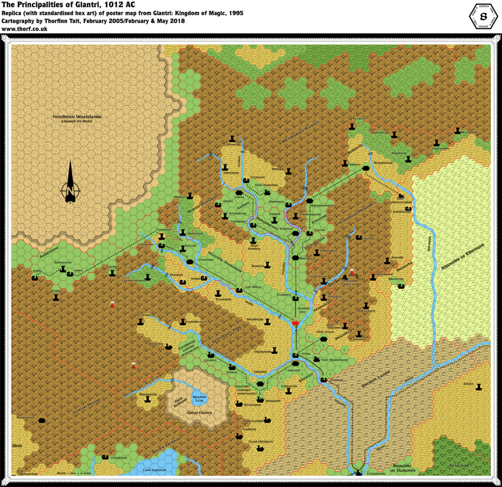
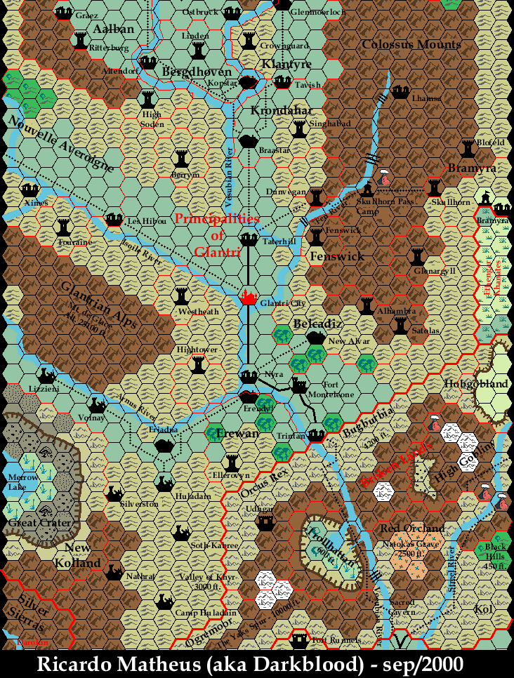
Glantri 2E Glantri, 8 miles per hex
The second (and unfortunately last) major boxed set for AD&D 2nd Edition Mystara focused on the Principalities of Glantri, updating the nation to 1013 AC to reflect all the changes that occurred during Wrath of the Immortals and the Poor Wizard’s Almanac series.
The main drastic change is the effect of Alphaks’ meteor strike: the Great Crater, and the ruined principalities around it. Otherwise, the map is a straight redo of GAZ3’s map, right up to the featureless terrain used in neighbouring lands.
Replica Map (June 2018)
Sources
- Glantri: Kingdom of Magic (1995) (PDF at DriveThruRPG)
- Poster map
Chronological Analysis
This is Map 271. It was published in December 1995. The updated version of this map has not yet been released. See also Appendix C for annual chronological snapshots of the area. For the full context of this map in Mystara’s publication history, see the upcoming Let’s Map Mystara 1995.
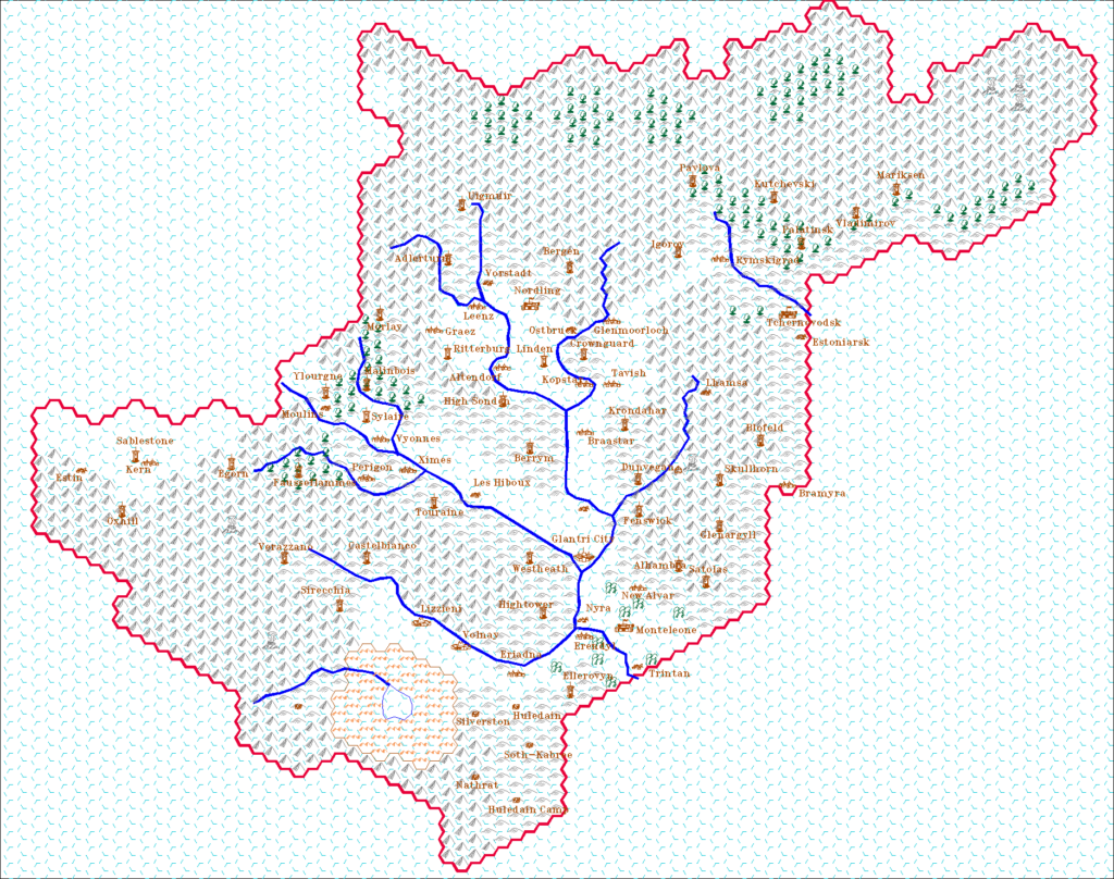
The following lists are from the Let’s Map Mystara project. Additions are new features, introduced in this map. Revisions are changes to previously-introduced features. Hex Art & Fonts track design elements. Finally, Textual Additions are potential features found in the related text. In most cases, the Atlas adopts these textual additions into updated and chronological maps.
Under Construction! Please check back again soon for updates.
Additions
- Dominions — Morlay-Malinbois makes its first appearance here, although it was previously referenced in PC4 (1992). New Kolland is a new principality appearing here for the first time.
- Settlements — Blackstone is a new tower on the site of the previous tower of Redstone.
Revisions
- Rivers — Many of the rivers (all except Arnus River and Red River) appear as bare names without “River” appended. This is a cosmetic change, of little consequence.
- Settlements — Camp Huledain has had its label inverted; up until now it was always Huledain Camp on maps. However, note that GAZ3’s text has always had Camp Huledain, so this revision actually puts the map in line with the original text. Skullhorn is a new shortened name for the previous Skullhorn Pass tower.
- Spelling — Errors: Huladain for Huledain; Kutcheviski for Kutchevski; Les Hibou for Les Hiboux.
- Terrain — The Northern Wastelands, noted to be claimed by Hule, is the latest name for the plateau known as the Wastelands (GAZ3), the Great Northern Wildlands (Wrath), and the Adri Varma Plateau (Champions).
Hex Art & Fonts
- Symbols — AD&D Mystara series standard. Symbols extend past the edges of hexes, and the palette is much higher contrast than the Gazetteer series maps, more closely resembling 1st Edition AD&D maps.
- Fonts — Feinen throughout.


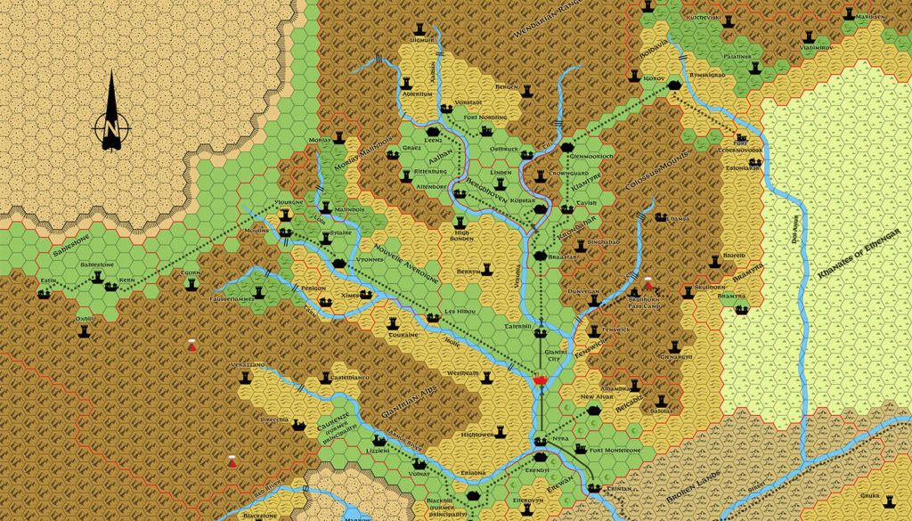
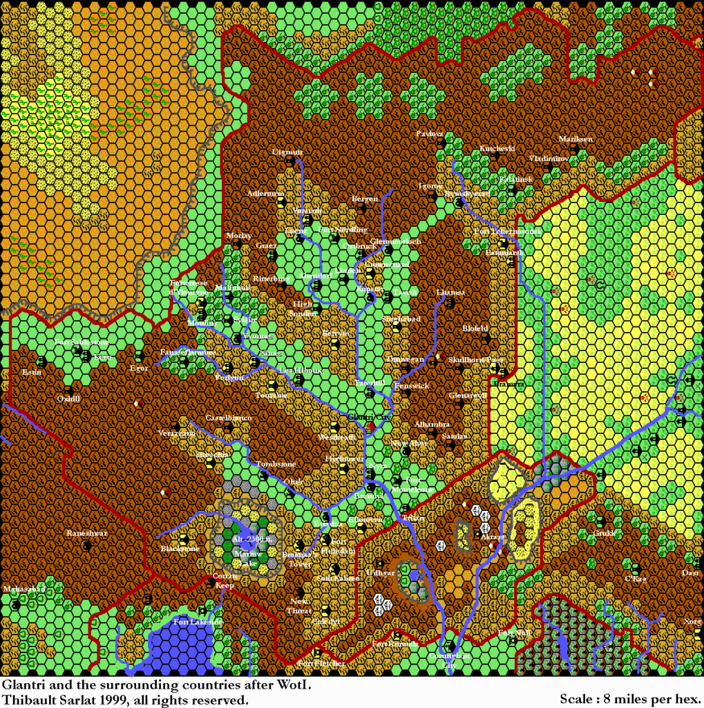


5 June 2018 @ 1:43 am
It’s worth noting that Urmahid’s tower (Skullhorn) apparently shifted 1 hex to the northeast.
Also apparently the borders of the new Bramyra do not include all of the area of the old county of Skullhorn. Did Urmahid have to give up some mountain terrain to get the princely title and the populated lowland area?
5 June 2018 @ 11:57 pm
The borders are also different in Boldavia and Nouvelle Averoigne. I must confess I haven’t read much of Glantri: Kingdom of Magic for many, many years (if at all?!?) so I don’t know the background here.
7 June 2018 @ 4:44 am
Oh wow, yeah, NA & B both gave-up a few suboptimal hexes in exchange for lots of better hexes – an especially large # in NA’s case, while Boldavia apparently annexed all the Boldavian baronies. I hadn’t noticed either of those before. But is Skullhorn the only location to of shifted hexes? Unfortunately this map is, as far as I’m aware, the only one showing the borders and extent of the P. of Bramyra