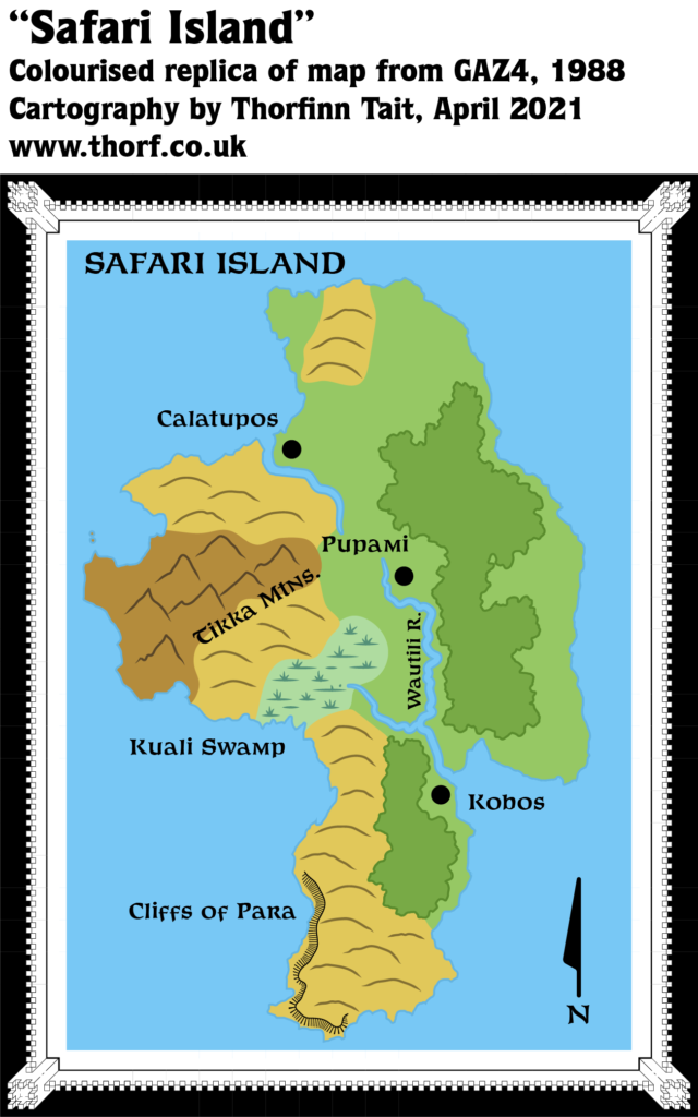
Safari Island (1987)
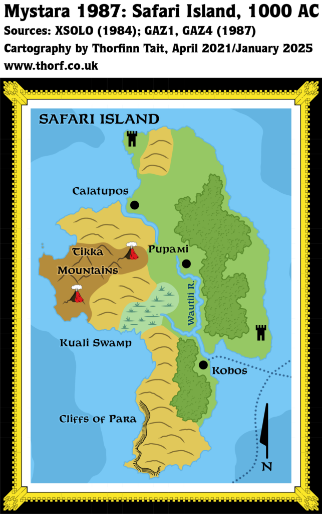
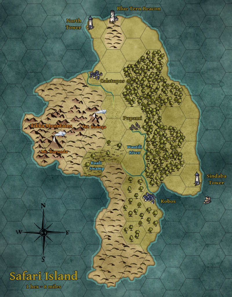
GAZ4 introduced a detailed map of Safari Island, although it was missing a few details that were present on the 8 mile per hex poster map. Namely, the towers, the volcanoes, and the sea depths were not included. This map presents a view of how Safari Island might have been mapped at the end of 1987, with these details as well as the shipping lanes added in. As with the hex map, the towers remained nameless at this point.
The scale of the original map was not marked. This version is presented at the same scale as the Atlas standard 6 mile per hex maps.
Chronological Map (January 2025)
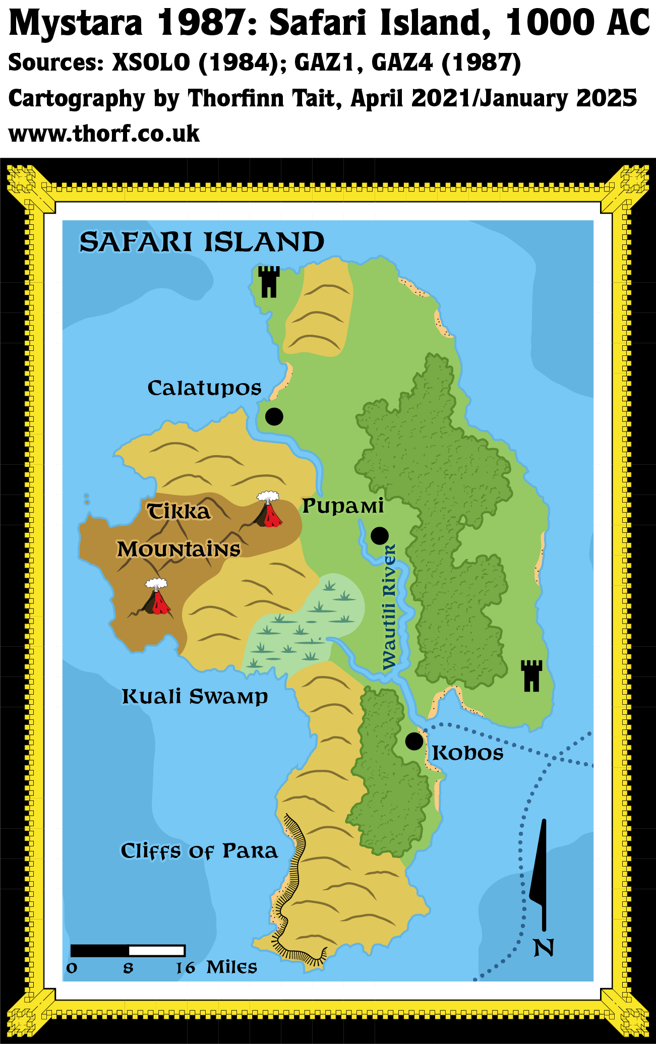
This map is part of the Mystara 1987 series of chronological maps. It is an updated map, incorporating all available sources and made internally consistent with other maps in its series. But it only uses sources published in or before 1987.
For more information, see Appendix C: Cartographic Chronology.
Sources
- Mystara 1984
- GAZ1 The Grand Duchy of Karameikos (1987) (PDF at DriveThruRPG)
- GAZ4 The Kingdom of Ierendi (1987) (PDF at DriveThruRPG)
Revisions
For detailed notes, see the posts for each individual source map at the links above.
- Beaches — As suggested in the Textual Additions for the Safari Island map, I have added some beaches to the coasts, primarily along the eastern side of the island.
- Volcanoes — The volcanoes lined up roughly with two of the peaks depicted on the original map, and as such have been nudged slightly to match them.
References
- Let’s Map Mystara 1987 — the original project thread for this map (upcoming)
- Let’s Map Mystara Together discussion thread at The Piazza (link leads to this map’s post) (upcoming)
- Ierendi at the Vaults of Pandius
Thanks to:
sirjonsnow
Past and Future Versions of this Map