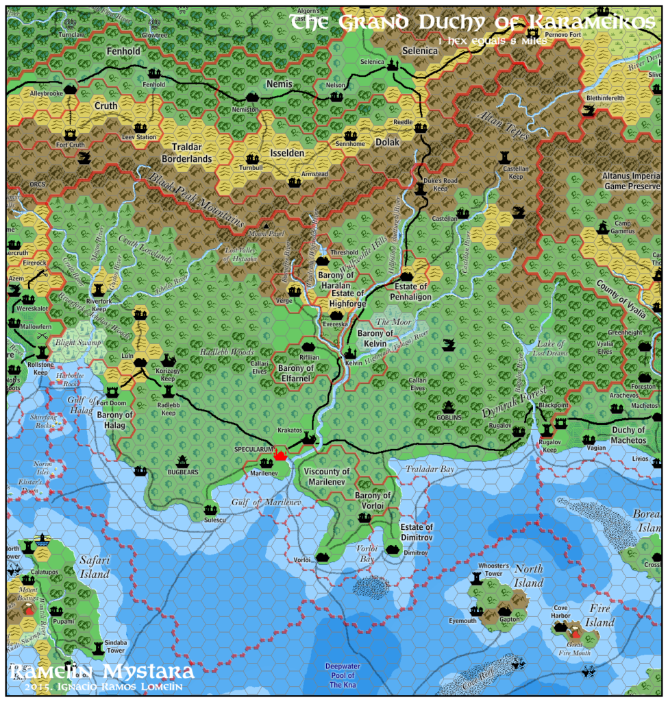
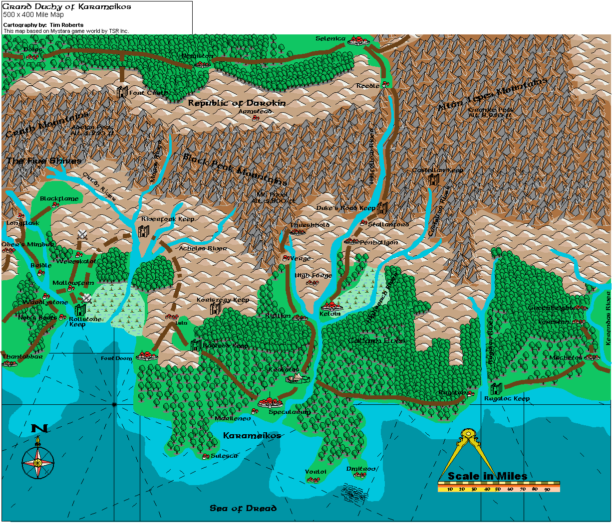
Tim’s Karameikos
Tim Roberts created three maps of the Known World using Campaign Cartographer 2 in 1998. As far as I can tell, he wasn’t active on the Mystara Mailing List at the time, although he did post there a few years later. Instead, his maps were shared by another fan and MML member, Patriarch.
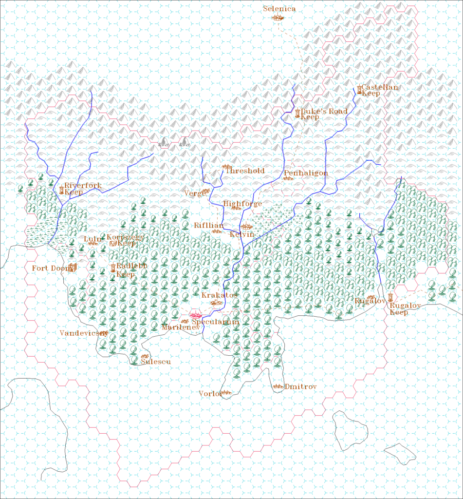
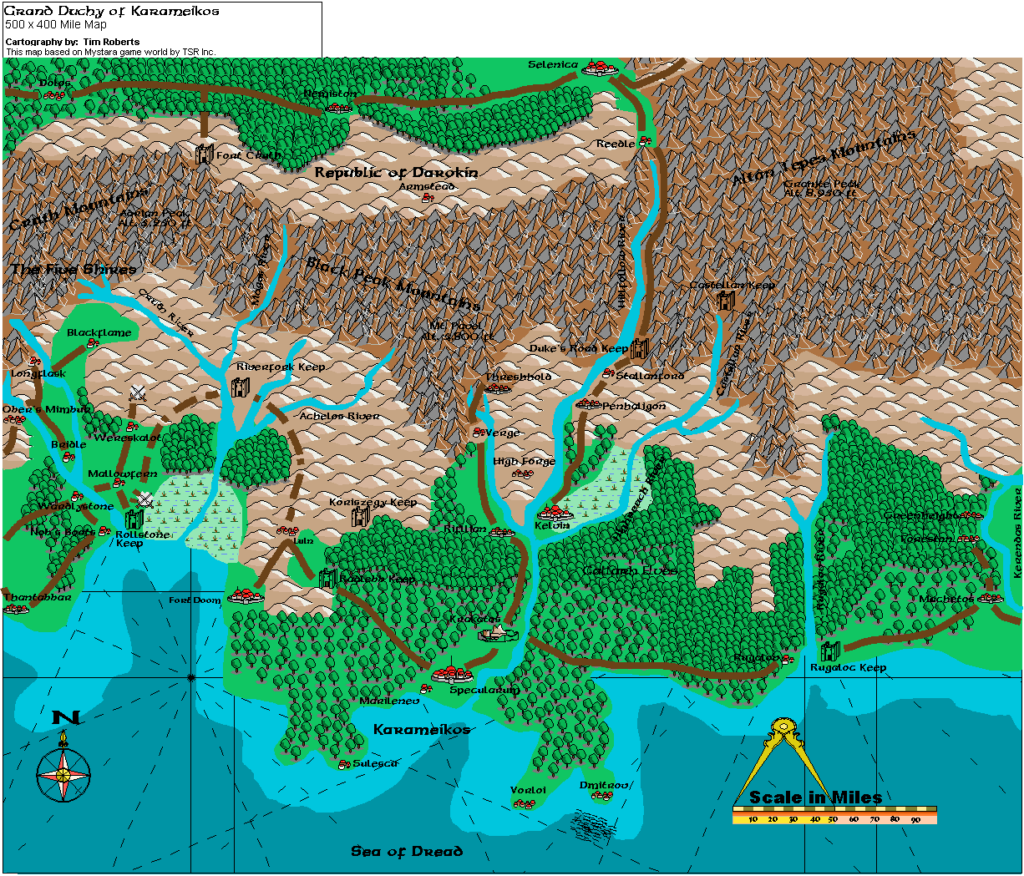
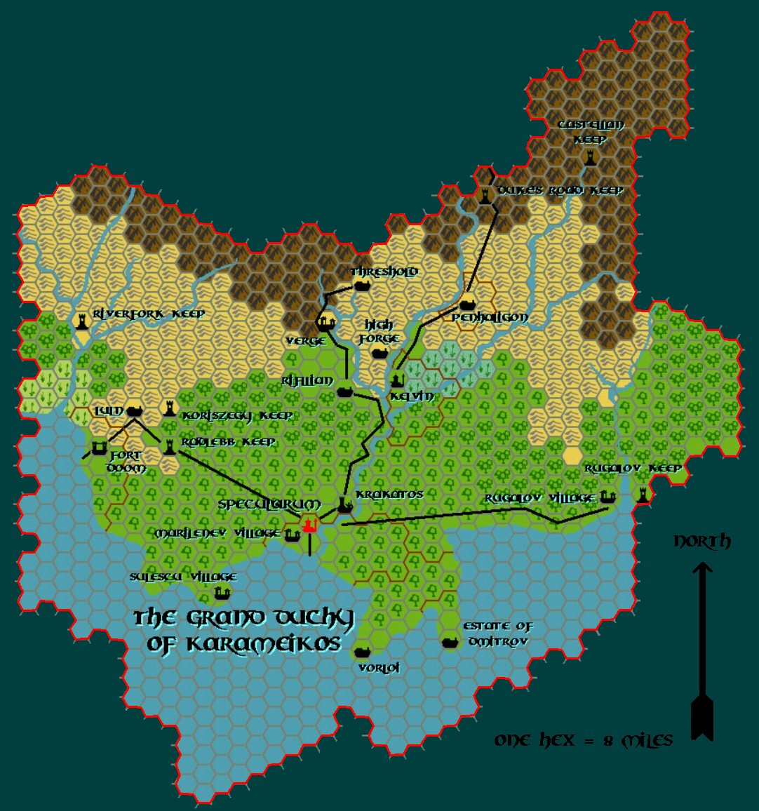
This was the first map shared, and naturally, it depicts the heart of the setting: Karameikos. It’s not a hex map, which means that Tim put some work into converting the GAZ1 map into a non-hex form. Despite the late 90s date, he gave it a decent export resolution, so it still holds up quite well even today.
Fan-made Map by Tim Roberts (March 1998)
This is an original map created by one of Mystara’s excellent fan cartographers. For more information on the cartographer, including a gallery of all their maps, see also Appendix M: Mappers of Mystara.
The Atlas has been unable to contact the original cartographer. This map therefore appears here without explicit permission from its creator. Any information on how to get in touch with them would be most welcome.
Sources
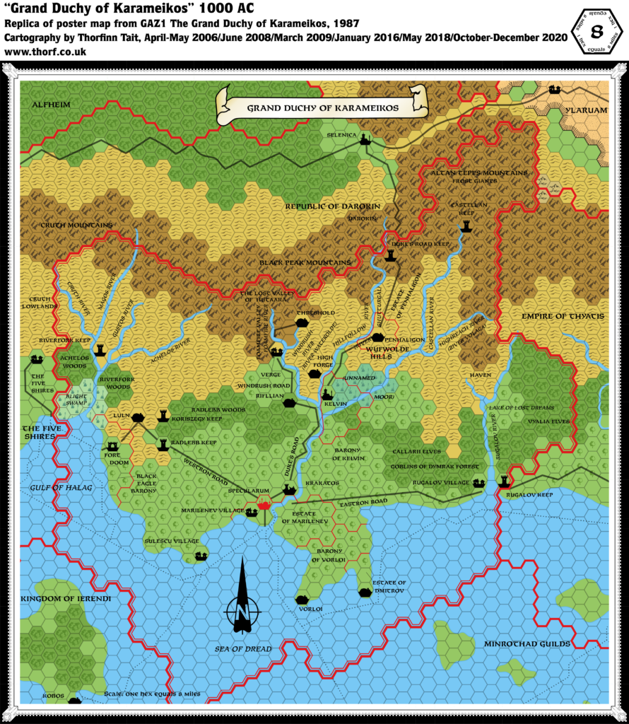
- GAZ1 The Grand Duchy of Karameikos (1987) (PDF at DriveThruRPG)
- TM1 The Western Countries (1989) (PDF at DriveThruRPG)
Fan Sources
- None
References
- All of Tim’s maps at the Atlas of Mystara
Chronological Analysis
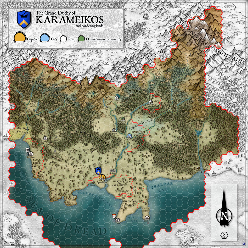
This is a fan-made map. It was published in March 1998. The updated Atlas version of this map is Karameikos, 8 miles per hex. See also Appendix C for annual chronological snapshots of the area. For the full context of this map in Mystara’s publication history, see the upcoming Let’s Map Mystara 1998.
The following lists are from the Let’s Map Mystara project. Additions are new features, introduced in this map. Revisions are changes to previously-introduced features. Hex Art & Fonts track design elements. Finally, Textual Additions are potential features found in the related text. In most cases, the Atlas adopts these textual additions into updated and chronological maps.
Under Construction! Please check back again soon for updates.