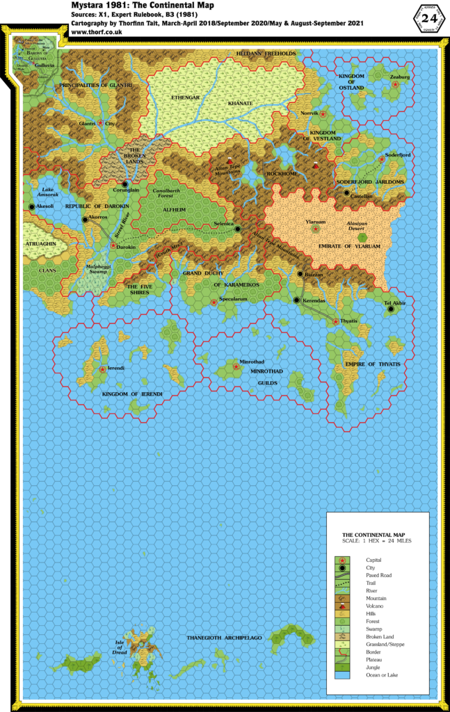
The first year of Mystara’s publication provided the all-important base for everything that was to follow: the core Known World area. Many of the names on this map came from Tom Moldvay and Lawrence Schick’s own campaign world, but the terrain itself was all new.
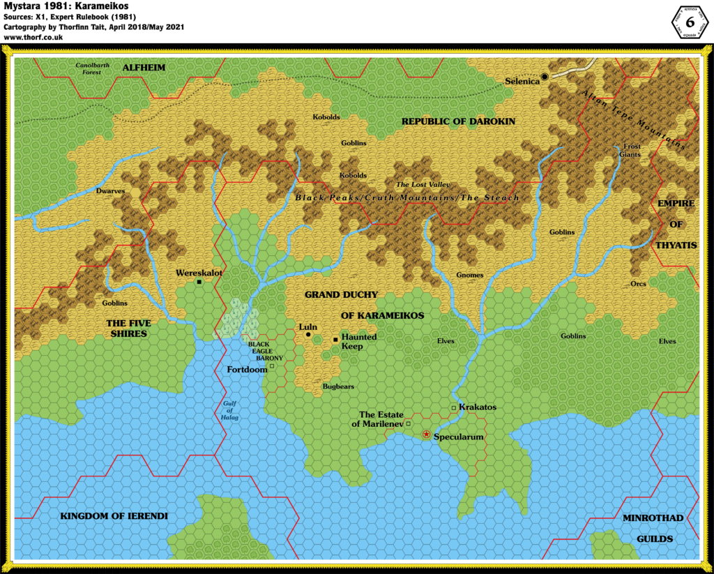
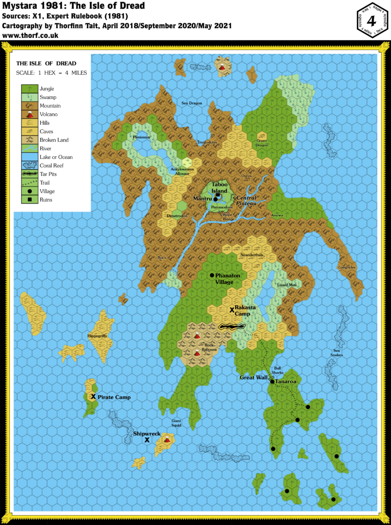
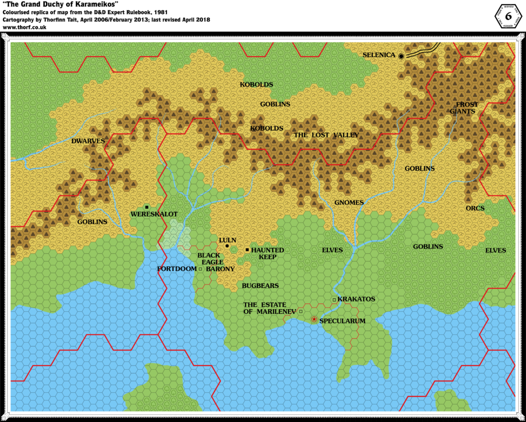
Of the other three maps published in 1981, two remain highly iconic of the setting: the first Karameikos map, which was redeveloped again and again in the following years; and the Isle of Dread, which has remained largely the same even in later editions’ revisits.
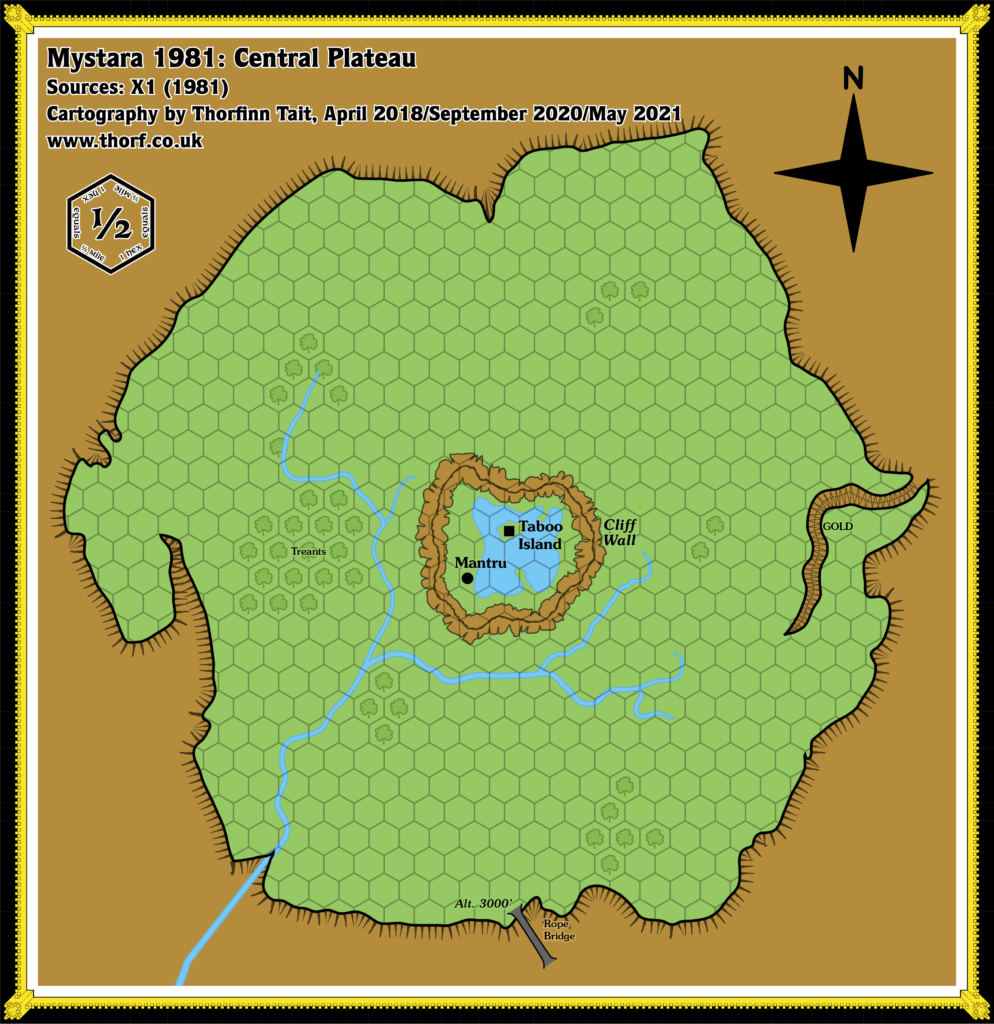
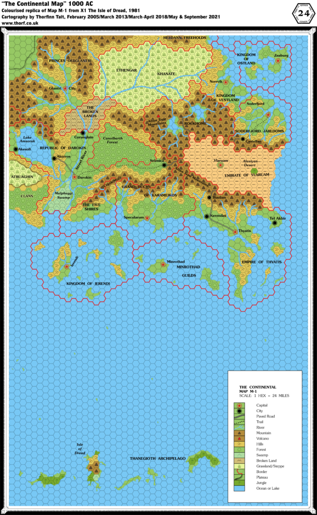
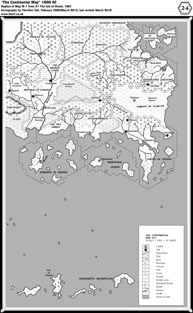
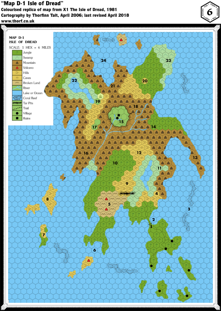
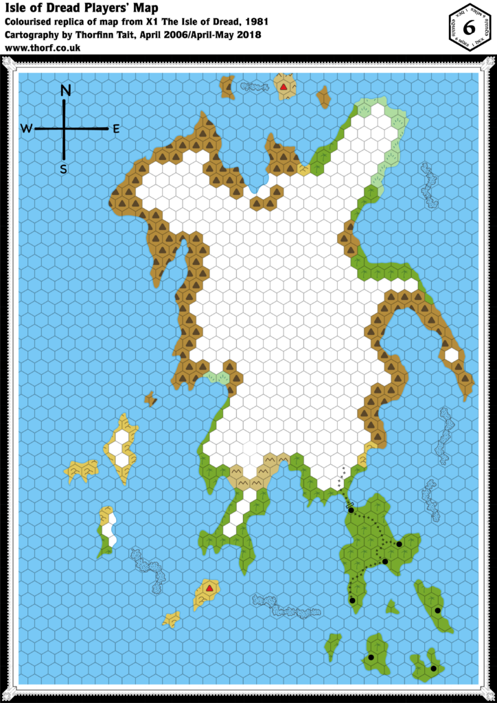
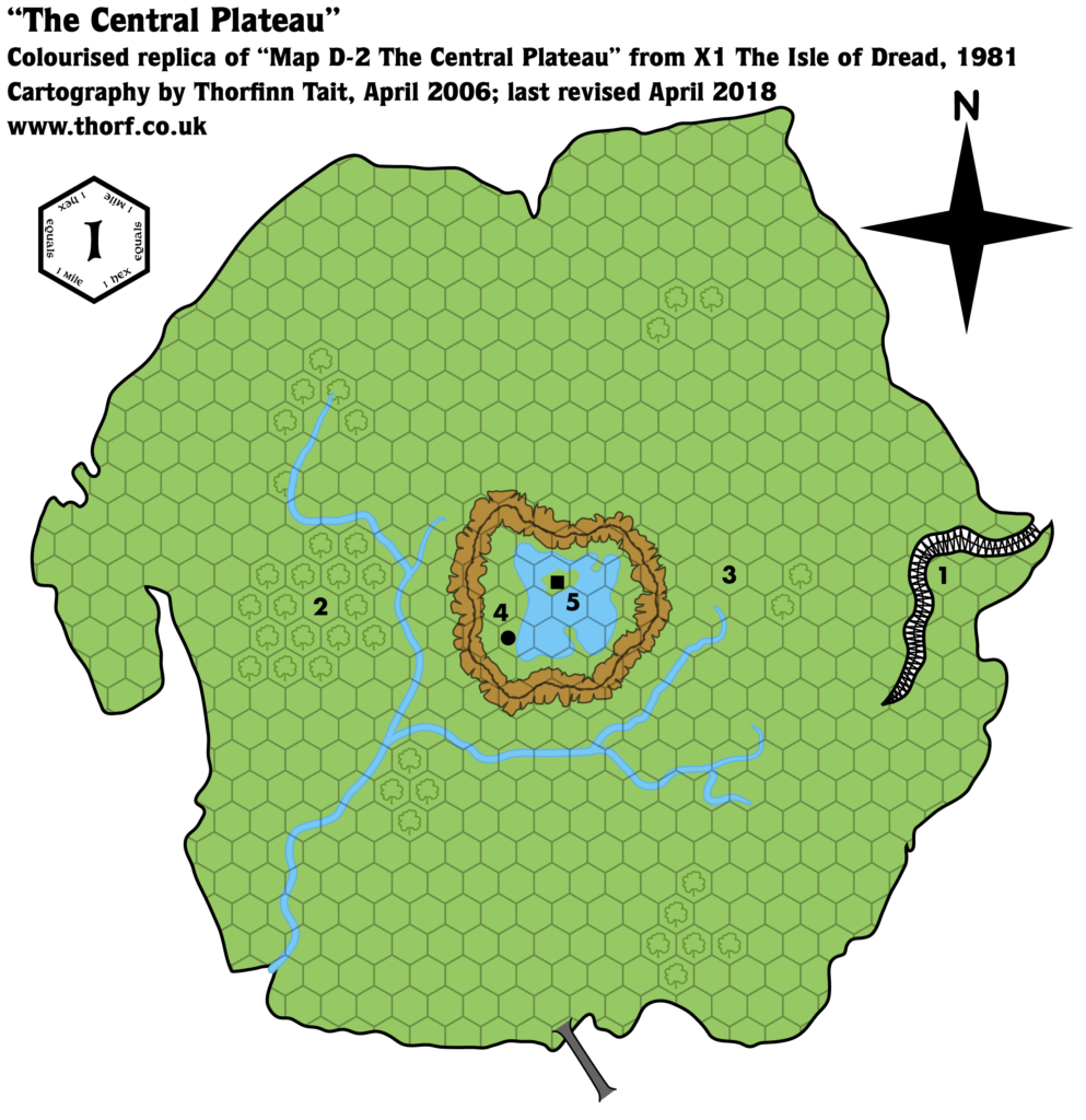
It’s worth noting here that there was a scale problem between the Isle of Dread’s large scale map and its representation on the Known World map. There are two possible ways to resolve it: (1) take the 6 mile per hex scale as written and enlarge the Isle of Dread on the 24 mile per hex map, or (2) change the scale to 4 miles per hex and leave both maps as they were printed. I have gone with (2) in order to make the least visual changes to the iconic Known World map, but (1) is equally valid, and may be more attractive to those wishing to have an Isle of Dread as big as its designers surely envisioned it. This also affects the Central Plateau large scale map, which is 0.5 miles per hex under (1), or 1 mile per hex under (2).
Finally, please note that the names “Mystara” and indeed “Known World” were nowhere to be seen in 1981. I use them here for the sake of convenience only.
The Maps
These maps have been made internally consistent, adopting the most detailed shapes and positions of each element.
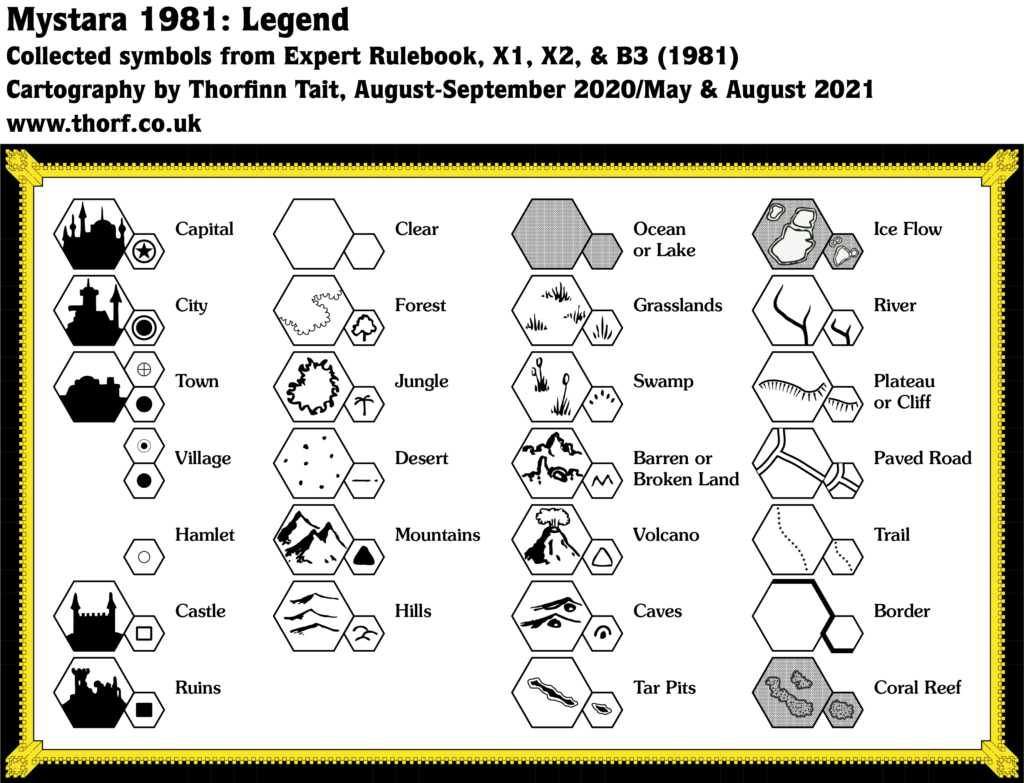
- Art — the simple hand-drawn symbol style from the original 1981 maps.
- Fonts — Souvenir. The original maps mostly used Souvenir, but 1981 also heralded the first appearance of Helvetica — a go-to font that would continue to appear sporadically throughout Mystara’s publication history. Souvenir seems like the most iconic font from this era, as it was also the main text font used in 1981’s rulebooks and modules. Futura and Franklin Gothic Condensed both made minor appearances, used for keyed numbers on a few maps. Finally, iconic AD&D font Neue Hammer Unziale made a cameo appearance in the recalled version of B3.


References
For more details on the individual maps and their interpretation here, please refer to the original Let’s Map Mystara project articles listed below.
- Let’s Map Mystara 1981 Part I, Part II, and 1981-1982
- Let’s Map Mystara Together discussion thread at The Piazza — 1981 discussion starts at this post
- Let’s Read the Known World/Mystara post 75 — 1981 discussion starts at this post
1981 Product Lineup
This table lists all the relevant products published in 1981, with links to each map’s individual page here at the Atlas. Product titles link to PDFs at DTRPG where they are available.
| Map | Name | Hex | Year | M | Source | Reference |
|---|---|---|---|---|---|---|
| 1 | Map M-1 The Continent | 24 | 1981 | 1 | X1 The Isle of Dread | p. 16-17 |
| 2 | Map D-1 Isle of Dread | 6 | 1981 | 1 | X1 The Isle of Dread | p. 14 |
| 2 | [Isle of Dread Players' Map] | 6 | 1981 | 1 | X1 The Isle of Dread | p. 32 |
| 3 | Map D-2 The Central Plateau | 1 | 1981 | 1 | X1 The Isle of Dread | p. 21 |
| 4 | The Grand Duchy of Karameikos | 6 | 1981 | 1 | Expert Rulebook | p. X61 |
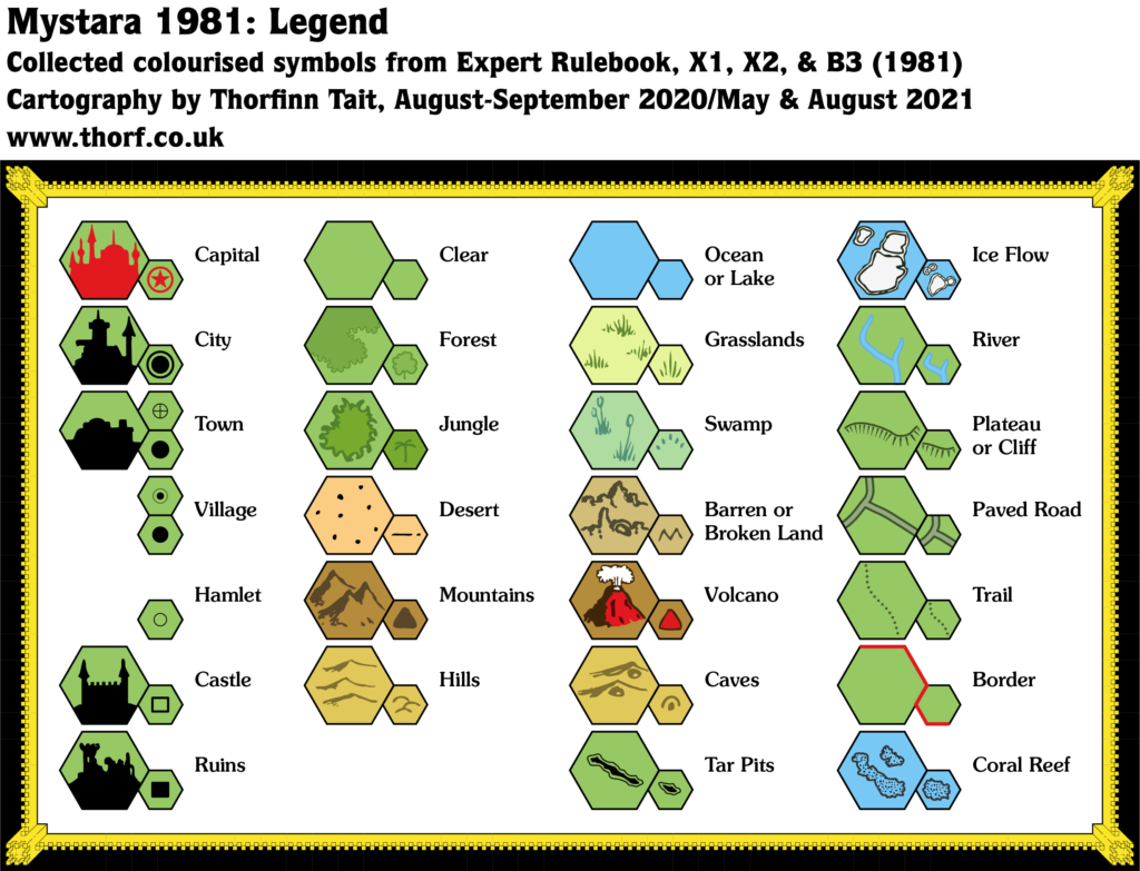
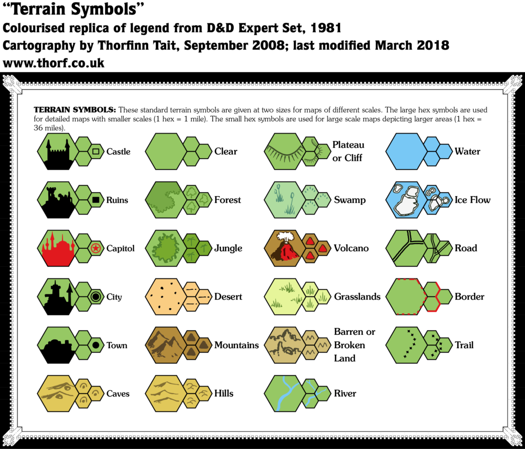
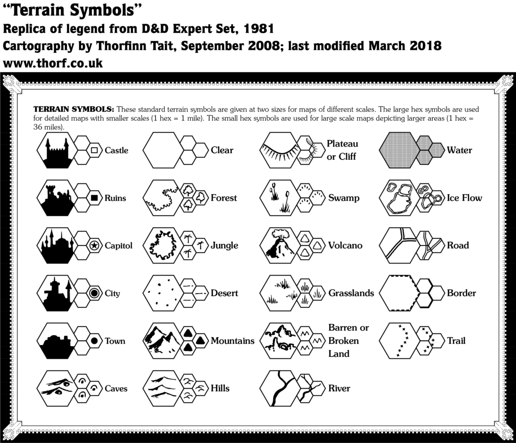
| - | Terrain Symbols | - | 1981 | 1 | Expert Rulebook | p. X62 |
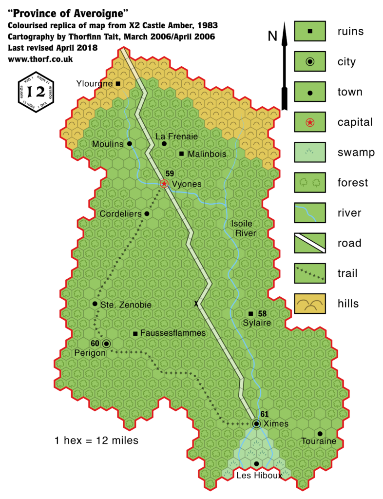
| 5 | Province of Averoigne | 12 | 1981 | 10 | X2 Castle Amber (Château d'Ambreville) | p. 16 |
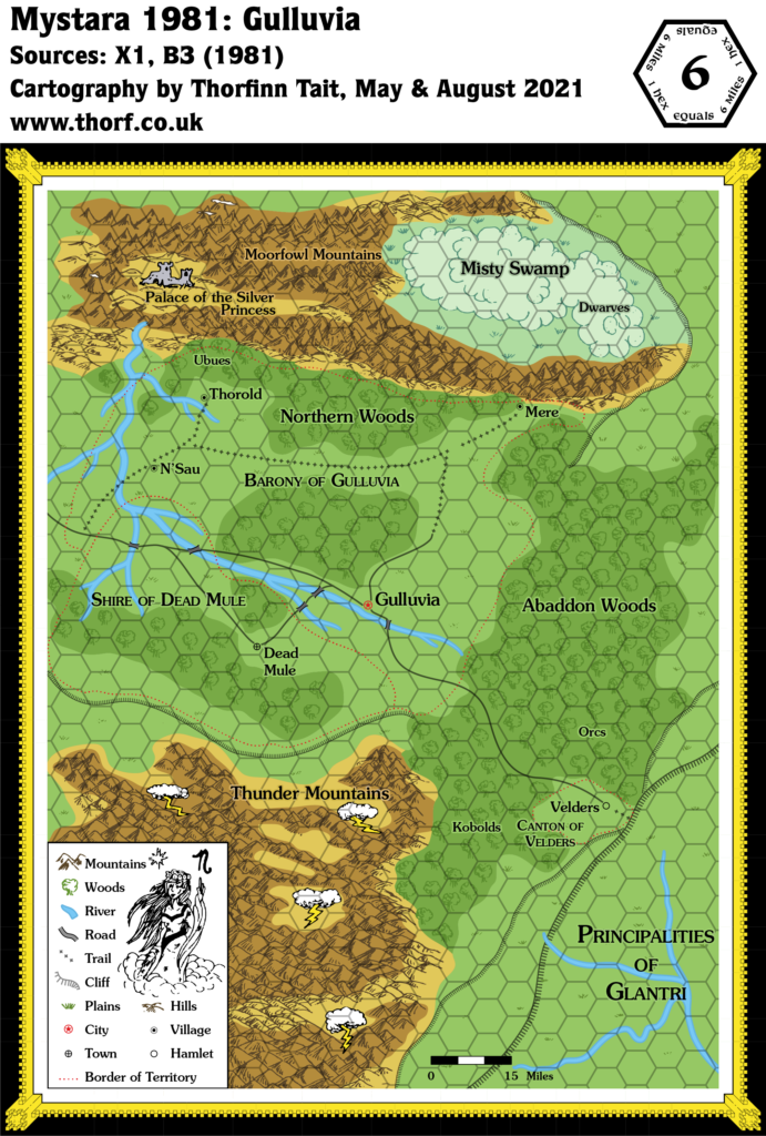
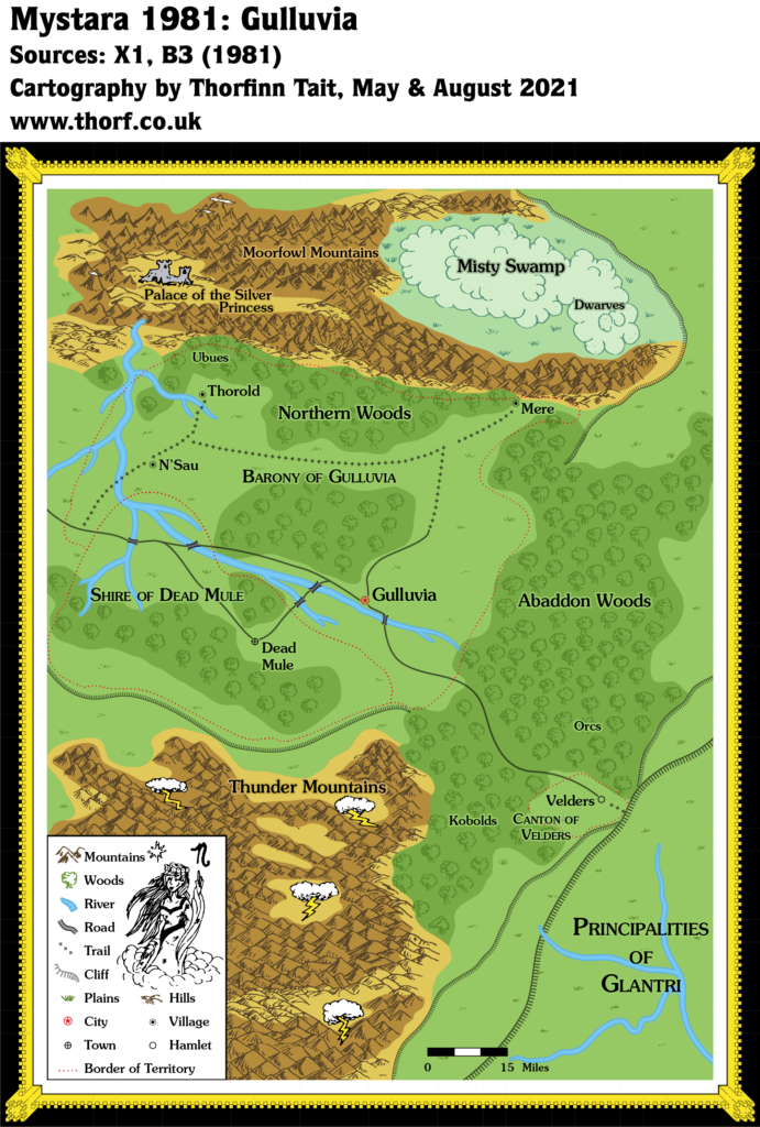
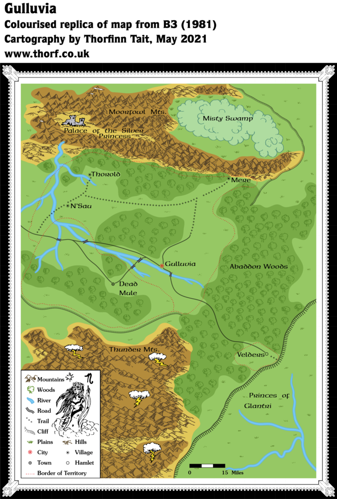
| 6 | Gulluvia | - | 1981 | 6 | B3 Palace of the Silver Princess (orange) | p. 5 |
1981 Map Gallery
This gallery shows all of the geographic maps published over the course of the year. These are replicas of the original maps. For full details, please check out the post for each map, linked to in the table above. For corrected and expanded versions, use the maps near the top of this page.

2 November 2018 @ 12:43 pm
I, for one, really appreciate all the technical difficulties involved in reconciling all the various discrepancies. The new adjustments look like they work fine. Thank you for all your hard work. Much Love. <3 <3