
Alan’s Xitaqa
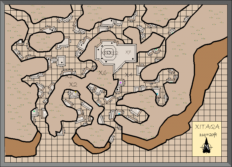
Although of course it lies in ruins, Xitaqa is the best preserved remnant of Hutaakan settlement in Karameikos outside the Lost Valley. Alan produced this map as a replica of B10’s map. Other than leaving out the parts of buildings that lie within rock walls (which were shown on the original map), this is a pretty close copy.
You can see a high resolution CC3+ export of Alan’s original CC2 file below, followed by his export from 2001.
Fan-made Map by Alan Derek Jones (June 2001)
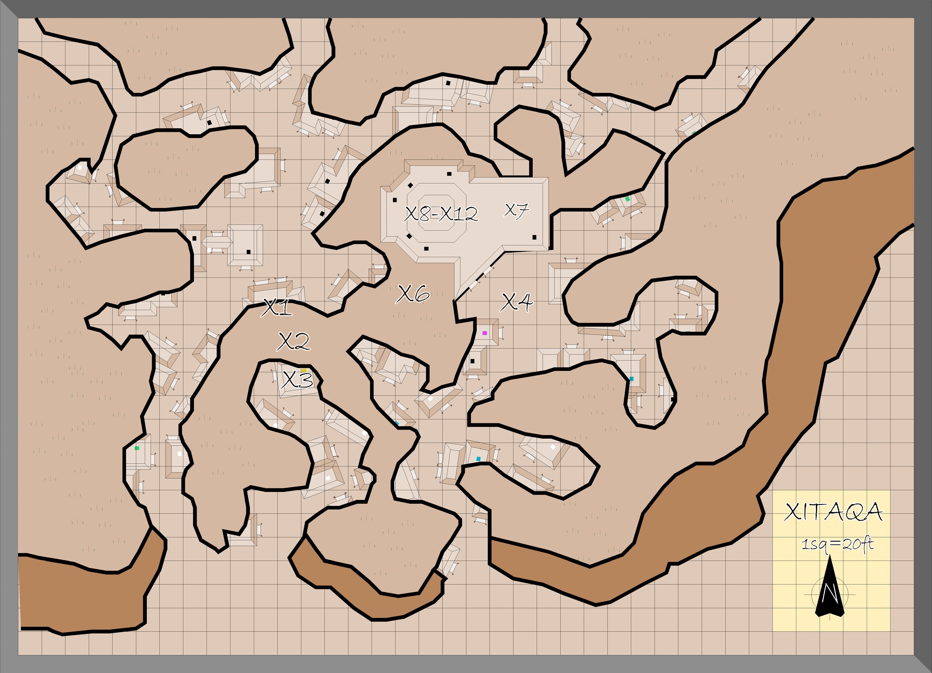
exported in high resolution by Thorfinn Tait, April 2025
Fan-made Map by Alan Derek Jones (June 2001)
This is an original map created by one of Mystara’s excellent fan cartographers. For more information on the cartographer, including a gallery of all their maps, see also Appendix M: Mappers of Mystara.
Sources
- B10 Night’s Dark Terror (1986) (PDF at DriveThruRPG)
- Xitaqa
Fan Sources
- None
References
- All of Alan’s maps at the Atlas of Mystara
- Alan’s entry in Appendix M: Mappers of Mystara (upcoming)
- Alan’s author page at the Vaults of Pandius
Chronological Analysis
This is a fan-made map. It was published in June 2001. The updated Atlas version of this map is not yet available. See also Appendix C for annual chronological snapshots of the area. For the full context of this map in Mystara’s publication history, see the upcoming Let’s Map Mystara 2001.
The following lists are from the Let’s Map Mystara project. Additions are new features, introduced in this map. Revisions are changes to previously-introduced features. Hex Art & Fonts track design elements. Finally, Textual Additions are potential features found in the related text. In most cases, the Atlas adopts these textual additions into updated and chronological maps.
Under Construction! Please check back again soon for updates.


