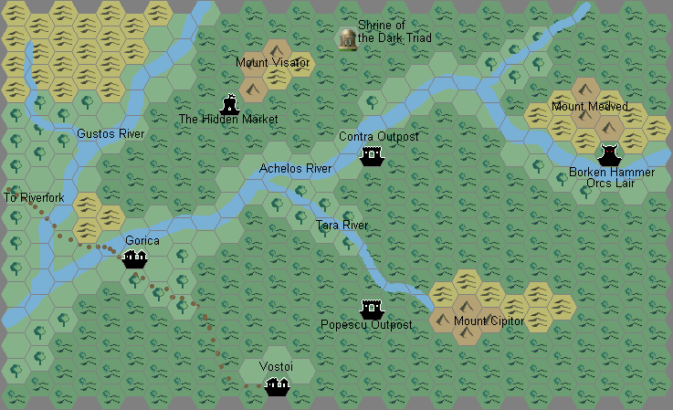
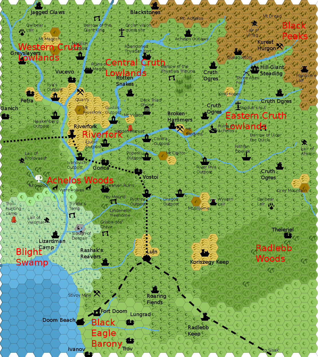
Agathokles’ Cruth Lowlands, 2.7 miles per hex
Having already created maps for Northeastern Karameikos, Vandevicsny Area, Achelos River and Karameikos as a whole, Giampaolo returned to the Cruth Lowlands area for an even more extensive project. He shared the first version of this new map in March 2012, with a few updates in the following days (as outlined in his thread at The Piazza). It especially builds on his Achelos River map, redrawing the area while incorporating most of that map’s details.
For a scale, this time he chose 2.7 miles per hex, a popular scale for fan-made maps since it involves the same zoom ratio from 8 to 2.7 mile hexes as the jump from 24 to 8.
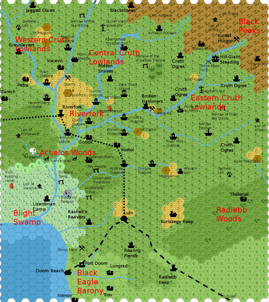
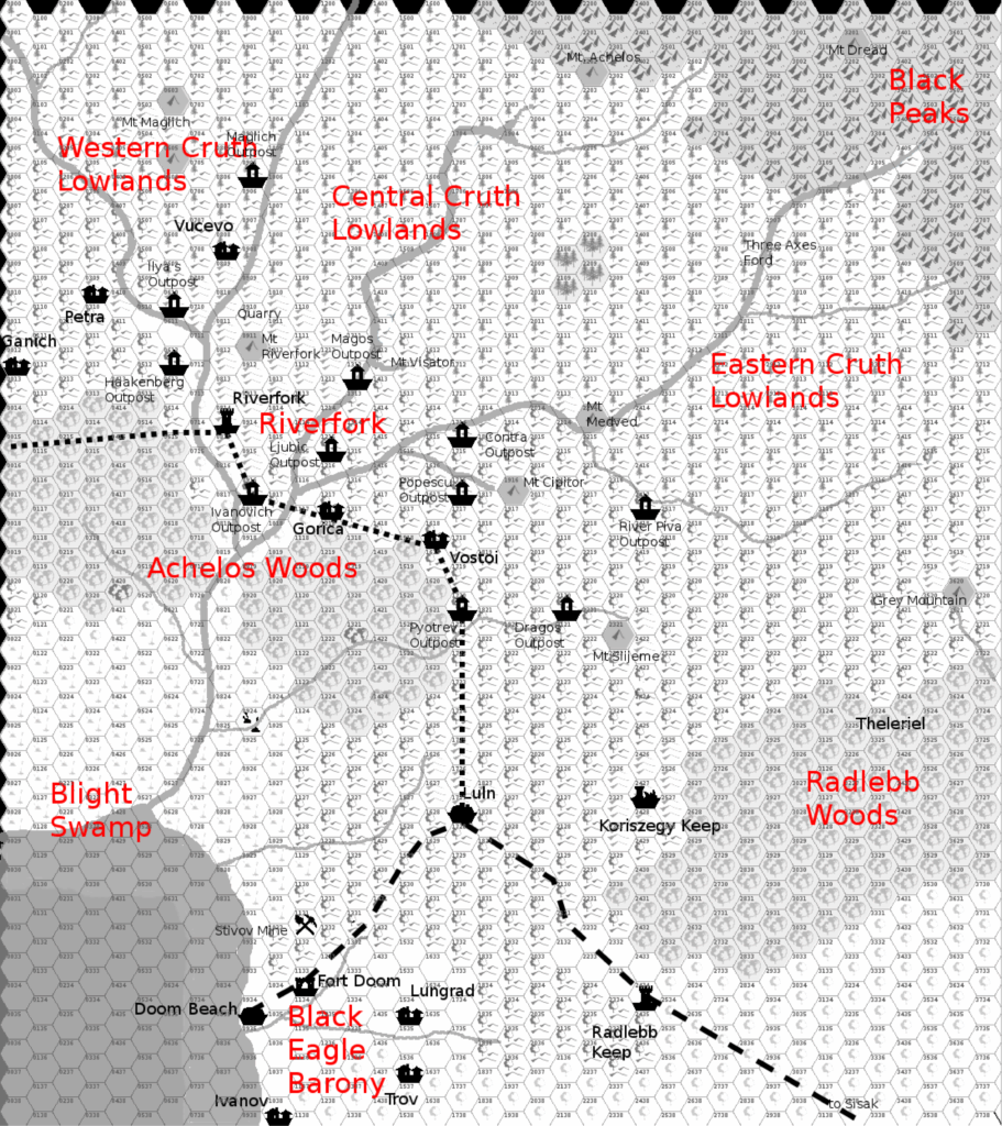
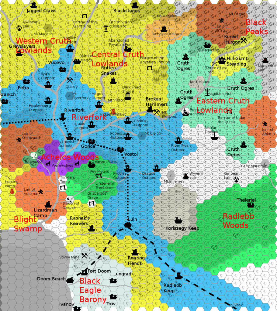
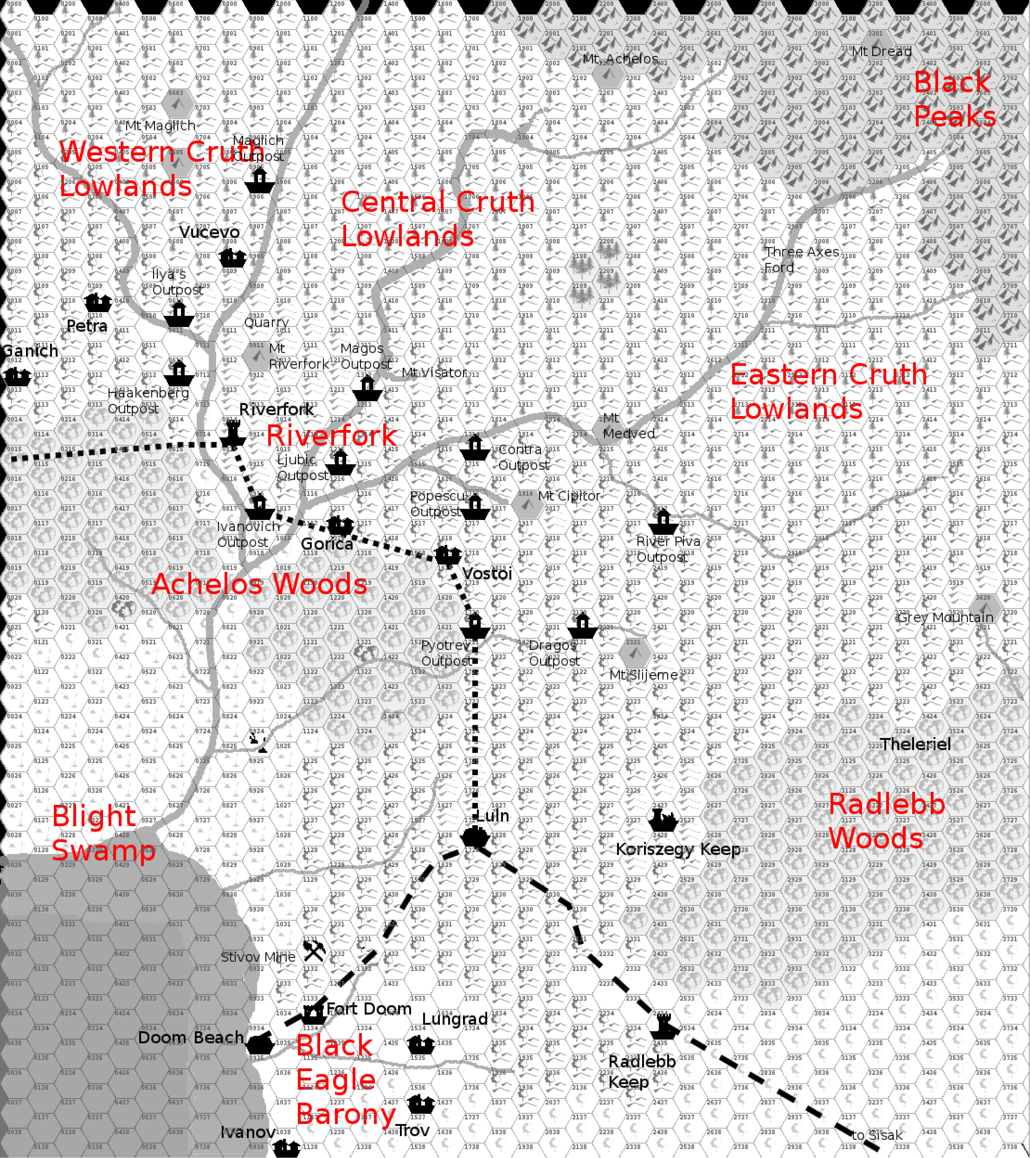
As a bonus, Giampaolo also produced a players’ map in black and white, included below, as well as a political map of the area. He included all of these maps in his PDF Lords of the Cruth Lowlands, published a few months later.
Fan-made Map by Giampaolo Agosta (March 2012)
Fan-made Map by Giampaolo Agosta (March 2012)
This is an original map created by one of Mystara’s excellent fan cartographers. For more information on the cartographer, including a gallery of all their maps, see also Appendix M: Mappers of Mystara.
Sources
- GAZ1 The Grand Duchy of Karameikos (1987) (PDF at DriveThruRPG)
- TM1 The Western Countries (1989) (PDF at DriveThruRPG)
- Karameikos: Kingdom of Adventure (1994) (PDF at DriveThruRPG)
Fan Sources
- Goblinoid Tribes of Karameikos by Giampaolo Agosta (January 2008) (Vaults of Pandius)
- Agathokles’ Karameikos, 3.2 miles per hex (October 2009)
- Agathokles’ Karameikos Political, 3.2 miles per hex (October 2009)
- Map of Karameikos at 3.2 miles/hex discussion thread (October 2009) (The Piazza)
- Map of Karameikos at 3.2 miles/hex by Giampaolo Agosta (October 2009) (Vaults of Pandius)
- Map of the Tribes of Karameikos from The Piazza (October 2009) (Vaults of Pandius)
- Cruth Lowlands map discussion thread (March 2012) (The Piazza)
- Lords of the Cruth Lowlands by Giampaolo Agosta (July 2012)
References
- All of Giampaolo’s maps at the Atlas of Mystara
- Giampaolo’s entry in Appendix M: Mappers of Mystara (upcoming)
- Giampaolo’s author page at the Vaults of Pandius
Chronological Analysis
This is a fan-made map. It was published in March 2012. The updated Atlas version of this map is not yet available. See also Appendix C for annual chronological snapshots of the area. For the full context of this map in Mystara’s publication history, see the upcoming Let’s Map Mystara 2012.
The following lists are from the Let’s Map Mystara project. Additions are new features, introduced in this map. Revisions are changes to previously-introduced features. Hex Art & Fonts track design elements. Finally, Textual Additions are potential features found in the related text. In most cases, the Atlas adopts these textual additions into updated and chronological maps.
Under Construction! Please check back again soon for updates.