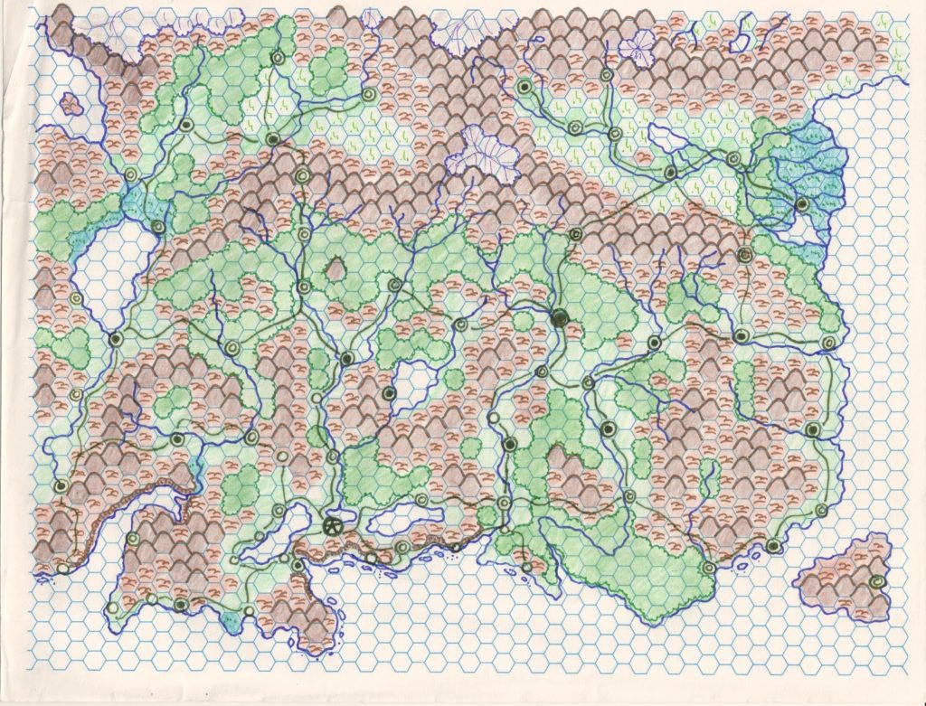
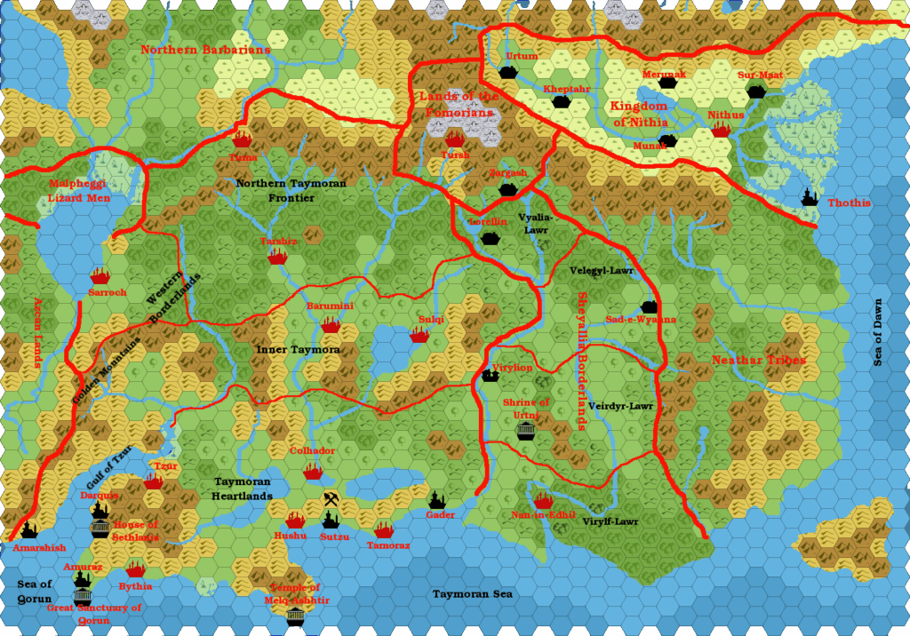
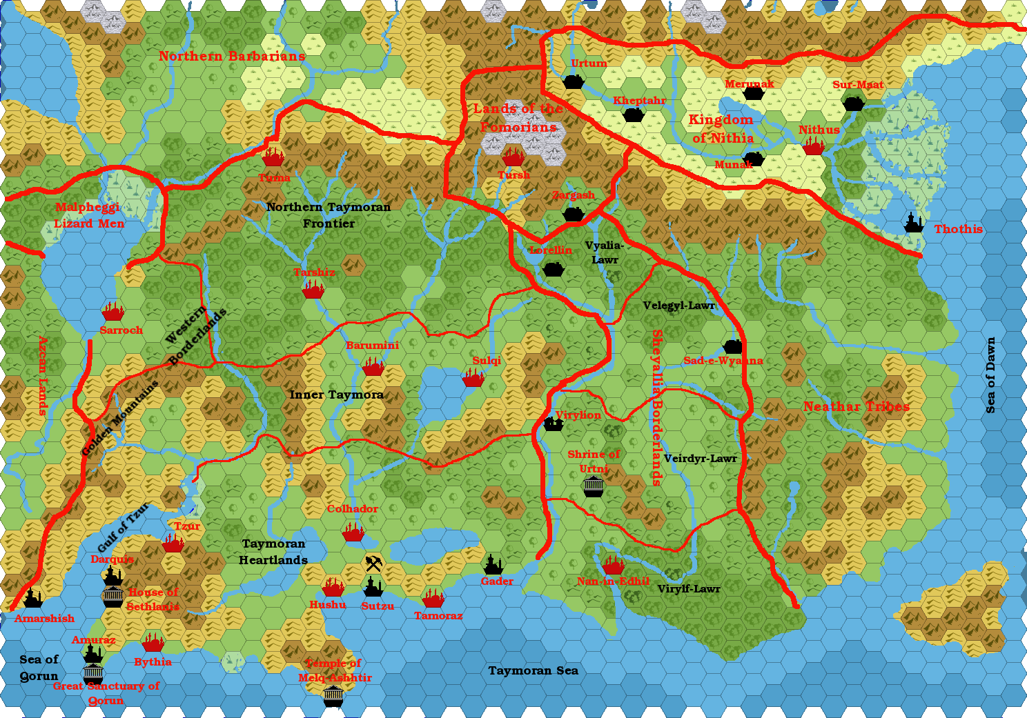
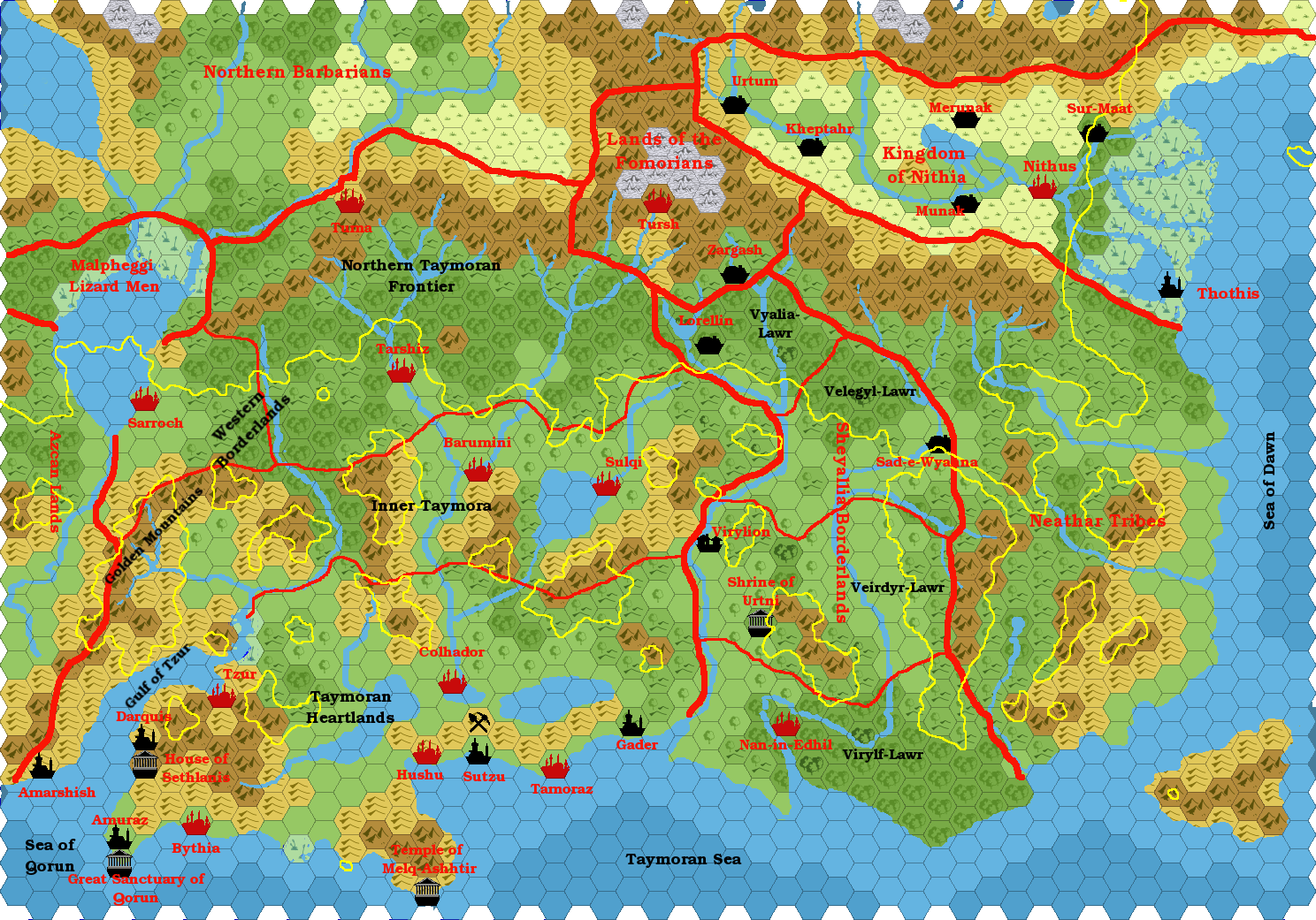
Agathokles’ Taymora 2000 BC, 24 miles per hex v2
For an overview of the development of Taymora maps, see the post for Giampaolo’s first version of this map, Taymora 2000 BC, 24 miles per hex.
This was Giampaolo’s second time exploring the nation of Taymora, approximately 3,000 years before the present day of the Gazetteer series. It had been 14 years since his first map. He revised it for an article on Taymora in Threshold #12.
Content-wise, it mostly remains the same map, changed from Andrew Theisen’s late 1990s hex art to my own system (via Isomage’s GIMP plugin). There are some minor differences, but really not that many.
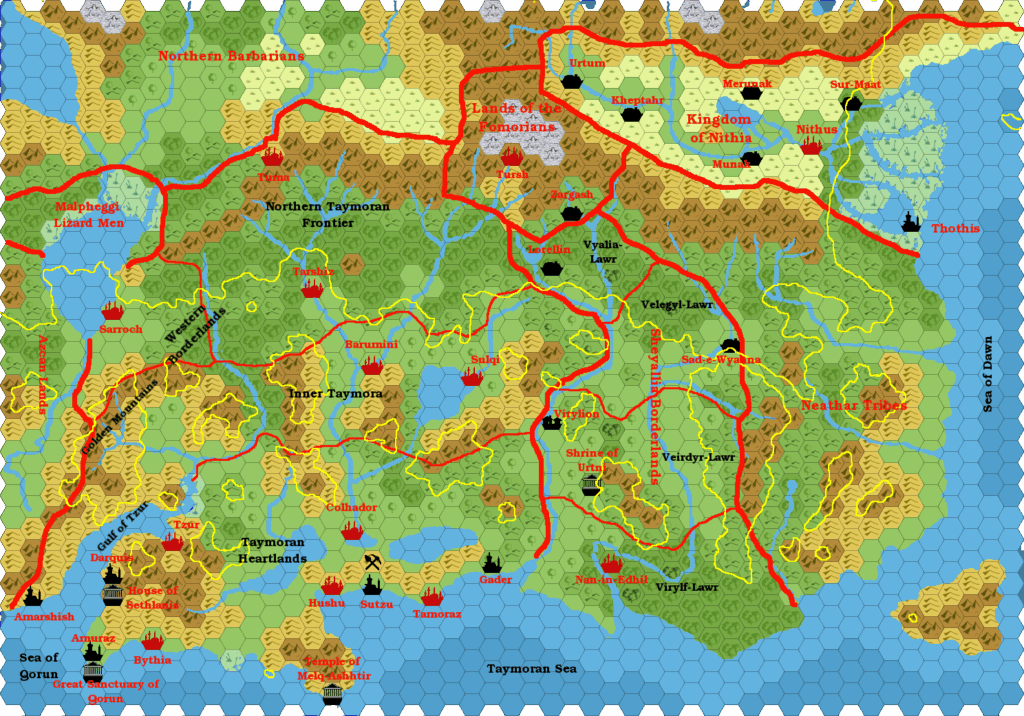
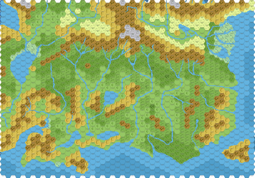
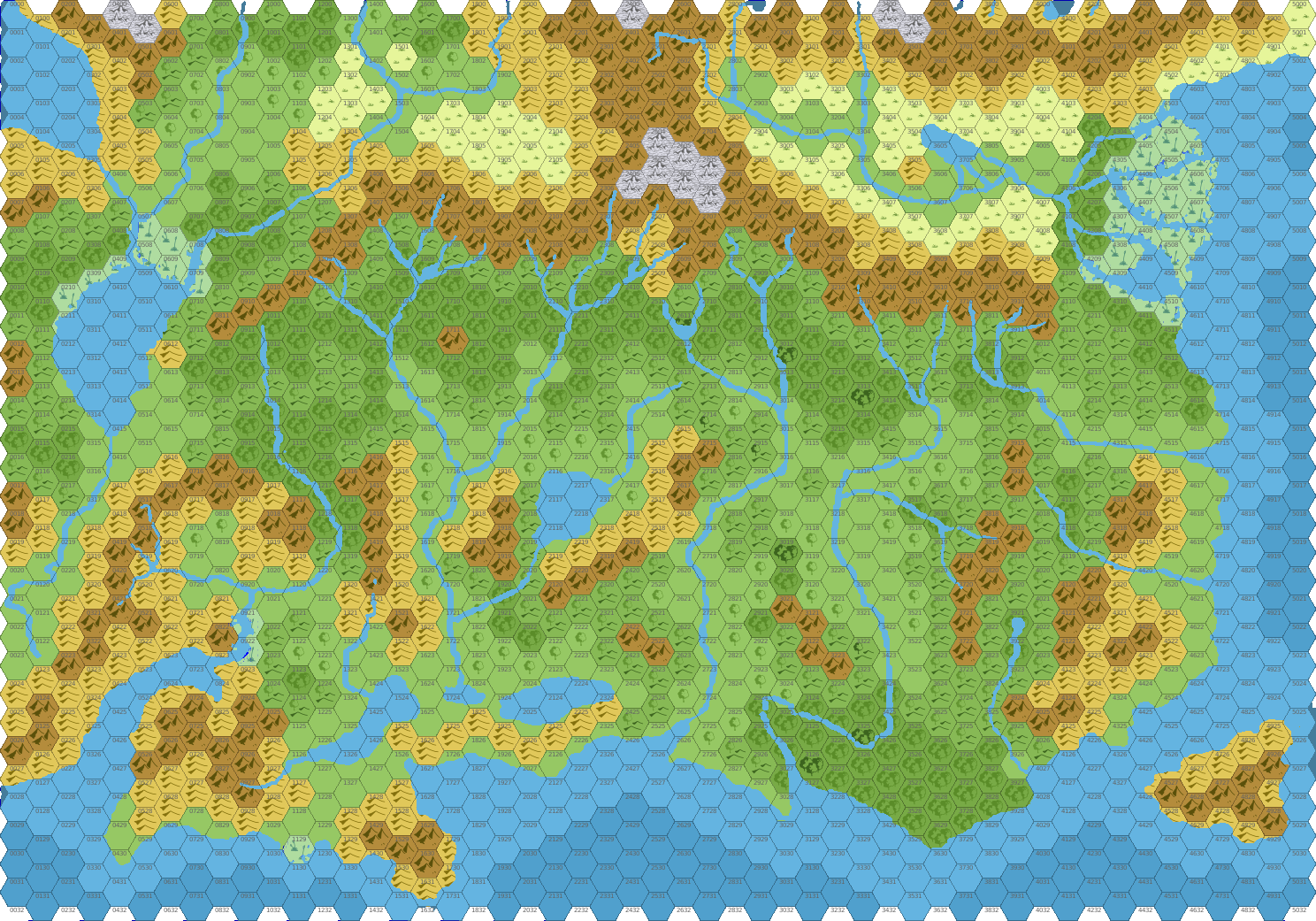
What is new is the variant versions of the map, including a comparison map showing the 1,000 AC coastlines, and a players’ map with numbered hexes.
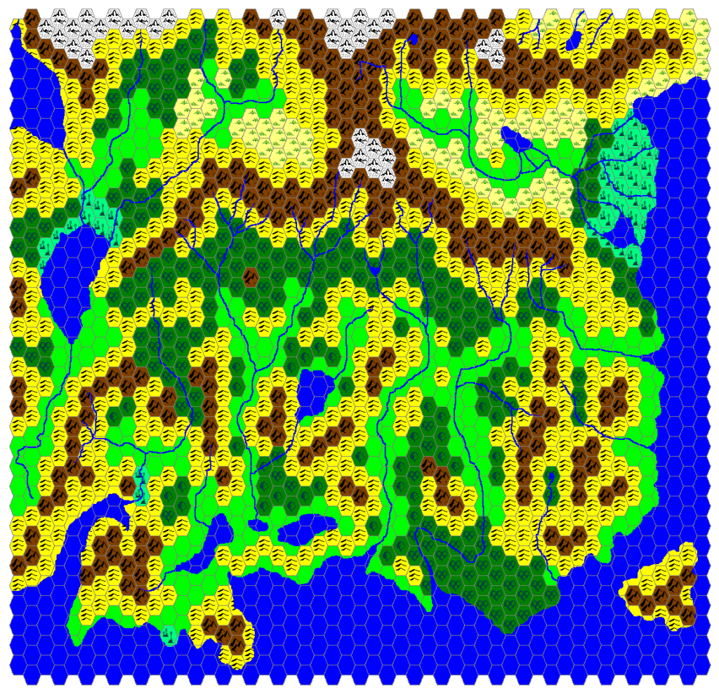
Fan-made Map by Giampaolo Agosta (July 2016)
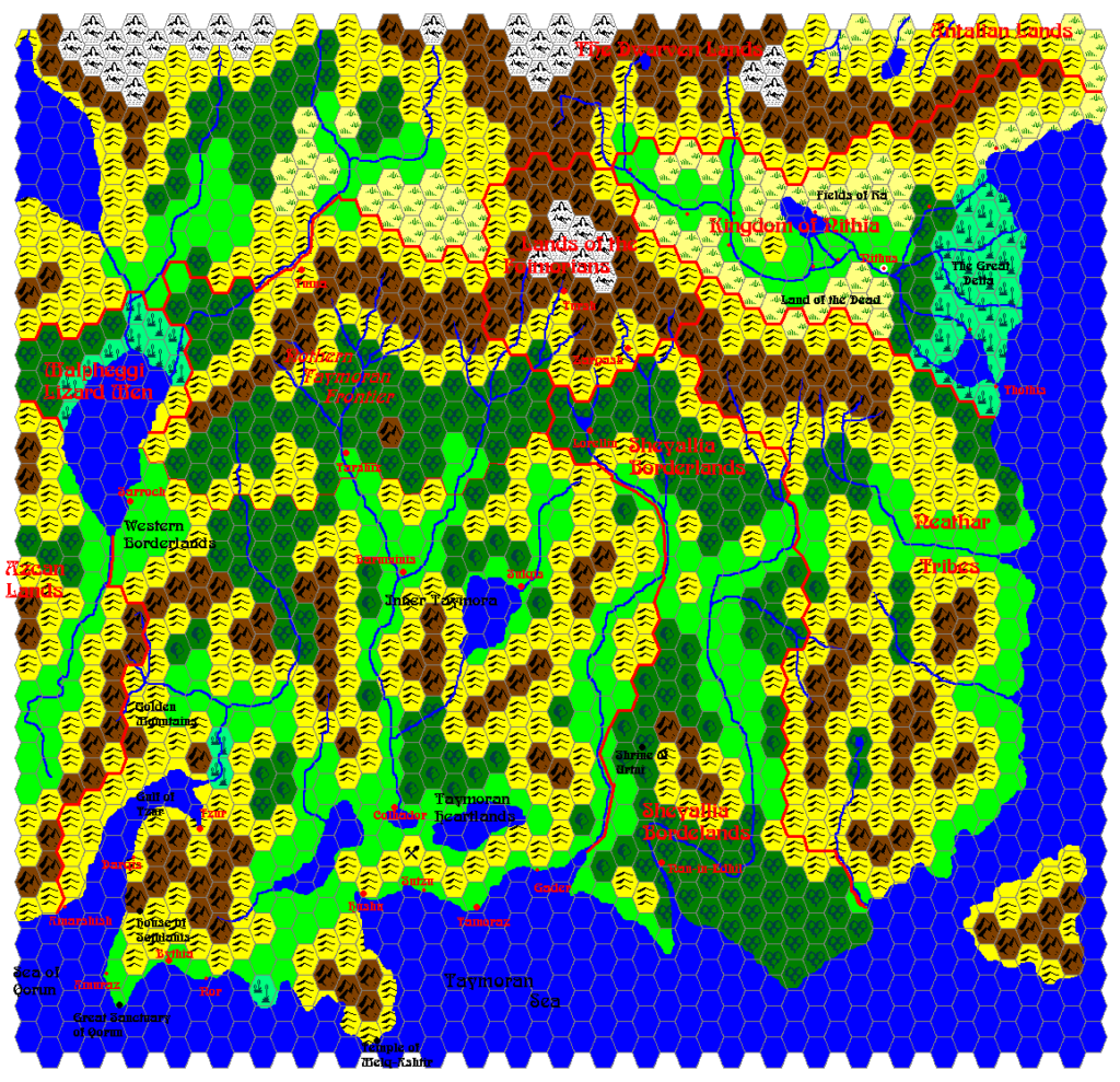
Fan-made Map by Giampaolo Agosta (July 2016)
Fan-made Map by Giampaolo Agosta (July 2016)
This is an original map created by one of Mystara’s excellent fan cartographers. For more information on the cartographer, including a gallery of all their maps, see also Appendix M: Mappers of Mystara.
Sources
- PC3 The Sea People (1990) (PDF at DriveThruRPG)
Fan Sources
- Mystaros’ Taymora 3000-2000 BC, 24 miles per hex (1999)
- Agathokles’ Taymora 2000 BC, 24 miles per hex (September 2002, September 2004)
- Threshold #12 (14 July 2016) (Vaults of Pandius)
References
- All of Giampaolo’s maps at the Atlas of Mystara
- Giampaolo’s entry in Appendix M: Mappers of Mystara (upcoming)
- Giampaolo’s author page at the Vaults of Pandius
Chronological Analysis
This is a fan-made map. It was published in July 2016. The updated Atlas version of this map is not yet available. See also Appendix C for annual chronological snapshots of the area. For the full context of this map in Mystara’s publication history, see the upcoming Let’s Map Mystara 2016.
The following lists are from the Let’s Map Mystara project. Additions are new features, introduced in this map. Revisions are changes to previously-introduced features. Hex Art & Fonts track design elements. Finally, Textual Additions are potential features found in the related text. In most cases, the Atlas adopts these textual additions into updated and chronological maps.
Under Construction! Please check back again soon for updates.