
Mark’s Known World and Sea of Dread, 72 miles per hex
This map is the 72 mile per hex part of Mark’s Worldographer map set, featuring the same area at 72, 24, and 8 miles per hex. For the story of these maps, see the post for Mark’s Known World and Sea of Dread, 24 miles per hex.
As noted in that post, Mark was experimenting with Worldographer, and in the end decided to go with a fully-featured graphics program instead. One of the reasons for this decision may have been the desire for more precise control over the maps; although Worldographer offers quite a few very useful features for fantasy hex-mapping, such as the ability to easily create “parent” and “child” maps, these are not necessarily shortcuts for cartographers of Mystara. But I’m just speculating. What Mark has stated is that he wasn’t happy with either the process or the results.
As with his previous 72 mile per hex map, this one ultimately went unlabelled. It is also his last map at this scale to date. Those with experience mapping Mystara will likely not be surprised, as it’s a scale with all sorts of problems — even the official maps at this scale were full of miscalculations and inaccuracies. In the end, it’s nice to have it for creating a Google Maps-style zoomable web map, but otherwise has limited usefulness.
Fan-made Map by Mark Howard (January 2019)
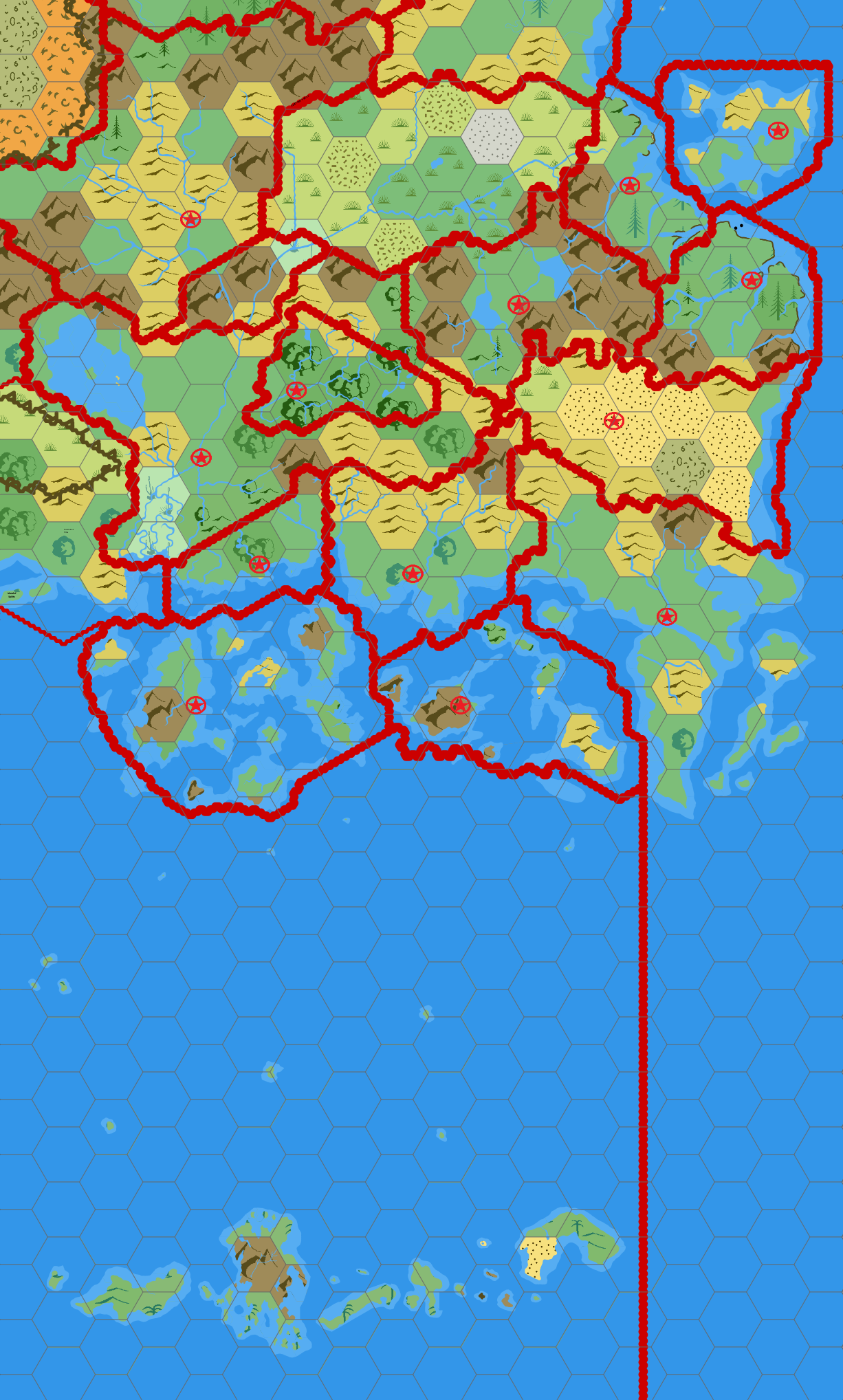
This is an original map created by one of Mystara’s excellent fan cartographers. For more information on the cartographer, including a gallery of all their maps, see also Appendix M: Mappers of Mystara.
Sources
- Dawn of the Emperors (1989) (PDF at DriveThruRPG)
- Poor Wizard’s Almanac II (1993) (PDF at DriveThruRPG)
Fan Sources
- Mark’s Known World Region, 72 miles per hex (June 2005)
- Known World and Sea of Dread at Mark’s web site (January 2019)
References
- All of Mark’s maps at the Atlas of Mystara
- Mark’s entry in Appendix M: Mappers of Mystara (upcoming)
- Mark’s author page at the Vaults of Pandius
Chronological Analysis
This is a fan-made map. It was published in January 2019. The updated Atlas version of this map is not yet available. See also Appendix C for annual chronological snapshots of the area. For the full context of this map in Mystara’s publication history, see the upcoming Let’s Map Mystara 2019.
The following lists are from the Let’s Map Mystara project. Additions are new features, introduced in this map. Revisions are changes to previously-introduced features. Hex Art & Fonts track design elements. Finally, Textual Additions are potential features found in the related text. In most cases, the Atlas adopts these textual additions into updated and chronological maps.
Under Construction! Please check back again soon for updates.
")
")
")