
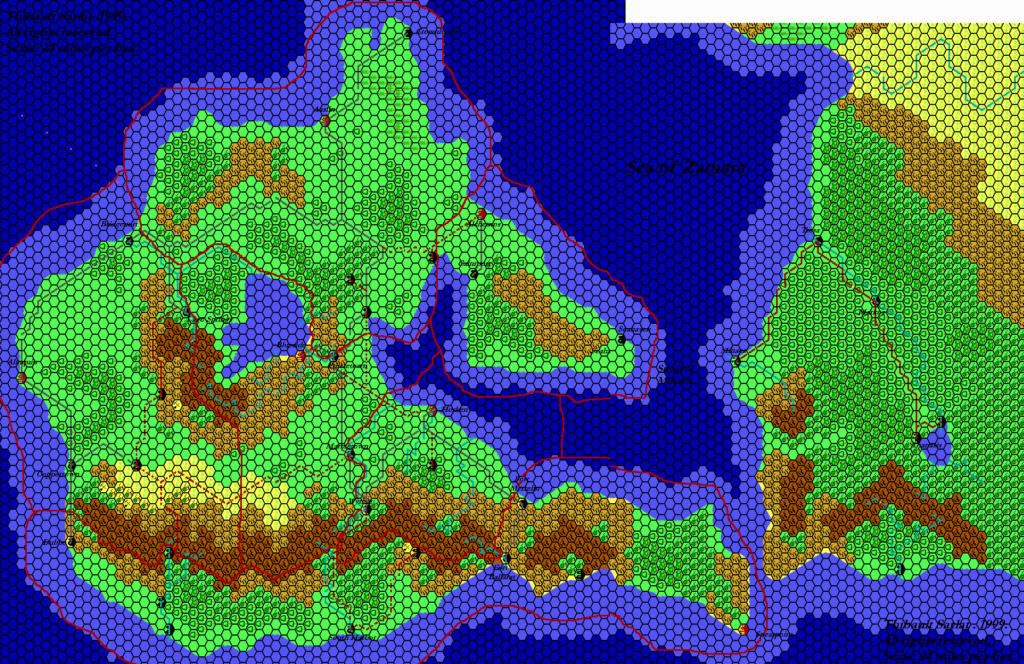
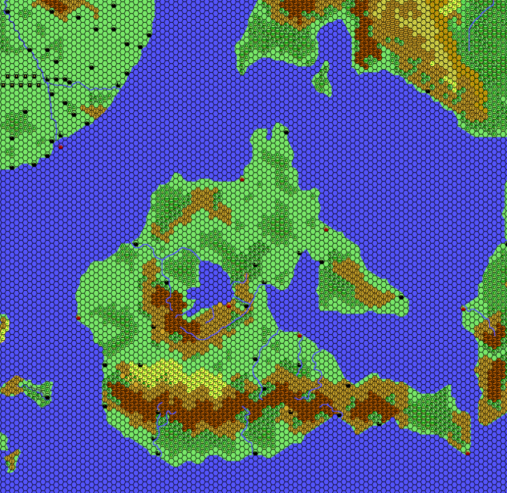
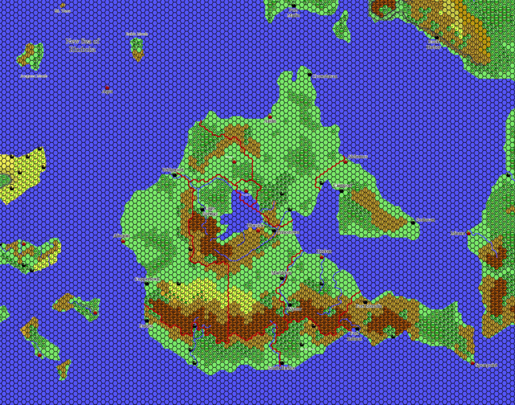
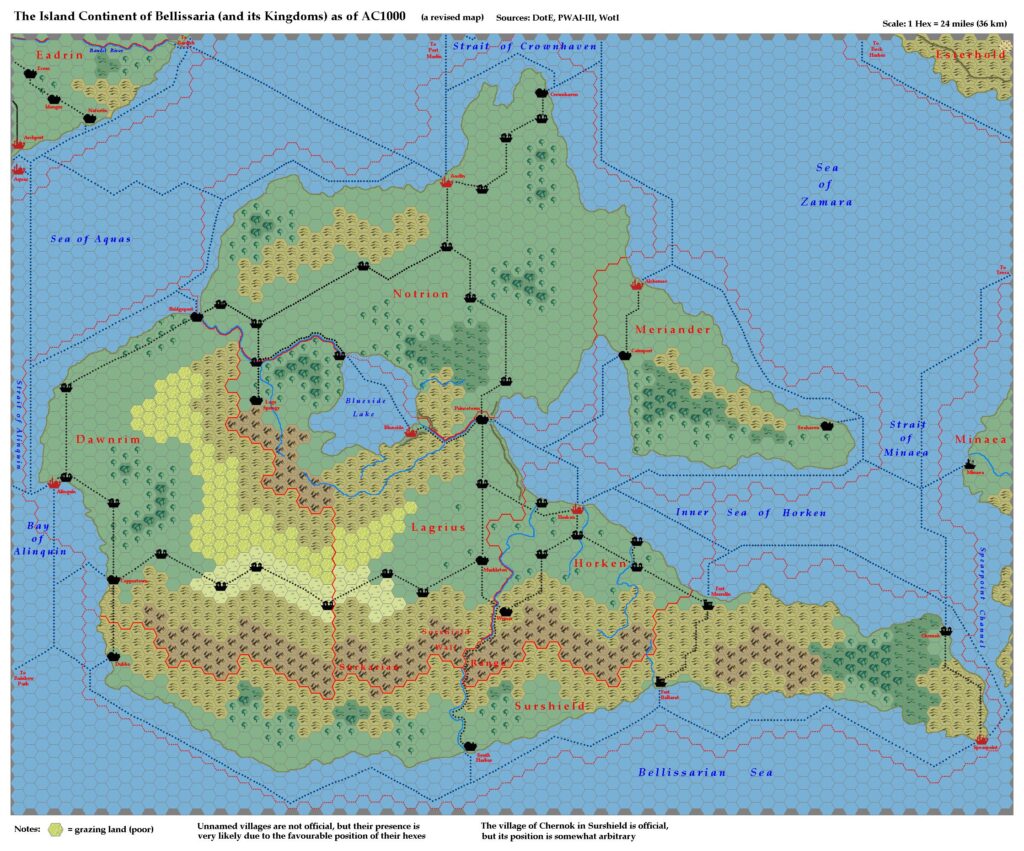
LoZompatore’s Bellissaria, 24 miles per hex
Although a number of cartographers (notably Thibault, Kal, and Mark) had already mapped Bellissaria at this scale, Michele chose to return to the original 72 mile per hex sources and make his own conversion to 24 miles per hex. But he didn’t stop there. Instead, he searched the texts for information to further embellish the terrain. As he posted on the MMB at the time:
The official maps of Bellissaria (DotE, PWAI, PWAIII, WotI) show the island in a very large scale (72 miles/Hex, with the exception of WotI’s map which shows about 1/3 of the island in a 48 miles/Hex scale)
I made a conversion in a 24 miles/Hex in a very simple way, basically by superposing a suitably-scaled hexed grid on the 72-48 miles/hex maps, and then filling the smaller hexes depending on the terrain type on the larger scale maps. The new maps show very large stretches of identical, uniform terrains (especially plains and hills) that I “spiced” up a little by adding every bit of information about Bellissaria I was able to find in DotE and PWAs manuals.
The two main diversions from previous fan-made maps were the poor grazing land in Dawnrim and Lagrius, and the addition of quite a few new villages. The former was designed to illustrate the description of the inner continent in Dawn of the Emperors, while he based the latter purely on logic — such as by placing villages at curves and junctions in the trails.
See the posts for each individual kingdom for a few more details on the additions in those regions.
All in all, Michele did a great job at adding further detail to one of Mystara’s barest hex-mapped regions. He was neither the first nor the last to do this, but his work has been consistently referenced by succeeding cartographers in the years since — including Jose Ignacio Ramos Lomelin in his 8 mile per hex maps of Bellissaria.
Fan-made Map by Michele Carpita (July 2006)
This is an original map created by one of Mystara’s excellent fan cartographers. For more information on the cartographer, including a gallery of all their maps, see also Appendix M: Mappers of Mystara.
Sources
- Dawn of the Emperors (1989) (PDF at DriveThruRPG)
- Wrath of the Immortals (1992) (PDF at DriveThruRPG)
- Poor Wizard’s Almanac (1992)
- Poor Wizard’s Almanac III (1994)
Fan Sources
- Component Maps:
- LoZompatore’s Dawnrim, 24 miles per hex (July 2006)
- LoZompatore’s Horken, 24 miles per hex (July 2006)
- LoZompatore’s Lagrius, 24 miles per hex (July 2006)
- LoZompatore’s Meriander, 24 miles per hex (July 2006)
- LoZompatore’s Notrion, 24 miles per hex (July 2006)
- LoZompatore’s Surshield, 24 miles per hex (July 2006)
- Thoughts about Bellissarian maps discussion thread at the MMB, archived at the Vaults of Pandius (July 2006)
- Thoughts about Bellissarian maps by Michele Carpita at the Vaults of Pandius (July 2006)
References
- All of Michele’s maps at the Atlas of Mystara
- Michele’s entry in Appendix M: Mappers of Mystara (upcoming)
- Michele’s author page at the Vaults of Pandius
Chronological Analysis
This is a fan-made map. It was published in July 2006. The updated Atlas version of this map is not yet available. See also Appendix C for annual chronological snapshots of the area. For the full context of this map in Mystara’s publication history, see the upcoming Let’s Map Mystara 2006.
The following lists are from the Let’s Map Mystara project. Additions are new features, introduced in this map. Revisions are changes to previously-introduced features. Hex Art & Fonts track design elements. Finally, Textual Additions are potential features found in the related text. In most cases, the Atlas adopts these textual additions into updated and chronological maps.
Under Construction! Please check back again soon for updates.
Additions
- XXX —
Revisions
- XXX —
Hex Art & Fonts
- Hex Art —
- Fonts —
")
")
")