
Hollow World Set Hollow World Antarctic Cap
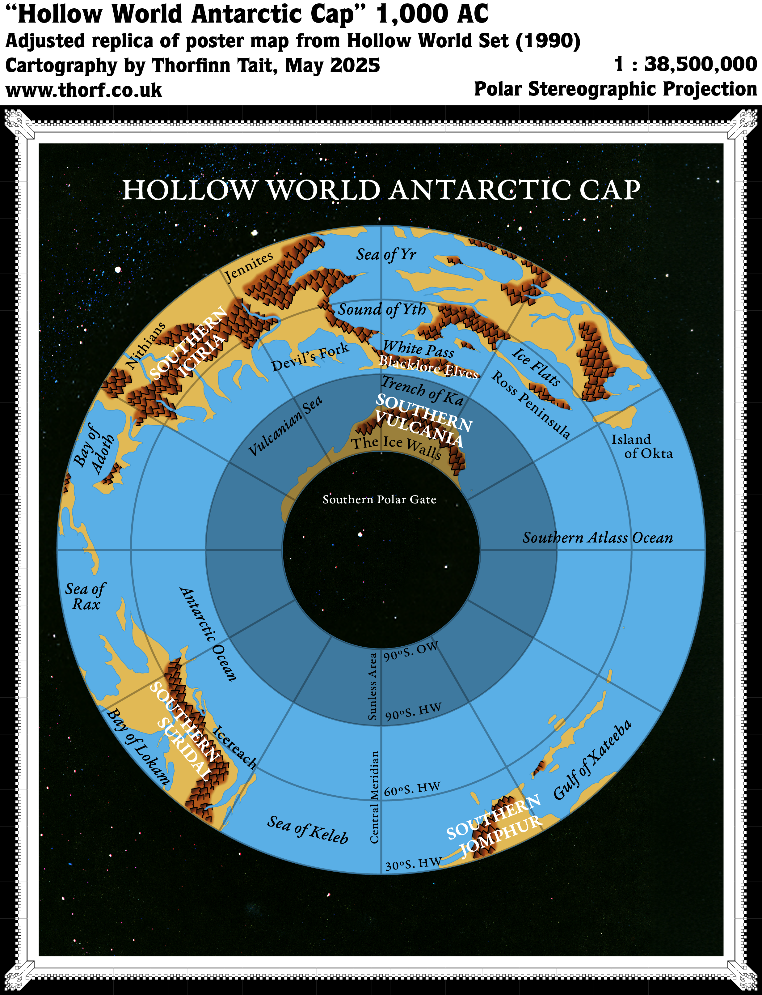
This was the final map showing the Polar Openings in the Hollow World Campaign Set, and the pair of the Outer World Antarctic Cap map. While that map showed the southern polar region from the Outer World, this one showed the Hollow World side.
As with the other polar maps from the Hollow World Set, this map was revolutionary in its portrayal of Mystara’s polar area in a suitable projection for the first time — of course while attempting to show the curved polar opening connecting the worlds.
This map also included a few new labels for areas around the extreme south of the Hollow World.
Replica Map (May 2025)
Sources
- Hollow World Campaign Set (1990) (PDF at DriveThruRPG)
- Poster map 3 (Cartography by David C Sutherland, David S LaForce, Dennis Kauth, Frey Graphics)
References
- New Map: Hollow World Antarctic Cap post at Patreon
Chronological Analysis
This is Map 152. It was published in August 1990. The updated version of this map has not yet been released. See also Appendix C for annual chronological snapshots of the area. For the full context of this map in Mystara’s publication history, see Let’s Map Mystara 1990.
The following lists are from the Let’s Map Mystara project. Additions are new features, introduced in this map. Revisions are changes to previously-introduced features. Hex Art & Fonts track design elements. Finally, Textual Additions are potential features found in the related text. In most cases, the Atlas adopts these textual additions into updated and chronological maps.
Under Construction! Please check back again soon for updates.
Additions
- XXX —
Revisions
- XXX —
Hex Art & Fonts
- Hex Art —
- Fonts —
Textual Additions (Hollow World Set, August 1990)
- XXX —
")
")
")