
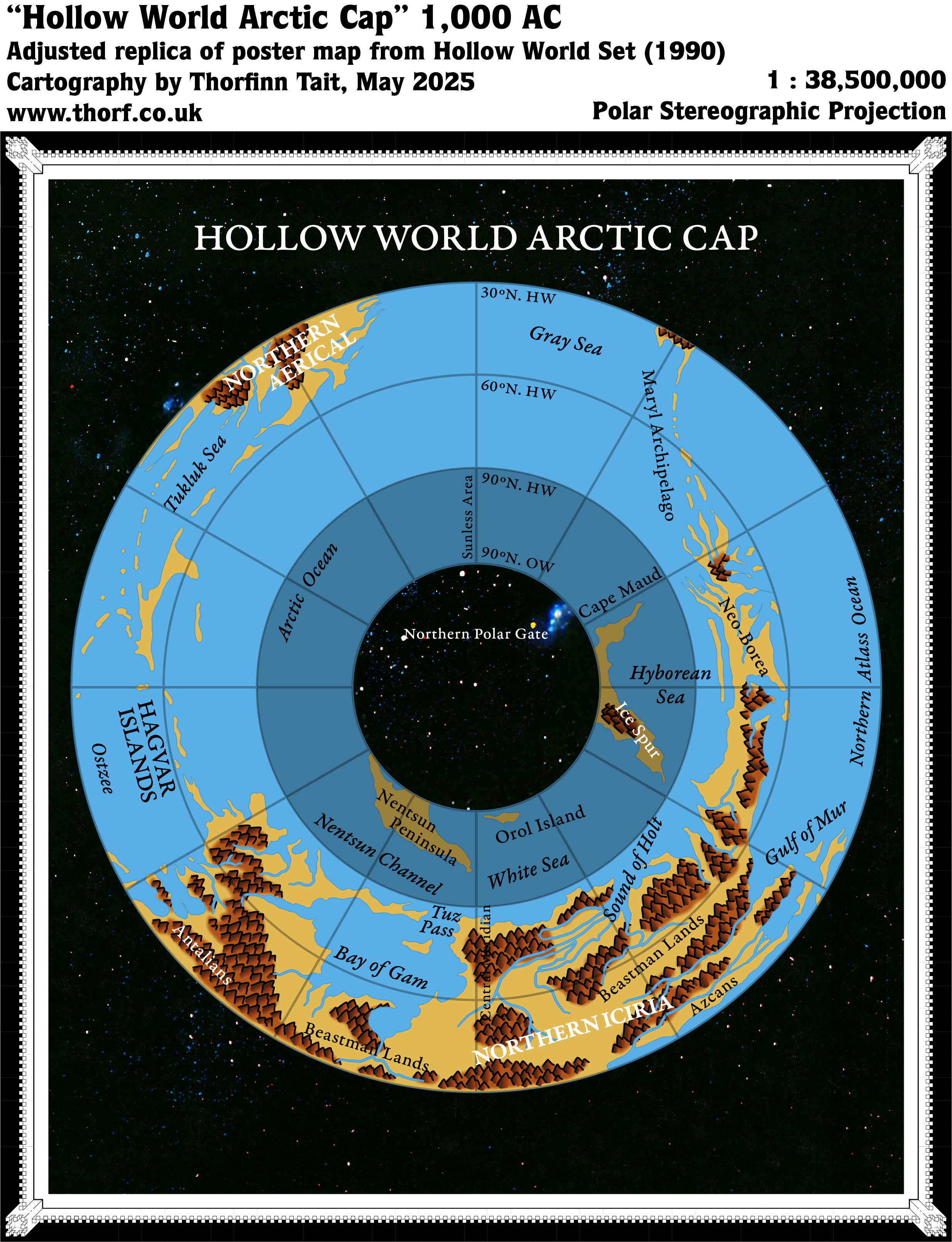
Hollow World Set Hollow World Arctic Cap
The pair of Hollow World Set Outer World Arctic Cap, this map showed the northern polar gate from inside the Hollow World. (See the Outer World map for an overview of this set of maps.)
The Hollow World maps suffered from few of the stretching problems that plagued the Outer World, as they mainly presented the wholly new internal world. That said, the parts of the Outer World shown here were indeed stretched. This map also made clear that the darkened Sunless Area was shared by both maps, with the same bits of land depicted inside it. It’s not quite clear which parts of these maps were intended to be part of the lip of the polar openings, but at the least this darkened area must surely be included as part of it.
Replica Map (May 2025)
Sources
- Hollow World Campaign Set (1990) (PDF at DriveThruRPG)
- Poster map 3 (Cartography by David C Sutherland, David S LaForce, Dennis Kauth, Frey Graphics)
References
- New Map: Hollow World Arctic Cap post at Patreon
Chronological Analysis
This is Map 151. It was published in August 1990. The updated version of this map has not yet been released. See also Appendix C for annual chronological snapshots of the area. For the full context of this map in Mystara’s publication history, see Let’s Map Mystara 1990.
The following lists are from the Let’s Map Mystara project. Additions are new features, introduced in this map. Revisions are changes to previously-introduced features. Hex Art & Fonts track design elements. Finally, Textual Additions are potential features found in the related text. In most cases, the Atlas adopts these textual additions into updated and chronological maps.
Under Construction! Please check back again soon for updates.
Additions
- XXX —
Revisions
- XXX —
Hex Art & Fonts
- Hex Art —
- Fonts —
Textual Additions (Hollow World Set, August 1990)
- XXX —
")
")
")