
Poor Wizard’s Almanac II Alphatia
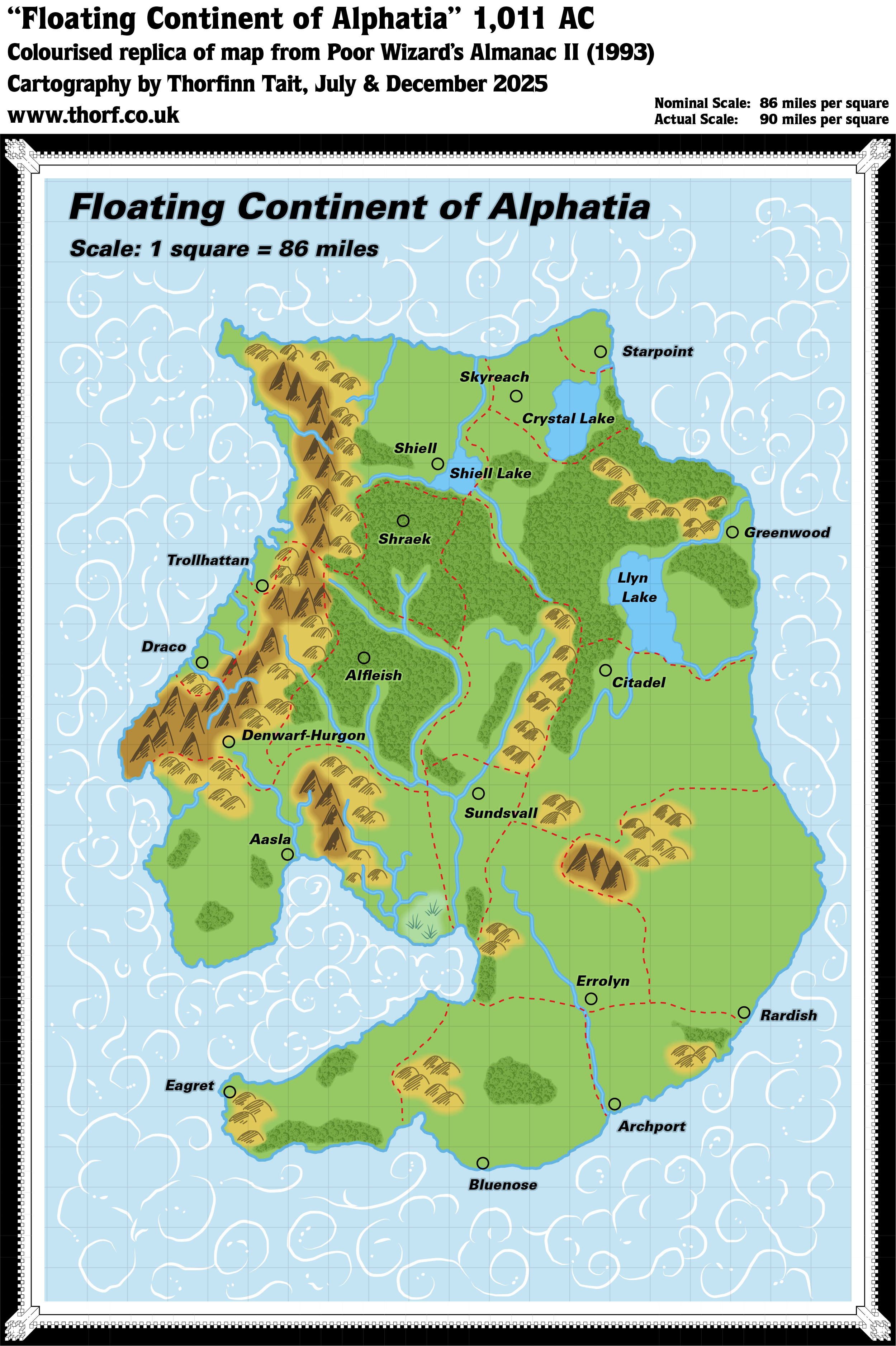
At first glance this map appeared to be a simple reprisal of its predecessor in the first Poor Wizard’s Almanac. Content-wise, it certainly fit that bill; the only meaningful change was the addition of borders dividing the floating continent into provinces.
However, while it’s true that there was nothing really new, a close examination reveals that the whole map was redrawn from scratch. Compare, for example, the coastlines of both maps, and it should quickly become apparent that this map has far more small details. The rivers and forests also line up better, and the artwork for the clouds is entirely redone, and a lot more detailed as well as evocative.
All in all, though the two maps are effectively the same, this map was nonetheless an improvement.
Replica Map (December 2025)
Sources
- Poor Wizard’s Almanac II (1993) (PDF at DriveThruRPG)
- Page 11 map, Cartography by John Knecht and Diesel
Chronological Analysis
This is Map 243. It was published in December 1993. The updated version of this map has not yet been released. See also Appendix C for annual chronological snapshots of the area. For the full context of this map in Mystara’s publication history, see Let’s Map Mystara 1993.
The following lists are from the Let’s Map Mystara project. Additions are new features, introduced in this map. Revisions are changes to previously-introduced features. Hex Art & Fonts track design elements. Finally, Textual Additions are potential features found in the related text. In most cases, the Atlas adopts these textual additions into updated and chronological maps.
Under Construction! Please check back again soon for updates.
Additions
- XXX —
Revisions
- XXX —
Hex Art & Fonts
- Hex Art —
- Fonts —
Textual Additions (Poor Wizard’s Almanac II, December 1993)
- XXX —


