
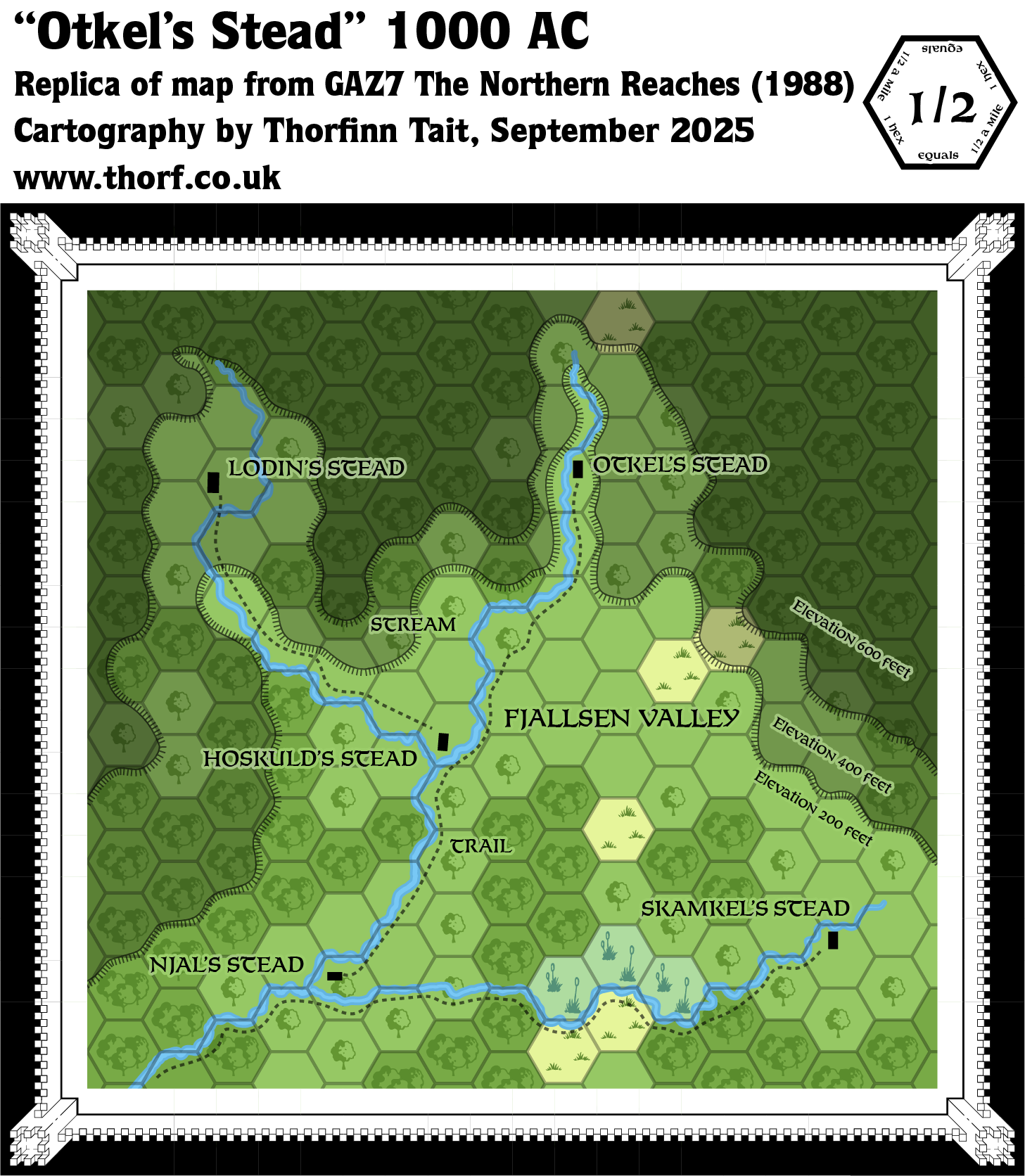
GAZ7 Otkel’s Stead, 0.5 miles per hex
The Defense of Otkel’s Stead was an adventure in GAZ7. It came with this map of the area, known as Fjallsen Valley. With a scale of half a mile per hex, the whole area of the map would roughly fit inside a single 8 mile hex. GAZ7 suggested that the valley could be placed in any of the Northern Reaches, so there was no single fixed location. It went further, saying that it should be “in a borderland domain of the Trollheim hills” in northwest Vestland, or “in a domain bordering the hills of Gnollheim in southeastern Soderfjord”. (There was no particular suggested location for Ostland.)
As usual, I have colourised the map, which was originally printed in shades of sepia.
Replica Map (September 2025)
Sources
- GAZ7 The Northern Reaches (1988) (PDF at DriveThruRPG)
- Inside Cover map, Cartography by Dave Sutherland, Dennis Kauth
References
- New Map: GAZ7 Otkel’s Stead post at Patreon
Chronological Analysis
This is Map 97. It was published in July 1988. The updated version of this map has not yet been released. See also Appendix C for annual chronological snapshots of the area. For the full context of this map in Mystara’s publication history, see Let’s Map Mystara 1988.
The following lists are from the Let’s Map Mystara project. Additions are new features, introduced in this map. Revisions are changes to previously-introduced features. Hex Art & Fonts track design elements. Finally, Textual Additions are potential features found in the related text. In most cases, the Atlas adopts these textual additions into updated and chronological maps.
Under Construction! Please check back again soon for updates.
Additions
- XXX —
Revisions
- XXX —
Hex Art & Fonts
- Hex Art —
- Fonts —
Textual Additions (GAZ7, July 1988)
- XXX —


