
LoZompatore’s Major Known Trade Routes Expanded
Michele’s Major Known Trade Routes map combined all official shipping lanes, roads and trails into a single map. He limited his information to only the maps, resisting expanding the network. With that map as a base, he then carefully extrapolated the whole network out to its logical extents.
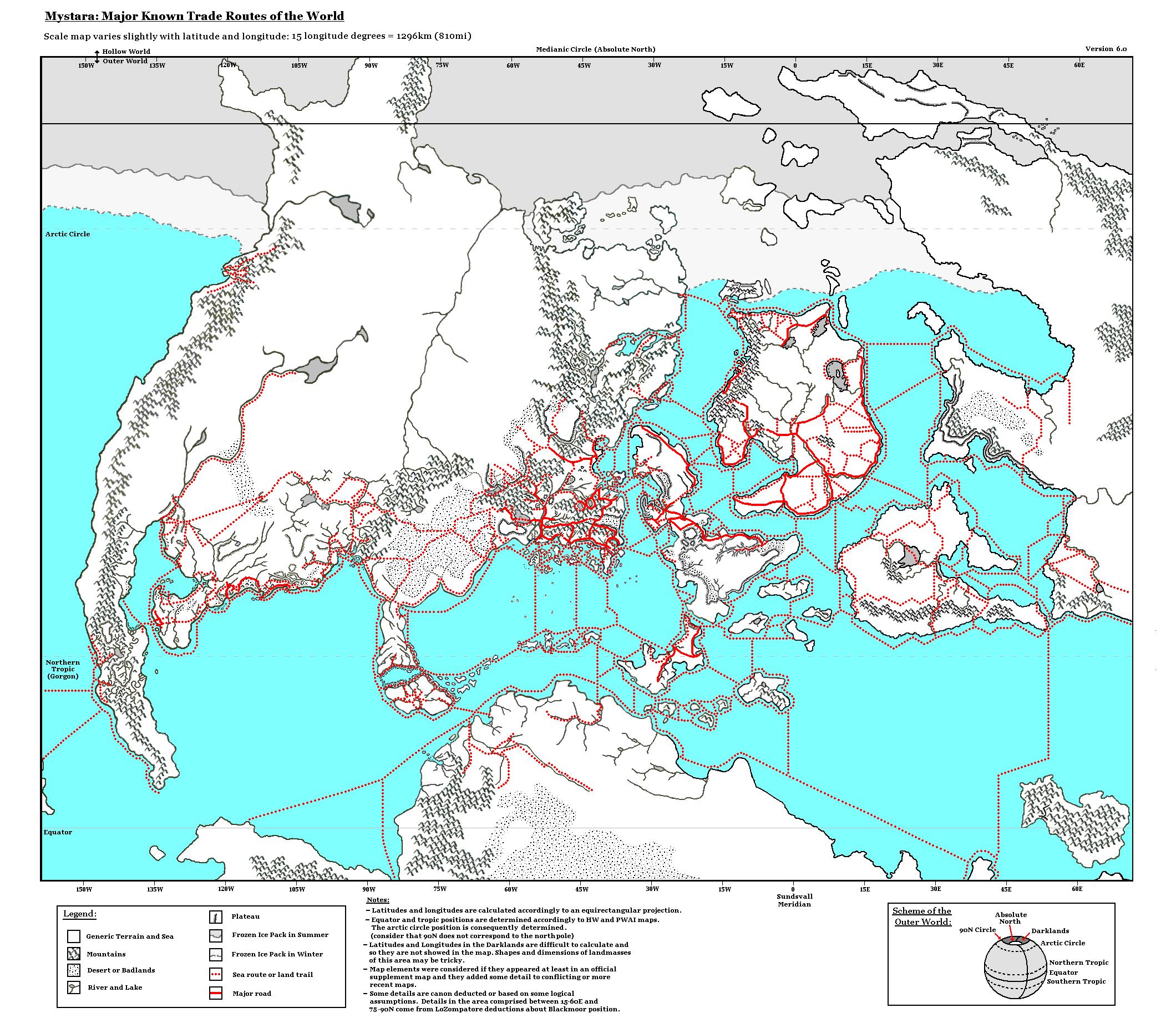
Here’s what he wrote about it in his posts at the MMB and The Piazza at the time:
The second map is a little bit more refined than the map above: among the modifications I made I extended the interrupted sea routes to faraway lands (Cestia, the Jungle Coast and possibly the western coast of Davania and Izonda). I also completed a couple of routes around some of the Alatians and the Pearl Islands.
About land routes I highlighted the paved roads with respect to the unpaved ones and I added some minor contributions stated in canon material (for example a trade route in Esterhold which is not explicitly shown in the maps but is cited in the PWAs, or the trade route along the Yalu river, which is stated in “Tortles of the Purple Sage” adventure).
This second version is, as Michele stated, more refined. In addition to the extra sections added to the routes, it also differentiates between paved (roads) and unpaved (trails).
For more explanation, see Michele’s full comments archived at the Vaults of Pandius.
Fan-made Map by Michele Carpita (May 2008)
This is an original map created by one of Mystara’s excellent fan cartographers. For more information on the cartographer, including a gallery of all their maps, see also Appendix M: Mappers of Mystara.
Sources
- All official maps that show trade routes
Fan Sources
- A general map of the trade network MMB discussion thread archived at the Vaults of Pandius (May 2008)
- A general map of the trade network discussion thread at The Piazza (May 2008)
- A general map of the trade network by Michele Carpita at the Vaults of Pandius (May 2008)
- LoZompatore’s Major Known Trade Routes (May 2008)
References
- All of Michele’s maps at the Atlas of Mystara
- Michele’s entry in Appendix M: Mappers of Mystara (upcoming)
- Michele’s author page at the Vaults of Pandius
Chronological Analysis
This is a fan-made map. It was published in May 2008. The updated Atlas version of this map is not yet available. See also Appendix C for annual chronological snapshots of the area. For the full context of this map in Mystara’s publication history, see the upcoming Let’s Map Mystara 2008.
The following lists are from the Let’s Map Mystara project. Additions are new features, introduced in this map. Revisions are changes to previously-introduced features. Hex Art & Fonts track design elements. Finally, Textual Additions are potential features found in the related text. In most cases, the Atlas adopts these textual additions into updated and chronological maps.
Under Construction! Please check back again soon for updates.
Additions
- XXX —
Revisions
- XXX —
Hex Art & Fonts
- Hex Art —
- Fonts —
")
")
")