
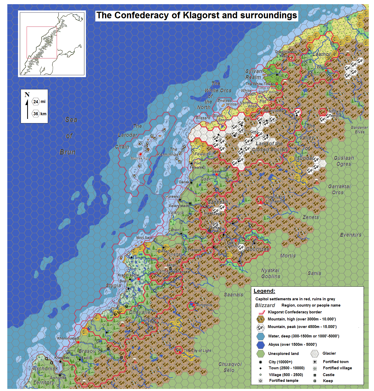
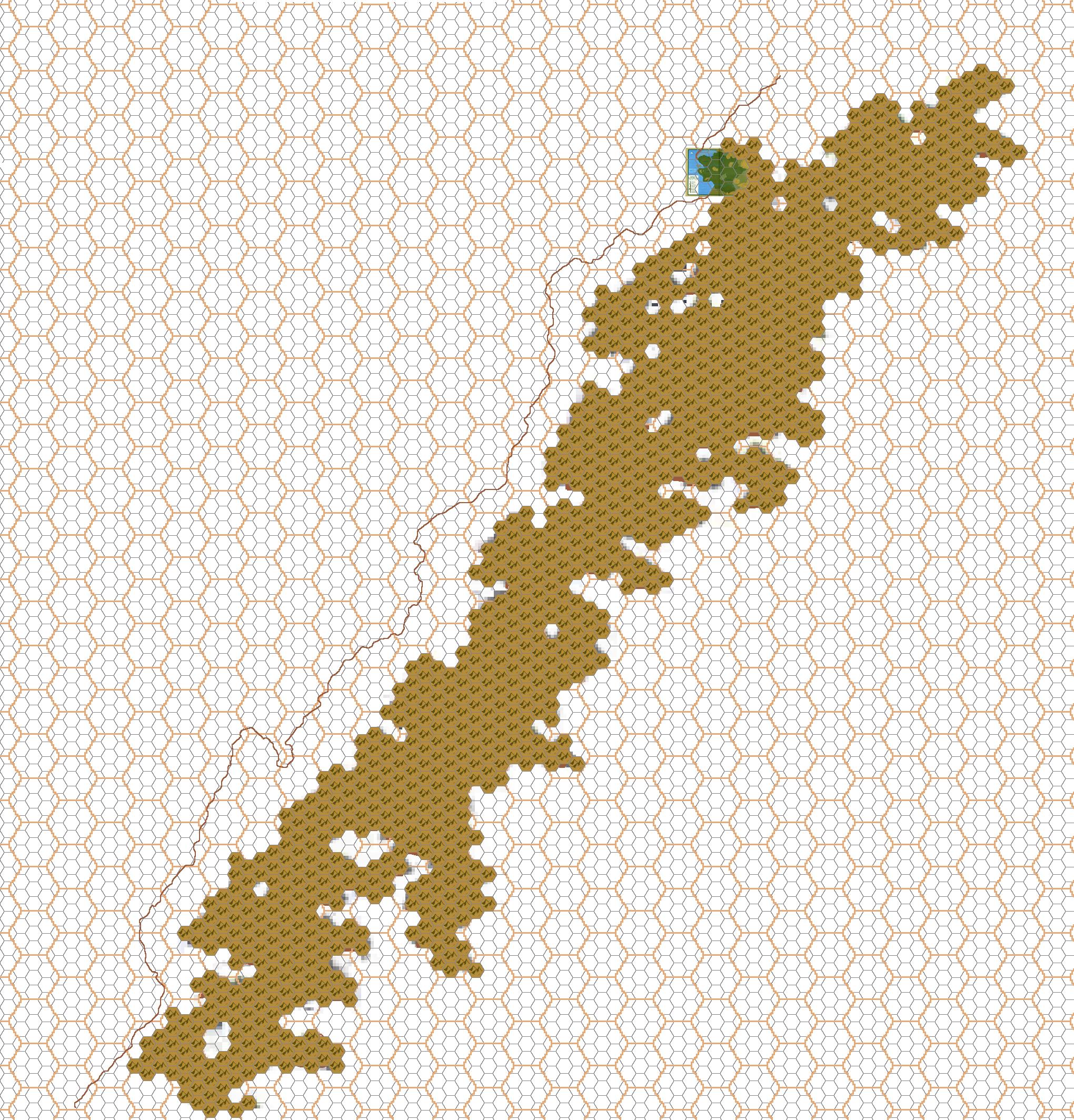
LoZompatore’s Klagorst, 24 miles per hex
Michele had been working on this map since at least October 2008 (based on his earliest remaining drafts), but he released the finished version in October 2010. His thesis for the map was that the work of various Mystaran fans (listed under Fan Sources below) to detail the region deserved far more attention, and he wanted to shine a light on these works through a detailed map of the region.
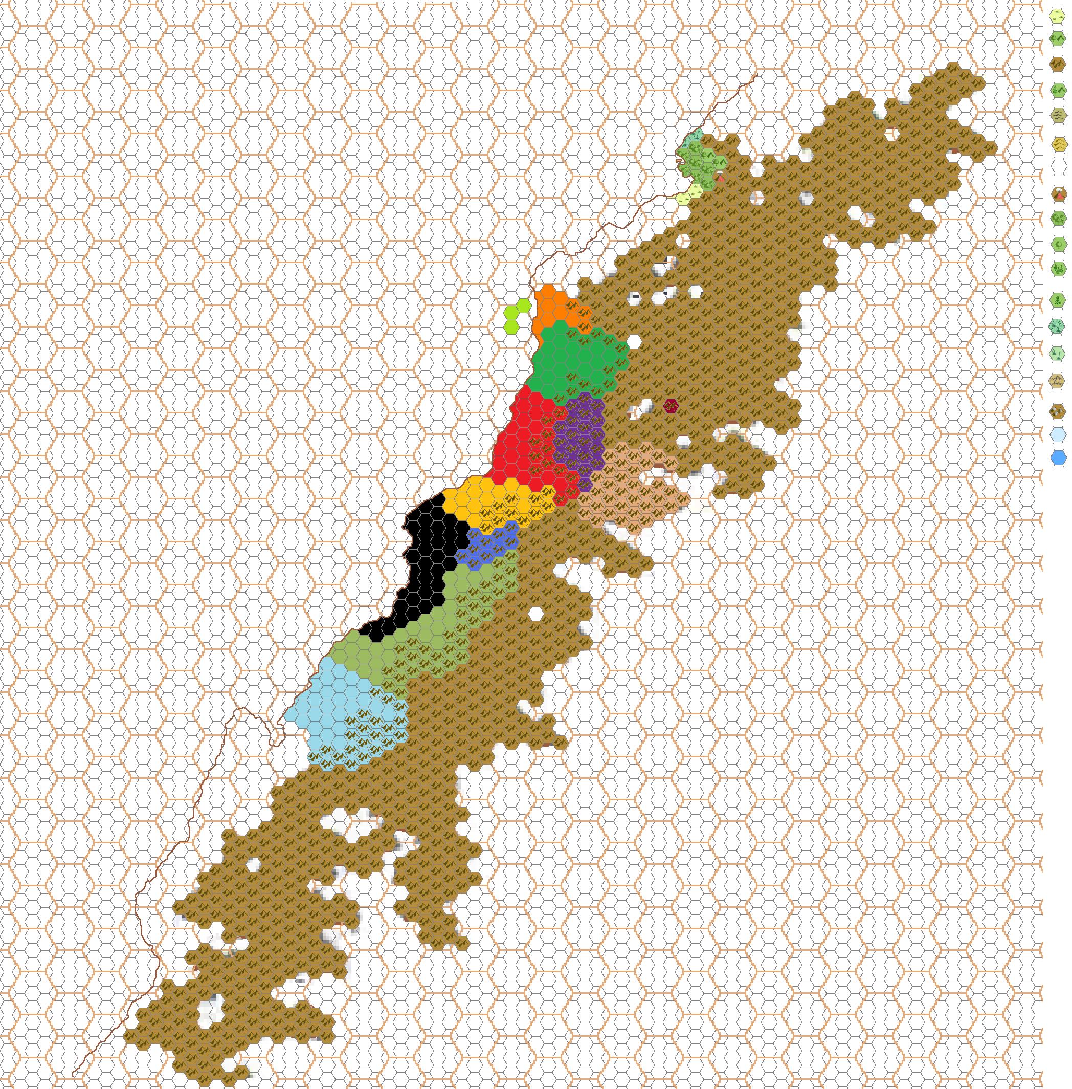
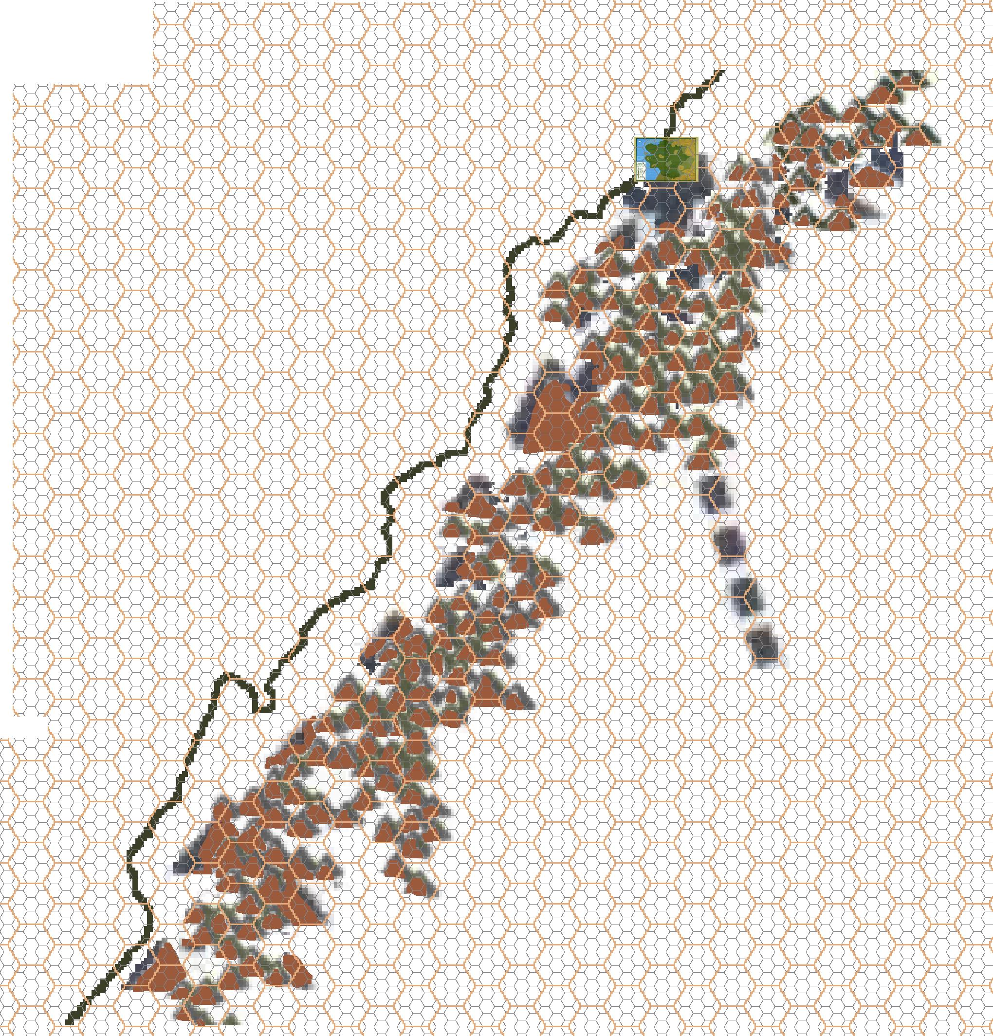
It’s clear that he put a huge amount of work into the creation of the map, and his drafts included workups of mountains based on the continental map; detailing of the terrain; and political divisions using different colours. I have included these drafts below. They date to July 2009 and October 2008.
As always, Michele provided extensive details in his article, which you can find at the Vaults of Pandius.
Fan-made Map by Michele Carpita (October 2010)
Draft Fan-made Maps by Michele Carpita (July 2009)
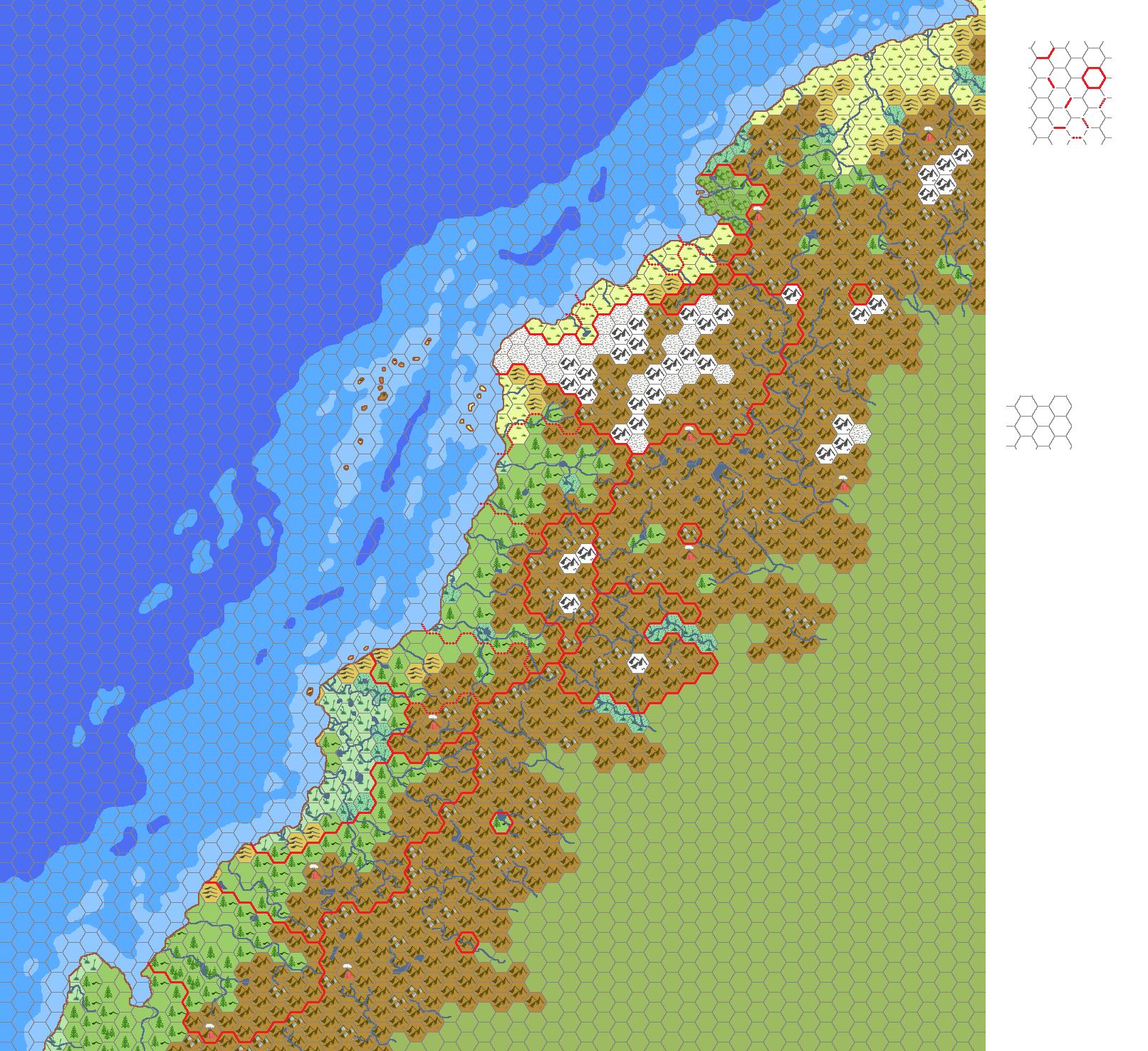
Draft Fan-made Maps by Michele Carpita (October 2008)
This is an original map created by one of Mystara’s excellent fan cartographers. For more information on the cartographer, including a gallery of all their maps, see also Appendix M: Mappers of Mystara.
Sources
- Companion Rules Set (1984) (PDF at DriveThruRPG)
Fan Sources
- The works of Giulio Caroletti, Thibault Sarlat, Adrian Mathias, Christian Constantin, Geoff Gander and Morten Greis
- Klagorst and surroundings: a mini atlas discussion thread at The Piazza (October 2010)
- Klagorst and surroundings: a mini atlas by Michele Carpita at the Vaults of Pandius October 2010)
References
- All of Michele’s maps at the Atlas of Mystara
- Michele’s entry in Appendix M: Mappers of Mystara (upcoming)
- Michele’s author page at the Vaults of Pandius
Chronological Analysis
This is a fan-made map. It was published in October 2010. The updated Atlas version of this map is not yet available. See also Appendix C for annual chronological snapshots of the area. For the full context of this map in Mystara’s publication history, see the upcoming Let’s Map Mystara 2010.
The following lists are from the Let’s Map Mystara project. Additions are new features, introduced in this map. Revisions are changes to previously-introduced features. Hex Art & Fonts track design elements. Finally, Textual Additions are potential features found in the related text. In most cases, the Atlas adopts these textual additions into updated and chronological maps.
Under Construction! Please check back again soon for updates.
Additions
- XXX —
Revisions
- XXX —
Hex Art & Fonts
- Hex Art —
- Fonts —
")
")
")