, November 2010")
LoZompatore’s Northwestern Platea, 8 miles per hex
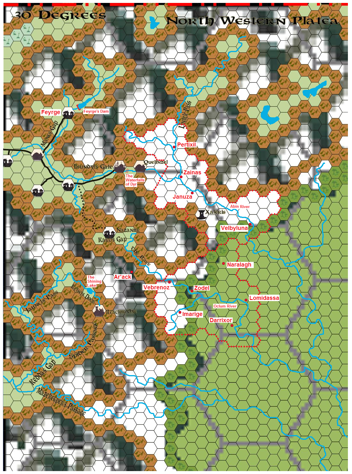
After Michele introduced his Platea project and solicited community contributions, Sean Meaney posted a number of work-in-progress Platea maps at the 8 mile per hex scale. Michele then modified one of Sean’s maps, resulting in the map below. He posted two different versions, of which the latest is below, followed by an earlier version; both maps are very similar.
Unfortunately I have been unable to find a completed version of this map, although it looks as if most of the empty gaps in the mountains could be filled in with mountain hexes. It’s also interesting to see how Sean used the mountain art to establish valleys in the mountains.
Fan-made Map by Michele Carpita (November 2010)

(modified from a map by Sean Meaney), November 2010
Fan-made Map by Michele Carpita (November 2010)
(modified from a map by Sean Meaney), November 2010
This is an original map created by one of Mystara’s excellent fan cartographers. For more information on the cartographer, including a gallery of all their maps, see also Appendix M: Mappers of Mystara.
Sources
- Hollow World Campaign Set (1990) (PDF at DriveThruRPG)
- Outer World Planetary Map
Fan Sources
- Platea: a challenge to the community discussion thread at The Piazza (October 2010)
- Introduction to Platea by Michele Carpita at the Vaults of Pandius (October 2010)
- LoZompatore’s Platea, 72 miles per hex (October 2010)
- Northwestern Platea by Michele Carpita at the Vaults of Pandius (November 2010)
References
- All of Michele’s maps at the Atlas of Mystara
- Michele’s entry in Appendix M: Mappers of Mystara (upcoming)
- Michele’s author page at the Vaults of Pandius
Chronological Analysis
This is a fan-made map. It was published in November 2010. The updated Atlas version of this map is not yet available. See also Appendix C for annual chronological snapshots of the area. For the full context of this map in Mystara’s publication history, see the upcoming Let’s Map Mystara 2010.
The following lists are from the Let’s Map Mystara project. Additions are new features, introduced in this map. Revisions are changes to previously-introduced features. Hex Art & Fonts track design elements. Finally, Textual Additions are potential features found in the related text. In most cases, the Atlas adopts these textual additions into updated and chronological maps.
Under Construction! Please check back again soon for updates.
Additions
- XXX —
Revisions
- XXX —
Hex Art & Fonts
- Hex Art —
- Fonts —
")
")
")