
LoZompatore’s Outer World with Graticule
A year after posting his survey of official Latitude Issues, Michele posted his own then-view of the world’s configuration. This was part of a fun thread at The Piazza aimed at developing out of the way places in Mystara. It sounds similar to his Platea project, though the scale is far smaller.
For the map, he used the Master Set world map, but reconfigured to more closely match the Hollow World Set map, with Zyxl and the tip of the Tangor Peninsula shifted to the far western edge of the map. He then tackled the lack of a graticule (a grid of latitude and longitude lines) by adapting the Hollow World Set’s configuration to the Master Set map. It’s a very reasonable approach, and I myself posted something similar around this time. It reflected our understanding at the time, although we now know it to be misguided in light of the hidden projection of the Master Set map. (For more on this topic, see Proto-Mystara and Lining Up Mystara Revisited.)
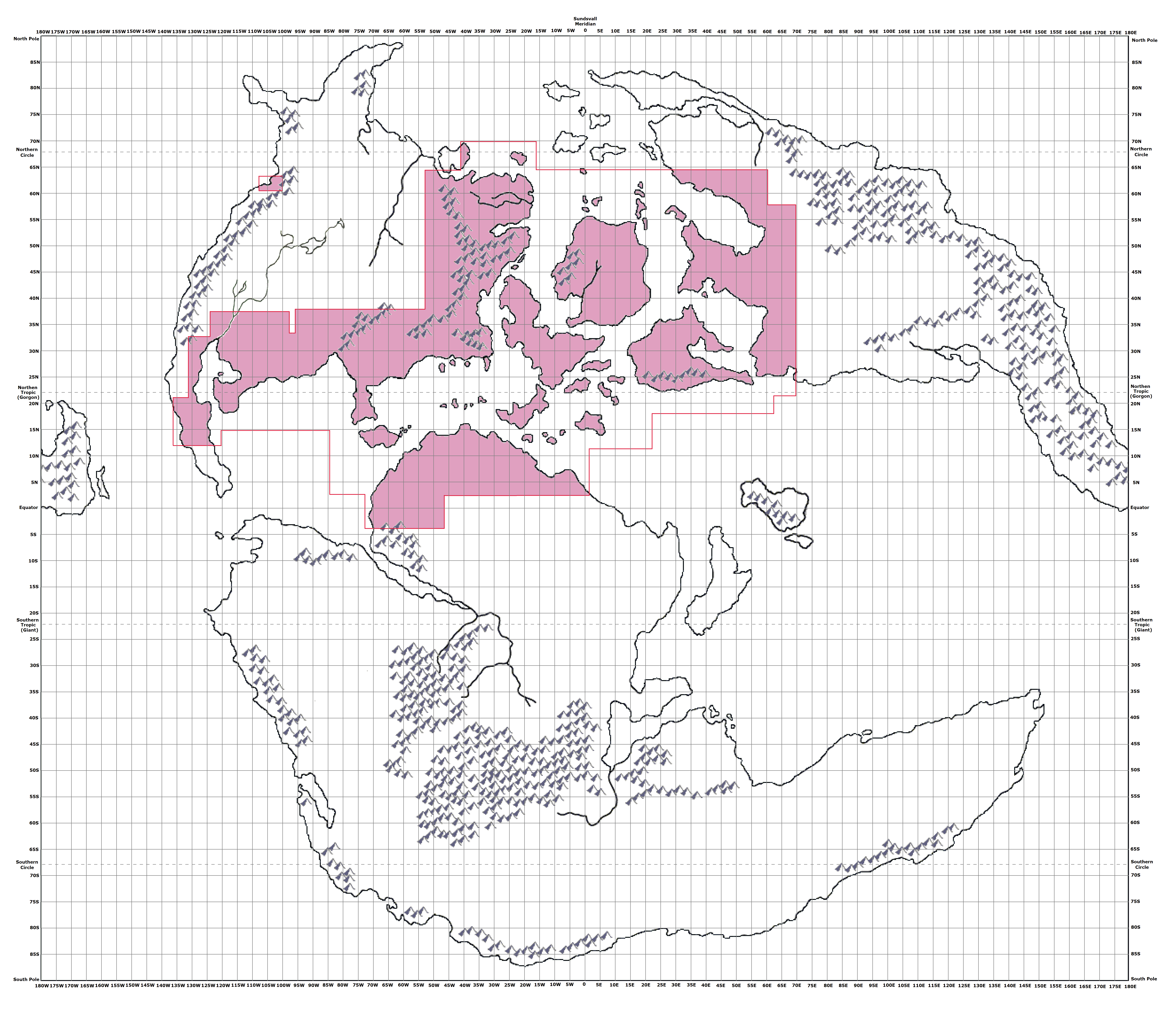
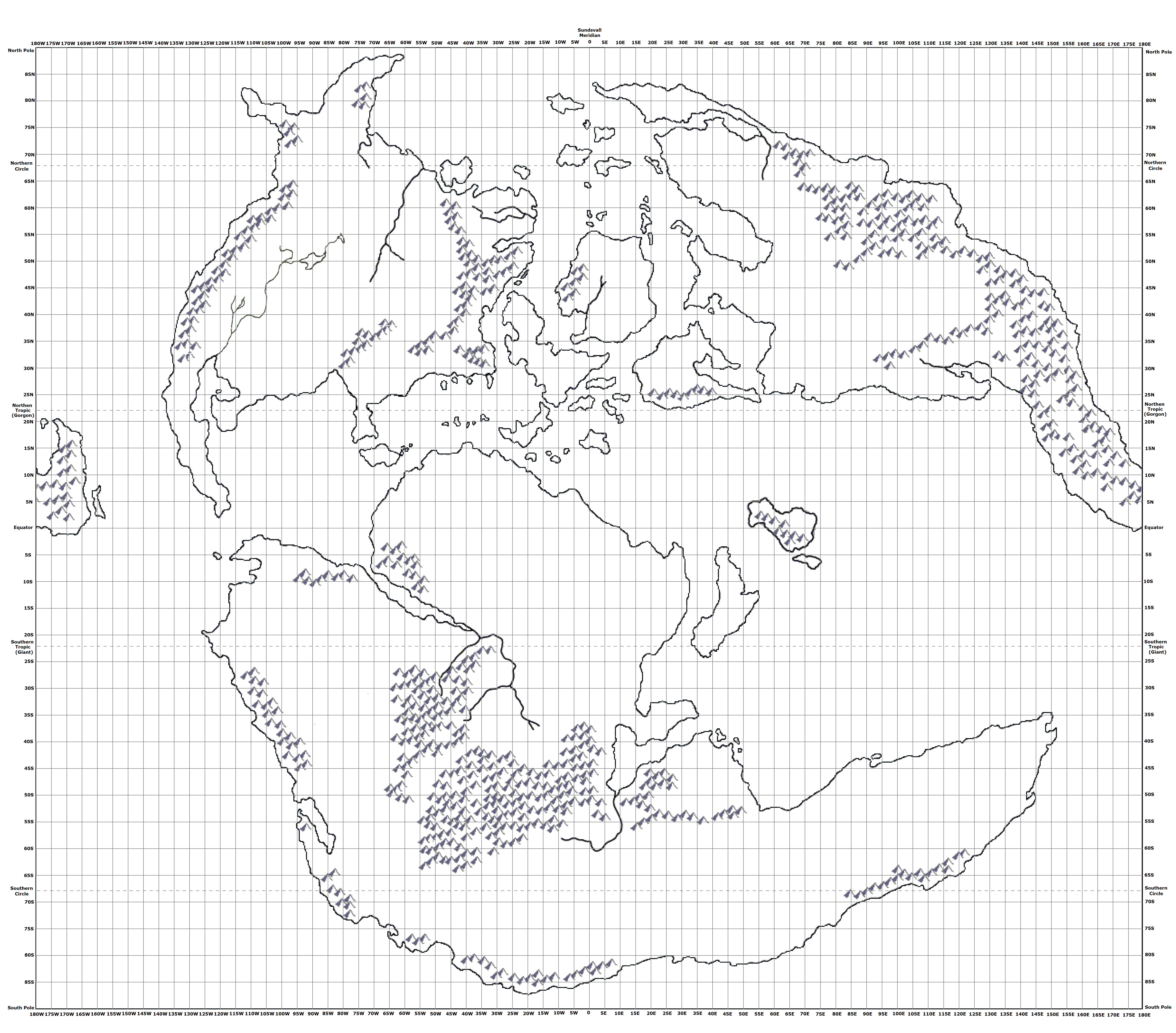
Michele also included an overlay showing all of the officially mapped areas, which should look familiar from his Mystara Icosahedral, 72 miles per hex maps. Finally, he produced a blank version without the overlay. Both appear below.
Fan-made Map by Michele Carpita (April 2013)
Fan-made Map by Michele Carpita (April 2013)
This is an original map created by one of Mystara’s excellent fan cartographers. For more information on the cartographer, including a gallery of all their maps, see also Appendix M: Mappers of Mystara.
Sources
- Master Rules Set (1985) (PDF at DriveThruRPG)
- Hollow World Campaign Set (1990) (PDF at DriveThruRPG)
- Outer World Planetary Map
Fan Sources
- LoZompatore’s Mystara Icosahedral, 72 miles per hex (August 2008)
- LoZompatore’s Latitude Issue (April 2012)
- Creative contest: faraway place on Mystara discussion thread at The Piazza (April 2013)
References
- All of Michele’s maps at the Atlas of Mystara
- Michele’s entry in Appendix M: Mappers of Mystara (upcoming)
- Michele’s author page at the Vaults of Pandius
Chronological Analysis
This is a fan-made map. It was published in April 2013. The updated Atlas version of this map is not yet available. See also Appendix C for annual chronological snapshots of the area. For the full context of this map in Mystara’s publication history, see the upcoming Let’s Map Mystara 2013.
The following lists are from the Let’s Map Mystara project. Additions are new features, introduced in this map. Revisions are changes to previously-introduced features. Hex Art & Fonts track design elements. Finally, Textual Additions are potential features found in the related text. In most cases, the Atlas adopts these textual additions into updated and chronological maps.
Under Construction! Please check back again soon for updates.
Additions
- XXX —
Revisions
- XXX —
Hex Art & Fonts
- Hex Art —
- Fonts —
")
")
")