 by Michele Carpita, March 2014")
LoZompatore’s Milenian Empire 1000 BC to 0 AC
Michele posted this map to illustrate his research on Milenia as presented in an extensive post in Christian Constantin’s thread at The Piazza. At that time, Christian was active in the community again for a short time, and working on Davania.
This map was very much a work-in-progress: Michele described it as “a no-names, no-legend, multi layered map with all layers shown in the same picture”. He also noted that it was “90% fanon”, and still in the process of attempting to reconcile the myriad sources. His post did however include a Legend, which I have reproduced below.
Michele’s work was an attempt to bring order to the chaos that had accumulated in twenty years of official and fan designs for the otherwise sparsely-detailed region. In this, previously Håvard had produced a useful map of the Milenian Empire, and of course Christian Constantin was working on his own Northerneastern Davania at the time Michele posted.
See Michele’s article for a much more extensive list of relevant sources.
Fan-made Map by Michele Carpita (March 2014)
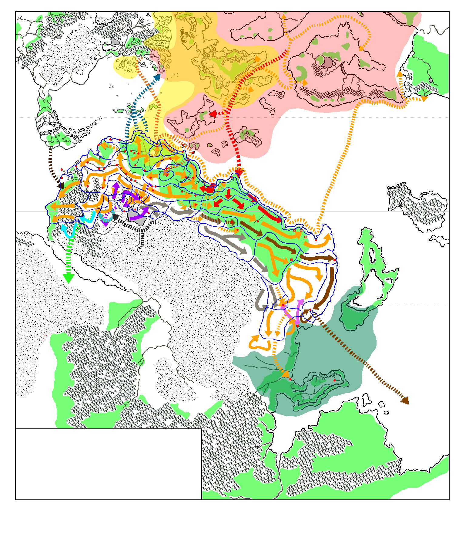
This is an original map created by one of Mystara’s excellent fan cartographers. For more information on the cartographer, including a gallery of all their maps, see also Appendix M: Mappers of Mystara.
Work in progress map: This map is incomplete. It appears here in the most recent state available, but it may be missing certain elements.
Map Legend by Michele Carpita (March 2014)
Continuous lines: military campaign
Dotted lines: non-military campaign: colonization, migration, trade
Yellow: Milenian
Pale grey: Pardasta/Fast Runners
Dark grey: Simbasta
Brown: Snartans
Red: Yasuko
Pink: Vanya’s Armies
Pale blue: Amazons incorporated into the Milenian Empire
Green: Brasol Amazons
Purple: Amossens (barbarians)
Black: Menami/Mezami
Yellow shaded area: Nithian sphere of influence in the 1000 BC – 0 BC timeframe (modified over time)
Pale red shaded area: Alphatian sphere of influence in the 1000 BC – 0 BC timeframe (modified over time)
Dark green shaded area: Varellyan sphere of influence in the 1000 BC – 0 BC timeframe
Sources
Fan Sources
- Re: Illustrated Timeline of “Arykkia,” Sub-Continent of Dava discussion thread at The Piazza (March 2014)
- Extent and expansion phases of the Milenian Empire by Michele Carpita at the Vaults of Pandius (March 2014)
References
- All of Michele’s maps at the Atlas of Mystara
- Michele’s entry in Appendix M: Mappers of Mystara (upcoming)
- Michele’s author page at the Vaults of Pandius
Chronological Analysis
This is a fan-made map. It was published in March 2014. The updated Atlas version of this map is not yet available. See also Appendix C for annual chronological snapshots of the area. For the full context of this map in Mystara’s publication history, see the upcoming Let’s Map Mystara 2014.
The following lists are from the Let’s Map Mystara project. Additions are new features, introduced in this map. Revisions are changes to previously-introduced features. Hex Art & Fonts track design elements. Finally, Textual Additions are potential features found in the related text. In most cases, the Atlas adopts these textual additions into updated and chronological maps.
Under Construction! Please check back again soon for updates.
Additions
- XXX —
Revisions
- XXX —
Hex Art & Fonts
- Hex Art —
- Fonts —
")
")
")