
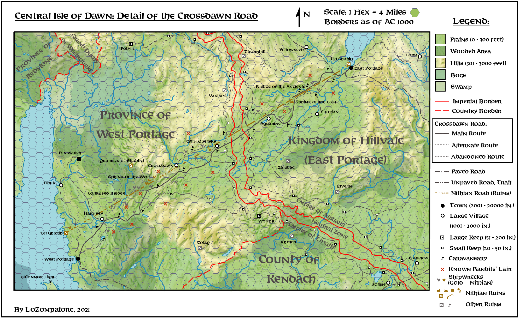
LoZompatore’s Crossdawn Road, 4 miles per hex
Michele created this wonderful topographic map of the Isle of Dawn’s Crossdawn Road in August 2021. He was drawn to the area because it’s a setting that is ripe for adventures, as he explained in the article accompanying the map, which provides lots of information for the map’s locations.
The style of the map was itself rather interesting, as Michele incorporated detailed hill shading in a way that had previously been virtually unknown in Mystara’s maps. He explained his technique as overlaying a real world topographic map that roughly fit the area, then arranging and rotating it to match the desired terrain — in this case based on Francesco Defferrari’s old Central Isle of Dawn map. I have included the snapshot of this process second below.
The end result is rather impressive, and a wonderful step forward for Mystaran cartography.
Michele chose the scale as a compromise between his desire to show a lot of detail and the need to display the whole road from West Portage to East Portage in a single map. 4 miles per hex is not a particularly common scale, with the main official example being GAZ6’s Darokin Tunnel map. Since Michele’s map didn’t use hex symbols, he was able to fit in more detail by using small iconography and labels.
Fan-made Maps by Michele Carpita (August 2021)
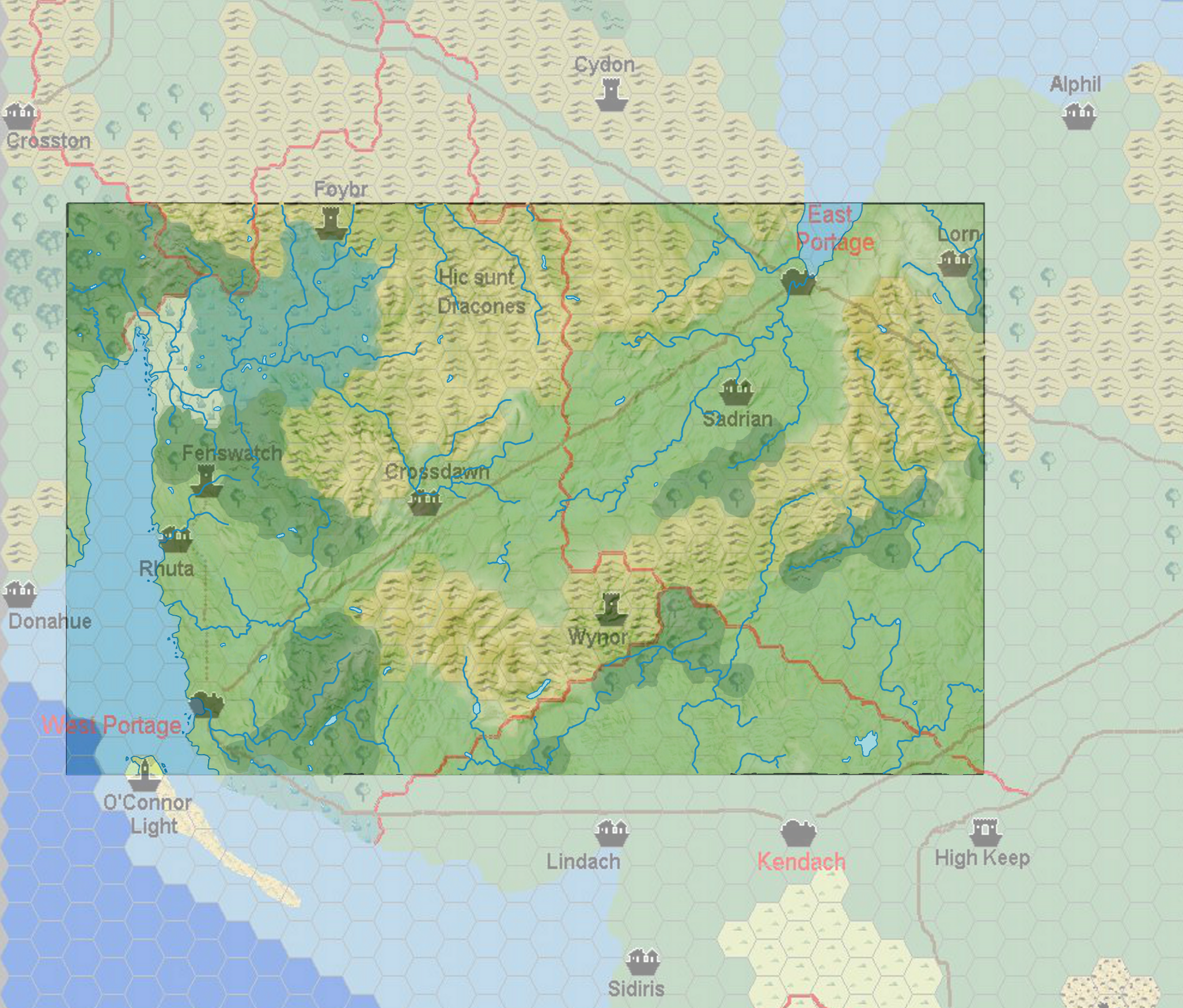
comprising Francesco Defferrari’s Isle of Dawn Central, 8 miles per hex, April 2003,
overlaid with a topographic map of Wales
This is an original map created by one of Mystara’s excellent fan cartographers. For more information on the cartographer, including a gallery of all their maps, see also Appendix M: Mappers of Mystara.
Sources
- Various (see Michele’s article)
Fan Sources
- Sturm’s Isle of Dawn Central, 8 miles per hex (April 2003)
- Adding details to the Crossdawn Road, East Portage and West Portage discussion thread at The Piazza (August 2021)
- Adding details to the Crossdawn Road, East Portage and West Portage by Michele Carpita at the Vaults of Pandius (August 2021)
References
- All of Michele’s maps at the Atlas of Mystara
- Michele’s entry in Appendix M: Mappers of Mystara (upcoming)
- Michele’s author page at the Vaults of Pandius
Chronological Analysis
This is a fan-made map. It was published in August 2021. The updated Atlas version of this map is not yet available. See also Appendix C for annual chronological snapshots of the area. For the full context of this map in Mystara’s publication history, see the upcoming Let’s Map Mystara 2021.
The following lists are from the Let’s Map Mystara project. Additions are new features, introduced in this map. Revisions are changes to previously-introduced features. Hex Art & Fonts track design elements. Finally, Textual Additions are potential features found in the related text. In most cases, the Atlas adopts these textual additions into updated and chronological maps.
Under Construction! Please check back again soon for updates.
Additions
- XXX —
Revisions
- XXX —
Hex Art & Fonts
- Hex Art —
- Fonts —
")
")
")