
LoZompatore’s Known World 3000-2500 BC
In November 2006, Michele posted a series of ten maps to the Italian Mystara Message Board. The sequence told the physical history of the Known World over the past four thousand years. He explained to me as follows:
It is a set of maps aimed at showing all major terrain changes in the Known World area since the Great Rain of Fire. Grey shading represents ice/frozen lands while green shading represents woods/forests.
This was the first map in the sequence, showing the state of the area immediately after the Great Rain of Fire. As the map shows, the area was slowly emerging from beneath an ice cap.
Fan-made Map by Michele Carpita (November 2006)
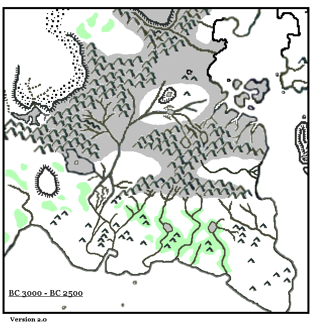
This is an original map created by one of Mystara’s excellent fan cartographers. For more information on the cartographer, including a gallery of all their maps, see also Appendix M: Mappers of Mystara.
Sources
- CM1 Test of the Warlords (1984) (PDF at DriveThruRPG)
- Master Rules Set (1985) (PDF at DriveThruRPG)
Fan Sources
References
- All of Michele’s maps at the Atlas of Mystara
- Michele’s entry in Appendix M: Mappers of Mystara (upcoming)
- Michele’s author page at the Vaults of Pandius
Chronological Analysis
This is a fan-made map. It was published in November 2006. The updated Atlas version of this map is not yet available. See also Appendix C for annual chronological snapshots of the area. For the full context of this map in Mystara’s publication history, see the upcoming Let’s Map Mystara 2006.
The following lists are from the Let’s Map Mystara project. Additions are new features, introduced in this map. Revisions are changes to previously-introduced features. Hex Art & Fonts track design elements. Finally, Textual Additions are potential features found in the related text. In most cases, the Atlas adopts these textual additions into updated and chronological maps.
Under Construction! Please check back again soon for updates.
Additions
- XXX —
Revisions
- XXX —
Hex Art & Fonts
- Hex Art —
- Fonts —
")
")
")