
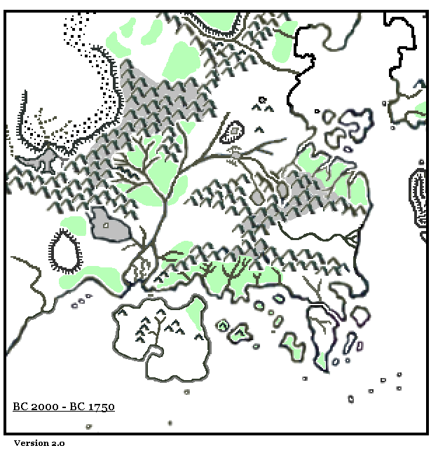
LoZompatore’s Known World 2000-1750 BC
The third in Michele’s sequence of Known World historical maps brought the lands up to the beginning of a new period of catastrophe, with volcanic activity decimating the southern coast. It was in the process of splitting off from the mainland, but with more upheavals still to come. During this time, early in the second millennium BC, the ice sheets had completely receded into the mountains, and the uncovered lands were flourishing with new growth.
Fan-made Map by Michele Carpita (November 2006)
This is an original map created by one of Mystara’s excellent fan cartographers. For more information on the cartographer, including a gallery of all their maps, see also Appendix M: Mappers of Mystara.
Sources
- CM1 Test of the Warlords (1984) (PDF at DriveThruRPG)
- Master Rules Set (1985) (PDF at DriveThruRPG)
Fan Sources
References
- All of Michele’s maps at the Atlas of Mystara
- Michele’s entry in Appendix M: Mappers of Mystara (upcoming)
- Michele’s author page at the Vaults of Pandius
Chronological Analysis
This is a fan-made map. It was published in November 2006. The updated Atlas version of this map is not yet available. See also Appendix C for annual chronological snapshots of the area. For the full context of this map in Mystara’s publication history, see the upcoming Let’s Map Mystara 2006.
The following lists are from the Let’s Map Mystara project. Additions are new features, introduced in this map. Revisions are changes to previously-introduced features. Hex Art & Fonts track design elements. Finally, Textual Additions are potential features found in the related text. In most cases, the Atlas adopts these textual additions into updated and chronological maps.
Under Construction! Please check back again soon for updates.
Additions
- XXX —
Revisions
- XXX —
Hex Art & Fonts
- Hex Art —
- Fonts —
")
")
")