")
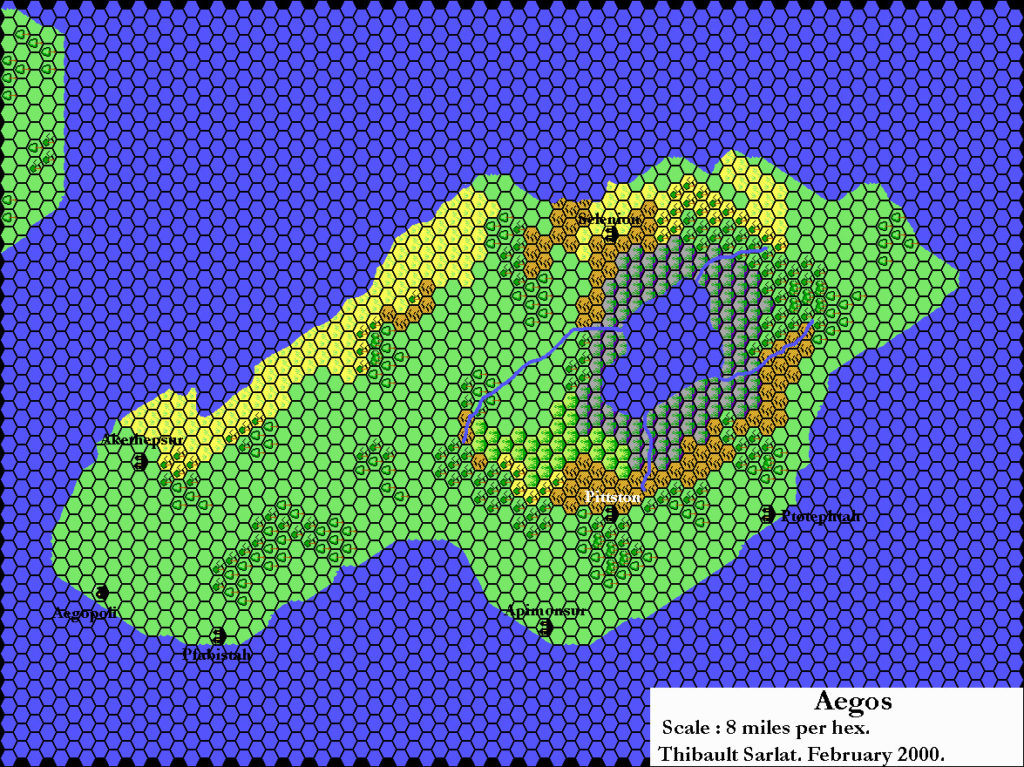
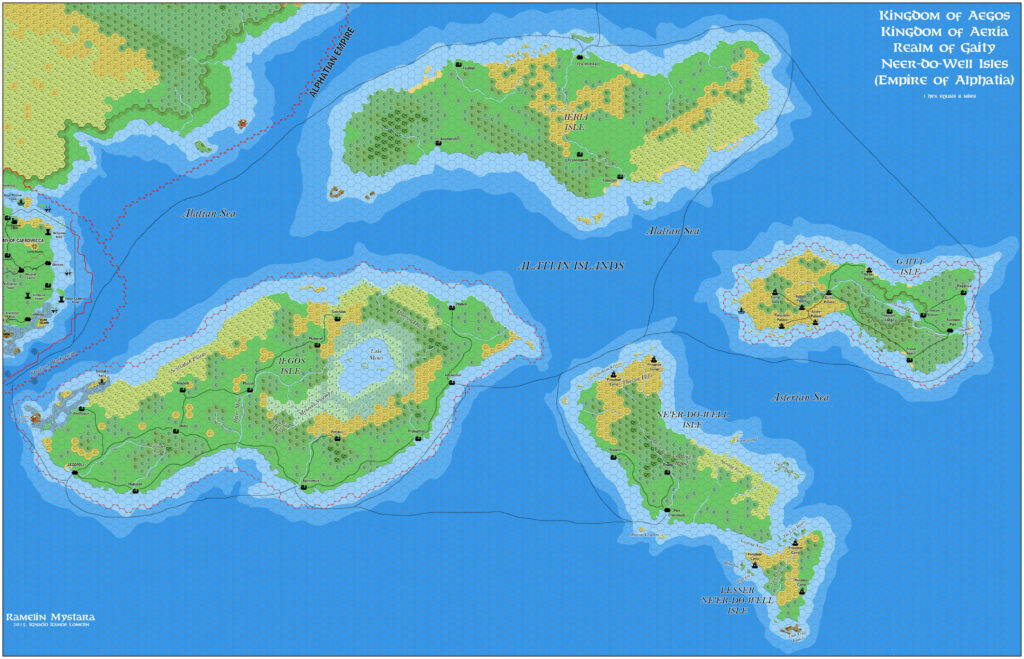
Ramelin’s Alatian Islands, 8 miles per hex v1
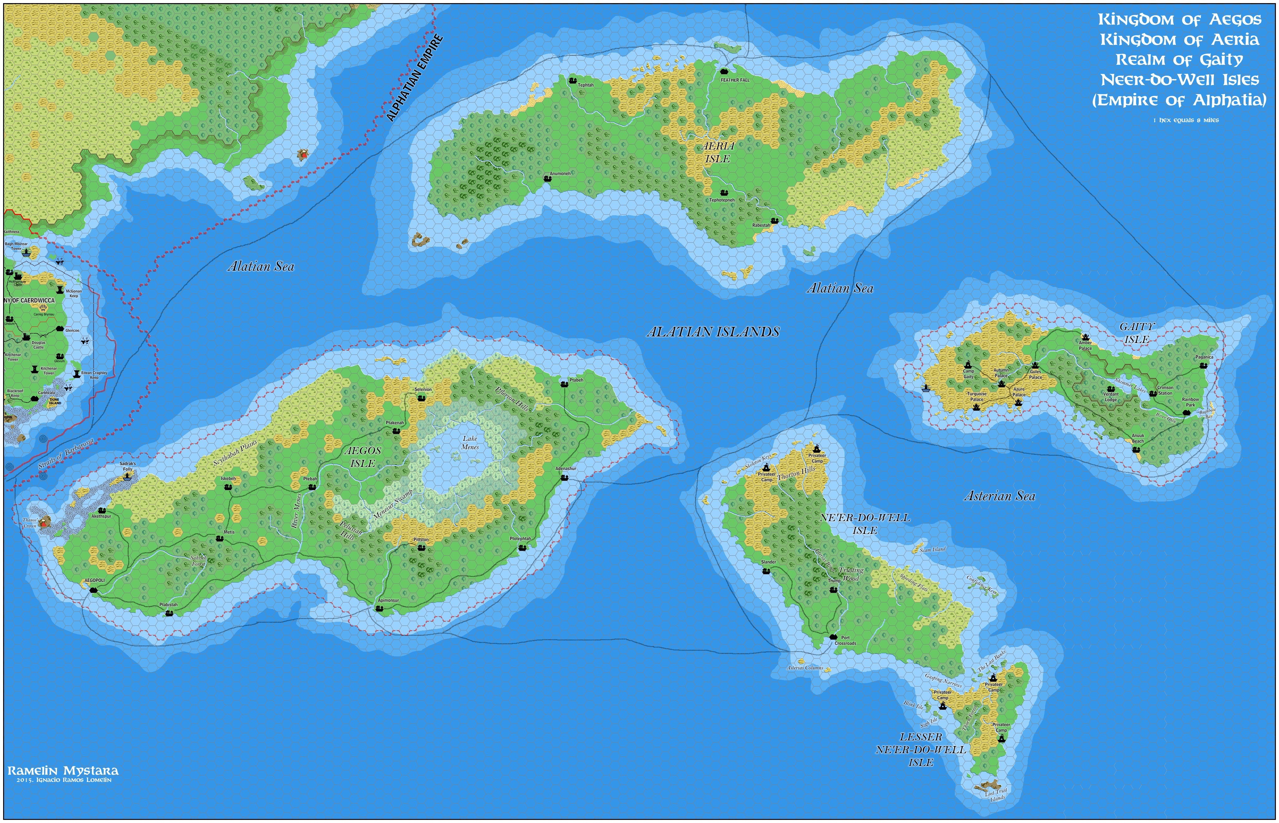
This is one of a small set of maps Jose posted on his Pinterest profile in late November 2015. It was his first pass of the Alatian Islands. Referencing Thibault’s 2000 maps as a base, he added a lot of terrain detail, as well as scattered new settlements. However, he left Aeria pretty blank — though he would come back to add more in the next version a few years later.
Fan-made Map by Jose Ignacio Ramos Lomelin (November 2015)
This is an original map created by one of Mystara’s excellent fan cartographers. For more information on the cartographer, including a gallery of all their maps, see also Appendix M: Mappers of Mystara.
Sources
- Dawn of the Emperors (1989) (PDF at DriveThruRPG)
Fan Sources
- Thibault’s Aegos, 8 miles per hex (2002)
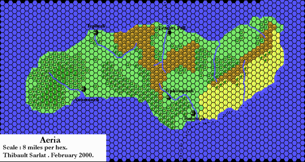
- Thibault’s Aeria, 8 miles per hex (2002)
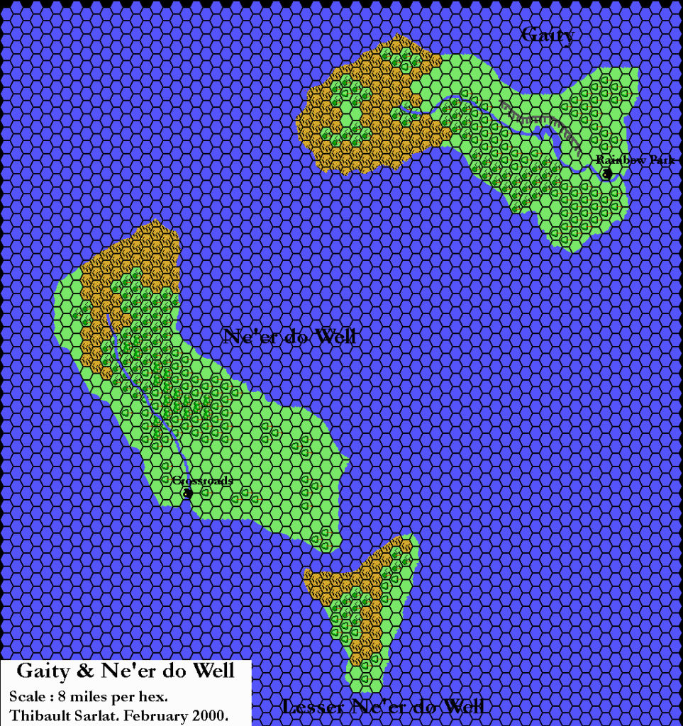
- Thibault’s Gaity and Ne’er-do-well, 8 miles per hex (2002)
References
- All of Jose’s maps at the Atlas of Mystara
- Jose’s entry in Appendix M: Mappers of Mystara (upcoming)
- Jose’s author page at the Vaults of Pandius
Chronological Analysis
This is a fan-made map. It was published in or around December 2015. The updated Atlas version of this map is not yet available. See also Appendix C for annual chronological snapshots of the area. For the full context of this map in Mystara’s publication history, see the upcoming Let’s Map Mystara 2015.
The following lists are from the Let’s Map Mystara project. Additions are new features, introduced in this map. Revisions are changes to previously-introduced features. Hex Art & Fonts track design elements. Finally, Textual Additions are potential features found in the related text. In most cases, the Atlas adopts these textual additions into updated and chronological maps.
Coming Soon