
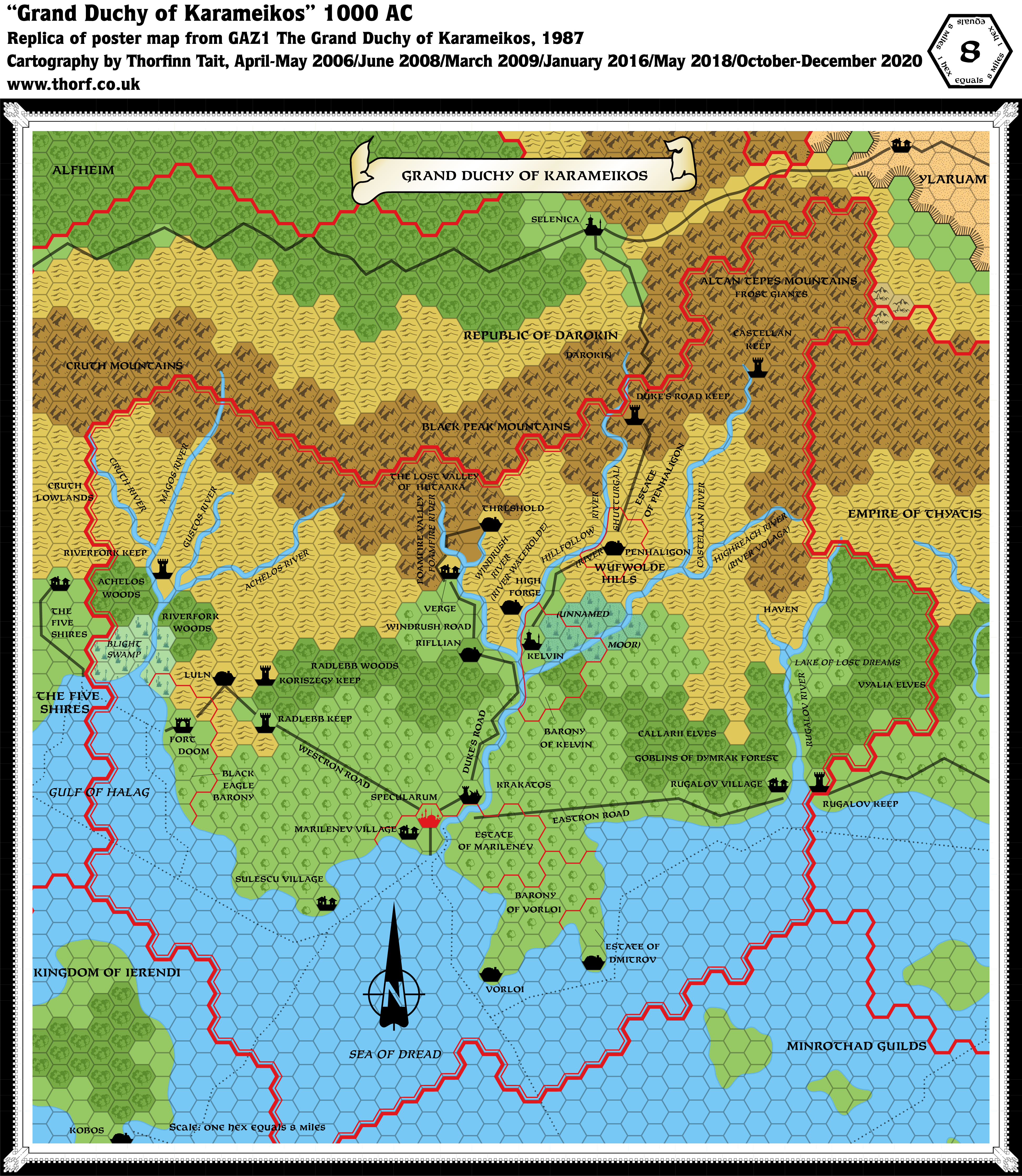
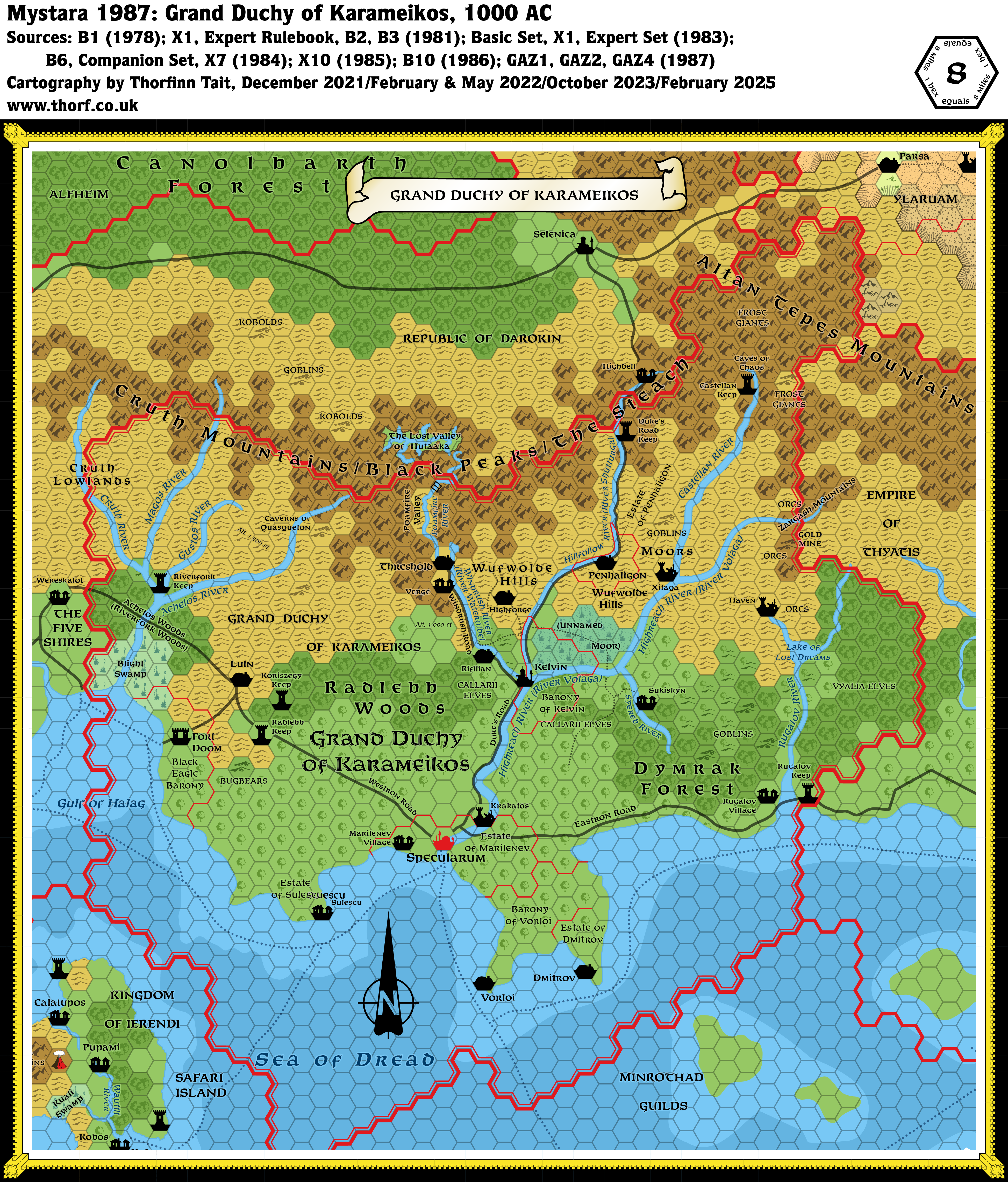
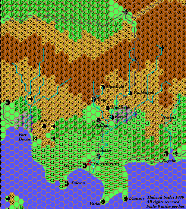
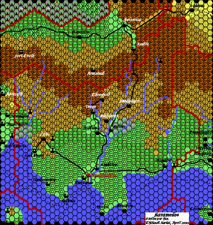
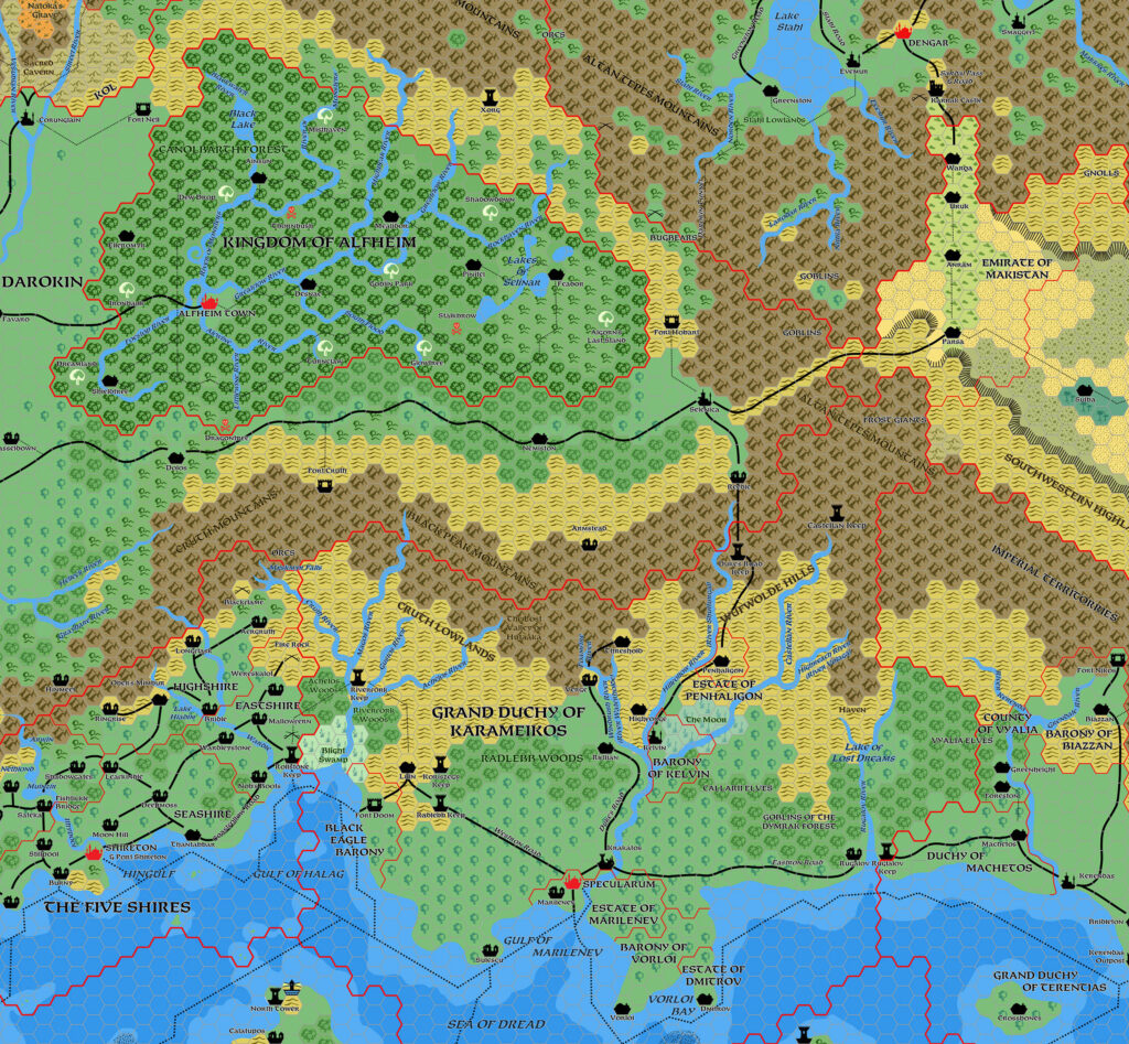
GAZ1 Karameikos, 8 miles per hex
1987’s GAZ1 heralded a new era for Mystaran cartography, bringing in the 8 mile Gazetteer series standard for hex maps, along with a new set of hex art, the distinctive castle border, and the change of font to Feinen Bold. Karameikos was redrawn to fit the new scale, likely based on the original X1 24 mile per hex map, with which it is quite a close fit. It also includes most locations from the Expert Set’s 6 mile per hex map, although the fit is much more problematic; indeed, the shunting around of locations — most notably Threshold — resulted in misalignment with previous maps of the area, including B10’s larger scale maps. Note that even though the forested hex symbol debuted in the legend, it was not actually used until later in the Gazetteer line, hence the lack of that terrain type in this map.
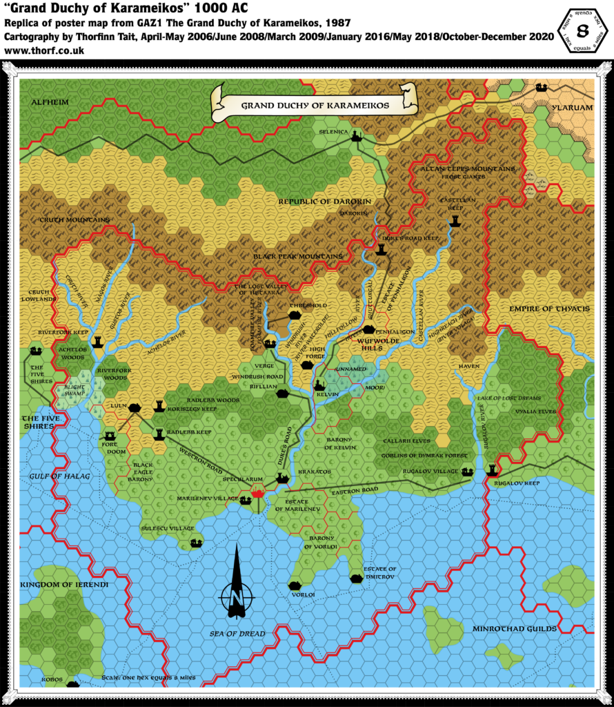
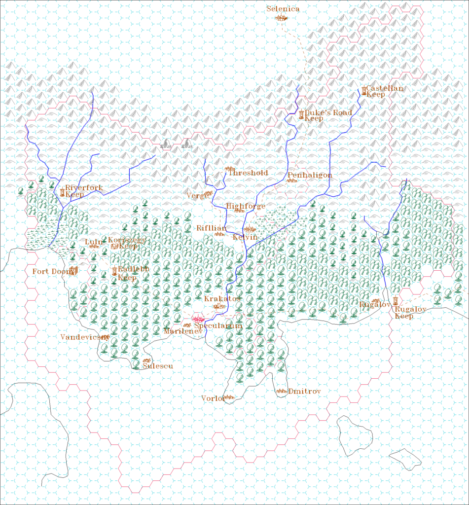
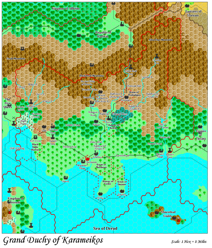
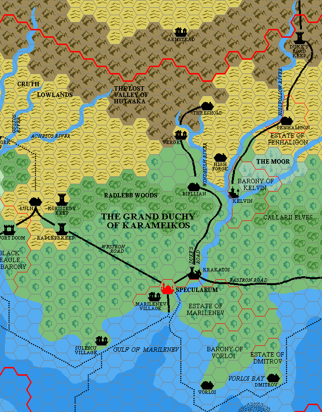
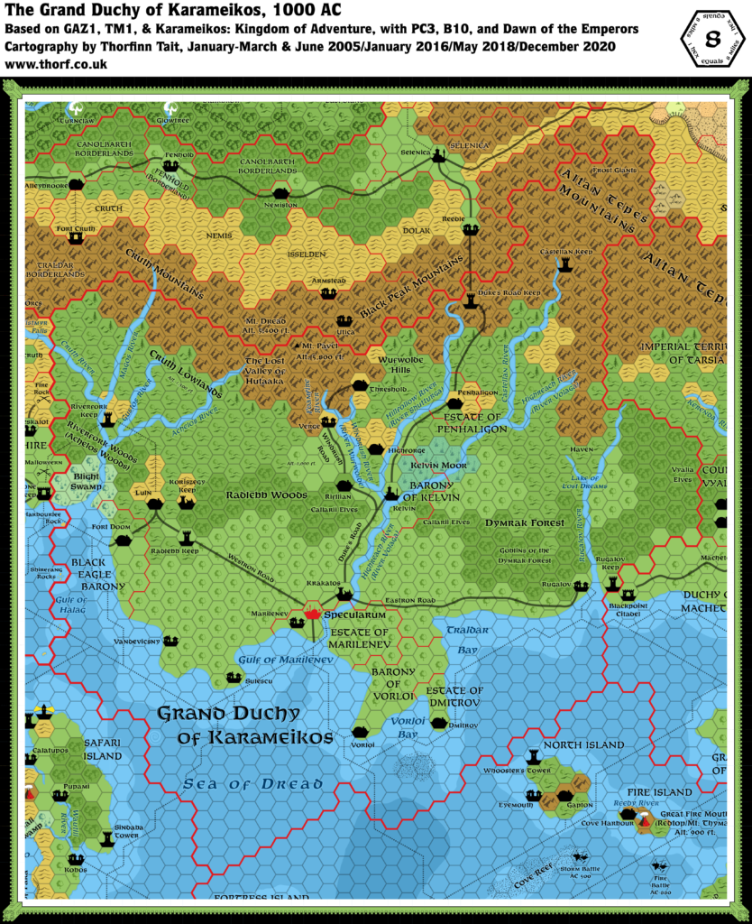
Replica Map (December 2020)
Sources
- GAZ1 The Grand Duchy of Karameikos (1987) (PDF at DriveThruRPG)
- Poster map (Cartography by Dennis Kauth, David C. Sutherland III, Ron Kauth)
Chronological Analysis
This is Map 54. It was published in May 1987. The updated version of this map is Karameikos, 8 miles per hex. See also Appendix C for annual chronological snapshots of the area. For the full context of this map in Mystara’s publication history, see the upcoming Let’s Map Mystara 1987.
The following lists are from the Let’s Map Mystara project. Additions are new features, introduced in this map. Revisions are changes to previously-introduced features. Hex Art & Fonts track design elements. Finally, Textual Additions are potential features found in the related text. In most cases, the Atlas adopts these textual additions into updated and chronological maps.
Additions
- Bays — The Gulf of Halag, which was referred to in the text as long ago as Expert 1981, was labelled for the first time on this map.
- Dominions — New on this map were the Estate of Dmitrov, Barony of Kelvin, Estate of Penhaligon, and the Barony of Vorloi.
- Rivers — The rivers themselves were not new, but the names were: Cruth River, Magos River, Gustos River, Achelos River, Rugalov River. Additionally, River Waterolde and Hillfollow River were new names for the Windrush River and the Shutturga River. (See Rivers under Revisions below for more details.)
- Roads — The system of roads itself was not new, but many roads were given names:
- The road north from Specularum to Selenica was named the Duke’s Road.
- The road east from Specularum, beginning after an unmarked crossing of the Highreach near Krakatos, was labelled the Eastron Road.
- The road west from Specularum became the Westron Road.
- Settlements — There’s a lot of new stuff here so I’ll split it up into points.
- There were many completely new settlements: Duke’s Road Keep, Penhaligon, Radlebb Keep, Riverfork Keep, Rugalov Keep, Rugalov Village, Sulescu Village, Vorloi.
- Castellan Keep was a new name for the keep from B2, which was marked as a module location in Expert 1983, and as a keep for the first time here.
- The town in the Estate of Dmitrov was unlabelled, though given how the other estates were labelled, it could reasonably be expected to be Dmitrov.
- Haven from B3 (green cover) is marked north of the Lake of Lost Dreams. Previously Expert 1983 had marked this area as module location “B3”. No settlement icon, however.
- High Forge itself was not new, but the name certainly was — previously it was simply “Gnomes” (see also Settlements in Revisions below).
- Verge appeared for the first time on a map here, though it was previously mentioned in X12.
- Finally, the lone village in Ylaruam appears for the first time here, without a name. (GAZ2 would soon name it Parsa.)
- Terrain — Although the features themselves were not new, the following gained names for the first time:
- Blight Swamp became the name for the swamplands northwest of the Black Eagle Barony.
- Achelos Woods and Riverfork Woods labels were added to the woods on either side of the forked river in western Karameikos. The map did not make it clear if these were different names for the same woods, or the names for the western and eastern parts.
- The foothills of the Cruth Mountains bordering the Five Shires were named the Cruth Lowlands. The label was placed over the border, making it unclear which parts of the hills this referred to.
- The moor near Kelvin, labelled Unnamed Moor (in parentheses) was a new feature on this map. It was likely suggested by B10, although there is an element here of the term “moor” getting lost in translation.
Revisions
- Coastlines — While likely not noticeable at first glance, the details of the coastline of Karameikos were rather different from previous maps. The overall shape remained similar.
- Dominions — The following dominions saw revisions in GAZ1’s map:
- The Black Eagle Barony’s borders underwent major changes (comparing with previous 6 mile per hex maps), losing the northeastern promontory close to Luln, but gaining a slightly larger area in the south.
- On previous maps, the Estate of Marilenev label was ambiguously placed, so that it wasn’t clear if it meant the bordered area or the castle. GAZ1 clarified this situation by shifting the label to the eastern area, and creating a separate label for the castle (now marked as a village), Marilenev Village. Additionally, the border of the estate was adjusted slightly, ceding one hex to the Barony of Vorloi (comparing with previous 6 mile per hex maps).
- Mountains — The mountain range to the north was previously noted to be one range with three names, apparently interchangeable throughout the range. GAZ1 instead used two of those three names, with each marked in different areas of the range: the western section was marked Cruth Mountains, while Black Peak Mountains was the name for the eastern section. These names were the same, while The Steach was no longer used (though it was only ever noted in the text of the Expert Set, never marked on a map). The Altan Tepes Mountains were pluralised — previously this was always Altan Tepe Mountains.
- Rivers — There were major revisions to river courses and names. The rivers were all adjusted to flow close to the edges of hexes, making them rather different from how they had appeared on earlier maps. The eastern source of the Rugalov River, northeast of the Lake of Lost Dreams, was extended, while the Cruth River was shortened. Regarding the names, previously (in Companion and B10), Karameikan rivers had mostly been listed with “River” preceding the river name (British style): River Highreach, River Windrush, River Shutturga, etc. This was contrary to most other Mystara rivers, which tended to append “River” after the name (American style). Further complicating the matter, there were already two names for the nation’s most major river, as Companion’s River Highreach became the Volaga River in B10. GAZ1 neatly explained this situation using the nation’s Thyatian/Traladaran cultural split. English-derived names were considered to be Thyatian, using American styling: Highreach River, Windrush River, Hillfollow River. Slavic-themed names became native Traladaran rivers, with British styling: River Volaga, River Waterolde, River Shutturga. Some rivers also gained a new “Thyatian” or “Traladaran” equivalent name.
- The previous River Highreach/Volaga River had its styling flipped, so that from GAZ1 it would be Highreach River/River Volaga.
- River Windrush and River Foamfire were likewise flipped, becoming Windrush River and Foamfire River respectively.
- Windrush River gained the Traladaran equivalent River Waterolde.
- River Shutturga was changed to (or misspelled as?) River Shutturgal, gaining the Thyatian equivalent name Hillfollow River.
- Roads & Trails — Most of the roads from previous maps remained largely in place, though (as with the rivers), they were changed in form. In the case of roads, they became angular, although not always fitting the hex grid that well.
- The newly named Eastron Road had previously been a trail, but was upgraded to a road.
- The road from Luln to Wereskalot, previously added in X10’s 24 mile per hex map, was left off this map — likely overlooked. Additionally, the other roads and trails around Wereskalot were also left out, replaced by a different road curving to the west before heading to the coast.
- The trails from B10, around Highforge and east of Kelvin, were all left out.
- Settlements — Settlements were mostly placed based on their X1 (24 mile per hex) locations, without reference to the more precise placements from Expert (6 mile per hex) maps. As a result, many of the main settlements ended up being slightly off when comparing 8 and 6 mile per hex maps. Additionally, the following changes were made:
- Castellan Keep was previously marked as a module location for B2, and therefore the Keep on the Borderlands (and the nearby Caves of Chaos).
- High Forge was previously marked as caves, labelled simply “Gnomes”.
- Kelvin was marked as a town on previous maps, but was now a city. Further, the spelling originally varied between Kelvin and Kelven, with B10 using Kelven exclusively. GAZ1 now used the other option, Kelvin.
- Kobos was previously a village, now a town.
- Krakatos was previously a castle, now a ruin.
- Marilenev Village replaced the previous castle symbol, with a new label clarifying the previous ambiguous situation with the Estate of Marilenev label. (See Dominions above.)
- Rifllian was previously a village, now a town.
- Selenica was previously at the entrance to the mountain pass from Darokin to Ylaruam, but GAZ1 moved it a couple of hexes to the northwest. It was also previously marked as being among hills, but here its immediate surroundings were changed to plains.
- Specularum was moved from its position east-southeast of Marilenev to instead be east-northeast of it.
- Threshold was previously a village, now a town. Moreover, its placement based on the 24 mile per hex map put it in a quite drastically different location — in fact, in the next valley over to the east.
- Wereskalot was previously a castle, now a village.
- Terrain — As with the settlements, GAZ1 seems to have used X1’s 24 mile per hex map as a base, developing new details without referencing existing larger scale maps from Expert (6 mile per hex) and B10 (3 and 2 mile per hex).
- The mountains were mostly a solid block of mountainous hexes, completely unlike the more nuanced terrain of previous larger scale maps. Part of this was due to the smaller 8 mile per hex scale, but many details that could have been preserved were not.
- Some slightly ambiguous hexes from X1’s map were interpreted differently from previous maps:
- The area directly north of the Achelos Woods: X1 had clear hexes, which Expert took to be clear terrain. GAZ1 assumed (not unreasonably) that these were intended to be hills, and marked the area accordingly.
- The Dymrak Forest, previously named in B10, received a confusing label mixing races and terrain: Goblins of the Dymrak Forest. Additionally, its entire northern part was changed to hills hexes.
- The label for the Wufwolde Hills was moved from north of Highforge (its B10 location) to just south of Penhaligon. This was likely due to label crowding around Highforge. As with the new label for the Cruth Lowlands, it seems likely that this label could be applied to much of the surrounding hilly area.
Hex Art & Fonts
- Symbols — Gazetteer series standard. Karameikos borders use an emphasising variant style only seen in this map and GAZ2’s Ylaruam map.
- Fonts — Feinen throughout.
Textual Additions (GAZ1 1987)
- Altitudes — GAZ1 page 35 gives some information on altitudes. On Karameikos’ northern mountains: “The average height of mountains in this range is about 4,000 feet, though many are much larger.” On the rest of the nation: “The land slopes very gently from the northern mountains to the southern coast. The most northern flatlands (the Cruth lowlands of western Karameikos) are about 1,500 feet above sea level; the flatlands south of the Black Peak mountains are about 1,000 feet above sea level.” (See Terrain below.)
- Bridges — Kelvin Bridge “is a good, strong stone bridge spanning a narrow portion of the river Hillfollow.” (GAZ1 page 38c)
- Dominions — Many of Karameikos’s dominions were marked on the map, but some were only given proper names and/or titles in the text of GAZ1. Others can be deduced from their rulers’ titles, as it seems a lord/lady rules an Estate, while of course a baron/baroness rules a Barony.
- Estate of Rugalov — Although this name appears neither on the map nor in the text, the title of Rugalov’s ruler, Lord Vlad Lutescu, suggests that it is an estate.
- Estate of Sulescu — The village of Sulescu was marked on the map, but without an estate label or border. The title appears on page 64.
- Barony of Threshold — Although this title doesn’t actually appear anywhere, page 22 refers to “the baronies of Threshold and Kelvin” and notes that its ruler, Patriarch Sherlane, is also known as Baron Halaran. Baron Sherlane Halaran’s profile on page 56 says that “he was granted the title of Baron of the Threshold area”.
- Estate of Verge — Sir Retameron and Lady Halia Antonic are rulers of Verge, which must mean that it is an estate.
- Forests — The forests of Karameikos were mostly established prior to GAZ1, but the text did provide some new information. Foremost among these is the fact that “Karameikos is one of the most thickly-wooded nations of the world.” (GAZ1 page 35) The implication is that most of the nation is wooded.
- Forested Hills — while the Gazetteer itself states on page 45 that most of Karameikos’ hills are “thickly covered with forest,” at the time GAZ1 was made the forested hills hex was not yet in use, despite appearing on the legend. There is much evidence that almost all of the hills (and indeed most of the mountains) in Karameikos are heavily forested. “Land Patterns” on page 35: “These mountains tend to be thickly covered with forest vegetation, gradually thinning to bare rock toward the peaks. The average height of mountains in this range is about 4,000 feet, though many are much larger.” It goes on to describe the extent of the forests in the foothills: “South of this mountain range, you have miles and miles of mountain foothills – also thickly covered with forest.” Further support in “Terrain” on page 35: “Karameikos is one of the most thickly-wooded nations of the world. In the northern parts of the Grand Duchy, pine forests cover the mountain slopes and the hillsides.” It continues, describing the “three great tracts of forest” in Karameikos. The description of the forests doesn’t mention anything about hills, but doesn’t rule out forested hills as parts of those forests either.
- Achelos Woods/Riverfork Woods — Although the placing of the labels on the poster map may suggest otherwise, these are variant names for the same forest. GAZ1 page 35 describes them as “variously called the Riverfork Woods and the Achelos Woods.”
- Dymrak Forest — GAZ1 page 35 states that this forest “stretches all the way from the borders of the Barony Kelvin to the border to Thyatis. It’s a mighty hardwood forest, and home to numerous nonhuman tribes—mostly violent nonhumans, plus the Vyalia Elves.”
- Radlebb Woods — GAZ1 page 35 describes Radlebb as “a forest inhabited by the majority of Callarii elves. It’s a little less dark and ominous than the western tract . . . but still has its dangerous wild animals.” It also seems that the Radlebb Woods stretch northeast into the hills south of Highforge. See “The Map” on page 6 of GAZ1: “The Callarii elves live in the central forests east and west of Kelvin and in the forested foothills south of the gnomish community.”
- Historical Notes — Kelvin was built on the remains of the village of Lavv, “the actual historical site which appears in the Song of Halav”. (GAZ1 page 39a) Lavv was “a fortified village” ruled by King Halav. Krakatos was the siege of Queen Petra. (GAZ1 page 12c) Before the Thyatian occupation, Specularum was known as Marilenev. It was “a flourishing trade city of a five hundred residents and the chief port of the Traladara region”, “at the mouth of the Volaga River”. The Thyatians renamed it to Specularum in 900 AC, building a defensive wall around the village. (The modern-day Marilenev Village is presumably a different settlement.)
- Mines — “There are numerous, extensive mines” in the area around Highforge in the Wufwolde Hills. (GAZ1 page 38c)
- Races — The text provides a little more information:
- Elves — The Callarii were marked on the map in the Dymrak Forest, but the text suggests that they are primarily in the Radlebb Woods, “a forest inhabited by the majority of Callarii elves.” (GAZ1 page 35) “The Callarii elves live in the central forests east and west of Kelvin and in the forested foothills south of the gnomish community. Accurate numbers for the entire elvish population of Karameikos are not available (the elves don’t bother to keep them and the humans can’t tally them), but a reasonable guess is that there are about 7,500 elves scattered through this territory, living in communities of 100-200.” (GAZ1 page 6)
- Rivers — With lots of new names floating around, the text provides some clarification on Karameikos’s rivers. Regarding the doubled up names: “Some places, particularly rivers, are listed with two names. This is because the settling Thyatians, uncomfortable with the native names […], simply renamed them. Today, when speaking Thyatian, most people use the Thyatian name, and when speaking Traladaran use the original name. On the map, the Thyatian name is given first, the Traladaran name given in parentheses.” (GAZ1 page 5)
- Shutturga — this old Traladaran name for the Hillfollow River comes from B10. However, it appears on GAZ1’s map as Shutturgal. Nevertheless, the text twice gives the name as Shutturga (pages 5 and 35), as in B10, but never uses Shutturgal. The town map of Kelvin also has Shutturga.
- Wufwolde — this old Traladaran name for the Windrush River is given in the text of GAZ1 (pages 5, 35). This differs from GAZ1’s map, which has Waterolde.
- Roads — The Duke’s Road is defined as running “from the city [Specularum] to the northern border of Karameikos”. (GAZ1 page 36c)
- Rulers — GAZ1 provides a wealth of details not just about the nation’s rulers, but also the dominion and town rulers.
- Arteris Penhaligon, Lady of Penhaligon. (GAZ1 page 39ab)
- Desmond Kelvin II, Baron and Patriarch of Kelvin. (GAZ1 pages 14, 22, 38c)
- Dorfus Hilltopper is Gnome-King of Highforge. (GAZ1 page 38b)
- Halia Antonic is Lady of Verge. (GAZ1 page 57b)
- Lev Dromilov is Lord of Dmitrov. (GAZ1 page 38b)
- Lucas Tormandros is Townmaster of Specularum. (GAZ1 page 36a)
- Ludwig von Hendriks is once again mentioned as the Black Eagle Baron. (GAZ1 page 14, 38b)
- Magda Marilenev is Lady of Marilenev. (GAZ1 page 39a)
- Philip Vorloi, Baron of Vorloi. (GAZ1 pages 14, 40)
- Prestelle is Chief Trader of Rifllian. (GAZ1 page 39b)
- Sir Retameron Antonic of Verge. (GAZ1 page 58a)
- Sascia is Townmistress (or just Mistress) of Luln. (GAZ1 page 56)
- Sherlane Halaran is the Patriarch as well as the Baron of Threshold. This is the first appearance of both his last name, Halaran, and his feudal title, Baron. It is further explained that Patriarch is his title as a cleric of the Church of Karameikos. (GAZ1 pages 14, 20)
- Stefan Karameikos III is Duke of the Grand Duchy. He is also listed as ruler of Specularum. (GAZ1 page 36a)
- Vlad Lutescu is Lord of Rugalov. (GAZ1 page 39b)
- Zemiros Sulescu is Lord of Sulescu. (GAZ1 page 39a)
- Settlements — Population figures are given for may of Karameikos’ settlements. Overall, these are often ten times the size of previous numbers. It is also noted that “there are literally hundreds of homesteads along the rivers and roads of the duchy. These are one- or two-family settlements, mostly farms and logging operations, with populations ranging from a handful of people to as many as 750 inhabitants.” (GAZ1 page 6a)
- Dmitrov’s population is 6,500. It is “primarily a fishing community, with mostly Traladaran population”. (GAZ1 page 38b)
- Fort Doom has a population of 10,000. It was formerly known as Halag. The people are “mostly Traladaran fishermen”. Its guards are humans and orcs. Bugbears and “other nasty humanoids” also dwell here. (GAZ1 page 5c, 38b)
- Forts: Each of the five forts in Karameikos is noted to be garrisoned with one battalion of 244 soldiers. The forts are Castellan Keep, Duke’s Road Keep, Radlebb Keep, Riverfork Keep, and Rugalov Keep. (All GAZ1 page 40bc)
- Castellan Keep is only reachable by riverboat, and is suggested as the setting for B2 Keep on the Borderlands. It is tasked with watching the activities of the frost giants of the Altan Tepes.
- Duke’s Road Keep lies “in the mountain pass on the Duke’s Road, right at the border”.
- Highforge is populated by five gnomish clans totalling 6,500, along with the Stronghollow clan of 1,000 dwarves. (GAZ1 pages 5-6, 38) While the map had High Forge, the single word Highforge appears numerous times throughout the text. The map’s High Forge spelling does not occur even once in the text.
- Kelvin’s population is 20,000. It has a “nearly 500-man standing garrison”. (GAZ1 page 38c, poster map)
- Luln has a population of 5,000. It is “a farming town halfway between civilisation and the Black Eagle Barony”, “founded on rich soil near a forest teeming with wildlife”. (GAZ1 page 39a)
- Marilenev is a farming village of 900. It is where Castle Marilenev is built. (GAZ1 page 39a)
- Penhaligon has a population of 3,750. It is “a fortified town”, “founded 30 years ago”. (GAZ1 page 39b)
- Rifllian’s population is listed as 1,700. (GAZ1 page 39b)
- Rugalov is a “trading and fishing village” with a population of 650. It “has only been in existence some 30 years”. (GAZ1 page 39b)
- Specularum is said to have had a population of about 50,000 at its last census, 15 years prior. The population is “certainly greater now”. (GAZ1 page 36a)
- Sulescu is a village of 950. It was named for its ruler 300 years ago. (GAZ1 page 39bc)
- Threshold’s population is now listed as 5,000. (GAZ1 page 39c) Both the nearby fishing village on Lake Windrush and the logging encampment are noted to each have a population of 1,000. (GAZ1 pages 39c-40a) Additionally, there are Ruins of an ancient town north of Threshold, on the west shore of Lake Windrush, with stone walls, rubble, and buried catacombs still accessible. It used to be a Hutaakan village. (GAZ1 page 40a)
- Vorloi has a population of 7,500. “It’s a trade town with its own small harbor”, primarily used by the Vorloi clan. (GAZ1 page 40b)
- Shipping Lanes — GAZ1’s text describes Vorloi as having a small harbour, mostly used for export. So while it’s not a major stop, it makes sense for there to be a link from Vorloi to the passing shipping lane.
- Spellings — The text gives different spellings from the map in some cases. Shutturga for the map’s Shutturgal (see Rivers above). Highforge for the map’s High Forge (see Settlements above).
- Terrain — The text provides a little clarification to some features of the map:
- Cruth Lowlands — As noted in Altitude above, page 35 says: “The most northern flatlands (the Cruth lowlands of western Karameikos) are about 1,500 feet above sea level”. The term “flatlands” here seems to refer to areas that are hilly rather than mountainous. Also, this confirm the supposition (under Additions/Terrain above) that the Cruth Lowlands label does indeed apply to all of the hilly area in western Karameikos.
- Wufwolde Hills — Given the above under Cruth Lowlands, it seems reasonable to assume that page 35’s “flatlands south of the Black Peak mountains” refers to the Wufwolde Hills, and therefore the “1,000 feet above sea level” also refers to these hills.
Analysis
For a full analysis of the problems with this map and its incorporation into the body of Mystaran maps up to this point, see Appendix L: The Karameikan Revolution.


23 August 2019 @ 1:30 pm
I’m confused with this map, isnt the town of Threshold on Windrush lake? This map doesnt show that.
21 October 2019 @ 9:40 am
The simple answer to this is that Lake Windrush is too small to appear at this scale. It doesn’t mean that it’s not there. On B10’s 3 mile hex map the lake takes up a little over one hex, meaning that it would be at most half a hex on this 8 mile hex map. Such details are often left out to avoid crowding the map.
It’s also worth noting that GAZ1’s map provided a new take on the area, slightly different from previous sources (notably B10). But in this case the lake was clearly still meant to be present, given the detail maps of Threshold included elsewhere in the module.