")
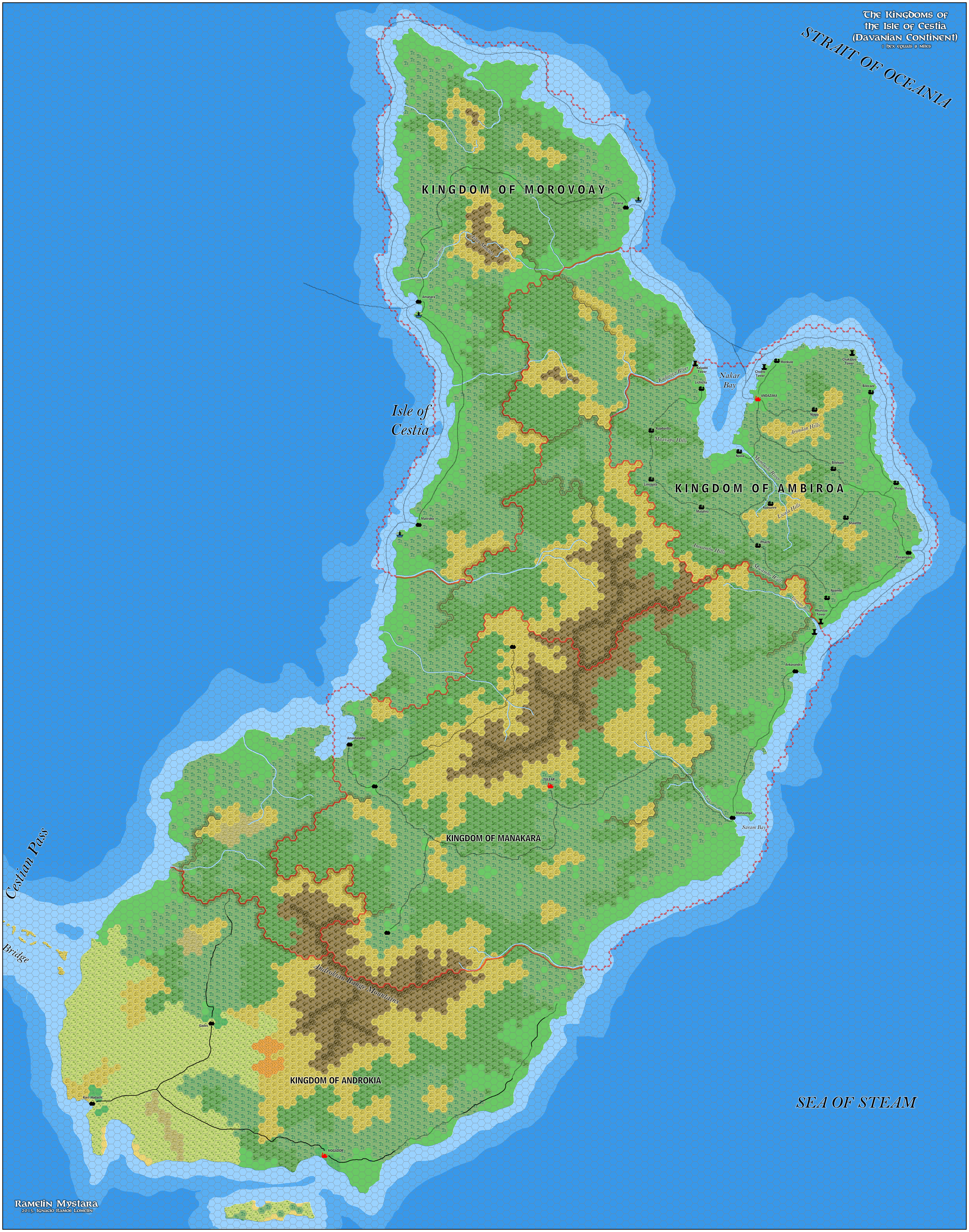
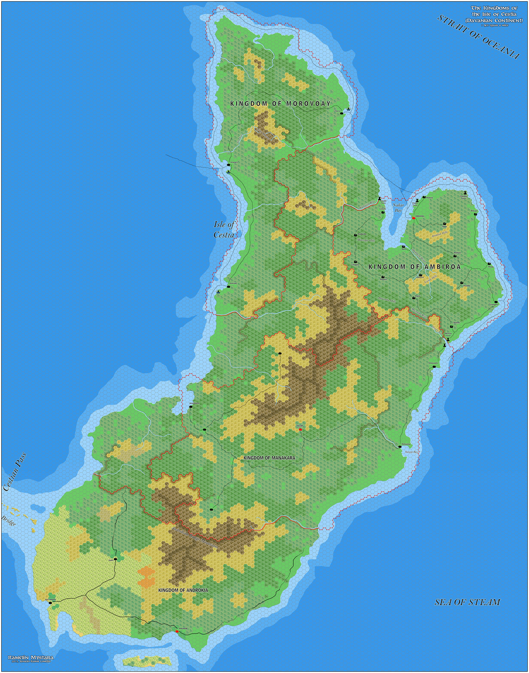
Ramelin’s Cestia, 8 miles per hex v1
At the end of 2016, Jose was working on two distinct areas, Norwold and Cestia/Oceania. The year had started off busily, with a bit of a lull mid-year, but this last batch of 2016 maps would turn out to be the calm before the storm, as Jose’s mapping was just getting going.
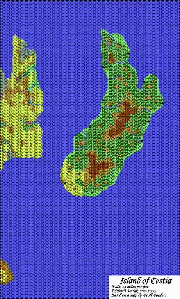
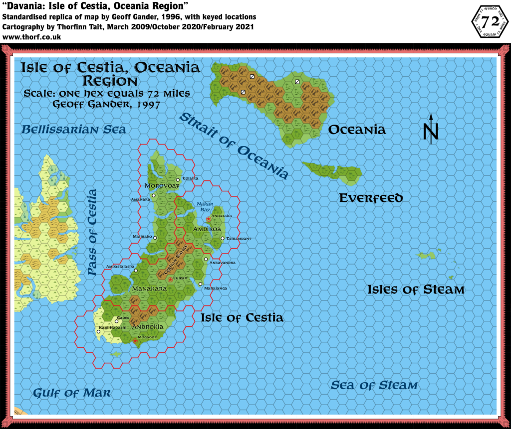
This was his first pass at Cestia, and it’s clearly still rather incomplete. The island had seen little in the way of fan-made maps over the years: Geoff Gander mapped out the kingdoms from Bruce Heard’s original Princess Ark article, and added in a smattering of major settlements; Thibault Sarlat then converted it to 24 miles per hex, including Geoff’s settlements. Jose thus became the first to map Cestia at 8 miles per hex, basing his terrain on the maps that came before.
He went further, adding a lot of details to the Kingdom of Ambiroa in the northeast, but he left the rest of the island largely undeveloped — for the moment. A return to finish the job would be certain, and indeed came the next year.
Fan-made Map by Jose Ignacio Ramos Lomelin (December 2016)
This is an original map created by one of Mystara’s excellent fan cartographers. For more information on the cartographer, including a gallery of all their maps, see also Appendix M: Mappers of Mystara.
Sources
- Hollow World Campaign Set (1990) (PDF at DriveThruRPG)
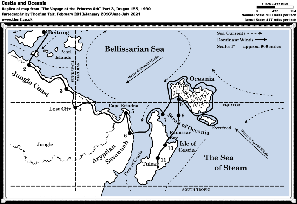
- The Voyage of the Princess Ark Part 3: To seek out new life and new civilisations, Dragon #155 (March 1990)
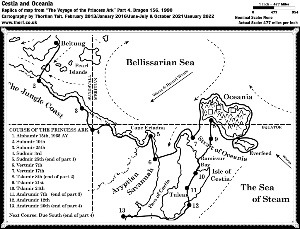
- The Voyage of the Princess Ark Part 4: Capture, surrender, and — death?, Dragon #156 (April 1990)
Fan Sources
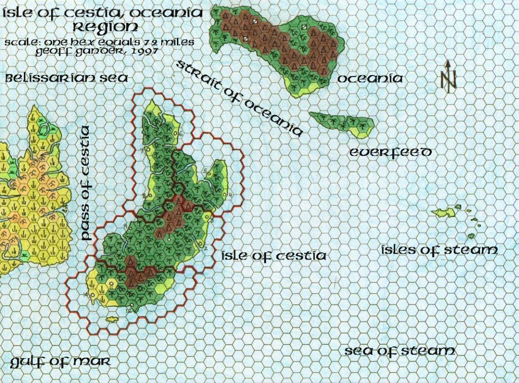
- Geoff’s Cestia and Oceania, 72 miles per hex (November 1997)
- The Isle of Cestia, current as of 18 May 1999 (Vaults of Pandius)
- Thibault’s Cestia, 24 miles per hex (August 2000)
References
- All of Jose’s maps at the Atlas of Mystara
- Jose’s entry in Appendix M: Mappers of Mystara (upcoming)
- Jose’s author page at the Vaults of Pandius
Chronological Analysis
This is a fan-made map. It was published in December 2016. The updated Atlas version of this map is not yet available. See also Appendix C for annual chronological snapshots of the area. For the full context of this map in Mystara’s publication history, see the upcoming Let’s Map Mystara 2016.
The following lists are from the Let’s Map Mystara project. Additions are new features, introduced in this map. Revisions are changes to previously-introduced features. Hex Art & Fonts track design elements. Finally, Textual Additions are potential features found in the related text. In most cases, the Atlas adopts these textual additions into updated and chronological maps.
Additions
- Bays — Saram Bay.
- Hills — Anocambo Hills, Arondan Hills, Licala Hills.
- Mountains — Androkian Range Mountains, Astar Mounts.
- Plateaus — Mocambo Wall.
- Rivers — Astar River, Kadosiza River, Mumlushi River, River Kera, Vorondor River.
- Settlements — By type:
- Lighthouses: three unnamed lighthouses in Morovoay.
- Towers: Chakaayo Tower, Chokto Tower, Kalaabe Tower, Mkunzaa Tower.
- Villages: Bilecaze, Bilekaze, Kaadoriba, Kaasunre, Limugola, Monkule, Mutahvu, Mwigu, Naamto, Njapa, Npola, Shaamte.
- Terrain — As this was the first map of Cestia at this scale, all of the terrain here is new — albeit based on previous smaller scale sources.
Revisions
- Spellings — Ambastalasha became Amastalasha. Tolaira became Tolaria.
Hex Art & Fonts
- Hex Art — Ramelin Mystara standard.
- Fonts — Bell MT (major geographic and all water labels), Bell Centennial (all other labels), Feinen (titling).
Maps of Cestia
")
")
")