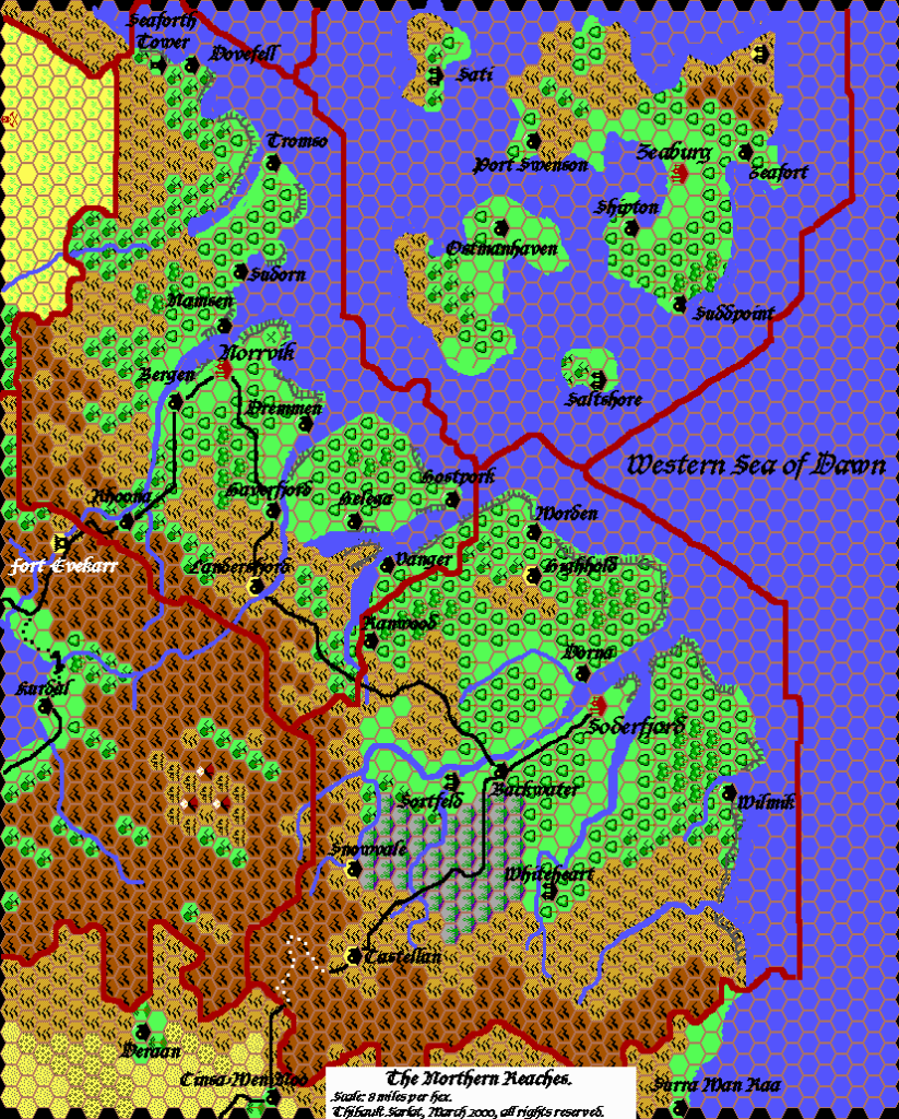
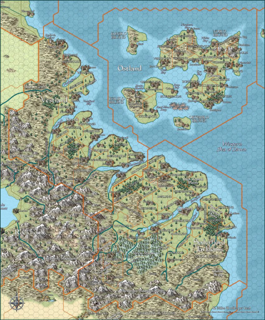
Northern Reaches, 8 miles per hex
The landscape of the Northern Reaches is a tilted plane sloping down from the high southwestern mountains to the low northeastern coast and offshore islands. The climate ranges from a cool, moist, maritime-temperate clime along the coast, to a cold subarctic climate in the higher elevations of the southern and western mountain ranges.
About one-fourth of the land is suitable for agriculture, most of it in the Ostland Islands and along the mainland coasts, rivers, and fjords. Another one-quarter of the land is only suitable for grazing, primarily in the mainland interior of the foothills. Half of the land is raw wilderness entirely unsuitable for human habitation. The wilderness includes regions of rugged alpine, dense forest, and marshy terrain.
from GAZ7 The Northern Reaches, by Ken Rolston
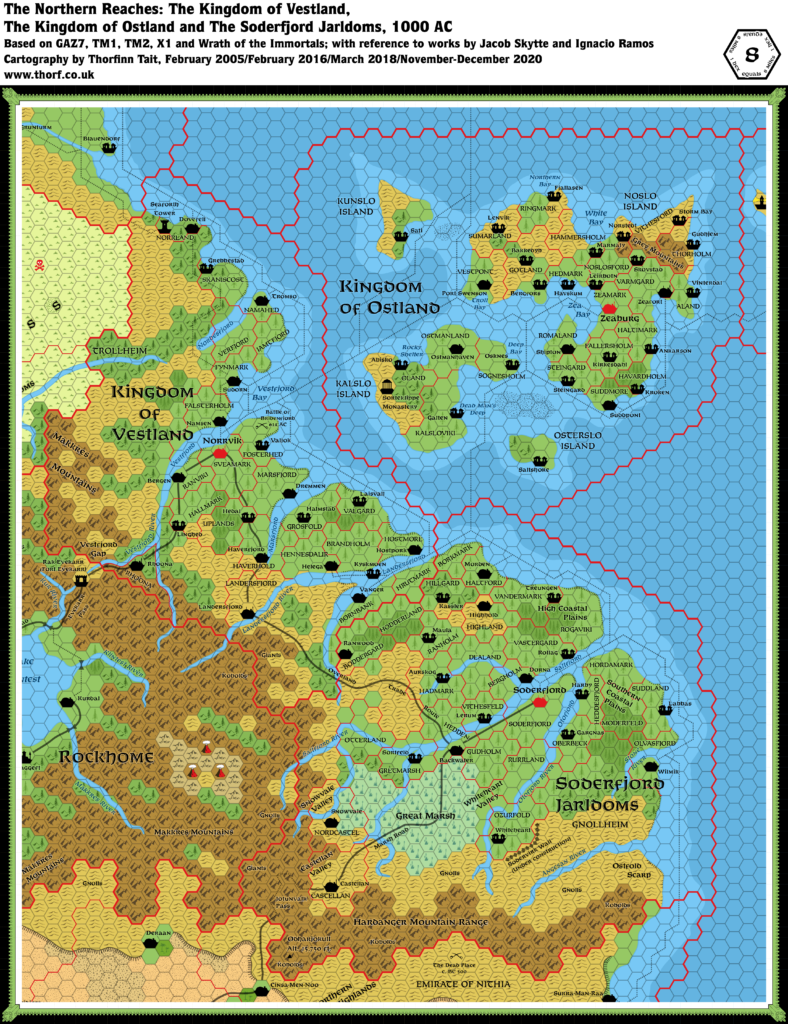
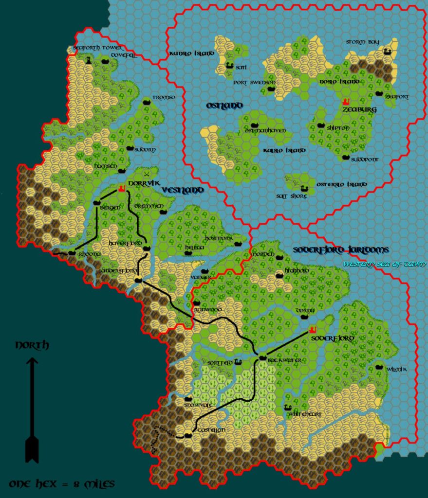
Map (December 2020)
Sources
- GAZ7 The Northern Reaches (1988) (PDF at DriveThruRPG)
- X1 The Isle of Dread (1981) (PDF at DriveThruRPG)
- GAZ6 The Dwarves of Rockhome (1988) (PDF at DriveThruRPG)
- TM1 The Western Countries (1989) (PDF at DriveThruRPG)
- TM2 The Eastern Countries (1989) (PDF at DriveThruRPG)
- Rules Cyclopedia (1991) (PDF at DriveThruRPG)
- Wrath of the Immortals (1992) (PDF at DriveThruRPG)
Fan Sources
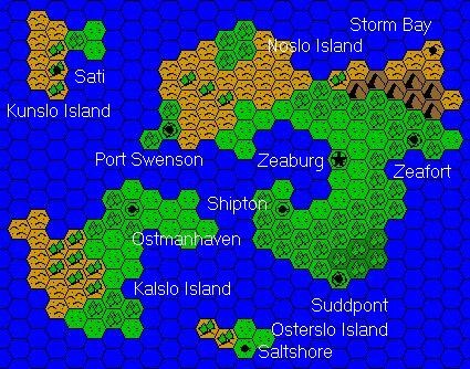
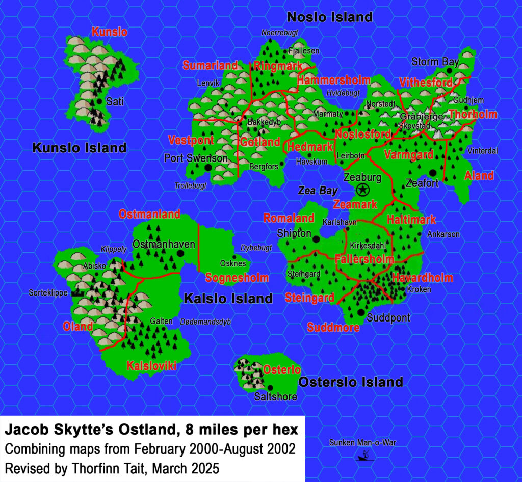
- The Complete Domains of Ostland 1st Ed by Jacob Skytte (2000-2002)
- Jacob’s Ostland, 8 miles per hex (2002)
- Jacob’s Ostland, 8 miles per hex
- Jacob’s Aland, 8 miles per hex (2000)
- Jacob’s Fallersholm, 8 miles per hex (2001)
- Jacob’s Gotland, 8 miles per hex (2001)
- Jacob’s Haltimark, 8 miles per hex (2000)
- Jacob’s Hammersholm, 8 miles per hex (2000)
- Jacob’s Havardholm, 8 miles per hex (2000)
- Jacob’s Hedmark, 8 miles per hex (2001)
- Jacob’s Kalsloviki, 8 miles per hex (2001)
- Jacob’s Kunslo, 8 miles per hex (2002)
- Jacob’s Noslosford, 8 miles per hex (2000)
- Jacob’s Oland, 8 miles per hex (2001)
- Jacob’s Osterlo, 8 miles per hex (2001)
- Jacob’s Ostmanland, 8 miles per hex (2001)
- Jacob’s Ringmark, 8 miles per hex (2000)
- Jacob’s Romaland, 8 miles per hex (2000)
- Jacob’s Sognesholm, 8 miles per hex (2001)
- Jacob’s Steingard, 8 miles per hex (2000)
- Jacob’s Suddmore, 8 miles per hex (2000)
- Jacob’s Sumarland, 8 miles per hex (2000)
- Jacob’s Thorholm, 8 miles per hex (2000)
- Jacob’s Varmgard, 8 miles per hex (2000)
- Jacob’s Vestpont, 8 miles per hex (2000)
- Jacob’s Vithesford, 8 miles per hex (2000)
- Jacob’s Zeamark, 8 miles per hex (2001)
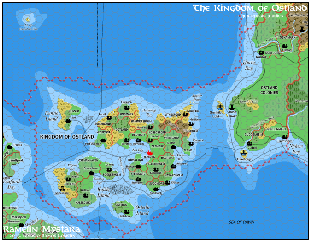
- Ramelin’s Ostland, 8 miles per hex (2015)
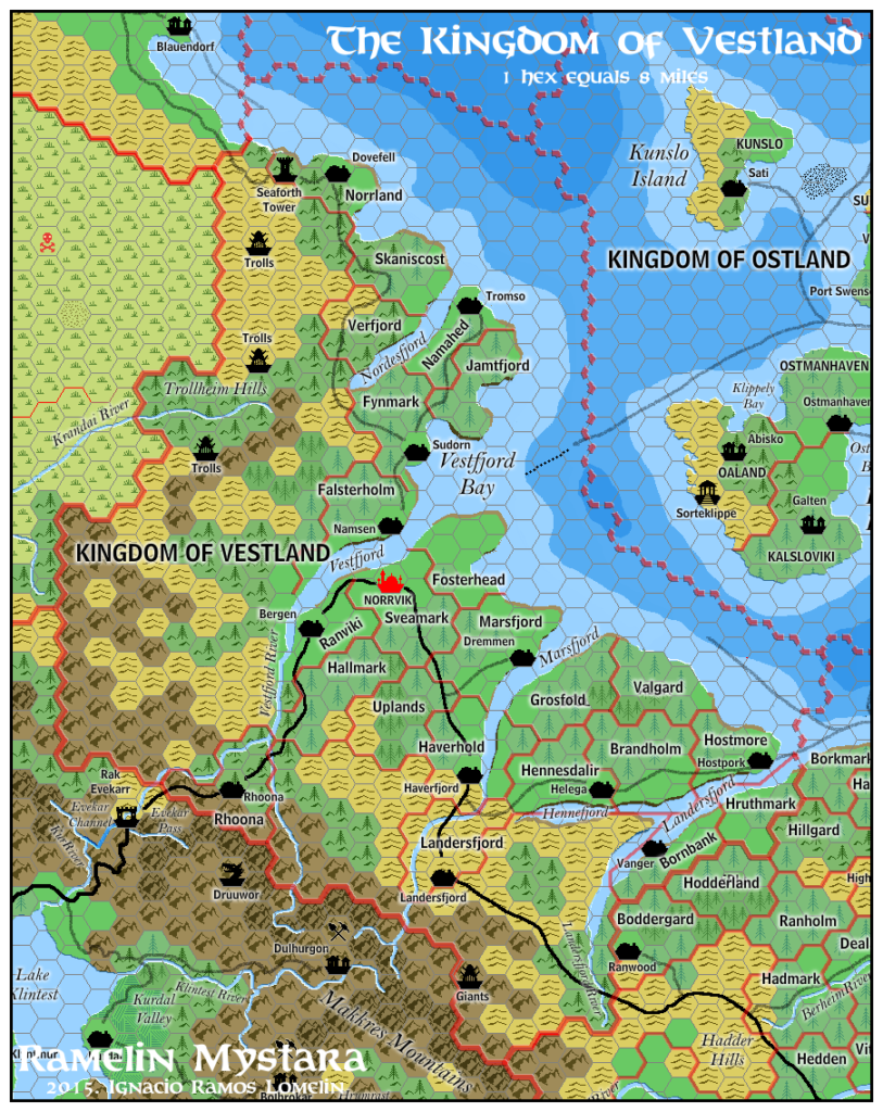
- Ramelin’s Vestland, 8 miles per hex (2015)
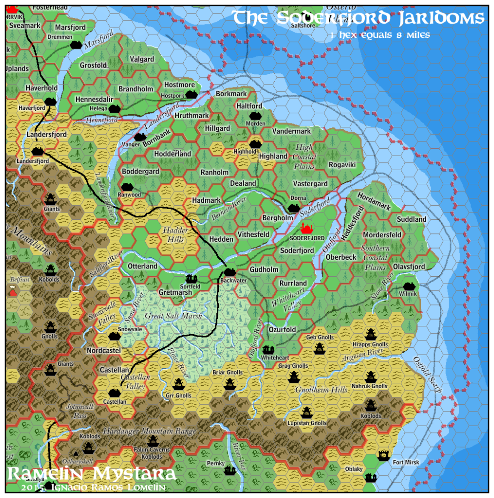
- Ramelin’s Soderfjord, 8 miles per hex (2015)
Comments
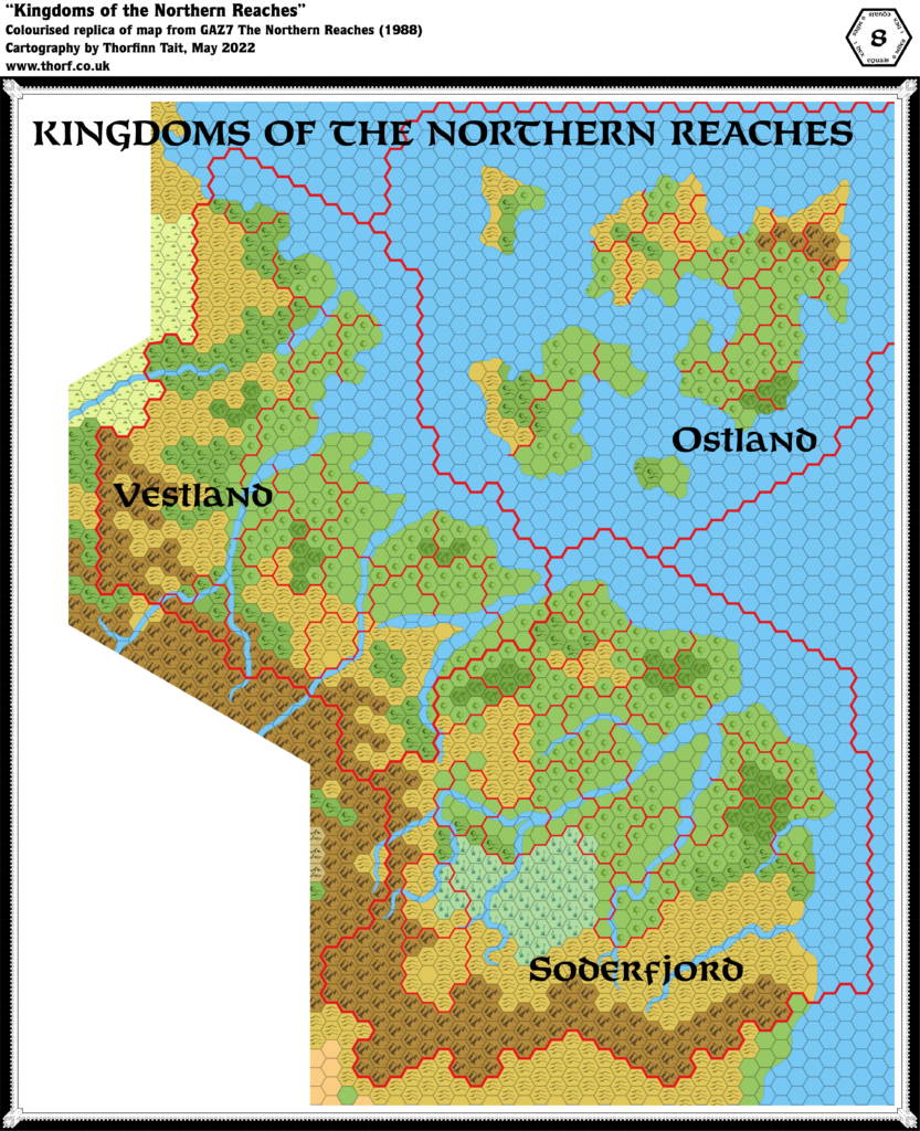
This map combines the colour maps with descriptions and black and white maps given in the text of GAZ7. Additionally, it shows the forests of the region as predominantly evergreen, as described in GAZ7 and shown on the Wrath of the Immortals map.
Update 25th March 2018: Pages 13-14 of the GAZ7 Players Book list the clans and dominions of the Northern Reaches, including the name of the settlement where each clan has its Great Hall. Many of these are already marked on the map as towns; the remainder have now been marked as villages. Jacob Skytte’s excellent work on Ostland already included these, and Ramelin Mystara also incorporated them into Ostland in the same locations, so the Atlas references these works in placing Ostland’s villages. Soderfjord and Vestland villages have been placed in logical positions within their domains.
Also of note are the revised rivers: the Landersfjord and Vestfjord rivers have been revised to reflect their original locations on X1’s map.
Notes
- Angstrom — Ostland’s most north-easterly village was labelled as this on TM2. However, GAZ7’s text and map both refer to it as Storm Bay. This mistake likely crept in because the Storm Bay label on GAZ7’s map was placed a whole hex away, over the sea. But the styling of the type indicates it is definitely a settlement label, not a sea label. The updated map therefore reverts to Storm Bay.
- Bakkedyb — added from Jacob Skytte’s Complete Domains of Ostland.
- Battle of Bridenfjord — incorrectly labelled as the Battle of Bridleford on GAZ7’s map. Both GAZ7’s text and TM2 confirm the correct label.
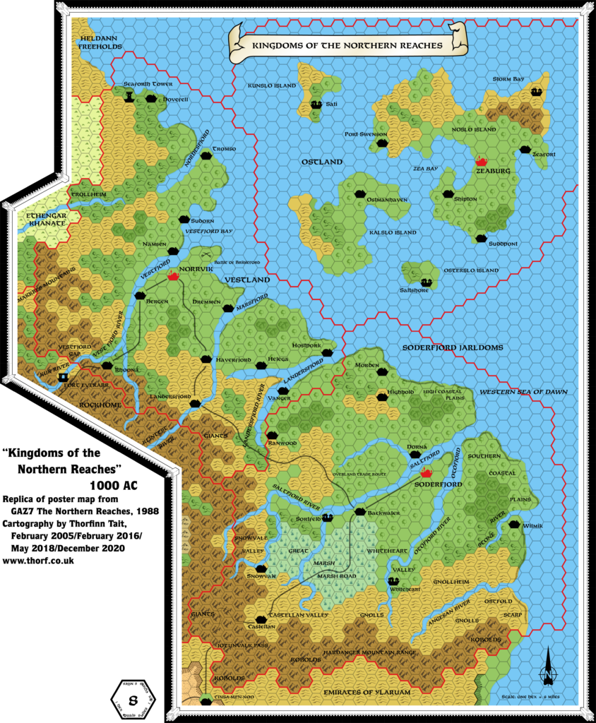
- Coastal Waters — many Gazetteers didn’t show shallow and deep water. TM2 showed coastal waters for the first time for the Northern Reaches.
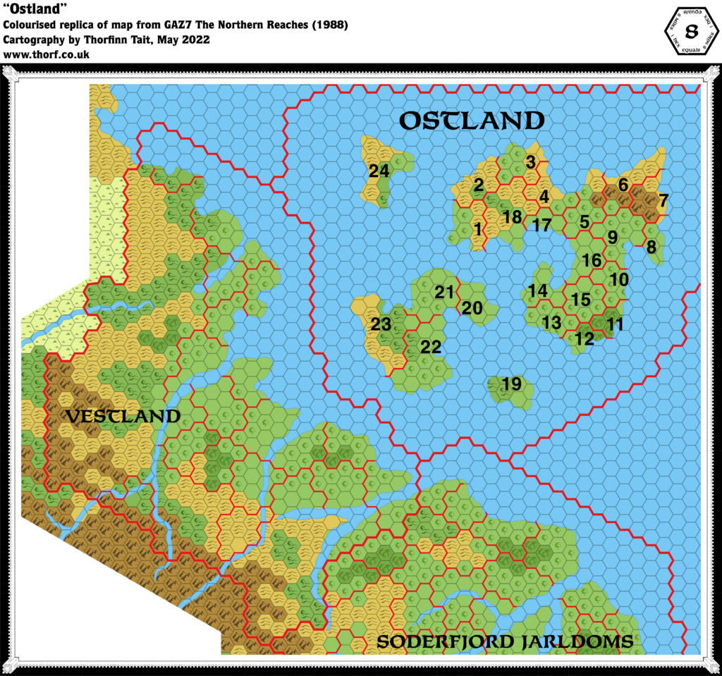
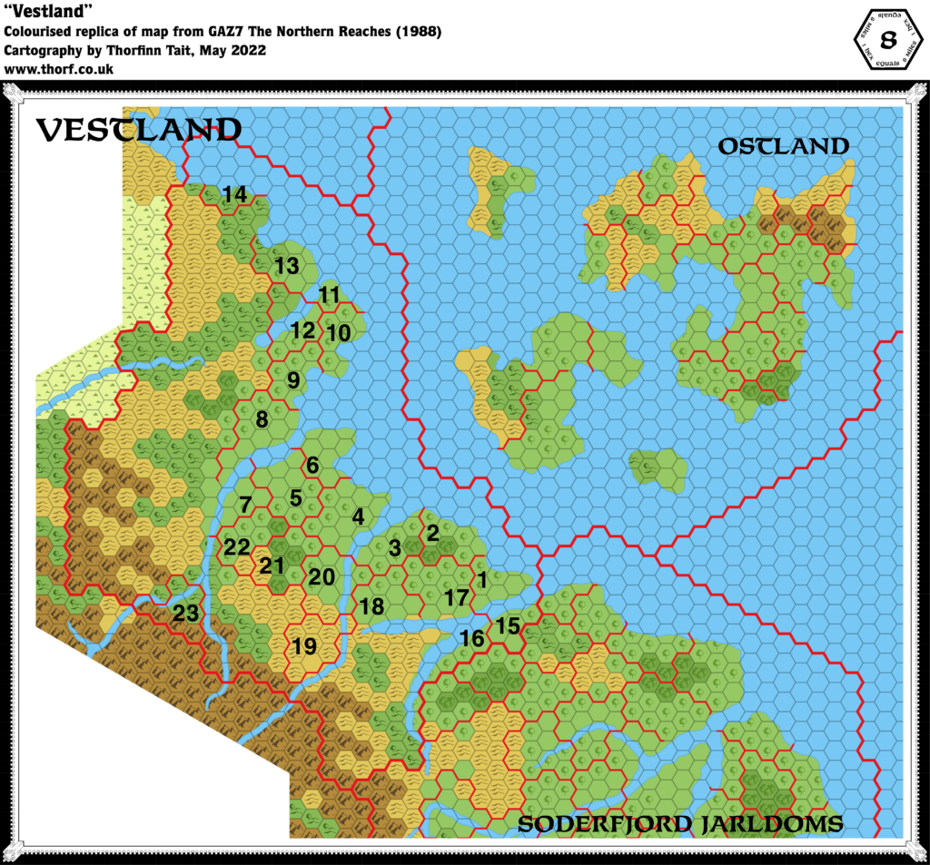
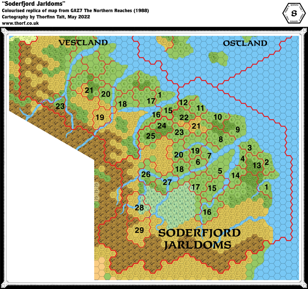
- Dominion borders — neither GAZ7’s poster map nor TM2 show the dominion borders for Ostland, Vestland and Soderfjord, although they are mapped out within GAZ7’s DM Book. (Some printings of the Gazetteer did not have numbers on the Ostland map, but others did.) Ostland is detailed on pages 10-11, Vestland on 14-15, and Soderfjord on 18-19.
- Forests near Wilmik — two forest hexes, one heavy and one light, shown on GAZ7’s map were changed to clear hexes on TM2. This change continued in the Rules Cyclopedia maps. The Atlas retains the original map’s forests.
- Fosterhed — this domain of Vestland is spelled “Fosterhead” in GAZ7 DM Book page 15’s table, but “Fosterhed” on page 14 of the Player Book. The Atlas assumes “Fosterhed” is correct, in line with another province, Namahed.
- Gudhjem — added from Jacob Skytte’s Complete Domains of Ostland.
- Havskum — added from Jacob Skytte’s Complete Domains of Ostland.
- Hex Art error — a hex on Noslo Island, four hexes due north of Zeaburg, had a forest symbol on a hills background colour on GAZ7’s map. TM2 corrected this error, replacing it with a standard light forest hex.
- Kobolds — two labels for these humanoids in the Hardanger Mountain Range were not shown on TM2, despite appearing on GAZ7’s map.
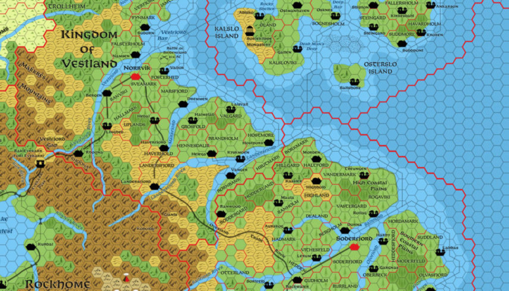
- Landersfjord — this name is shared by the fjord itself, a river, a town, and a dominion. However, GAZ7’s map has the river taking a sharp bend south from the fjord instead of going west to meet the town. Instead, the town sits on the river that feeds Marsfjord. But GAZ7 DM Book page 17a-b states: “Landersfjord: This frontier and trade town on the Overland Trade Route is also a deep-water port on the Landersfjord River.” Moreover, reference to X1’s Known World map shows that the rivers here were obscured by labels on the original map. The Atlas concludes that Landersfjord River should indeed flow into Landersfjord itself, and the town should also be situated on that river. The updated map therefore cuts Marsjord off at Haverfjord, instead connecting Landersfjord river and fjord. See also the Klintest River entry for Rockhome’s updated map.
- Mountain names — TM2 added a new label for Odharjokull (Alt. 15,750 ft.) in the Hardanger Range, Soderfjord.
- Norstedt — added from Jacob Skytte’s Complete Domains of Ostland.
- Osterslo Island — this island is labelled as “Osterlo Island” on TM2. Although this is not necessarily a mistake (GAZ7’s text uses both names), the GAZ7 map uses “Osterslo”, which is in keeping with the names of the other Ostland islands. The Atlas therefore uses “Osterslo” as the correct name.
- Rhoona borders — the borders marked in GAZ7 suggest that this domain may be defined by the rivers to the north and east.
- Settlements on terrain hexes — GAZ7’s map put a number of towns on top of forest and forested hill symbols, rather than the usual coloured hex of the appropriate type.
- Shipping Lanes and Reefs — these were all added in TM2. GAZ7 shows none at all.
- Skovstad — added from Jacob Skytte’s Complete Domains of Ostland.
- Sodervirk Wall — GAZ7 DM Book page 19 references this wall under construction in “the southeast hill region”.
- Sorteklippe Monastery — added from Jacob Skytte’s Complete Domains of Ostland.
- Storm Bay — this village was mislabelled Angstrom on TM2, likely due to confusion caused by “Storm Bay” appearing over an actual bay on GAZ7’s map. See Angstrom for more details.
- Steingard — added from Jacob Skytte’s Complete Domains of Ostland.
- Vestfjord Gap — this label was missing from TM2.
- Villages — other than a few token villages, GAZ7’s map does not feature a lot of villages. However, pages 13-14 of the GAZ7 Players Book list the clans and dominions of the Northern Reaches, including the name of the settlement where each clan has its Great Hall. Many of these are already marked on the map as towns; the remainder have been marked as villages. Jacob Skytte’s excellent work on Ostland already included these, and Ramelin Mystara also incorporated them into Ostland in the same locations, so the Atlas references these works in placing Ostland’s villages. Soderfjord and Vestland villages have been placed in logical positions within their domains.
- Vinterdal — added from Jacob Skytte’s Complete Domains of Ostland.
References
- Ostland at the Vaults of Pandius
- Soderfjord at the Vaults of Pandius
- Vestland at the Vaults of Pandius
- Northern Reaches map thread at The Piazza
Thanks to:
Jesper Andersen (Spellweaver), Jose Ignacio Ramos Lomelin, Mike (metal), Sheldon Morris (Hugin), Jacob Skytte, Andrew Theisen (Cthulhudrew)



24 January 2019 @ 9:45 pm
Hi Thorffinn
I am currently working on the 1 mile hex map of Ethengar, and in this process I take large sections of Heldann and Vestland, amongst others.
I have a problem in deciding which path to follow.
The map of X1 reveals the green coast of Heldann instead being Hills.
This is the earliest Canon source of the region
https://i0.wp.com/www.thorfmaps.com/wp-content/uploads/2018/04/lets-map-mystara-ii-24.png
The Trailmap reveals somewhat more information on this region
https://mystara.thorfmaps.com/tm2-eastern-countries-8/
The Fanon map http://www.pandius.com/heldann.jpg seems to fllow this regime although totally forgetting the mountain hex.
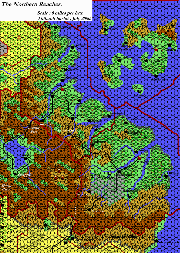
The most used fanon map http://glacas.fr/lantredemystara/wp-content/uploads/sites/2/2017/03/heldann.gif seems to ignore all information and instead using the bare hills as in the https://i1.wp.com/mystara.thorfmaps.com/wp-content/uploads/2016/02/gaz7-northern-reaches-8-sm.png?fit=846%2C1024&ssl=1 Northern Reaches map while still seemingly imposing the bare maps of TSR 9218 – X13 – Crown of Ancient Glory as material.
The problem for me lies in to use what(or merge what) due the immense altitude of the Ethengar Plateau (4000feet very close to the ocean being canon as per Gaz 12 Golden Khan of Ethengar). I have tried to resolve this as can be seen in this discussion; http://www.thepiazza.org.uk/bb/viewtopic.php?f=3&t=15023&start=325#p226066
I try to use canon matter as a base, adding the fanon over it for more detail
Yet somehow I am very unsure how to go exactly. So I do require at least some advise from the Mystara Mapping Master.
Another issue in these maps is asked here; http://www.thepiazza.org.uk/bb/viewtopic.php?f=3&t=15023&start=225#p221335
Could/would you join in the discussion and help me here in both issues??
With Great respect I await your answer
Robin
21 March 2019 @ 7:24 pm
Hi Robin!
I answered you elsewhere, but since I just found your comment here too…
I agree that the most detailed source — usually the latest one — is the one to go with if at all possible. With Heldann, there really isn’t a good official source, but TM2 gives the biggest suggestion of how the region may have been developed at 8 miles per hex. This is why my own version still has yet to see the light of day. There’s just no way to tackle this region in detail without making a lot of stuff up on your own, which is why each fan version is quite different from the next.
24 February 2019 @ 6:17 am
Hi Thorf
I discovered that the location of Rhoona might be flawed on the canon 8 mile maps.
I discovered this in my research for the 1 mile hex map of the region…See my post on this in the Piazza
http://www.thepiazza.org.uk/bb/viewtopic.php?f=3&t=15023&p=227529#p227529
All in all it seems Rhoona must be placed 1 hex NE, which is the closest to its clearly described location in Curse of Xanathon
What do you think of this?
Greets
Robin
21 March 2019 @ 7:17 pm
Interesting… A very quick comparison of the 8 and 24 mile per hex maps suggests that the best solution may be to do as you suggest, then redraw the fjord on the 8 mile per hex map so that the confluence is in the same hex as the town. The 24 mile per hex map supports this.
21 March 2019 @ 8:37 pm
We Mystara mappers must work together. For neither of us can see everything. 😉
The discrepancy was especially noted due the textual description of Rhoona while resembling the Rhoona detail map, and the accompanying Curse of Xanathon region hex map
Hope this helped
Greets
Robin