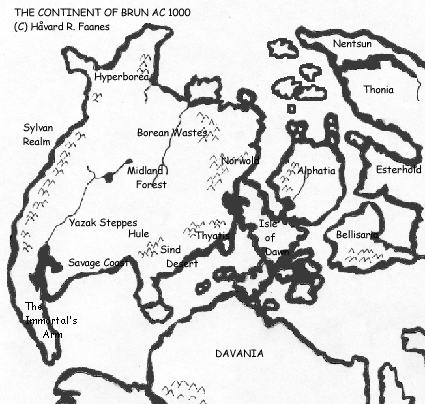
CM1 Brun
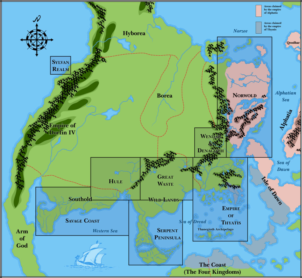
Before the world map was published in 1985’s Master Rules Set, this map of the continent of Brun appeared in CM1 Test of the Warlords (1984). An almost identical map was in the Companion Rules Set (1984).
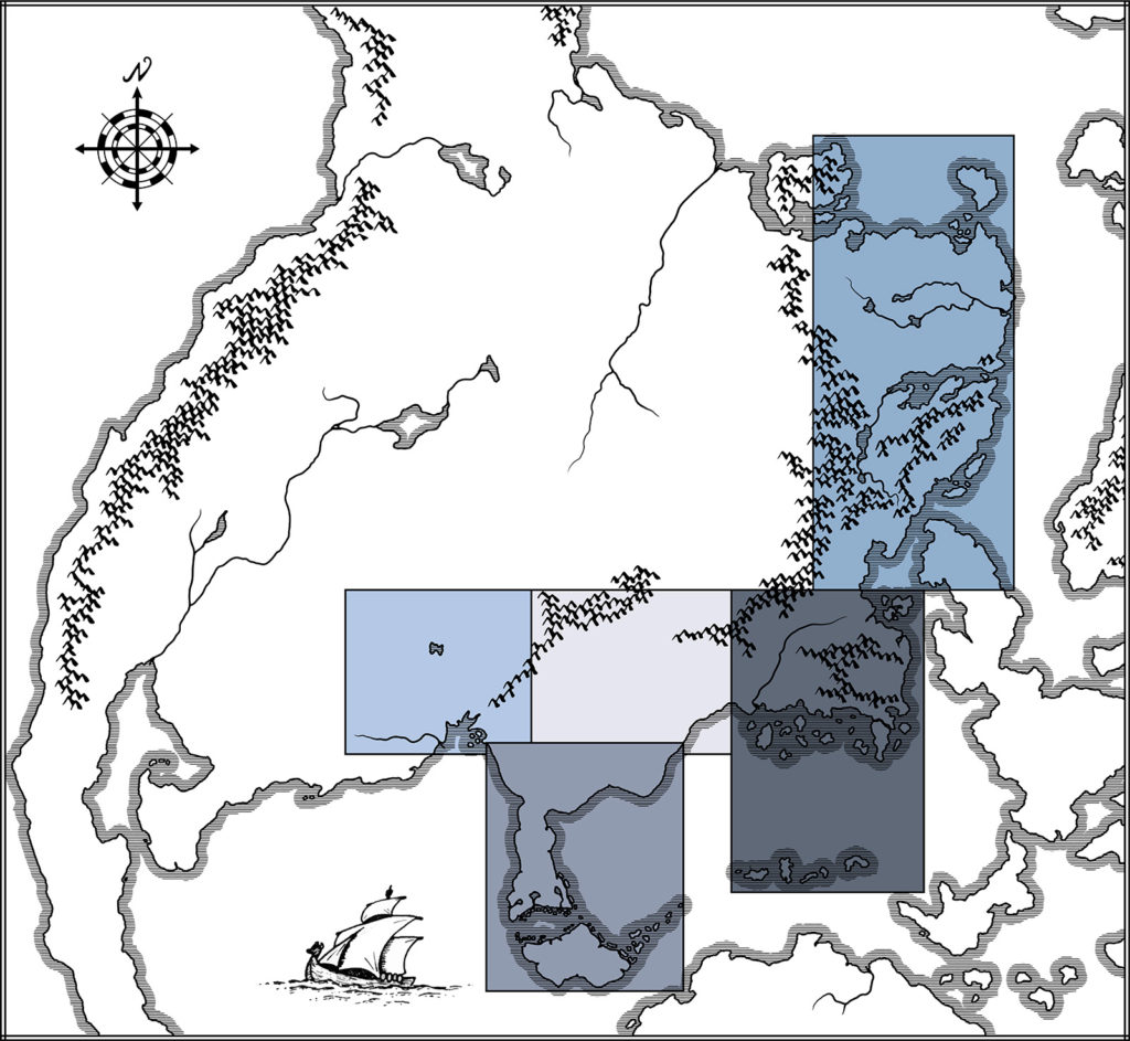
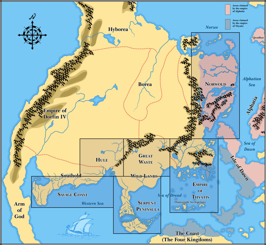
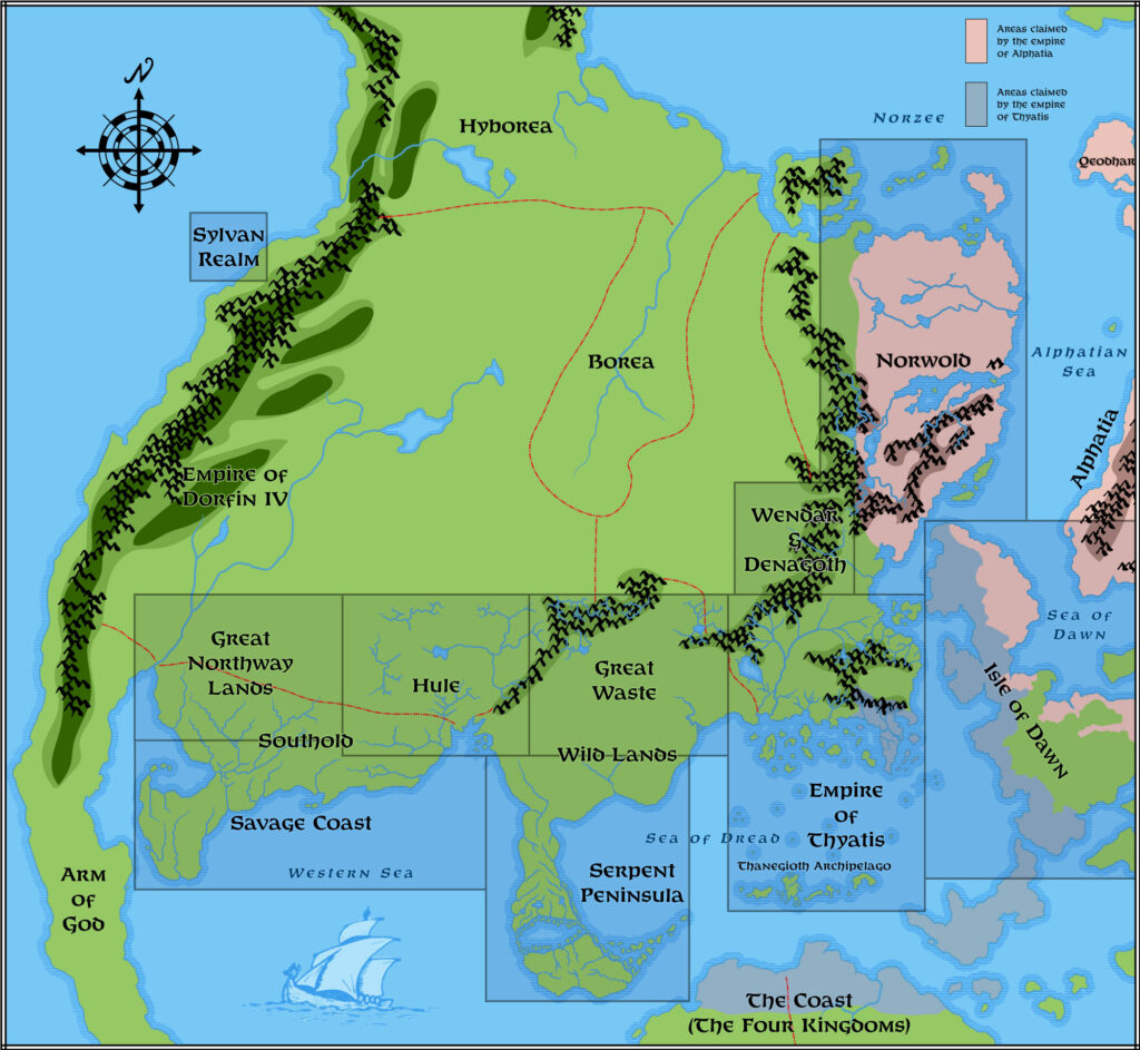
This map shows most of the continent of Brun and the Isle of Dawn, along with hints of Alphatia and the much larger southern continent, Davania. It was the first small scale view of the world. While CM1’s map showed the extents of the warring empires of Thyatis and Alphatia, the Companion Set‘s map focused on showing where existing maps fit into the world.
The inspiration for this map is prehistorical maps of ancient Earth — Jurassic Earth, to be precise, around 150 million years ago. The map which this map was probably inspired from was featured in Continents in Collision (1983), a Time Life book in the Planet Earth series. Many fans spotted the similarities back in the 80s, though the map was not posted online until it was unearthed once again in February 2018. For the full story, see this article on thorfmaps.com.
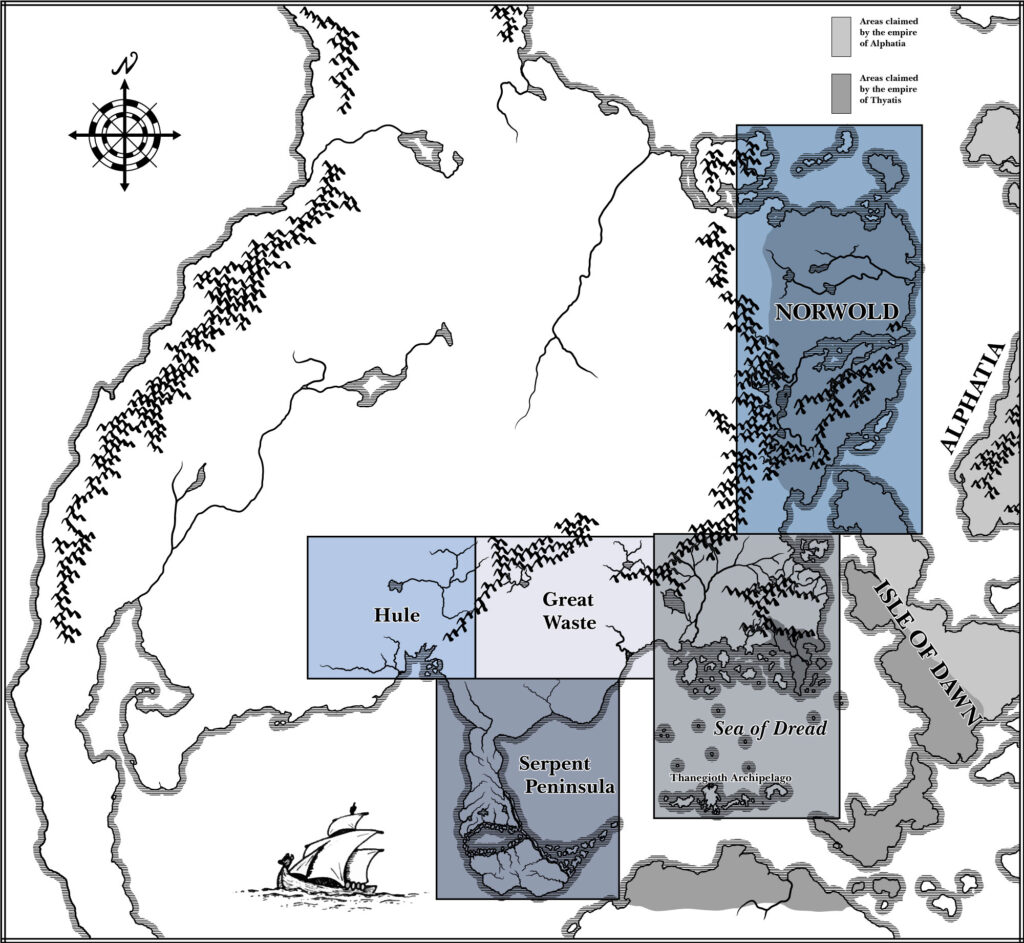
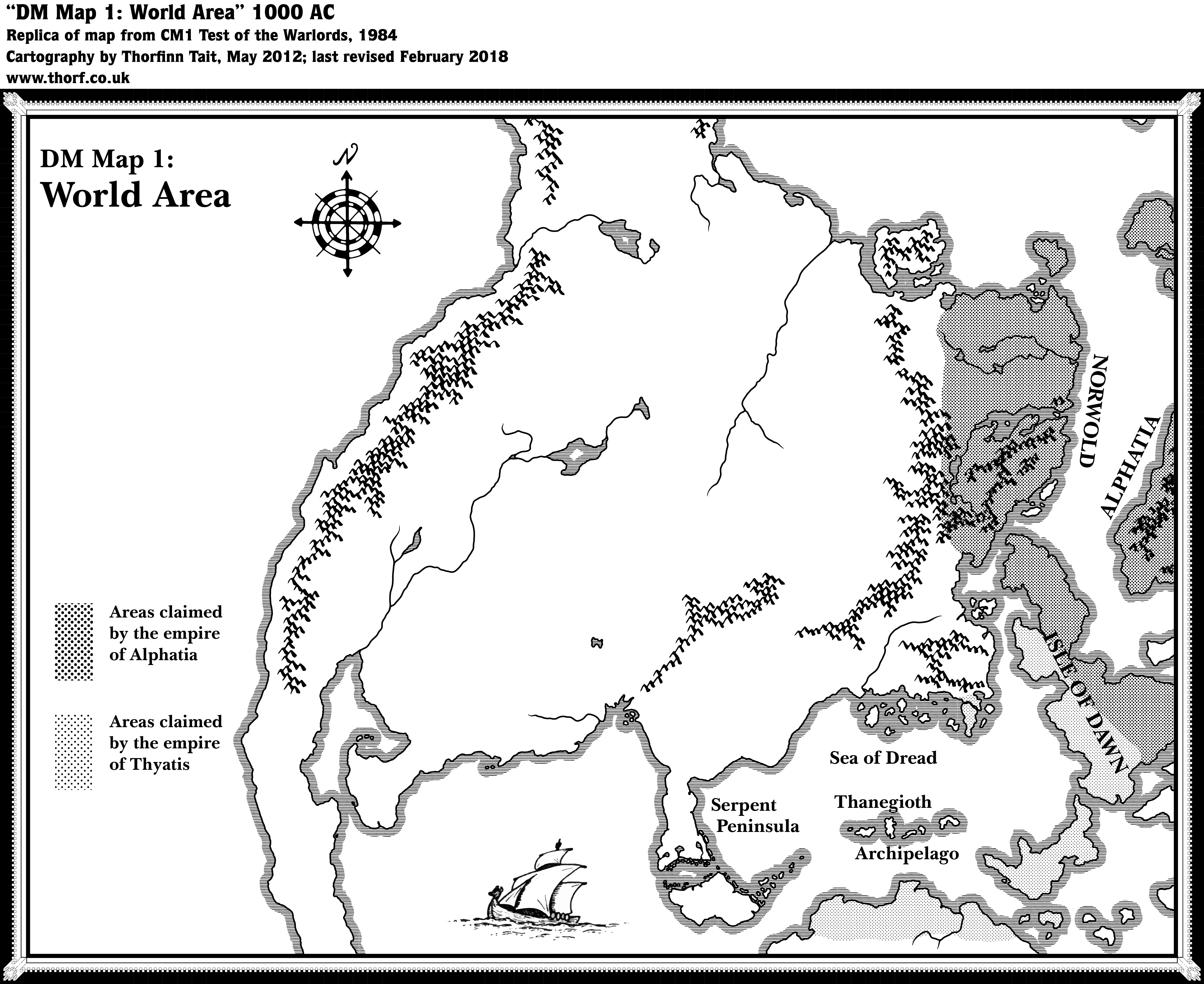
Replica Map (February 2018)
Sources
- CM1 Test of the Warlords (1984) (PDF at DriveThruRPG)
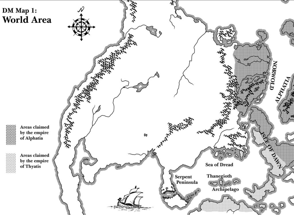
- DM Map 1: World Area, non-hex map on page 3 (Cartography by Diesel)
Chronological Analysis
This is Map 22. It was published in June 1984. The updated version of this map has not yet been released. See also Appendix C for annual chronological snapshots of the area. For the full context of this map in Mystara’s publication history, see Let’s Map Mystara 1984.
The following lists are from the Let’s Map Mystara project. Additions are new features, introduced in this map. Revisions are changes to previously-introduced features. Hex Art & Fonts track design elements. Finally, Textual Additions are potential features found in the related text. In most cases, the Atlas adopts these textual additions into updated and chronological maps.
Additions
- Borders — the rough border between the empires of Thyatis and Alphatia on the Isle of Dawn is discernible, as are the general areas of influence of each empire, although they don’t quite match up with contemporary maps. Alphatia is shown to claim all of Norwold except for the extreme northwest, Frosthaven, and the small isles north of the Isle of Dawn; the islands north of the Alphatian mainland; the Alphatian mainland, but not the spur to its southwest (likely an oversight); and of course half of the Isle of Dawn. Thyatis is shown to claim northern Davania, Ochalea and the western Pearl Islands (all still unnamed); half of the Isle of Dawn; and the Thyatian mainland, though the peninsula of Tel Akbir and some of the islands are not marked (likely an oversight).
- Nations — this map marks the first appearance of the Empire of Alphatia.
Hex Art & Fonts
- Fonts — Baskerville.
- New Symbols — None.
Analysis
CM1’s version of the Companion Set continental map matches it closely, to the point that they are variations of the same map. This one just adds a few labels and the extents of the empires.
Join in the Discussion at The Piazza
Come and join in the discussion about this map at The Piazza, where I am holding a “read through” of the Let’s Map Mystara project.
Past and Future Versions of Brun Overview Maps