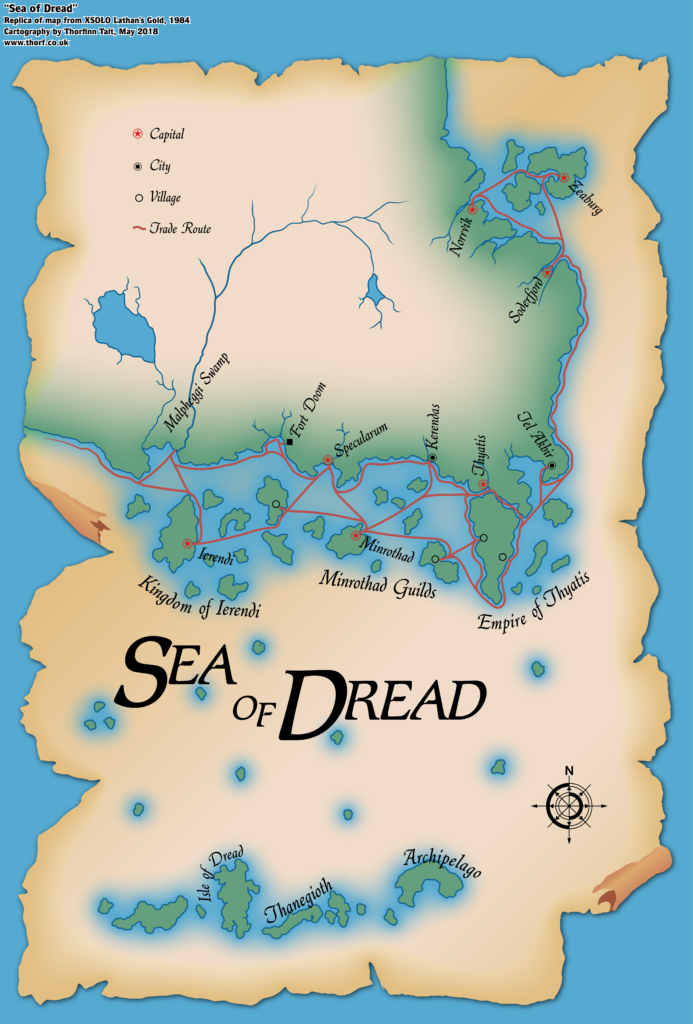
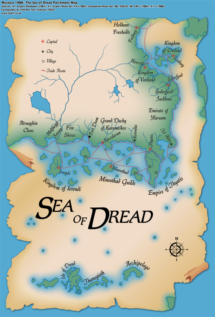
Sea of Dread Parchment (1984)
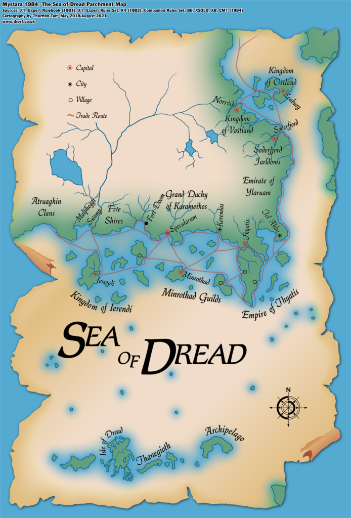
I’ve rebuilt this map from the ground up, using the coastlines, settlements, and so on from the full Brun, 24 miles per hex (1984) map. Since it’s a player handout, it never needed to be entirely accurate, but it’s nice to have a more accurate version anyway — and the original is, of course, still available if you would like a less precise version.
New additions from other 1984 maps include the Isle of Dawn, Teki-nura-ria and its neighbours, and Ochalea, all on the eastern edge of the map. I have also added many more labels to the coastal realms and settlements than the original included.
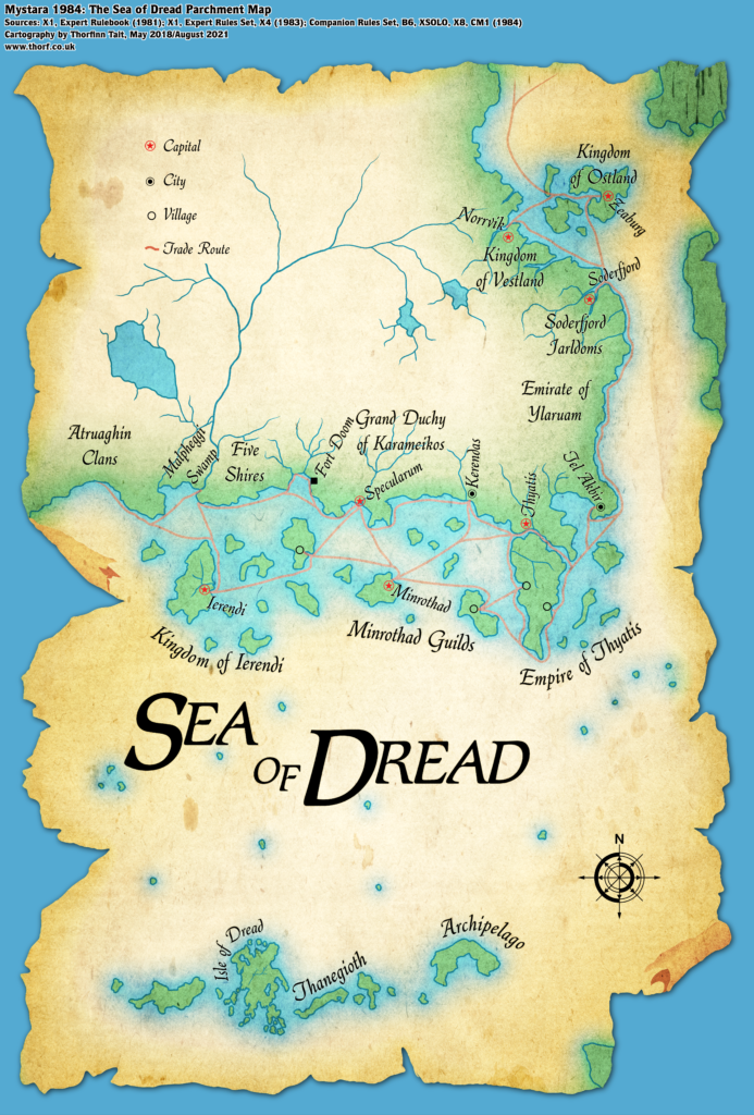
Finally, there is a bonus version of the map with added texture.
Chronological Map (August 2021)
This map is part of the Mystara 1984 series of chronological maps. It is an updated map, incorporating all available sources and made internally consistent with other maps in its series. But it only uses sources published in or before 1984.
For more information, see Appendix C: Cartographic Chronology.
Sources
- Mystara 1983
- Companion Rules Set (1984) (PDF at DriveThruRPG)
- B6 The Veiled Society (1984) (PDF at DriveThruRPG)
- X7 The War Rafts of Kron (1984) (PDF at DriveThruRPG)
- X8 Drums on Fire Mountain (1984) (PDF at DriveThruRPG)
- CM1 Test of the Warlords (1984) (PDF at DriveThruRPG)
- XSOLO Lathan’s Gold (1984) (PDF at DriveThruRPG)
Revisions
For detailed notes, see the posts for each individual source map at the links above.
- Coasts — All coasts come from the Brun, 24 miles per hex (1984) map.
- Islands — As noted in related posts, the shapes of the islands come from XSOLO, while the scale has been adjusted to fit X1’s original sizes. Exact positions on the map also match X1’s locations.
References
- Let’s Map Mystara 1984 — the original project thread for this map
- Let’s Map Mystara Together discussion thread at The Piazza (link leads to this map’s post)
- The Sea of Dread and the Thanegioth Archipelago at the Vaults of Pandius

