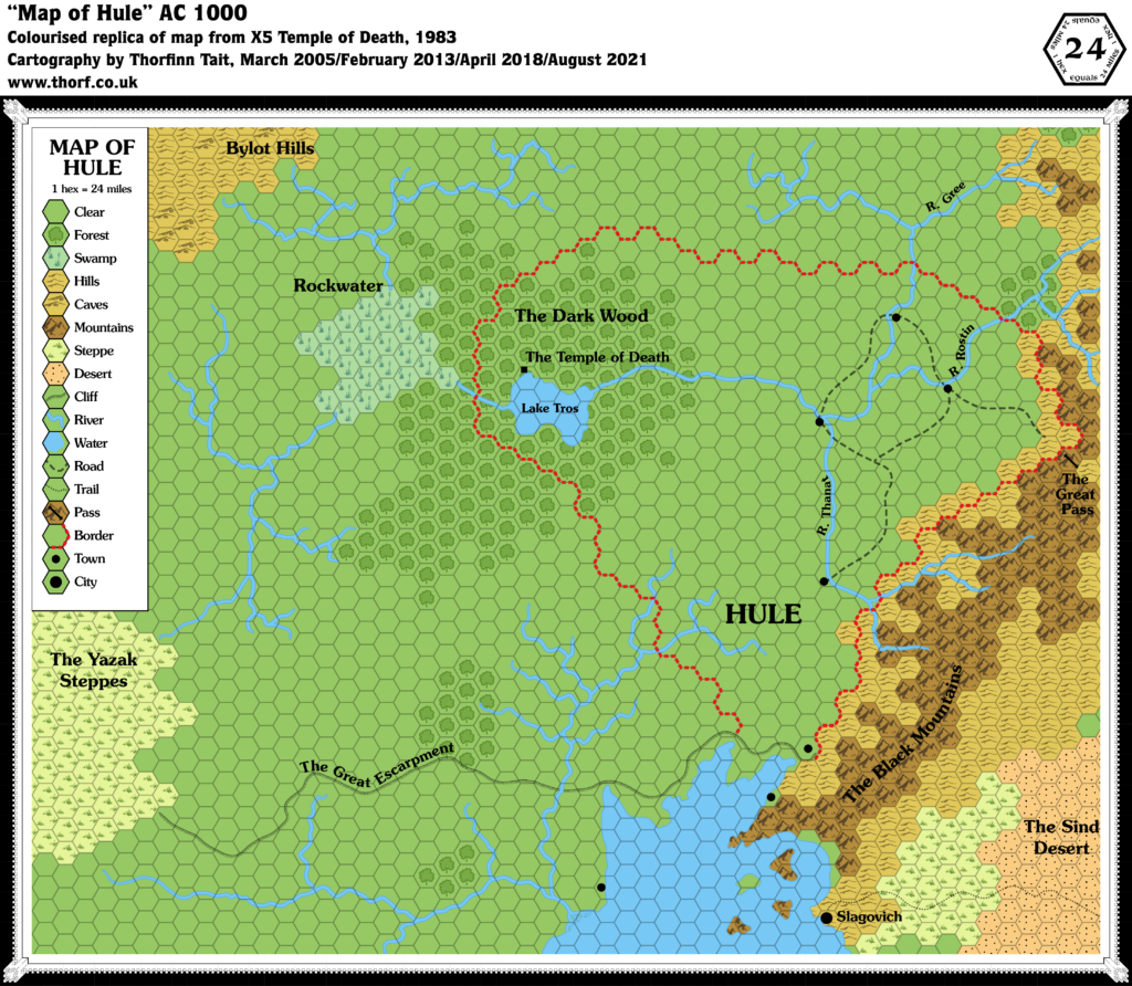
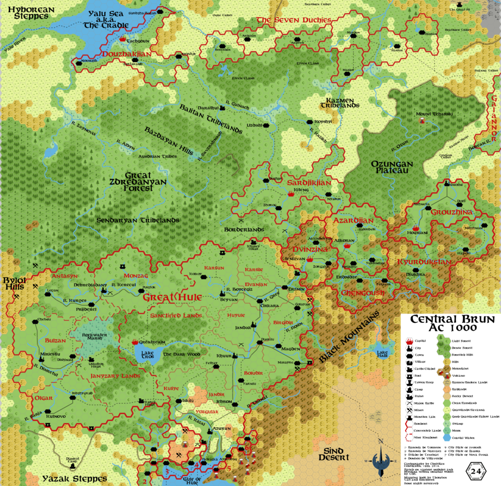
X5 Hule, 24 miles per hex
X5 followed quickly after X4, and it again expanded the world westward. This time, the map included an overlap of two hex columns with the previous map, making the join between them less problematic; unfortunately, the overlapping area is not the same on both maps.
The area covered was Hule and its surrounding areas. We got our first glimpse of the Great Escarpment, as well as the Gulf of Hule area, which would be fully detailed and expanded some years later beginning in Dragon 171 and continuing through to the Savage Coast Campaign Setting.
But back in 1983, detail was somewhat scarce. Slagovich made its first appearance, and Hule itself made a barebones appearance with just a few towns and the titular Temple of Death.
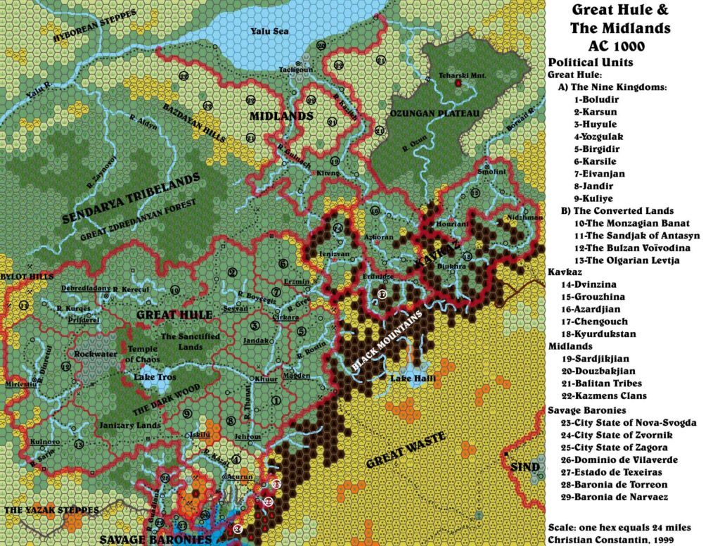
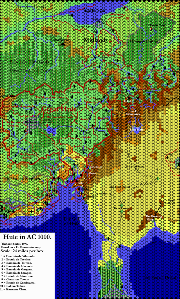
Unfortunately, this area was never again shown on official maps, with the sole exception of a tantalising glimpse on the edge of Champions of Mystara‘s Great Waste map. Luckily, fans have since taken up the challenge and fully detailed Hule.
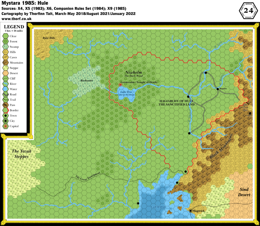
Replica Map (August 2021)
Sources
- X5 Temple of Death (1983) (PDF at DriveThruRPG)
- “Map of Hule”, page 31
Chronological Analysis
This is Map 9. It was published in July 1983. The updated version of this map has not yet been released. See also Appendix C for annual chronological snapshots of the area. For the full context of this map in Mystara’s publication history, see Let’s Map Mystara 1983.
The following lists are from the Let’s Map Mystara project. Additions are new features, introduced in this map. Revisions are changes to previously-introduced features. Hex Art & Fonts track design elements. Finally, Textual Additions are potential features found in the related text. In most cases, the Atlas adopts these textual additions into updated and chronological maps.
Additions
- Borders — Hule’s borders are shown, although the logic behind them is a bit opaque.
- Coastline — the northern part of the Gulf of Hule is shown for the first time, although it remains nameless at this time.
- Islands — four islands are shown in the Gulf of Hule.
- Lakes — Lake Tros.
- Mountains — the western limits of the Black Mountains.
- Plateaus — the Great Escarpment.
- Rivers — River Gree, River Rostin, River Thanat. Note that it’s not clear which river is a tributary to which.
- Settlements — seven unnamed towns, as well as Slagovich (a city) and the Temple of Death itself (marked as a filled black square).
- Terrain — the Bylot Hills, the Yazak Steppes, Rockwater, and the Dark Wood.
- Trails & Roads — although the join is not exact, the trail from X4’s map is shown to end at Slagovich. Hule’s northern four towns are connected by a network of roads.
Revisions
- Mountain Passes — the precise location of the Great Pass is almost half a hex further west than it was in X4, though its general location remains the same.
Hex Art
- Fonts — Souvenir.
- New Symbols — All-new art in a hand-drawn style, although it conforms rather well to the hex grid. Symbol-wise, the usual filled black circle is used for Town, while a larger version of the same is used for City. The Temple of Death’s filled black square is not present in the legend.
Textual Additions (X5)
- Borders — p. 10 describes the sacred forest as being “in the centre of the country”. This suggests a much larger Hule than is depicted on the map.
- Fauna — animals found in the Dark Wood “include bears, boars, deer, small game, owls, crows, ravens, toads, and bats.” (p. 15) There are also spectral hounds. (p. 16)
- Government — “Hule is a hagiarchy, a government run by “holy men” and clergy. Only humans are active in the government, although the non-humans may act as advisors to a high official.” (p. 10)
- Lakes — the map’s Lake Tros is “also known as the Lake of the Deeps“. (p. 10)
- Monuments — a Golden Cenotaph (obelisk) stands at the eastern edge of the Dark Wood, likely close to the river. (p. 15) Inside the forest, just off the “cleared path”, lies a Black Altar, a 6 foot high black stone edifice. (p.15)
- Nations — Hule, also known as the Sanctified Land.
- Plateaus — the Great Escarpment is referred to as the Risilvar Escarpment. (p. 10) This name only appears once in X5’s text.
- Races — “The population of the country is a mix of humans and non-humans, mainly orcs, gnolls, bugbears, kobolds, and ogres. All these groups seem to live and work together to some degree, although they often feud and raid one another.” Humans nevertheless seem to be the dominant race: “because the humans are so many and well-organized, nearly all the non-human tribes have allied with the government.” (p. 10) Further, demi-humans are rare: “Non-human characters (dwarves, elves, and halflings) are very rare and are objects of curiosity to the humans of Hule.” (p. 11)
- Rulers — the Master of Hule, Hosadus. (p. 12)
- Settlements — “The farmland is dotted with small villages and farming communities. These are very small and simple, and not interesting to the players. Any information peasants can give is only rumors or guesses. These villages are not located on the map.” The towns marked on the map are noted to be “bustling centres of trade” with “all the services adventurers need, including information”. (p. 10) The Temple of Death is Hule’s capital, but in Hule it is known as Greatrealm. (p. 11 and 17) It is located “not far from the shores of Lake Tros”, “on the slope of a small valley”. “The temple is a number of buildings inside a walled compound. The land around the temple is surrounded by fields.” It seems there are “many people” staying in the temple, though the exact population is not noted. (p. 17) Magden (which “contains about 4,000 inhabitants”) is the name of the first town the players enter; since this is most likely to be the one closest to the Great Pass, we will take this one to be Magden. (p. 12)
- Terrain — Most of Hule’s countryside is said to be farmland, with the “sacred forest” of Niwhelm in the “centre of the country”. This disagrees with the map on two levels: the map shows Hule’s borders as encompassing only part of this forest; and the map calls this forest the Dark Wood. Likely this is a perspective thing, like the Temple of Death/Greatrealm. (p. 10) The Dark Wood is said to be feared by local people, with no human population, and “many of the evil non-humans avoid it”. “The most common trees of the forest are oak and aspen. The underbrush in this forest is very thick. Thorn bushes abound.” “The river becomes enchanted when it enters the wood.” Those drinking the water will eventually be transformed into boars and deer. (p. 15) The map’s Yazak Steppes are referred to as the Dravish Steppes. (p. 10) As with the Risilvar Escarpment (see Plateaus above), this name only appears once in the text.
- Trails & Roads — it is implied that there is a cleared path through the Dark Wood. (p. 15) “A large path leads from the temple compound to the shore of the lake, which is out of sight of the temple”. This road is lined with statues. (p. 17)
Join in the Discussion at The Piazza
Come and join in the discussion about this map at The Piazza, where I am holding a “read through” of the Let’s Map Mystara project.
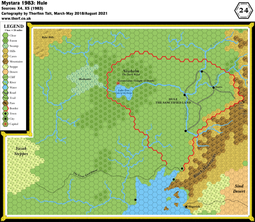
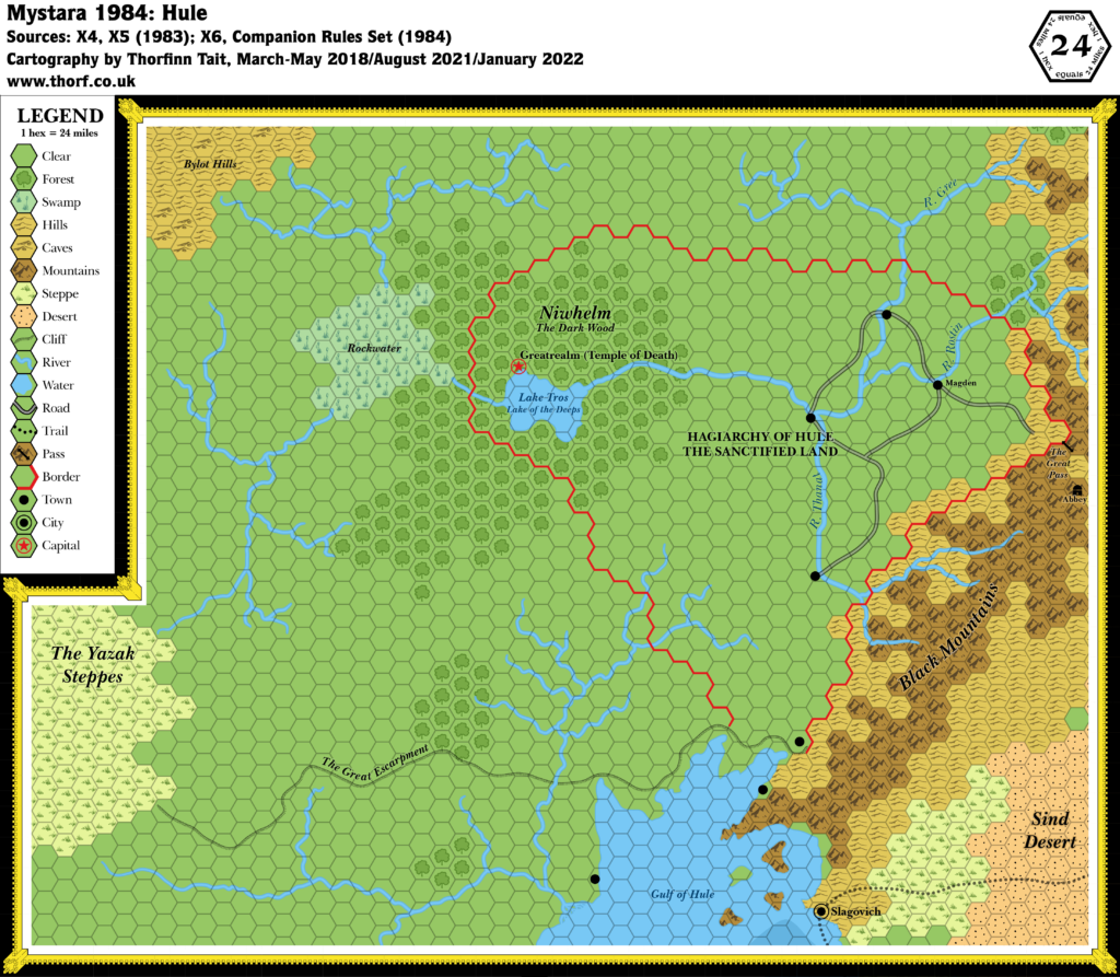
Past and Future Versions of this Map
This article was first posted 13th April 2018.

14 April 2018 @ 1:50 am
I think it is also important to remember that the symbology used for the terrain in x5 didn’t always cover a whole hex. The area covered by the swamp had a border similar in style to the coastline and the mountains emphasized the branches of the range more than area covered. It would have been interesting to see later maps done in a similar style, though it is hard read in black and white.
14 April 2018 @ 10:18 am
That’s a good point. The swamp especially is drawn much like a lake. It’s interesting how faithful much of the map remains to the hex grid, too — especially the forests.
This would be a good time to remember that hexes do not mean that their entire area is filled with that terrain type, but only that the marked terrain is the main type present within that hex. The obvious example here is a single mountain hex in the middle of an otherwise flat plain; the mountain hex is likely intended to represent a single, lonely mountain in that case. And it could take up much less than the whole hex — or it could actually extend into adjacent hexes, depending on the scale.
Hexes leave a lot of room for interpretation in this way.
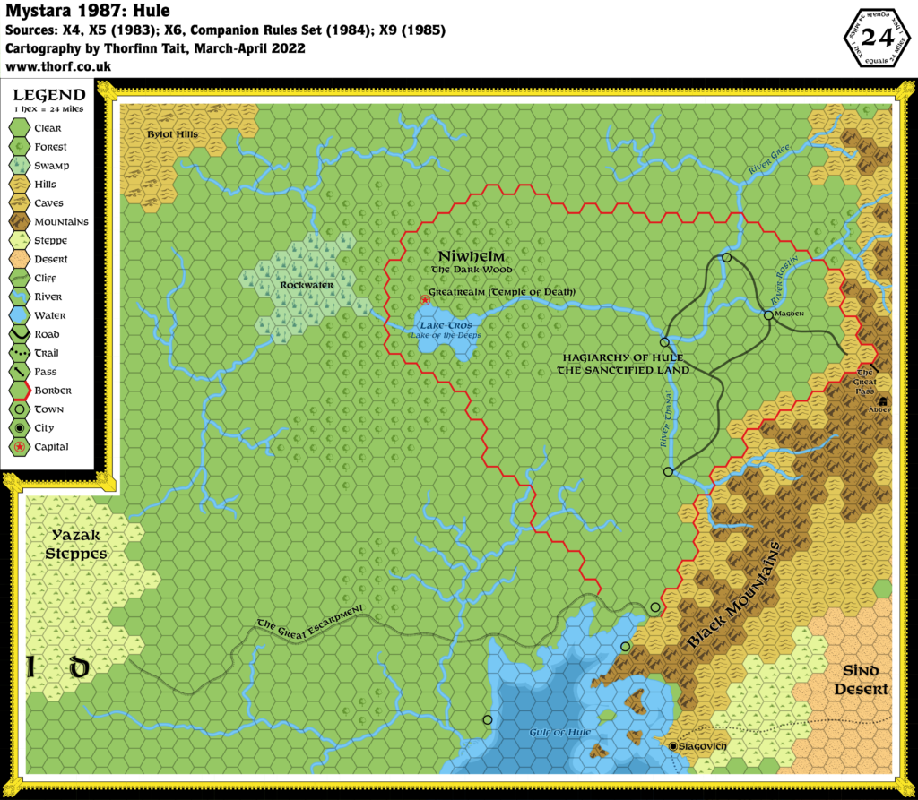
Incidentally, this is one of the only maps where I have refrained from replicating the original art style.