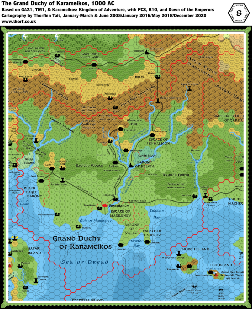
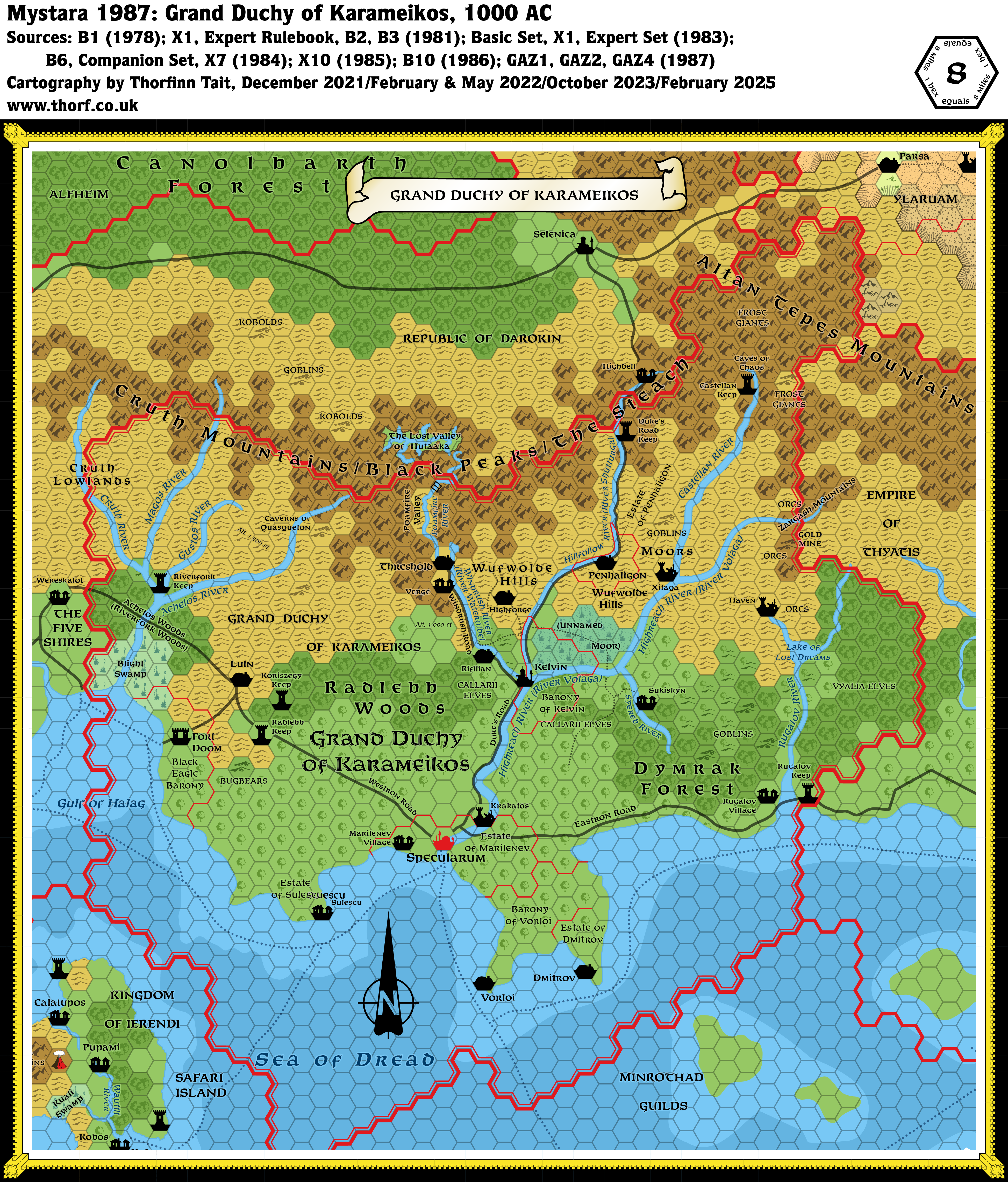
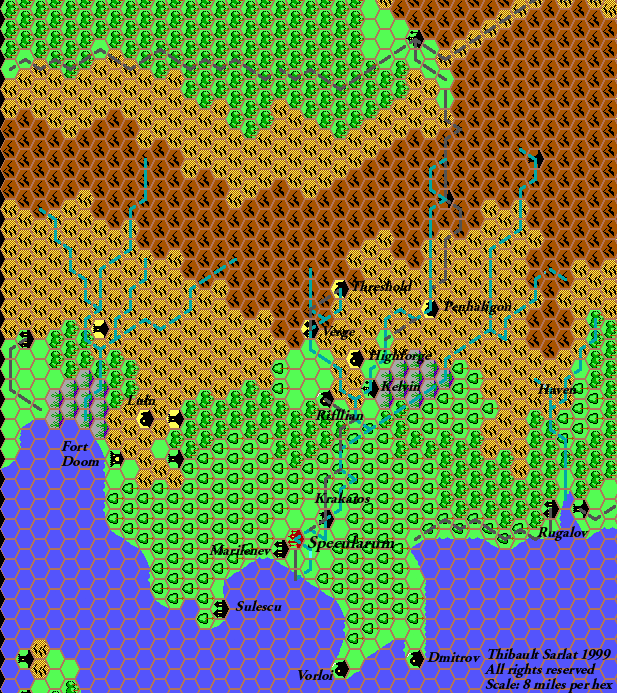
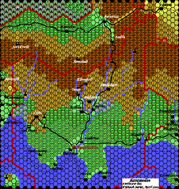
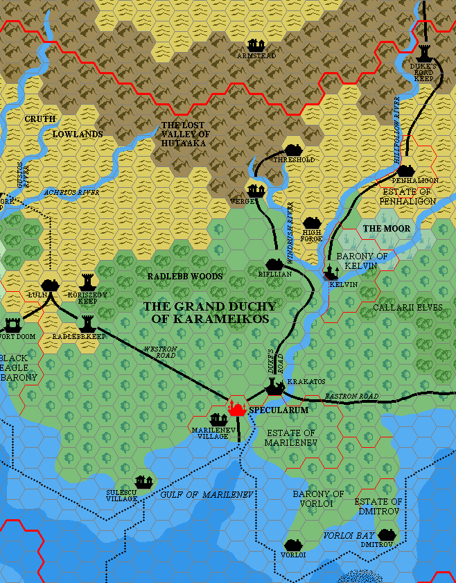
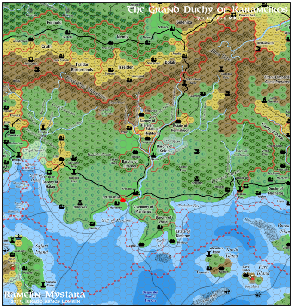
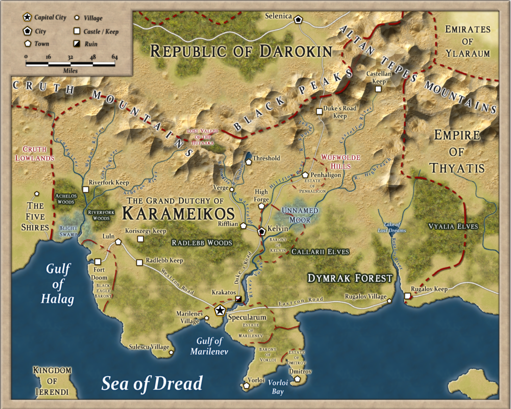
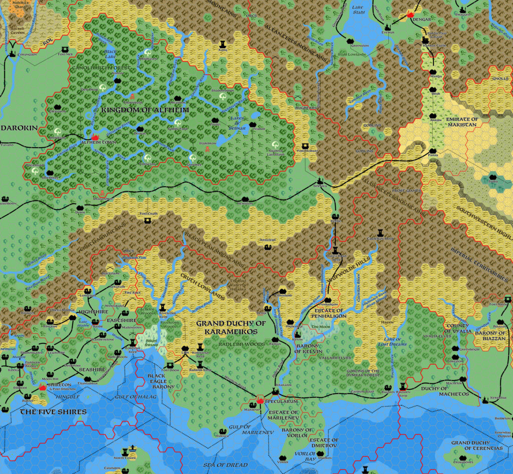
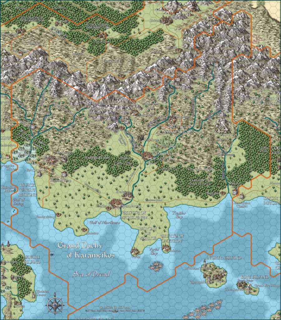
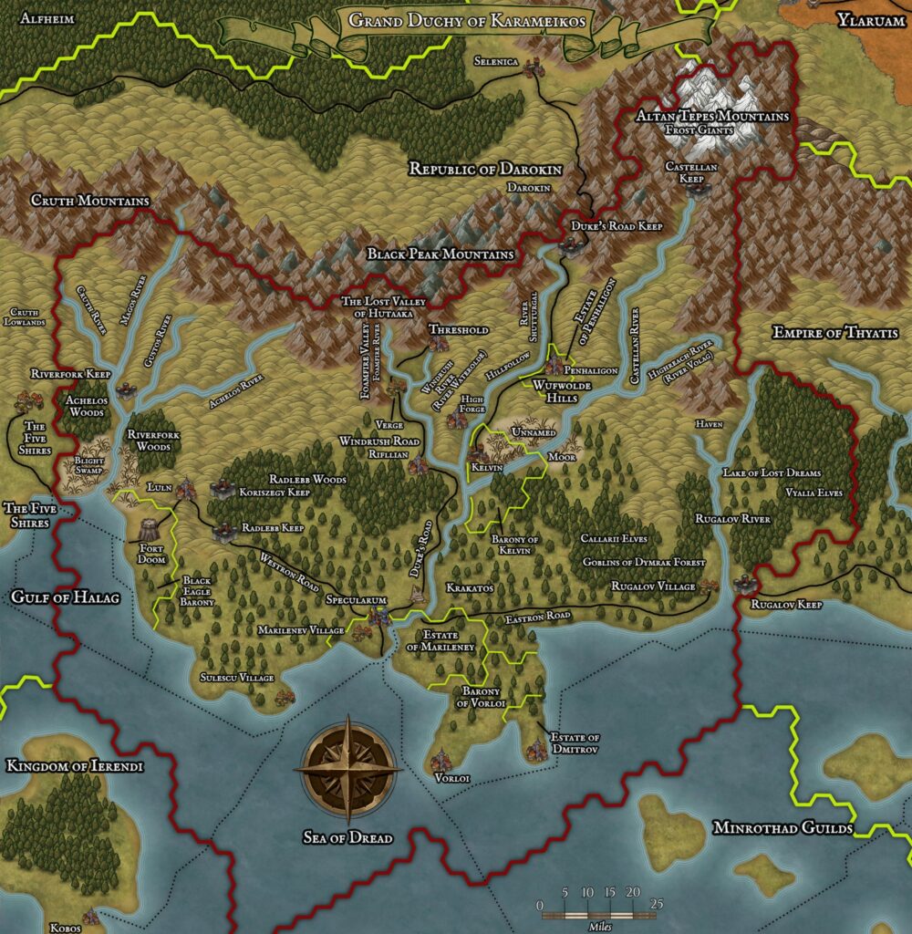
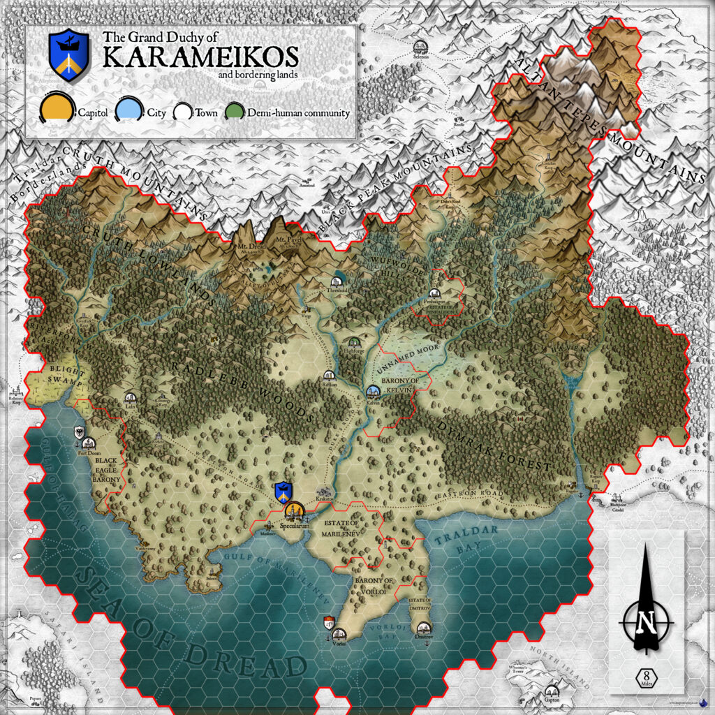
Karameikos, 8 miles per hex
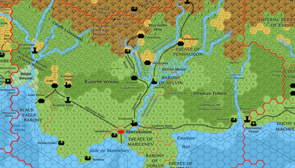
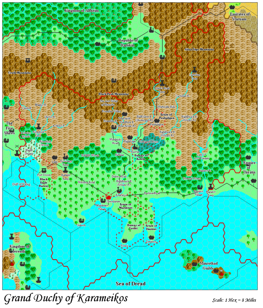
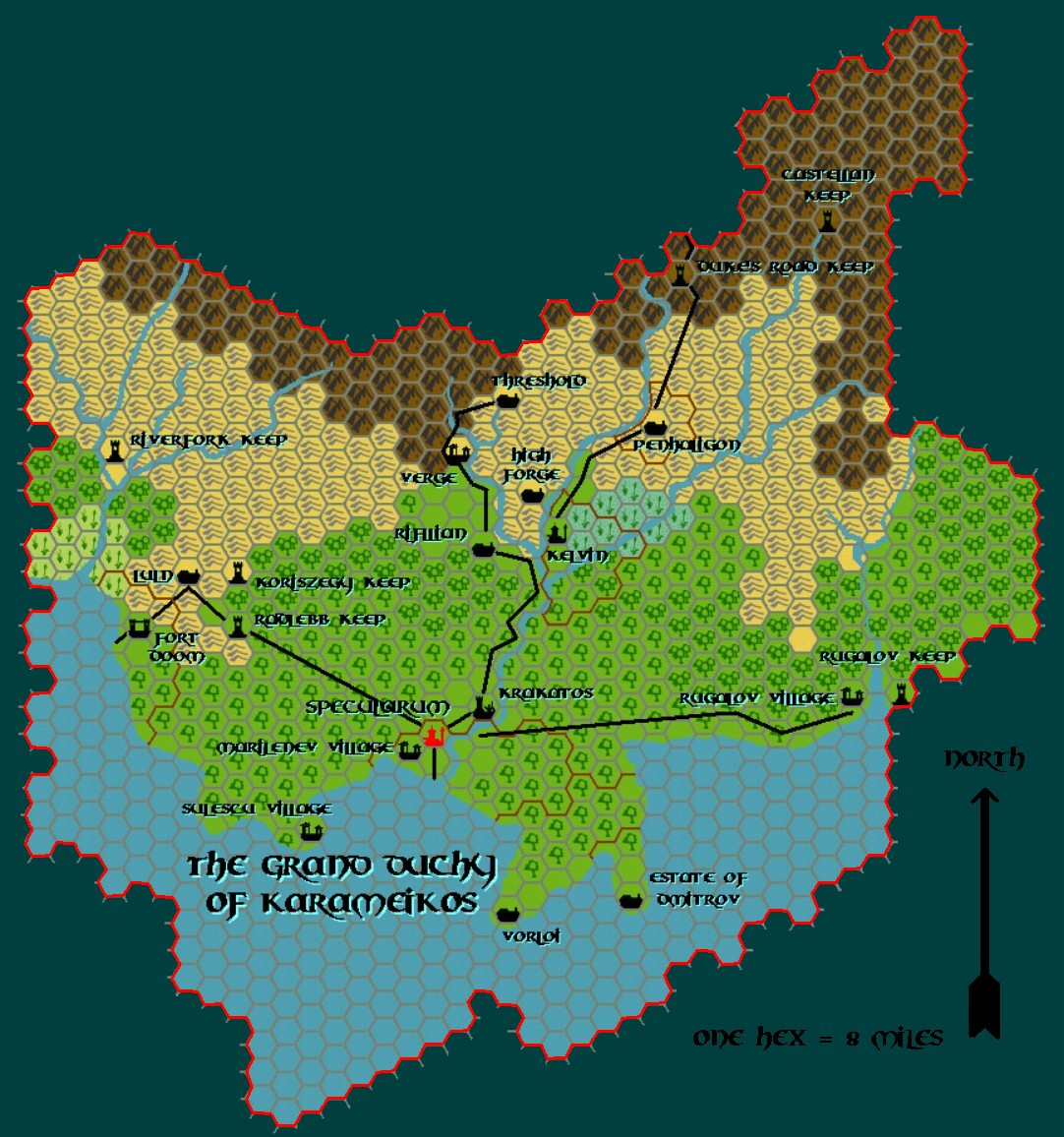
As you can see, most of the Grand Duchy is forest and foothills, with a few large patches of flatlands, moors, and one swampy region. Also evident is that most of the communities […] are on the coast or along the rivers. There are very few human communities in deep woods or far from well-travelled roads, so the vast majority of the Grand Duchy is unsettled no-man’s-land, unexplored and undefended.
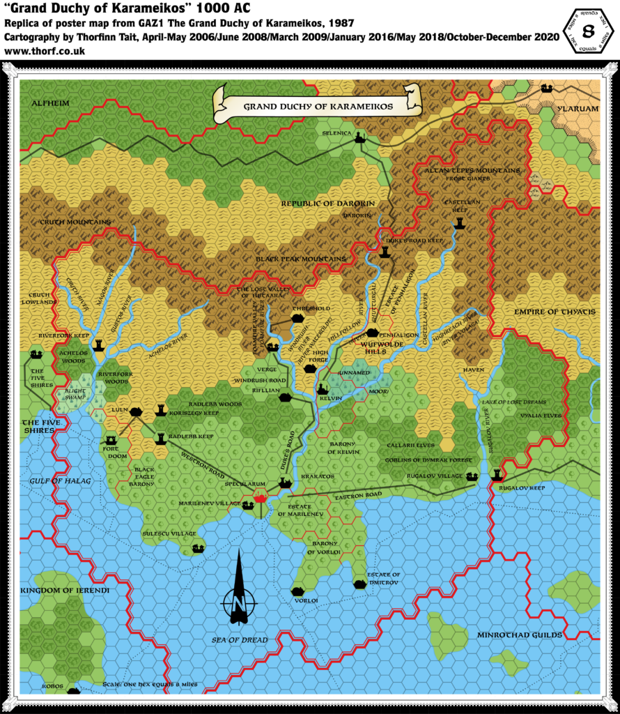
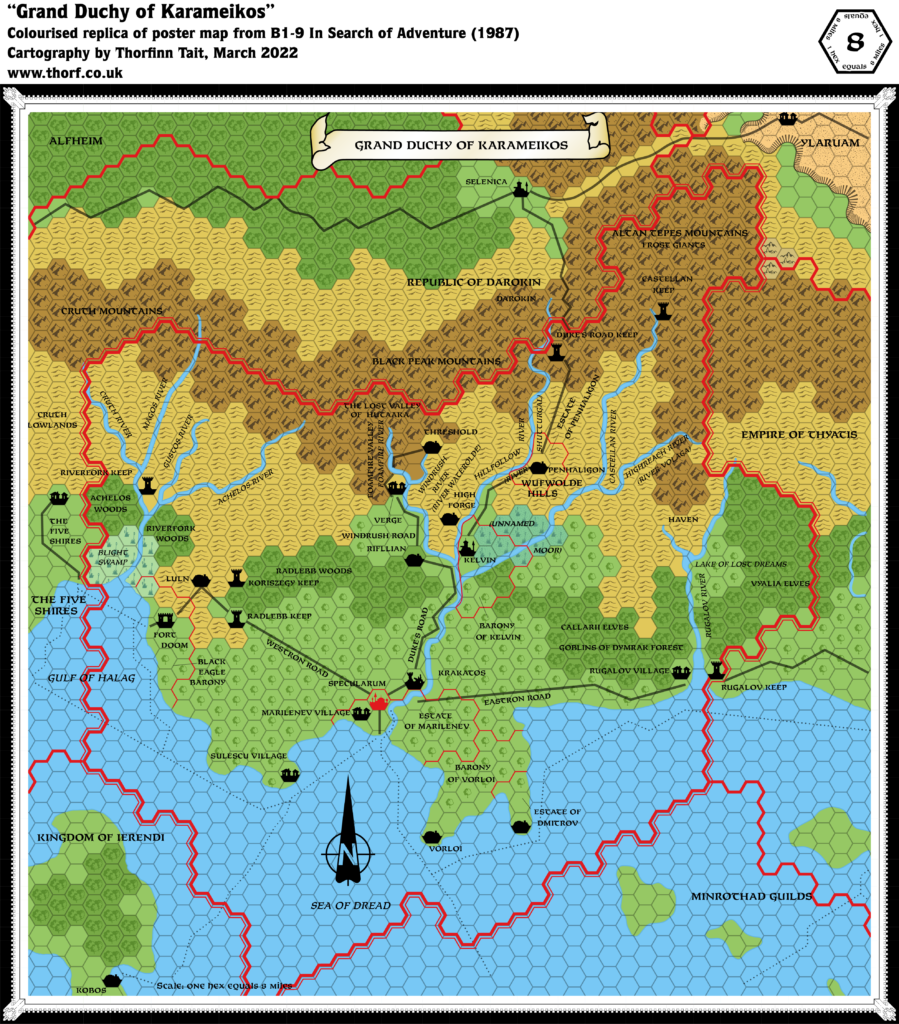
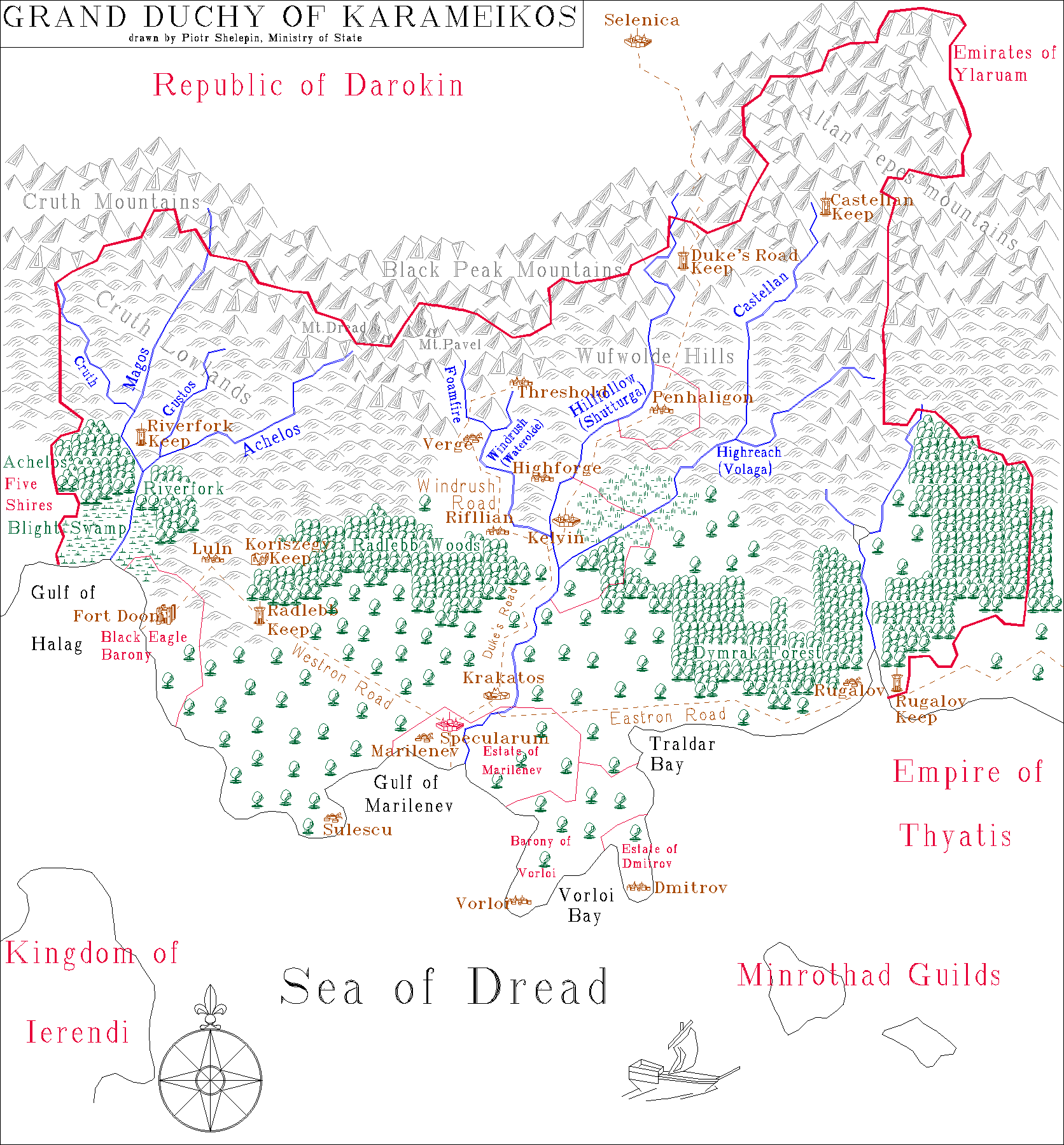
from GAZ1 The Grand Duchy of Karameikos, by Aaron Allston
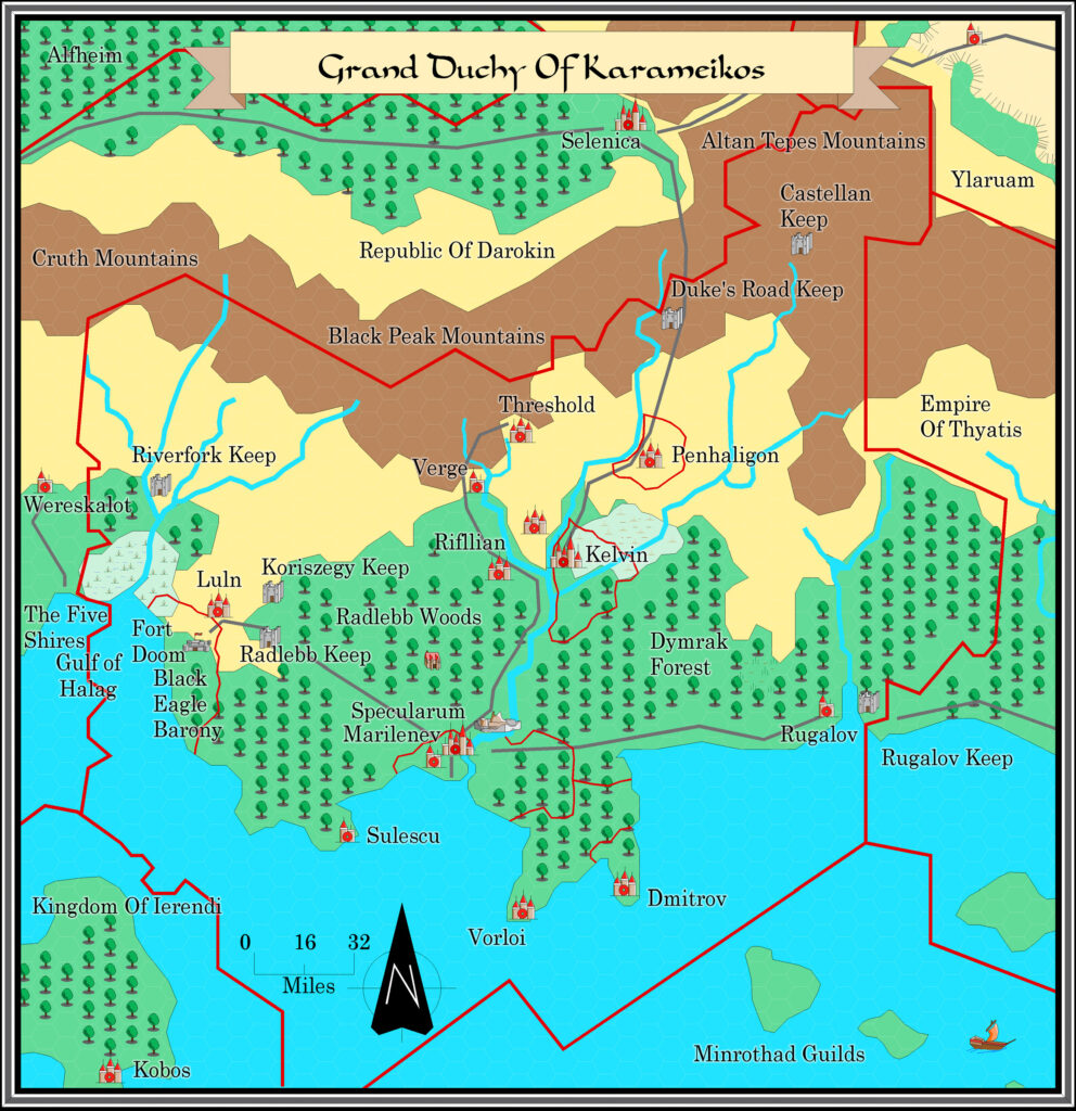
Map (December 2020)
Sources
- GAZ1 The Grand Duchy of Karameikos (1987) (PDF at DriveThruRPG)
- TM1 The Western Countries (1989) (PDF at DriveThruRPG)
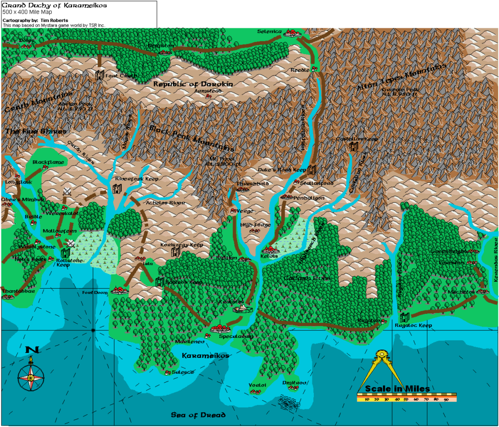
- Karameikos: Kingdom of Adventure (1994) (PDF at DriveThruRPG)
- B10 Night’s Dark Terror (1986) (PDF at DriveThruRPG)
- Dawn of the Emperors (1989) (PDF at DriveThruRPG)
- PC3 The Sea People (1990) (PDF at DriveThruRPG)
- Rules Cyclopedia (1991) (PDF at DriveThruRPG)
Secondary Sources
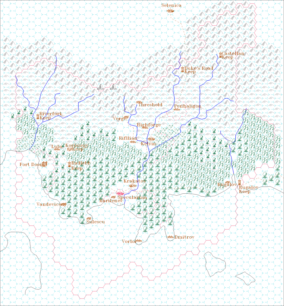
- Threshold and Surroundings, 2.7 miles per hex map by Simone Neri
- Karameikos, 3.2 miles per hex by Giampaolo Agosta
Comments
The most notable feature of the updated map is the forested hills, long described in the text but included for the first time in Karameikos: Kingdom of Adventure. The text in fact implies that almost all the hills are forested. Due to the popularity of a variant I made back in 2005, the Atlas has adopted the text’s version, with the vast majority of Karameikos’ hills forested. Other fan-created maps have built on this variant, so it makes sense to stay true both to them as well as the source material.
I have also introduced some evergreen forest hexes along the edge of the mountains, mostly in reference to Simone and Giampaolo’s maps. This is a judgement call of course, but I think they did a good job.
Notes
- Achelos Woods/Riverfork Woods — although the placing of the labels on the map may suggest otherwise, these are variant names for the same forest. GAZ1 Page 35 describes them as “variously called the Riverfork Woods and the Achelos Woods.”
- Altitude — GAZ1 page 35 gives two altitude labels, which have been added to the map.
- Callarii Elves — according to “The Map” on page 6 of GAZ1, “The Callarii elves live in the central forests east and west of Kelvin and in the forested foothills south of the gnomish community.”
- Coastal waters — GAZ1 showed no depth variation in its coastal waters. TM1 provided these for the first time. PC3 extensively revised shallow and deep water throughout the area, providing depth measurements. Kingdom of Karameikos redrew them yet again. The main differences are the addition of shallow water beneath the reef south of Vorloi, and alteration of deeper water in the bays: Traldar Bay and Vorloi Bay get deeper water, while the Gulf of Halag, the Gulf of Marilenev, and the Rugalov River estuary all lose their deeper water. The Atlas considers PC3 the best source for water depths, but keeps the deeper water bays from the other sources.
- Cruth Lowlands — this label was likely brought across from the Five Shires. Given the location beneath the Cruth Mountains, it makes perfect sense that this title applies to both the Five Shires and Karameikos.
- Forested Hills — while the Gazetteer itself states on page 45 that most of Karameikos’ hills are “thickly covered with forest,” at the time GAZ1 was made the forested hills hex had not yet been created. Karameikos: Kingdom of Adventure corrected this, showing some of the hills as indeed being forested. However, there is much evidence that almost all of the hills (and indeed most of the mountains) in Karameikos are heavily forested. “Land Patterns” on page 35: “These mountains tend to be thickly covered with forest vegetation, gradually thinning to bare rock toward the peaks. The average height of mountains in this range is about 4,000 feet, though many are much larger.” It goes on to describe the extent of the forests in the foothills: “South of this mountain range, you have miles and miles of mountain foothills – also thickly covered with forest.” Further support in “Terrain” on page 35: “Karameikos is one of the most thickly-wooded nations of the world. In the northern parts of the Grand Duchy, pine forests cover the mountain slopes and the hillsides.” It continues, describing the “three great tracts of forest” in Karameikos. The description of the forests doesn’t mention anything about hills, but doesn’t rule out forested hills as parts of those forests either.
- Forested Hills near Highforge — it seems that the hills south of Highforge are forested. See “The Map” on page 6 of GAZ1: “The Callarii elves live in the central forests east and west of Kelvin and in the forested foothills south of the gnomish community.”
- Forest Types — as we might expect, higher altitude forests have a tendency to be evergreen, while lower lying forests at this latitude are deciduous, with a gradation of the two in between. “Terrain” on page 35 of GAZ1: “Karameikos is one of the most thickly-wooded nations of the world. In the northern parts of the Grand Duchy, pine forests cover the mountain slopes and the hillsides. The further south you get, the more hardwoods – oak especially – you see; in the southernmost parts of the Dymrak Forest of eastern Karameikos, all you see are ancient oaks towering into the sky.”
- Fort Doom — the symbol has been changed to a town on the updated map. This issue could go either way, as the population of 10,000 does also fit with the definition of a fort. However, it seems as if fan consensus is to go with a town symbol.
- Kelvin — the detail map for this city in GAZ1 shows that it is situated at the confluence of the Highreach and Hillfollow Rivers. However, GAZ1’s map shows Kelvin one hex north of this position. This atlas uses the position as described in the text. Also, GAZ11’s trade map (Players’ Guide pages 16-17) and Supply and Demand table (page 27) both use the original “Kelven” spelling, which was used in the 6 mile per hex map of Karameikos in the Expert Rules Set (1983). The Atlas uses “Kelvin” throughout.
- Kelvin Moor — see “The Moor”.
- Koriszegy Keep — though marked on GAZ1’s map as a keep, the text clearly states that it is ruined on page 40. I have thus marked it as ruins.
- The Moor — labelled “Unnamed Moor” on GAZ1’s map, it received this minimalistic name on TM1. More importantly, it was changed from moorland to swamp. Given the name, this seems particularly unnecessary, and the updated map retains GAZ1’s moor. Karameikos: Kingdom of Adventure uses identical symbols for these, and so doesn’t provide any more evidence; however, it did finally give the moor a name, “Kelvin Moor”. The updated map uses this final name, with the assumption that locals do indeed call it simply The Moor.
- Shutturgal River — this old Traladaran name for the Hillfollow River is given on GAZ1’s map, and repeated on TM1. However, the text twice gives the name as Shutturga (pages 5 and 35). The detail map of Kelvin also has Shutturga. Karameikos: Kingdom of Adventure repeats the text reference while eliminating the old name from the map. This issue could probably go either way, but this atlas uses the name as given in the text, Shutturga.
- Specularum-Krakatos road — this single-hex road between these two locations was omitted from TM1. This was likely an error, and it is present again on Karameikos: Kingdom of Adventure‘s map.
- Trade Routes — page 22 of the Dawn of the Emperors DM’s Sourcebook provides some amendments to trade routes: “First, the island of Terentias is on the Vorloi-to-Kerendas stretch; most ships hug the northern coast, while many jump down from Rugalov to Terentias and then up to Kerendas. Also, the Minrothad-to-Gapton route continues on to Terentias and then to Kerendas.” I have therefore added a route from just off Rugalov down to Crossroads on Terentias; another from Crossroads up to Kerendas; and another coming from Gapton up round Terentias to Crossroads.
- Traladaran names — although the listing of Thyatian and Traladaran names is pretty intuitive, GAZ1 does give us an explicit explanation. Page 5 states: “Some places, particularly rivers, are listed with two names. This is because the settling Thyatians, uncomfortable with the native names […], simply renamed them. Today, when speaking Thyatian, most people use the Thyatian name, and when speaking Traladaran use the original name. On the map, the Thyatian name is given first, the Traladaran name given in parentheses.”
- Traldar Bay — this bay in eastern Karameikos was labelled for the first time in Karameikos: Kingdom of Adventure.
- Vandevicsny — this previously unmarked village appears for the first time on the 8 mile per hex map in Karameikos: Kingdom of Adventure.
- Vorloi trade route — GAZ1’s text describes Vorloi as having a small harbour, mostly used for export. So while it’s not a major stop, it makes sense for there to be a link from Vorloi to the passing trade route.
- Whirlpools — the whirlpools shown on PC3’s map clearly also affect the surface world, and have therefore been added to the updated map.
- Wufwolde River — this old Traladaran name for the Windrush River is given in the text of GAZ1 and repeated in Karameikos: Kingdom of Adventure. However, GAZ1’s map has Waterolde, while TM1 has Waterholde. It seems likely that the river shares the name of the hills through which it flows, and therefore this atlas uses the name Wufwolde.
References
- Karameikos at the Vaults of Pandius
- Karameikos map thread at The Piazza
- Mapping Issues: Towers, Keeps, Forts and Castles at The Piazza
Thanks to:
Giampaolo Agosta (Agathokles), Jesper Andersen (Spellweaver), John Calvin (Chimpman), Malcolm Iggleden, Katana One, Kheldren, Joe Mason, Sheldon Morris (Hugin), Hervé Musseau (Andaire), Simone Neri (Zendrolion), Andrew Theisen (Cthulhudrew)



15 January 2016 @ 11:06 pm
This is my ‘Home’, my starting point – as it may have been for many gamers…
Just as the maps of Middle Earth are for reading Tolkien.
Thorfinn
Thank you for bringing this together
Both the map and the sources used, I’m sure to be wandering these lands again soon…
19 January 2016 @ 9:24 pm
Glad to hear it, Malcolm! I hope to be helping my kids to wander through these lands someday soon. 😉
27 January 2016 @ 3:23 am
Wasn’t the Wufwolde referred to as the Wulfholde at one point? I want to say maybe in B10, but I don’t have that handy for reference at the moment.
27 January 2016 @ 3:28 pm
I just checked, and you are correct, Andrew. B10’s Karameikos map does indeed have Wufwolde. As if we needed yet another variation for this name! 😉
My recent thinking for things like this is that in fact all the names are equally valid, being nothing more than variations used by different people to refer to the same thing — or indeed being used by the locals to refer to the same thing in different ways.
So the names on my updated maps shouldn’t really be taken as stating that the other names are wrong; it’s just that it’s not possible to list all the variants on each map.
3 February 2016 @ 4:08 pm
Where does Thunder Rift fall in the maps you made? I may have missed it mind you.
5 February 2016 @ 8:59 pm
I don’t think there’s a completely official placement anywhere. Personally I would not be averse to placing it, though.
18 June 2021 @ 2:20 pm
I thought the Lost Valley was supposed to be more-or-less directly north of the Foamfire river? Was your spacing of the name more of a “crowding” issue? (There are an awful lot of names crammed in that area….)
10 July 2021 @ 10:40 pm
This is the can of worms that is B10 vs. GAZ1 Karameikos. B10 is the only source for the exact location of the Lost Valley, but unfortunately GAZ1 moved Threshold around, making it very hard to reconcile the two. I’m afraid I still don’t have a conclusive answer to this. It will be coming, though, and quite soon, as I will need to tackle this thorniest of issues in Mystara 1987.
With apologies for the pun, Rob. 😉