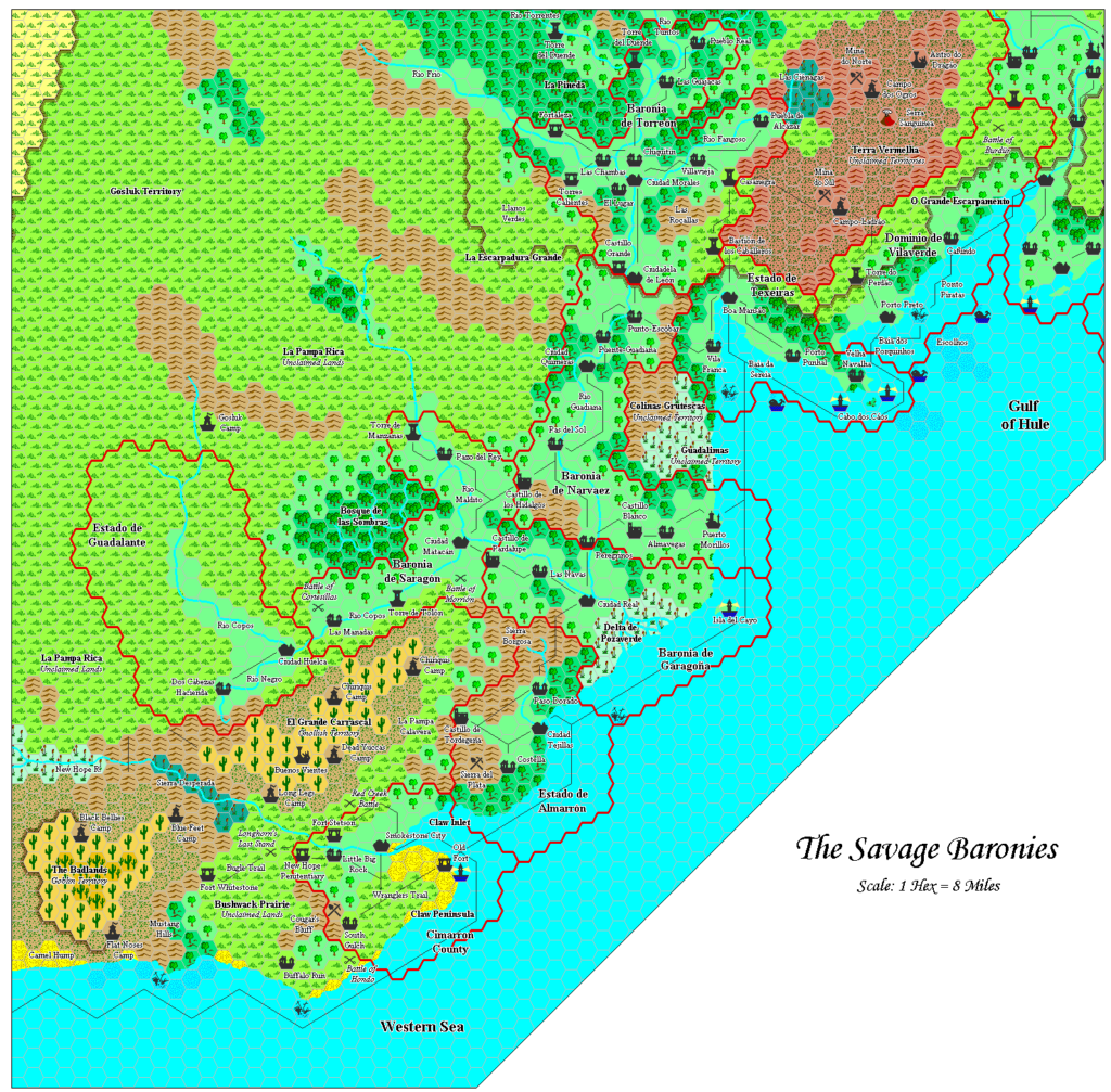
Adamantyr’s Savage Baronies, 8 miles per hex
The second map of Adamantyr’s Savage Coast series combined three maps into one, presenting the Savage Baronies as a single contiguous map. He also referenced Red Steel to fill in the terrain northwest of the baronies.
This map is most notable for its departures from Adamantyr’s usual palette. There are two of these: grasslands gained a yellow symbol in addition to the green one, and the hills and badlands of the Terra Vermelha actually appear redder. Adamantyr later clarified on the MMB that these are both largely visual changes:
I thought that it was too mono-color in the region, so I colored the higher steppes a yellowish-green to differentiate them. That’s also why the badlands and hills are “reddish” over in the Savage Baronies as well… color considerations.
Adamantyr, 4th May 2007, Mystara Message Board
Such customisation of hex art and palette was likely a first for Mystara at this point. Previously, cartographers occasionally added new hexes in order to represent different terrain features, but never for colour considerations. In the case of Terra Vermelha in particular, it seems entirely appropriate.
Fan-made Map by Adamantyr (February 2000)
This is an original map created by one of Mystara’s excellent fan cartographers. For more information on the cartographer, including a gallery of all their maps, see also Appendix M: Mappers of Mystara.
Sources
- Dragon Magazine Issue 172
- Dragon Magazine Issue 174
- Dragon Magazine Issue 175
- Dragon Magazine Issue 176
- Red Steel (1994)
References
- All of Adamantyr’s maps at the Atlas of Mystara
- Adamantyr’s entry in Appendix M: Mappers of Mystara
- Adamantyr’s author page at the Vaults of Pandius
Chronological Analysis
This is a fan-made map. It was published in 2000. For the updated Atlas version of this map, see Gulf of Hule, 8 miles per hex. See also Appendix C for annual chronological snapshots of the area. For the full context of this map in Mystara’s publication history, see the upcoming Let’s Map Mystara 2000. (Please note that it may be some time before the project reaches this point.)
The following lists are from the Let’s Map Mystara project. Additions are new features, introduced in this map. Revisions are changes to previously-introduced features. Hex Art & Fonts track design elements. Finally, Textual Additions are potential features found in the related text. In most cases, the Atlas adopts these textual additions into updated and chronological maps.
Coming Soon


