
Alan’s Eastern Karameikos
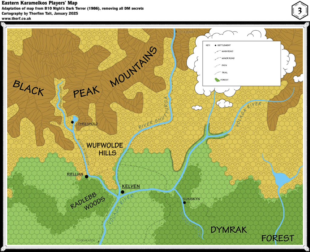
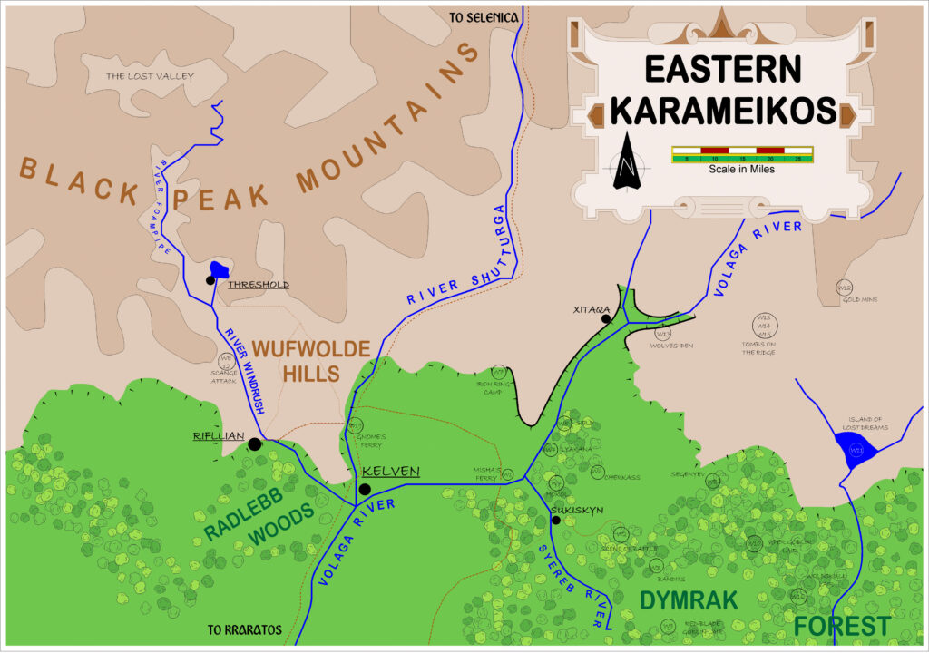
The first project Alan tackled and presented on his web site was the various maps from B10 Night’s Dark Terror. First up was his rendition of Eastern Karameikos. The original map had a 3 mile hex grid, but Alan elected to include a scale instead. He also changed the forests from solid blocks to individual tree icons, and showed the hills and mountains without symbols or ridge lines.
On the other hand, he colourised the map, giving the forests a nice variation of tree symbols. And he kept closely to the detail of the original map, making this an excellent map to use in play.
This was one of the more troublesome maps to convert to Campaign Cartographer 3+, as the whole southern area displayed in pink. After working out how to solve that, with the help of the wonderful ProFantasy forum community, I then edited each of the 60 tree symbols to increase the stroke width a little. (For more on this, see also the article for Alan’s Mystara.)
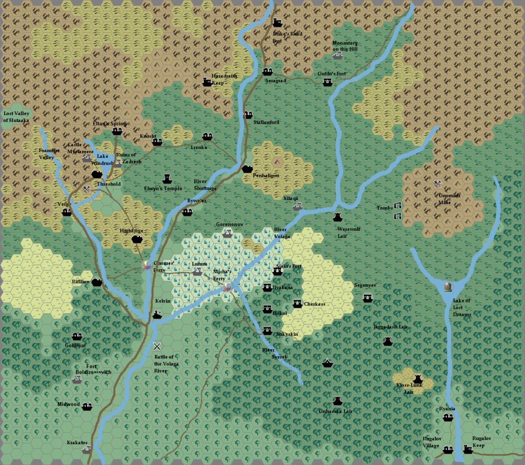
Below you can see my CC3+ conversion, followed by Alan’s original CC2 export from 2001.
Fan-made Map by Alan Derek Jones (June 2001)
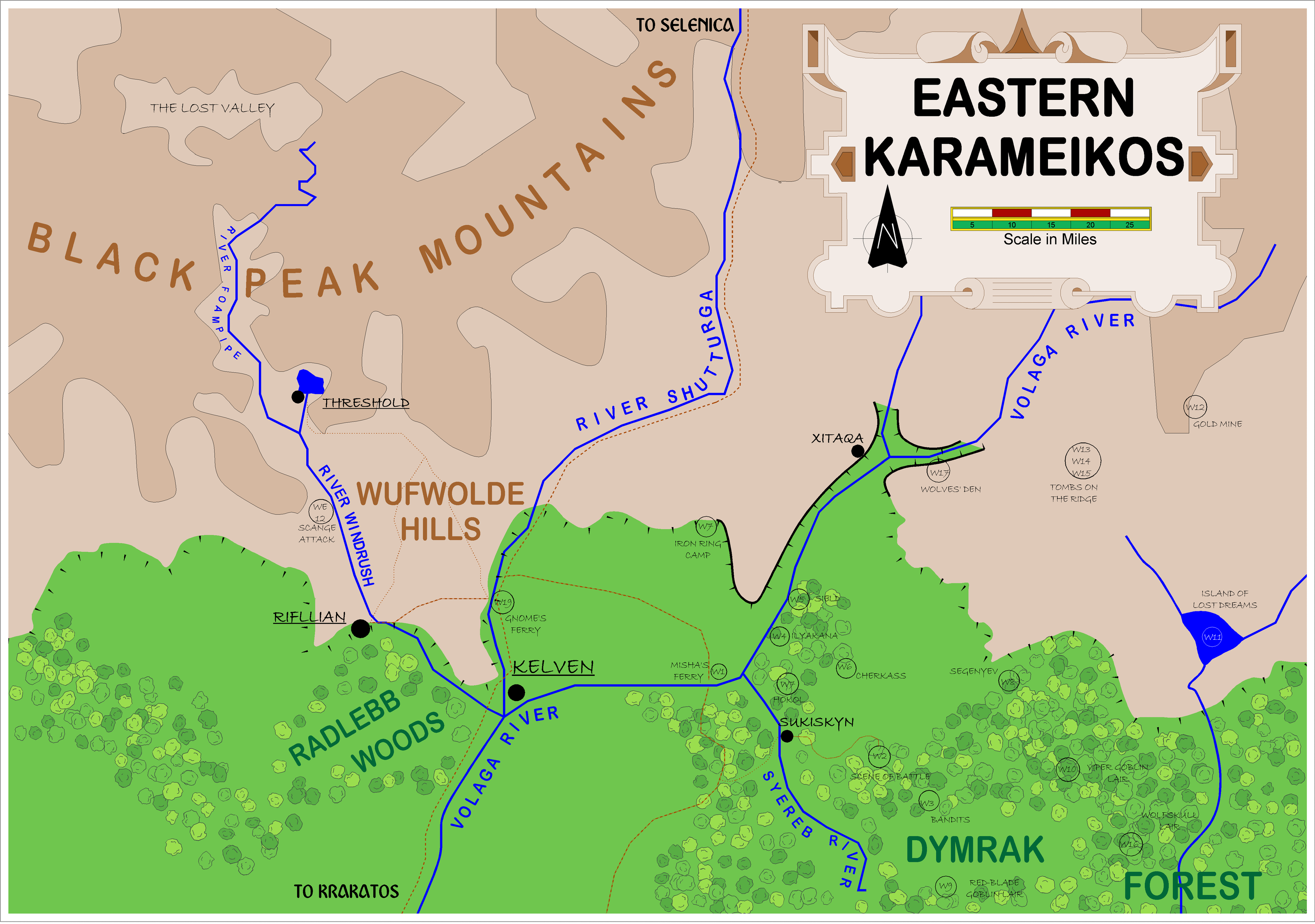
exported in high resolution by Thorfinn Tait, April 2025
Fan-made Map by Alan Derek Jones (June 2001)

This is an original map created by one of Mystara’s excellent fan cartographers. For more information on the cartographer, including a gallery of all their maps, see also Appendix M: Mappers of Mystara.
Sources
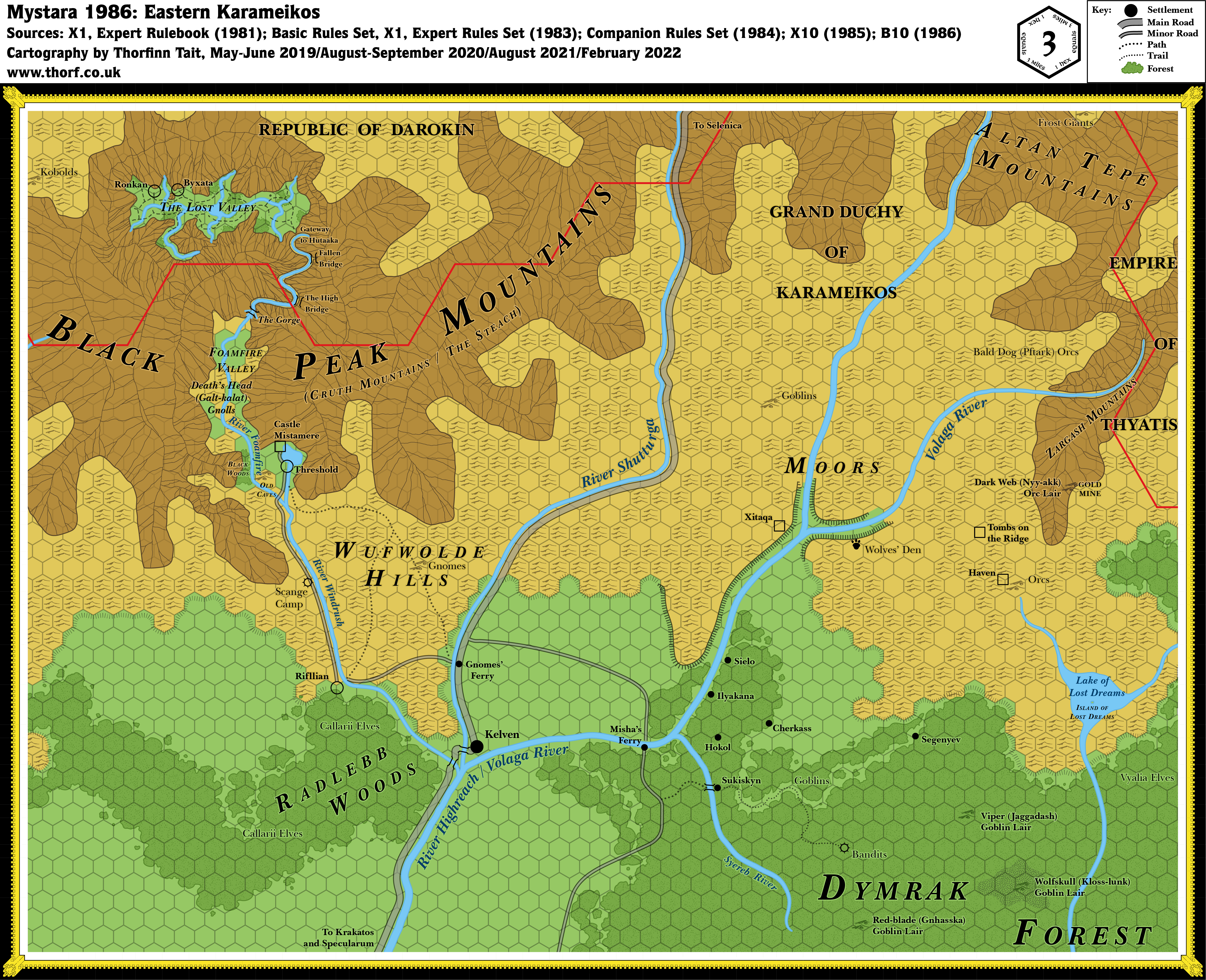
- B10 Night’s Dark Terror (1986) (PDF at DriveThruRPG)
Fan Sources
- None.
References
- All of Alan’s maps at the Atlas of Mystara
- Alan’s entry in Appendix M: Mappers of Mystara (upcoming)
- Alan’s author page at the Vaults of Pandius
Chronological Analysis
This is a fan-made map. It was published in June 2001. The updated Atlas version of this map is not yet available. See also Appendix C for annual chronological snapshots of the area. For the full context of this map in Mystara’s publication history, see the upcoming Let’s Map Mystara 2001. (Please note that it may be some time before the project reaches this point.)
The following lists are from the Let’s Map Mystara project. Additions are new features, introduced in this map. Revisions are changes to previously-introduced features. Hex Art & Fonts track design elements. Finally, Textual Additions are potential features found in the related text. In most cases, the Atlas adopts these textual additions into updated and chronological maps.
Under Construction! Please check back again soon for updates.
Additions
Revisions
Hex Art & Fonts
- Art — Campaign Cartographer 2 symbols and palette.
- Fonts — Arial Rounded (titling, terrain features), Bradley Hand ITC (settlements, encounters), Abbey Regular (off-map directions).


