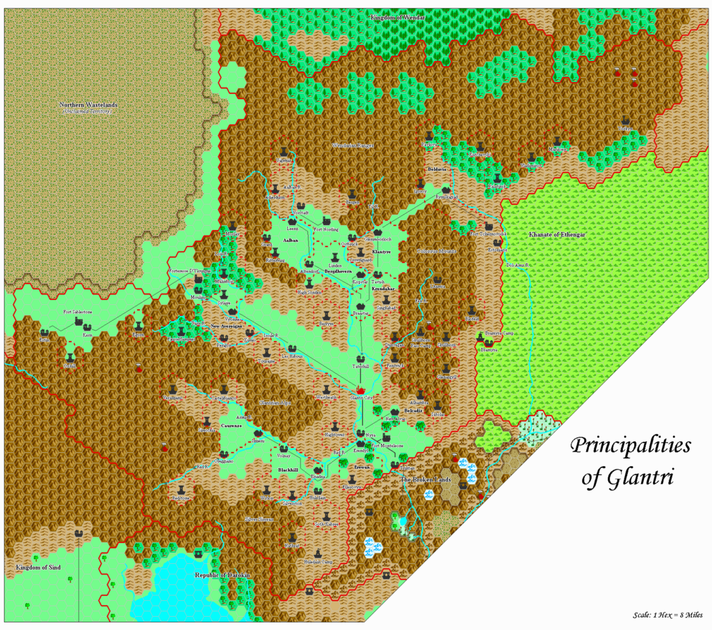
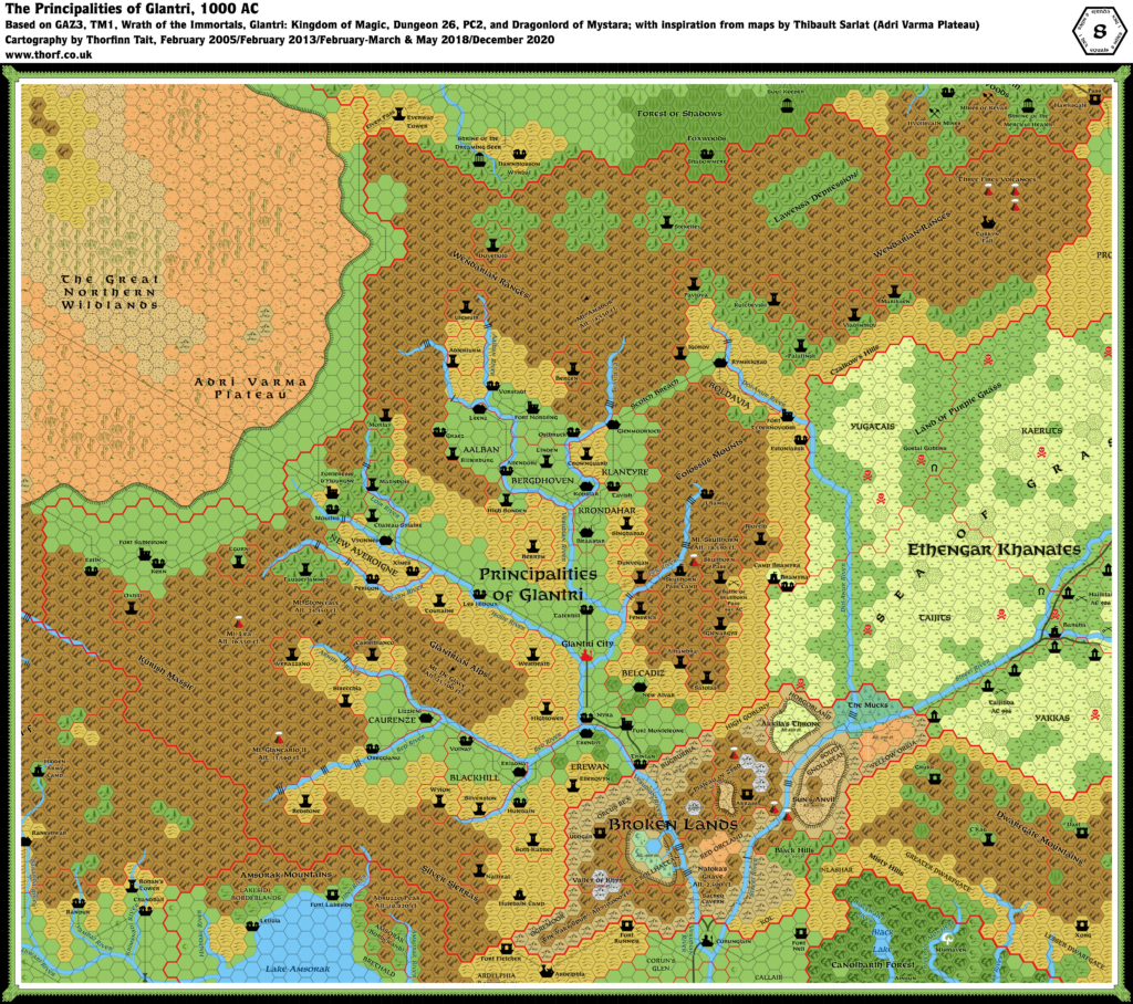
Alan’s Glantri, 8 miles per hex
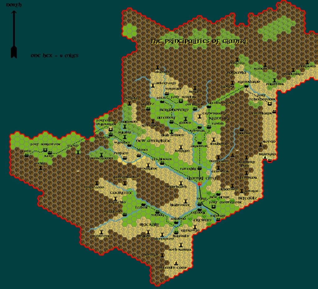
By early 2002, Alan had completed all of GAZ1 and GAZ2’s maps, and was moving forward with GAZ3’s. As with Ylaruam, he first tackled the regional hex map. While he had left all of Ylaruam’s terrain hexes as solid colours, now he began to add a few symbols, beginning with forests and volcanoes. It was clearly still an evolving process, and he did not yet have the required art in place. This is most clearly seen in the lack of forested hills, which are instead marked simply as forests.
It’s worth noting that by the end of his mapping journey the next year, he would solve all of these problems. But for whatever reason, he never revisited these older maps. Given the increased system resources necessary to process more complex maps, I suspect that the computers of the time just weren’t fast enough to make it worthwhile.
Aside from these problems, the map itself is a very detailed and faithful rendering of GAZ3’s original. In my CC3+ conversion of Alan’s CC2 file, I have done minimal tweaking — just enough to make Alan’s original map shine in high resolution. As always, my conversion is directly below, with Alan’s original export after it.
Fan-made Map by Alan Derek Jones (March 2002)
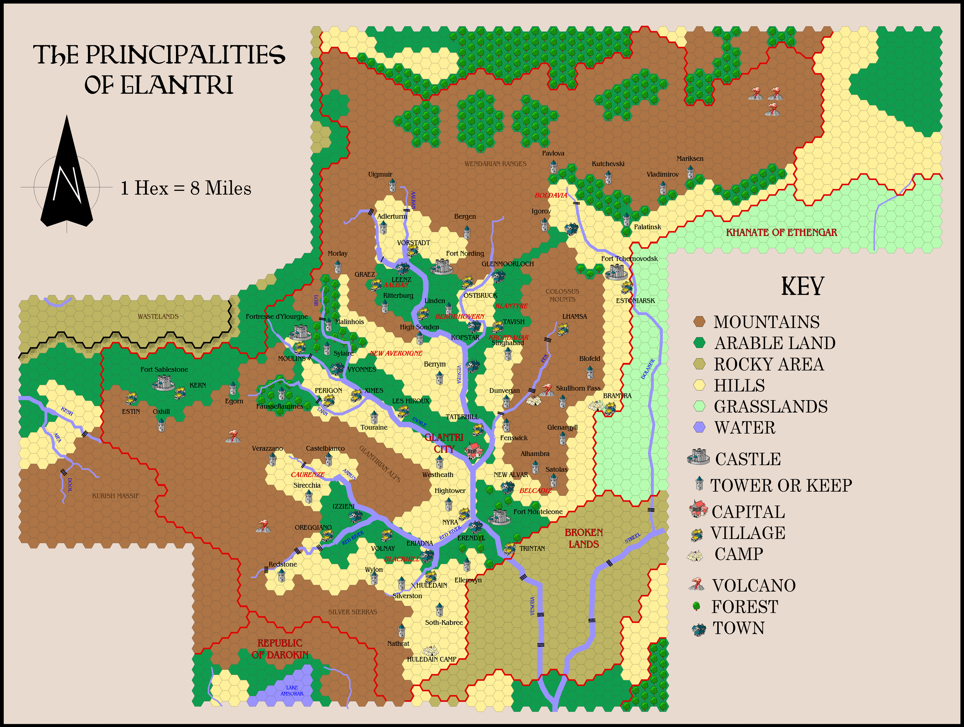
exported in high resolution by Thorfinn Tait, April 2025
Fan-made Map by Alan Derek Jones (March 2002)
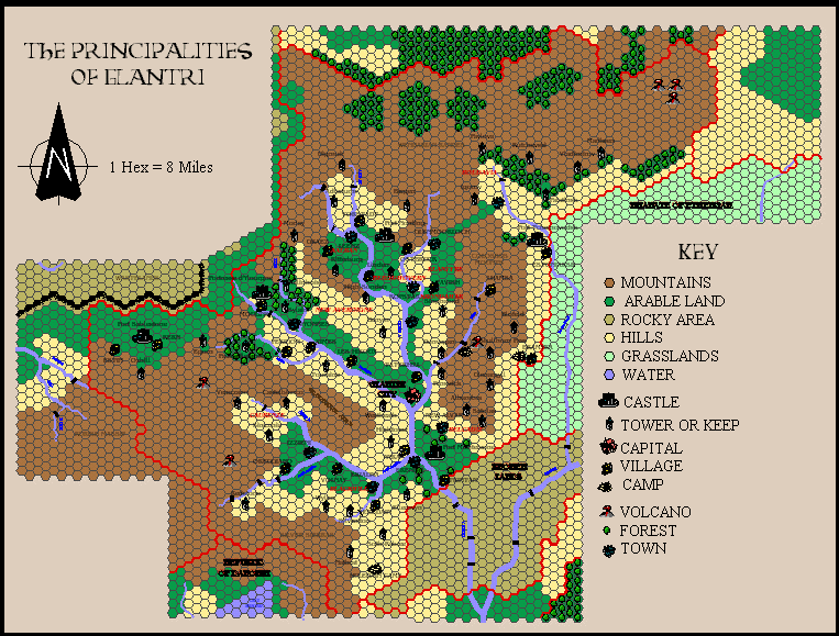
This is an original map created by one of Mystara’s excellent fan cartographers. For more information on the cartographer, including a gallery of all their maps, see also Appendix M: Mappers of Mystara.
Sources
- GAZ3 The Principalities of Glantri (1987) (PDF at DriveThruRPG)
Fan Sources
- None.
References
- All of Alan’s maps at the Atlas of Mystara
- Alan’s entry in Appendix M: Mappers of Mystara (upcoming)
- Alan’s author page at the Vaults of Pandius
Chronological Analysis
This is a fan-made map. It was published in March 2002. The updated Atlas version of this map is Glantri, 8 miles per hex. See also Appendix C for annual chronological snapshots of the area. For the full context of this map in Mystara’s publication history, see the upcoming Let’s Map Mystara 2002.
The following lists are from the Let’s Map Mystara project. Additions are new features, introduced in this map. Revisions are changes to previously-introduced features. Hex Art & Fonts track design elements. Finally, Textual Additions are potential features found in the related text. In most cases, the Atlas adopts these textual additions into updated and chronological maps.
Under Construction! Please check back again soon for updates.
Additions
Revisions
- Hex Grid — In my CC3+ conversion, I have tweaked Alan’s hex grid, increasing its width but making it transparent to prevent it from taking attention away from the map’s fine details.
- Terrain — All of GAZ3’s forested hills hexes are here marked as simply forests. This was likely due to the lack of a proper symbol to distinguish them. For that matter, very few terrain types actually have hex symbols on this map, suggesting that it was perhaps still unfinished — although Alan clearly posted it and moved on regardless. By the next year, he had solved this problem, recreating all the hexes for his La Vallée des Loups map.
Hex Art & Fonts
- Art — Campaign Cartographer 2 style symbols, art and palette.
- Fonts — Beowulf1 (title), Century Schoolbook (scale and key), Benguiat Book (everything else).